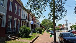
Rockingham County is a county located in the U.S. state of Virginia. As of the 2020 census, the population was 83,757. Its county seat is the independent city of Harrisonburg.

Stanardsville is a town in Greene County, Virginia, United States. The population was 349 at the 2020 census, down from 367 at the 2010 census. It is the county seat of Greene County. The name is from Robert Stanard, a benefactor who donated land for public use. It is part of the Charlottesville, Virginia metropolitan area.

The Southwest Mountains of Virginia are a mountain range centered on Charlottesville, parallel to and geologically associated with the Blue Ridge Mountains, which lie about 30 miles (50 km) to the west. The range is breached by the Rivanna River between Monticello and Pantops Mountain. Some of the more prominent peaks include Carters Mountain, Fan Mountain, Brush Mountain, Peters Mountain, Walton's Mountain, and Hightop Mountain.

The North River is a 55.3-mile-long (89.0 km) river in the mountains and Shenandoah Valley of northern Virginia, the United States. It joins the South River at Port Republic to form the South Fork Shenandoah River.

The National Ground Intelligence Center (NGIC) is part of the United States Army Intelligence and Security Command. The NGIC provides scientific and technical intelligence (S&T) and general military intelligence (GMI) on foreign ground forces in support of the warfighting commanders, force and material developers, Department of the Army, Department of Defense, and National-level decisionmakers. The NGIC also manages the Army's Foreign Materiel Exploitation Program and foreign material acquisition requirements, and constitutes a single authoritative source for comprehensive ground forces threat to the Army and other services.

The Corner is a seven-block collection of bars, restaurants, bookstores, and night spots on University Avenue in Charlottesville, Virginia, extending from 121⁄2 Street Southwest to Chancellor Street. located across the street from the University of Virginia. It is bounded by Graduate Charlottesville on the east and Bank of America on the west.
The Virginia Seismic Zone in the U.S. state of Virginia covers about 8,000 square kilometers (3,100 sq mi) in the Piedmont province. Earthquakes in the state are irregular and rarely reach over 4.5 in magnitude.
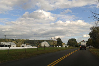
Criglersville is an unincorporated community along the Old Blue Ridge Turnpike in Madison County, Virginia, United States. The Robinson River passes through the town.
Old Rag was an unincorporated community located in Madison County, Virginia, on Old Rag Mountain. Originally known as Weakley Valley, Old Rag was inhabited by white people in the 1770s. By 1900, Old Rag had a post office, a school, two churches and two stores, and a cemetery.
The Conway River is a 14.4-mile-long (23.2 km) river in the U.S. state of Virginia. Rising near the triple junction of Madison, Greene and Page counties at the crest of Shenandoah National Park, the river flows south, then southeast to the Rapidan River northwest of Burtonville. The river is part of the Rappahannock River watershed.
The Dry River is a 22.6-mile-long (36.4 km) tributary of the North River in the U.S. state of Virginia. It flows entirely within Rockingham County, rising within the George Washington National Forest east of the West Virginia border and flowing south to the North River at Bridgewater. Via the North River, it is part of the Shenandoah River system, flowing to the Potomac River.
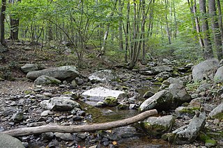
The Hughes River is a 14.0-mile-long (22.5 km) river in Madison, Rappahannock, and Culpeper counties in the U.S. state of Virginia. The river rises on the east slope of Stony Man mountain in Shenandoah National Park and flows southeast past the village of Nethers to join the Hazel River west of Boston, Virginia. Via the Hazel River and the Rappahannock River, the Hughes River is part of the Chesapeake Bay watershed.
The Middle River is a 70.6-mile-long (113.6 km) river in the U.S. state of Virginia. Flowing entirely within Augusta County, the Middle River joins the North River, which in turn meets the South River at Port Republic to form the South Fork Shenandoah River.
The Piney River is an 8.3-mile-long (13.4 km) river in the U.S. state of Virginia. Rising in the northern part of Shenandoah National Park, it is a tributary of the Thornton River, and via the Hazel and Rappahannock rivers is part of the Chesapeake Bay watershed.
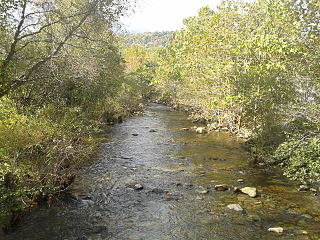
The Rose River is an 8.8-mile-long (14.2 km) river in the U.S. state of Virginia. Rising on the south face of Hawksbill Mountain, the highest point in Shenandoah National Park, the river flows southeast to its junction near Syria, Virginia, with the Robinson River, a tributary of the Rapidan River and part of the Rappahannock River watershed.
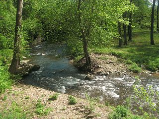
The Rush River is a 12.5-mile-long (20.1 km) river in the U.S. state of Virginia. It rises in the northern part of Shenandoah National Park and flows southeast to the Thornton River at Rock Mills. Via the Thornton and Hazel rivers, it is part of the Rappahannock River watershed.
The South River is a 13.7-mile-long (22.0 km) river in the U.S. state of Virginia. Rising northeast of Swift Run Gap in Shenandoah National Park, the river flows southeast to the Rapidan River near Burtonville. It is part of the Rappahannock River watershed. The whole river is within Greene County, Virginia.
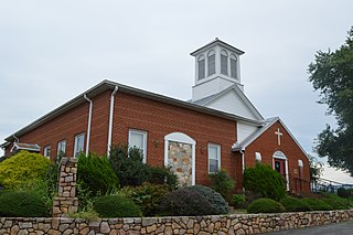
Alma is an unincorporated community in Page County, in the U.S. state of Virginia. The community is said to have been named, in the mid-1850s, by local doctor James Lee Gillespie. The doctor, who relocated to Page County around 1851 is said to have been a follower of events of the Crimean War, and is believed to have named the little village either for the Battle of Alma or the Alma River, in Ukraine. From that, it is believed that the word is the Crimean Tatar word for apple.

Union Mills is an unincorporated community in Fluvanna County, in the U.S. state of Virginia.
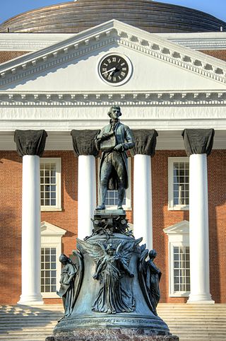
Thomas Jefferson is a statue of Founding Father and third United States president, Thomas Jefferson, in front of the Rotunda at the University of Virginia, the university he founded and designed. The statue was crafted by Moses Ezekiel in 1910 and is a copy of the Jefferson Monument in Louisville, Kentucky.
