Hermitage Road Historic District

Last updated

Hermitage Road Historic District
HRHDASign 015 WIKI.jpg
HRHD sign near the Laburnum and Hermitage intersection
USA Virginia location map.svg
Red pog.svg
Usa edcp location map.svg
Red pog.svg
Location3800–4200 blocks of Hermitage Rd.
Richmond, Virginia
Coordinates 37°35′2.94″N77°27′45.17″W / 37.5841500°N 77.4625472°W / 37.5841500; -77.4625472
Built1894
Architect D. Wiley Anderson
Architectural styleLate Victorian, Late 19th and 20th Century Revivals
NRHP reference No. 06000031 [1]
VLR No.127-6076
Significant dates
Added to NRHPFebruary 9, 2006
Designated VLRDecember 7, 2005 [2]

Hermitage Road Historic District (HRHD) is a Northside neighborhood in the independent city of Richmond, Virginia. The district is a Richmond Old and Historic District, as well as being listed on the Virginia Landmarks Register and the National Register of Historic Places.

Contents

The historic district consists of properties built in different architectural styles (Victorian, Tudor, Arts and Crafts, Georgian, Colonial Revival, etc.) located in the 3800 to 4300 blocks of Hermitage Road, this portion of which is designated as State Route 161, which crosses over Interstate 95 at the north end of the 4300 block. [3]

Boundaries

The south end of the district is at the intersection of Laburnum Avenue and Hermitage Road, which was formerly marked by the A.P. Hill Monument. The monument had stood at the intersection from the neighborhood’s creation until 14-Dec-2022 when the final remains of AP Hill were removed for re-burial in Culpeper County, Virginia. The AP Hill monument was the last major Richmond City owned monument to be de-constructed, a process which began with the George Floyd protests in Richmond, Virginia in 2020.

Also at the south end of the district is the 13 Acres house, which was donated by the Blair family with the intention of providing a permanent green space in the city. The house is currently used by the Richmond Public School system.

The north end of the district is at the intersection of Hermitage Road and Westbrook Avenue near the Freeman Marker No. 34, which marks the outer defense line for the City of Richmond during the Civil War.

Origins of the neighborhood

The area was originally developed as one of Richmond's Northside streetcar suburbs. Most of the original concrete poles used for the overhead trolley wiring are still located in the median of the street and are still in service after over 100 years. The streetcar line extended to Lakeside Park in Henrico County, terminating at the present site of Lewis Ginter Botanical Garden. [3]

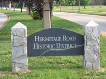
Creation of the Historic District

In 1988, the historic district was formed in response to a move by a local organization to tear down two historic houses (one, an excellent example of the Romanesque Revival style, was built in the 1890s). The people of the neighborhood "blocked the wrecking ball" and quickly formed a City Old and Historic District. The goal of the district is the protection and preservation of historic resources through zoning enforcement along Hermitage Road. [3]

The HRHD Association continues to have active participation from homeowners and cooperates with other nearby neighborhood associations, such as Bellevue and Rosedale.

Related Research Articles

Hermitage, The Hermitage or L'Hermitage may refer to:

<span class="mw-page-title-main">Monument Avenue</span> United States historic place

Monument Avenue is a tree-lined grassy mall dividing the eastbound and westbound traffic in Richmond, Virginia, originally named for its emblematic complex of structures honoring those who fought for the Confederacy during the American Civil War. Between 1900 and 1925, Monument Avenue greatly expanded with architecturally significant houses, churches, and apartment buildings. Four of the bronze statues representing J. E. B. Stuart, Stonewall Jackson, Jefferson Davis and Matthew Fontaine Maury were removed from their memorial pedestals amidst civil unrest in July 2020. The Robert E. Lee monument was handled differently as it was owned by the Commonwealth, in contrast with the other monuments which were owned by the city. Dedicated in 1890, it was removed on September 8, 2021. The last remaining statue on Monument Avenue is the Arthur Ashe Monument, memorializing the African-American tennis champion, dedicated in 1996.

<span class="mw-page-title-main">Fan District</span> United States historic place

The Fan is a district of Richmond, Virginia, so named because of the "fan" shape of the array of streets that extend west from Belvidere Street, on the eastern edge of Monroe Park, westward to Arthur Ashe Boulevard. However, the streets rapidly resemble a grid after they go through what is now Virginia Commonwealth University. The Fan is one of the easterly points of the city's West End section, and is bordered to the north by Broad Street and to the south by VA 195, although the Fan District Association considers the southern border to be the properties abutting the south side of Main Street. The western side is sometimes called the Upper Fan and the eastern side the Lower Fan, though confusingly the Uptown district is located near VCU in the Lower Fan. Many cafes and locally owned restaurants are located here, as well as historic Monument Avenue, a boulevard formerly featuring statuary of the Civil War's Confederate president and generals. The only current statue is a more modern one of tennis icon Arthur Ashe. Development of the Fan district was strongly influenced by the City Beautiful movement of the late 19th century.

<span class="mw-page-title-main">Oregon Hill</span> United States historic place

Oregon Hill is a historic working-class neighborhood in Richmond, Virginia. Oregon Hill overlooks the James River and Belle Isle, and provides access to Hollywood Cemetery. Due to the neighborhood's proximity to the Monroe Park Campus of Virginia Commonwealth University, the neighborhood is sometimes referred to as a student quarter because of its high college student population.

The Greater Richmond, Virginia area has many neighborhoods and districts.

Arthur Ashe Boulevard is a historic street in the near the West End of Richmond, Virginia, providing access to Byrd Park. It serves as the border between the Carytown/Museum District to the west and the Fan district to the east. Attempts were made to rename the street after Arthur Ashe, a tennis star and social activist who was born and grew up in Richmond, but previous attempts failed until February 2019 when Richmond City Council voted in favor of changing the name to Arthur Ashe Boulevard. Near the south end is Richmond's Boulevard Bridge across the James River. Arthur Ashe Boulevard intersects with main arteries Cary Street, Main Street, Monument Avenue, Broad Street, Leigh Street, and Interstate 64/95, and terminates at Hermitage Road. The Diamond is located on Arthur Ashe Boulevard. The intersection of Arthur Ashe Boulevard and Monument Avenue featured a statue of Stonewall Jackson.

<span class="mw-page-title-main">Highland Park (Richmond)</span>

Highland Park is a neighborhood comprising several historic districts north of downtown Richmond, Virginia. Over time, various boundaries have served to split the neighborhood into sections traditionally labeled East Highland Park, North Highland Park, and South Highland Park. The southern Highland Park boundaries are roughly First Avenue to the west, Fifth Avenue to the east, the Shockoe Valley to the south, and E. Brookland Park Boulevard to the north. The Highland Park Southern Tip neighborhood is also known as the Chestnut Hill-Plateau Historic District. The Highland Park Plaza/Northern Highland Park boundaries are roughly defined by Pensacola ave and the railroad tracks to the north, Fifth avenue to the east, E. Brookland Park boulevard to the south, and Meadowbridge Road to the west. The zip code is 23222.

<span class="mw-page-title-main">North Side (Richmond, Virginia)</span>

The Northside is an area composed of northern Richmond, Virginia and some parts of Henrico County, Virginia.

<span class="mw-page-title-main">Jackson Ward</span> United States historic place

Jackson Ward, previously known as Central Wards, is a historically African-American district in Richmond, Virginia, with a long tradition of African-American businesses. It is located less than a mile from the Virginia State Capitol, sitting to the west of Court End and north of Broad Street. It was listed as a National Historic Landmark District in 1978. "Jackson Ward" was originally the name of the area's political district within the city, or ward, from 1871 to 1905, yet has remained in use long after losing its original meaning.

<span class="mw-page-title-main">Grandin Road Commercial Historic District</span> Historic district in Virginia, United States

The Grandin Road Commercial Historic District, also referred to as Grandin Village, is a historic district listed on the National Register of Historic Places located in the Raleigh Court neighborhood of the independent city of Roanoke, Virginia, U.S.A. Centered at the intersection of Memorial Avenue and Grandin Road, Grandin Village has become one of the more eclectic areas of Roanoke, with an array of independently owned retail and dining establishments. The district has been noted as one of Roanoke's best examples of a mixed-use urban village, and has been used as a local model for future mixed-use developments within the community.

<span class="mw-page-title-main">Chimborazo Park</span>

Chimborazo Park is a park and historic land site in Richmond, Virginia, United States. Created in 1874, the park was the site of Chimborazo Hospital, one of the world's largest military hospitals.

<span class="mw-page-title-main">Union Hill, Richmond, Virginia</span> United States historic place

Union Hill is a historic district of Richmond, Virginia. According to the Richmond Times Dispatch, the neighborhood "generally is bordered on the south by East Marshall Street and Jefferson Avenue, on the west by Mosby Street, on the north by O and Carrington streets, and angled on the east by North 25th Street." The neighborhood is on the Virginia Landmarks Register and the National Register of Historic Places, and is also one of sixteen designated "Old and Historic Districts" in Richmond.

<span class="mw-page-title-main">Tree Hill (Richmond, Virginia)</span> Historic house in Virginia, United States

Tree Hill near Richmond, Virginia, in Henrico County, Virginia, is a Greek Revival style plantation house overlooking the James River about two miles east of downtown Richmond near the intersection of the historic Osborne Turnpike and New Market Road. Currently still a private farm, but expected to become partly a park after housing and commercial development, it was once owned by Richmond distiller and landowner Franklin Stearns, a prominent Unionist during the American Civil War. Centuries earlier, it had been a Native American camp site, and the birthplace of powerful chief Powhatan (d.1618).

<span class="mw-page-title-main">Barton Heights</span> Historic house in Virginia, United States

Barton Heights is a streetcar suburb neighborhood and former town in the Northside area of Richmond, Virginia. The area was primarily developed between 1890 and the 1920s.

<span class="mw-page-title-main">Museum District, Richmond, Virginia</span> United States historic place

The Museum District, alternately known as West of the Boulevard, is a neighborhood in the city of Richmond, Virginia. It is anchored by the contiguous six-block tract of museums along the west side of Boulevard, including the Virginia Museum of Fine Arts and the Virginia Museum of History & Culture, hence the name.

<span class="mw-page-title-main">Chestnut Hill–Plateau Historic District</span> Historic district in Virginia, United States

The Chestnut Hill–Plateau Historic District is a historic area in the Highland Park neighborhood of Richmond, Virginia. It is also known as 'Highland Park Southern Tip' on city neighborhood maps.

<span class="mw-page-title-main">Laburnum Park Historic District</span> Historic district in Virginia, United States

The Laburnum Park Historic District is a national historic district located at Richmond, Virginia. The district encompasses 226 contributing buildings and 2 contributing structures located north of downtown Richmond. The primarily residential area developed starting in the early-20th century as one of the city's early "streetcar suburbs" and as home to several important local institutions. The buildings are in a variety of popular early-20th century architectural styles including Queen Anne and Colonial Revival. It was developed as neighborhood of middle-to-upper-class, single-family dwellings. Notable buildings include the Laburnum House (1908), Richmond Memorial Hospital (1954-1957), Richmond Memorial Hospital Nursing School (1960-1961), "The Hermitage" (1911), Laburnum Court (1919), Veritas School.

<span class="mw-page-title-main">Brookland Park Historic District</span> Historic district in Virginia, United States

The Brookland Park Historic District is a national historic district located at Richmond, Virginia. The district encompasses 1,157 contributing buildings located north of downtown Richmond and Barton Heights.

<span class="mw-page-title-main">Forest Hill Historic District (Richmond, Virginia)</span> Historic district in Virginia, United States

The Forest Hill Historic District is a national historic district located at Richmond, Virginia. The district encompasses 1,106 contributing buildings and 5 contributing structures located south of downtown Richmond. The primarily residential area developed starting in the early-20th century as one of the city's early "streetcar suburbs." The buildings are in a variety of popular late-19th and early-20th century architectural styles including frame bungalows, Colonial Revival, Tudor Revival, and Mission Revival. The buildings in Forest Hill exemplify a high quality of materials in their construction. Brick is the dominant building material. Notable non-residential buildings include Forest Hill Presbyterian Church; Good Shepherd Episcopal Church; and Forest Hill Church of Christ.

<span class="mw-page-title-main">Sherwood Park (Richmond, Virginia)</span>

Sherwood Park is one of several historical neighborhoods that comprise the area known as Northside in the city of Richmond, Virginia.

References

  1. "National Register Information System". National Register of Historic Places . National Park Service. April 15, 2008.
  2. "Virginia Landmarks Register". Virginia Department of Historic Resources. Retrieved March 19, 2013.
  3. 1 2 3 Lisa C. Wood; Bonnie Alberts; Catherine Easterling; Robert Taylor; Sevanne Steiner; Jean McRae (April–October 2005). "National Register of Historic Places Inventory/Nomination: Hermitage Road Historic District" (PDF). Virginia Department of Historic Resources. and Accompanying three photos