The Peace River is a 1,923-kilometre-long (1,195 mi) river in Canada that originates in the Rocky Mountains of northern British Columbia and flows to the northeast through northern Alberta. The Peace River joins the Athabasca River in the Peace-Athabasca Delta to form the Slave River, a tributary of the Mackenzie River. The Finlay River, the main headwater of the Peace River, is regarded as the ultimate source of the Mackenzie River. The combined Finlay–Peace–Slave–Mackenzie river system is the 13th longest river system in the world.
Highway 2 is a major highway in Alberta that stretches from the Canada–United States border through Calgary and Edmonton to Grande Prairie. Running primarily north to south for approximately 1,273 kilometres (791 mi), it is the longest and busiest highway in the province carrying more than 170,000 vehicles per day near Downtown Calgary. The Fort Macleod—Edmonton section forms a portion of the CANAMEX Corridor that links Alaska to Mexico. More than half of Alberta's 4 million residents live in the Calgary–Edmonton Corridor created by Highway 2.
Highway 1 is a major east–west highway in southern Alberta that forms the southern mainline of the Trans-Canada Highway. It runs from the British Columbia border near Lake Louise through Calgary to the Saskatchewan border east of Medicine Hat. It continues as Highway 1 into both provinces. It spans approximately 534 km (332 mi) from Alberta's border with British Columbia in the west to its border with Saskatchewan in the east. Highway 1 is designated as a core route in Canada's National Highway System and is a core part of the developing Alberta Freeway Network.

Wabamun Lake is one of the most heavily used lakes in Alberta, Canada. It lies 65 kilometres (40 mi) west of Edmonton. It is 19.2 kilometres (11.9 mi) long and 6.6 kilometres (4.1 mi) wide, covers 82 square kilometres (32 sq mi) and is 11 metres (36 ft) at its deepest, with somewhat clear water.
Long Lake Provincial Park is a provincial park located in Alberta, Canada. Long Lake is located one and one half hours from Edmonton along Highway 831, south of the village of Boyle and northeast of the hamlet of Newbrook, within Thorhild County.

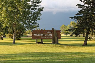
Vermilion Provincial Park is a provincial park located in east-central Alberta, Canada, in the County of Vermilion River. It is located on the outskirts of the town of Vermilion, which is at the junction of Highways 16 (Yellowhead) and 41, between Edmonton and Lloydminster.

Highway 63 is a 434-kilometre (270 mi) highway in northern Alberta, Canada that connects the Athabasca oil sands and Fort McMurray to Edmonton via Highway 28. It begins as a two-lane road near the hamlet of Radway where it splits from Highway 28, running north through aspen parkland and farmland of north central Alberta. North of Boyle, it curves east to pass through the hamlet of Grassland and becomes divided west of Atmore where it again turns north, this time through heavy boreal forest and muskeg, particularly beyond Wandering River. Traffic levels significantly increase as Highway 63 bends through Fort McMurray, crossing the Athabasca River before connecting the city to the Syncrude and Suncor Energy plants further north. It ends approximately 16 km (10 mi) beyond a second crossing of the Athabasca River northeast of Fort McKay.

Amber Valley is an unincorporated community in northern Alberta, Canada, approximately 160 kilometres (99 mi) north of Edmonton. Its elevation is 608 m (1,995 ft). Originally named Pine Creek, Amber Valley was among several Alberta communities settled in the early 20th century by early Black immigrants to the province from Oklahoma and the Deep South of the United States. About 1,000 African Americans emigrated to Alberta from 1909-1911. Amber Valley is the location of the Obadiah Place provincial heritage site, a homestead of one of the first African-American settler families.

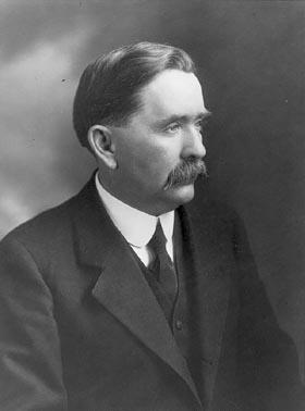
John Robert Boyle was a Canadian politician and jurist who served as a Member of the Legislative Assembly of Alberta, a cabinet minister in the Government of Alberta, and a judge on the Supreme Court of Alberta. Born in Ontario, he came west and eventually settled in Edmonton, where he practiced law. After a brief stint on Edmonton's first city council, he was elected in Alberta's inaugural provincial election as a Liberal. During the Alberta and Great Waterways Railway scandal, he was a leader of the Liberal insurgency that forced Premier Alexander Cameron Rutherford from office.

McGregor Lake is an elongated reservoir in Southern Alberta. McGregor Lake was created in 1920 by the completion of two dams bracketing water flowing through in Snake Valley. It is situated 100 km (62 mi) southeast of Calgary in the Vulcan County.
Portage College is a public board-governed community college in Lac La Biche, Alberta, Canada. Portage has seven campus locations throughout northeastern Alberta.

Alberta Provincial Highway No. 663 is a highway in the province of Alberta, Canada. It runs west-east from Highway 44 near Fawcett, runs concurrent with Highway 2 and Highway 63 to Boyle. Then to a concurrency with Highway 55 in Lac La Biche before extending north around Lakeland Provincial Park to Torchwood Lake. It is also known as Taylor Road in Boyle, and 88 Avenue in Lac La Biche.

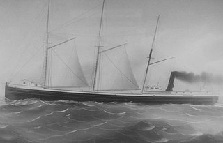
The John M. Osborn was a wooden steam barge that sank in Lake Superior in 1884 with the loss of five lives. The Osborn was just 2 years old when the larger, steel-hulled Alberta, which was called a "steel monster" and "terror of the lakes", rammed her. The wreck of the Osborn was discovered 100 years after her sinking. The wreck was illegally salvaged in the 1980s. Many of Osborn's artifacts became the property of the State of Michigan after they were seized from Great Lakes Shipwreck Museum. The State allows the museum to display the artifacts as a loan. The wreck of the Osborn is now protected by the Whitefish Point Underwater Preserve as part of an underwater museum.

The first inhabitants hunted and gathered in the area that is now Edmonton, Alberta, Canada, around 3,000 BC and perhaps as early as 10,000 BC, when an ice-free corridor opened up as the last ice age ended and timber, water, and wildlife became available in the region.
Caslan is a hamlet in central Alberta, Canada in Athabasca County. It is 21 kilometres (13 mi) south of Highway 55, 152 kilometres (94 mi) west of Cold Lake. The first baby in the area was born in 1921.
Lac St. Cyr is a lake in the County of St. Paul No. 19, Alberta. The lake is near the town of St. Paul and since 1951 has been used as a source of water. In 1978, seasonal pumping of water from the North Saskatchewan River into the lake was begun to address a fall in the water level.

The Long Lake oil sands upgrader project is an in situ oil extraction project near Anzac, Alberta, 40 km (25 mi) southeast of Fort McMurray in the Athabasca oil sands region of Alberta.
Alberta Provincial Highway No. 46, commonly referred to as Highway 46, was a highway in north-central Alberta, Canada connecting Edmonton to Lac La Biche. It existed between the 1950s and 1970s, and has formed portions of Highways 55 and 63 since the late 1970s.

The Lubicon Lake Band is a Cree First Nations band government in northern Alberta, Canada. Missed by government agents during the signing of Treaty 8 in 1899, the Lubicon community was long without federal support. Seeking to have their traditional title acknowledged through the creation of an Indian reserve, Lubicon representatives have maintained an active land claim since 1933. As oil and gas development changed the face of Alberta, development on Lubicon land became an increasingly pressing issue. Between 1979 and 1982, over 400 oil and gas wells were drilled around the community of Little Buffalo, the band's headquarters. Most prominently, the nation mounted a protest campaign during the 1988 Winter Olympics in Calgary, blockading roads crossing its traditional territory in October of the same year.

The Ghost River is a river in Alberta, Canada. It begins within the front ranges of the Canadian Rocky Mountains, joining the Bow River at Ghost Lake. These waters flow through Cochrane, Calgary, and ultimately into Hudson Bay. The upper reaches of the Ghost are fully protected by the Ghost River Wilderness Area.


