Long Puak

Last updated
Long Puak
Borneo Locator Topography.png
Red pog.svg
Long Puak
Coordinates: 3°49′00″N114°26′00″E / 3.81667°N 114.43333°E / 3.81667; 114.43333 Coordinates: 3°49′00″N114°26′00″E / 3.81667°N 114.43333°E / 3.81667; 114.43333
Country Flag of Malaysia.svg  Malaysia
State Flag of Sarawak.svg  Sarawak
Administrative Division Marudi
Elevation
152 m (499 ft)

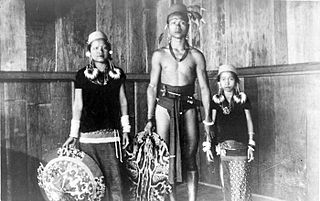
Long Puak, formerly known as Long Ballong, is a small-village found about 2 km from Long Banga in the Marudi division of Sarawak, Malaysia. [1] [2] It lies approximately 519.1 kilometres (323 mi) east-north-east of the state capital Kuching.

Long Ballong, now known as Long Puak, is an abandoned village found less than 0.5 kilometres away from Long Puak in Sarawak.

Long Banga Place in Sarawak, Malaysia

Long Banga is a rural village located in the north east of Sarawak, Malaysia, in the Marudi division. It lies approximately 589.6 kilometres (366 mi) east-north-east of the state capital Kuching. The name of "Long Banga" originated from a small river near the site of the village.

Marudi, Sarawak Town in Sarawak, Malaysia

Marudi is a town on the Baram River in Miri Division, Sarawak, Malaysia. Marudi is a quiet town situated inland from Miri, similar in size to Kapit though nowhere near as busy. Its main attraction is another of the Brooke outposts, the beige wooden Fort Hose. It is the cultural heart of Sarawak's highland tribesfolk, collectively called Orang Ulu. Before Miri was founded, Marudi was the administrative centre of the northern region of Sarawak.

Contents

Description

It is believed that the population is less than 50 people, with majority of the inhabitants being Sabans, along with Kelabit and Kenyah people. The village's main activities are agriculture-based activities like planting paddy, fruits, raising chickens, pigs, buffalo and cows, and fishing.

Kelabit people ethnic group

The Kelabit are an indigenous Dayak people of the Sarawak/North Kalimantan highlands of Borneo with a minority in the neighbouring state of Brunei. They have close ties to the Lun Bawang. The elevation there is slightly over 1,200 meters. In the past, because there were few roads and because the area was largely inaccessible by river because of rapids, the highlands and the Kelabit were relatively untouched by modern western influences. Now, however, there is a relatively permanent road route on which it is possible to reach Bario by car from Miri. The road is marked but driving without a local guide is not advisable, as it takes over 11 hours of driving to reach Bario from Miri through many logging trail junctions and river crossings.

Kenyah people ethnic group

The Kenyah people are an indigenous, Austronesian-speaking people of Borneo, living in the remote Baram, Data Kakus, Data Surau, Senap River, Long Dungan, Long Busang, Long Beyak, Bintulu, Miri, Asap River resettlement for Bakun Dam, Long Bulan, Long Jawe and Belaga regions in Sarawak, Malaysia and the remote Apau Kayan, Bahau (Bau), Benua Lama, Benua Baru and Mahakam regions in East Kalimantan, Indonesia.

The village is very quiet; most of the younger generation have gone to urban areas like Miri and Marudi in search of better living and employment opportunities. Some have also gone to nearby logging camps to work as woodmen, mechanics and other timber-related jobs.

Miri, Malaysia City in Sarawak, Malaysia

Miri is a coastal city in northeastern Sarawak, Malaysia, located near the border of Brunei, on the island of Borneo. The city covers an area of 997.43 square kilometres (385.11 sq mi), located 798 kilometres (496 mi) northeast of Kuching and 329 kilometres (204 mi) southwest of Kota Kinabalu. Miri is the second largest city in Sarawak, with a population of 358,020 as of 2016. The city is also the capital of Miri District of the Miri Division.

Education

Most of the children in the village will be sent to Long Banga for primary education; for secondary school, they will be sent to Bario.

Bario Town in Sarawak, Malaysia

Bario is a community of 13 to 16 villages located on the Kelabit Highlands in Miri Division, Sarawak, Malaysia, lying at an altitude of 1000 m (3280 ft) above sea level. It is located close to the Sarawak-Kalimantan border, 178 km to the east of Miri. It is the main settlement for the indigenous Kelabit tribe. There are regular flights between the Bario, Miri and Marudi.

Neighbouring settlements

Neighbouring settlements include:

Long Banio Place in Sarawak, Malaysia

Long Banio is a large longhouse village in the Marudi division of Sarawak, Malaysia. It lies approximately 522.5 kilometres (325 mi) east-north-east of the state capital Kuching.

Long Laput Place in Sarawak, Malaysia

Long Laput is a settlement in the rural interior of the Marudi district of Sarawak, Malaysia. It lies approximately 514.3 kilometres (320 mi) east-north-east of the state capital Kuching.

Lirong Kawit Place in Sarawak, Malaysia

Lirong Kawit is a settlement in the Miri division of Sarawak, Malaysia. It lies approximately 514.5 kilometres (320 mi) east-north-east of the state capital Kuching.

Related Research Articles

Long Selatong Place in Sarawak, Malaysia

Long Selatong is a Kenyah longhouse in the Marudi division of Sarawak, Malaysia. It lies approximately 531.2 kilometres (330 mi) east-north-east of the state capital Kuching.

Rumah Kulit Place in Sarawak, Malaysia

Rumah Kulit is a settlement in the Belaga division of Sarawak, Malaysia. It lies approximately 438.4 kilometres (272 mi) east of the state capital Kuching.

Pa Bangar Place in Sarawak, Malaysia

Pa Bangar is a settlement in the Marudi division of Sarawak, Malaysia. It lies approximately 621.9 kilometres (386 mi) east-north-east of the state capital Kuching.

Long Seridan Place in Sarawak, Malaysia

Long Seridan is a Kelabit settlement in the Miri division of Sarawak, Malaysia. It lies approximately 590 kilometres (367 mi) east-north-east of the state capital Kuching.

Long Napir Place in Sarawak, Malaysia

Long Napir is a cluster of four settlements of Penan and Kelabit people in the Limbang division of Sarawak, Malaysia. It lies approximately 606 kilometres (377 mi) east-north-east of the state capital Kuching.

Kampung Buang Place in Sarawak, Malaysia

Kampung Buang is a settlement in the Marudi division of Sarawak, Malaysia. It lies approximately 541.6 kilometres (337 mi) east-north-east of the state capital Kuching, near the border with Brunei.

Kampung Setapang Place in Sarawak, Malaysia

Kampung Setapang is a settlement in the Miri division of Sarawak, Malaysia. It lies approximately 536.8 kilometres (334 mi) east-north-east of the state capital Kuching.

Kampung Melikat Place in Sarawak, Malaysia

Kampung Melikat is a settlement in the Marudi division of Sarawak, Malaysia. It lies approximately 530.8 kilometres (330 mi) east-north-east of the state capital Kuching.

Rumah Sebatang Place in Sarawak, Malaysia

Rumah Sebatang is a settlement in the Miri division of Sarawak, Malaysia. It lies approximately 487.3 kilometres (303 mi) east-north-east of the state capital Kuching.

Long Tungan Place in Sarawak, Malaysia

Long Tungan is a settlement in the Marudi division of Sarawak, Malaysia. It lies approximately 564.4 kilometres (351 mi) east-north-east of the state capital Kuching.

Long Palai Place in Sarawak, Malaysia

Long Palai is a settlement in the Marudi division of Sarawak, Malaysia. It lies approximately 526.3 kilometres (327 mi) east-north-east of the state capital Kuching.

Long Peluan Place in Sarawak, Malaysia

Long Peluan is a settlement in the Marudi division of Sarawak, Malaysia. It lies approximately 594.4 kilometres (369 mi) east-north-east of the state capital Kuching.

Long Baleh Place in Sarawak, Malaysia

Long Baleh is a settlement in the Marudi division of Sarawak, Malaysia. It lies approximately 597.3 kilometres (371 mi) east-north-east of the state capital Kuching.

Pa Dali Place in Sarawak, Malaysia

Pa Dali is a Kelabit settlement in the Marudi division of Sarawak, Malaysia. It lies approximately 619.9 kilometres (385 mi) east-north-east of the state capital Kuching, in the Kelabit Highlands.

Rumah Nyumbang Place in Sarawak, Malaysia

Rumah Nyumbang is a settlement in the Kanowit division of Sarawak, Malaysia. It lies approximately 146.9 kilometres (91 mi) east of the state capital Kuching.

Rumah Asun Place in Sarawak, Malaysia

Rumah Asun is a settlement in the Kanowit division of Sarawak, Malaysia. It lies approximately 150.9 kilometres (94 mi) east of the state capital Kuching.

References

  1. M. Mohizah, S. Julia and W. K. Soh (2006). A Sarawak Gazetteer (PDF). Kuala Lumpur: Sarawak Forestry Department Malaysia and Forest Research Institute Malaysia. ISBN   983-2181-86-0. OCLC   85818866. Archived from the original (PDF) on 2011-07-22. Retrieved 2011-01-01.
  2. "Long Puak, Malaysia". Geonames. 1994-02-10. Retrieved 2010-12-27.