Los Nacimientos (Belén) | |
|---|---|
Municipality and village | |
| Country | |
| Province | Catamarca Province |
| Department | Belén |
| Time zone | UTC−3 (ART) |
Los Nacimientos is a village and municipality in Catamarca Province in northwestern Argentina. [1]
Los Nacimientos (Belén) | |
|---|---|
Municipality and village | |
| Country | |
| Province | Catamarca Province |
| Department | Belén |
| Time zone | UTC−3 (ART) |
Los Nacimientos is a village and municipality in Catamarca Province in northwestern Argentina. [1]

Bridal Veil Falls Provincial Park is a BC Park located on the Trans-Canada Highway just east of Rosedale, British Columbia, Canada, part of the City of Chilliwack. The community of Bridal Falls is located adjacent to the falls and park as well as the interchange between the Trans-Canada and BC Highway 9 and has a variety of highway-based tourism services. Access to the falls requires a short hike from the parking lot and well groomed trails, taking most groups 15-25 minutes.

Coroico is a town in Nor Yungas Province, in the La Paz Department of western Bolivia.
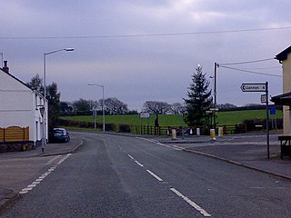
Five Roads is a village on the B4309 road in Carmarthenshire, Wales, 5 miles (8.0 km) from Llanelli and 10 miles (16 km) from Carmarthen.
Athos Range is the northernmost range in the Prince Charles Mountains of Mac. Robertson Land, Antarctica. The range consists of many individual mountains and nunataks that trend east–west for 40 miles (64 km) along the north side of Scylla Glacier.
The Fairmount neighborhood is located within the West Duluth district of Duluth, Minnesota, United States.
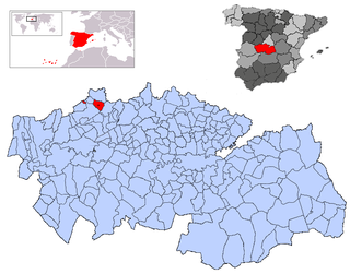
Almendral de la Cañada is a municipality located in the province of Toledo, Castile-La Mancha, Spain. According to the 2018 census (INE), the municipality has a population of 305 inhabitants.
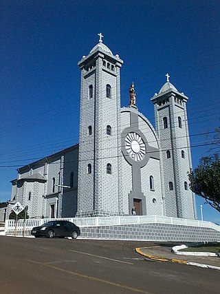
Jaborá is a municipality in the state of Santa Catarina in the South region of Brazil.
Karageorgievo is a village in the municipality of Aytos Municipality, in Burgas Province, in southeastern Bulgaria.
San Pedro (Capayán) is a village and municipality in Catamarca Province in northwestern Argentina.
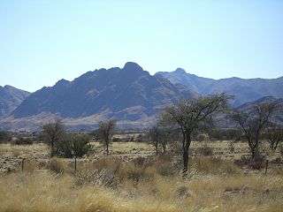
The Great Karas Mountains are located in the ǁKaras Region of southern Namibia, the driest part of the country. Mt. Schroffenstein, at 2206 meters is the highest peak in the range. The peak lies about ten kilometers east of the national road B1 between Keetmanshoop and Grünau.
Charles Peak is a bare rock peak, 990 metres (3,250 ft) high, surmounting the southeast end of the Collier Hills in the Heritage Range. It was mapped by the United States Geological Survey from surveys and from U.S. Navy air photos, 1961–66, and named by the Advisory Committee on Antarctic Names for Charles E. Williams, meteorologist at Little America V Station in 1958.
Visser Hill is a hill 2.5 nautical miles (4.6 km) south of Mount Velain in northern Adelaide Island. Mapped from air photos taken by Ronne Antarctic Research Expedition (RARE) (1947–48) and Falkland Islands and Dependencies Aerial Survey Expedition (FIDASE) (1956–57). Named by United Kingdom Antarctic Place-Names Committee (UK-APC) for Philipp C. Visser (1882–1955), Dutch diplomat and mountaineer who made classic investigations of glaciers in the Karakoram (1921–35).

Cape Evensen is a cape forming the north side of the entrance to Auvert Bay, on the northwest coast of Stresher Peninsula, Graham Land in Antarctica. It was discovered by the French Antarctic Expedition, 1903–05, and named by Jean-Baptiste Charcot for Captain C.J. Evensen of the Hertha, who explored along the west coast of the Antarctic Peninsula in 1893.

Forbes Glacier is a glacier which flows from Hemimont Plateau west into the northeast corner of Square Bay, on the west coast of Graham Land, Antarctica. It is 10 nautical miles (19 km) long, 4 nautical miles (7 km) wide in its central part, and narrows to 2 nautical miles (4 km) at its mouth. The lower reaches of the glacier were first surveyed in 1936 by the British Graham Land Expedition under John Rymill. The survey was completed in 1946–48 by the Falkland Islands Dependencies Survey who named the glacier for James David Forbes, a Scottish physicist who was noted for his pioneer works on glaciology.
Cape Henderson is an ice-free cape, overlain by morainic drift, marking the northwest end of the Bunger Hills in Antarctica. It was mapped from air photos taken by U.S. Navy Operation Highjump in February 1947, and was named by the Advisory Committee on Antarctic Names for the USS Henderson (DD-785), the destroyer escort of the western task group of Operation Highjump, Task Force 68, 1946–47.
Mount Velain is a 750 m tall mountain with an isolated, black triangular summit showing through its snow mantle, standing in the northeast part of Adelaide Island. It was first charted by the French Antarctic Expedition 1903–05, under Charcot, and named by him for Charles Velain, a French geologist, geographer, and professor of physical geography at the Sorbonne.
Toualet is a small town and rural commune in Settat Province of the Chaouia-Ouardigha region of Morocco. At the time of the 2004 census, the commune had a total population of 11815 people living in 1708 households.
SS Richard Bland was a Liberty ship built in the United States during World War II. She was named after Richard Bland, an American planter and statesman from Virginia. He served for many terms in the House of Burgesses, was a delegate to the Continental Congress in 1774 and 1775, and is considered a Founding Father of the United States.
The Anglican Diocese of Asaba is one of 12 within the Anglican Province of Bendel, itself one of 14 provinces within the Church of Nigeria. The current bishop is Kingsley Chukwukamadu Obuh.
27°11′S66°44′W / 27.183°S 66.733°W
| | This article about a place in Catamarca Province, Argentina is a stub. You can help Wikipedia by expanding it. |
