Loudoun Heights | |
---|---|
Highest point | |
Elevation | 1,175 ft (358 m) [1] |
Prominence | 340 ft (100 m) |
Coordinates | 39°18′28″N77°44′19″W / 39.30778°N 77.73861°W [2] |
Geography | |
Location | Loudoun County, Virginia / Jefferson County, West Virginia, U.S. |
Parent range | Blue Ridge Mountains Appalachian Mountains |
Topo map | USGS Harpers Ferry |
Loudoun Heights, sometimes referred to as Loudoun Mountain, is the first peak of the Blue Ridge Mountain south of the Potomac River in Loudoun County, Virginia and Jefferson County, West Virginia. The northwestern slope is part of Harpers Ferry National Historical Park.
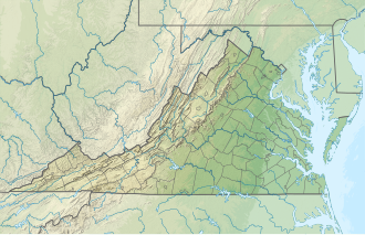
The peak, which overlooks Harpers Ferry, was used by Stonewall Jackson to bombard the town during the Battle of Harpers Ferry. It was also the scene of the first and perhaps worst defeat for Confederate Partisan John Mosby at the hands of the Cole's Maryland Cavalry during the Battle of Loudoun Heights.
The Appalachian Trail (AT) traverses the peak before descending its northwestern slope to the Shenandoah River and Harpers Ferry. A spur trail called the Loudoun Heights Trail (the original route of the AT) leads off the AT down the northern slope, passing by Civil War earthworks and providing good views of the confluence of the Potomac and Shenandoah as well as Harpers Ferry at the Split Rock overlook. [3] The trail until recently descended from the overlook before crossing the Potomac on the U.S. Route 340 bridge and rejoining the AT at Sandy Hook, Maryland. However, this section was closed due to erosion and damage following storms.
Harpers Ferry is a historic town in Jefferson County, West Virginia, in the lower Shenandoah Valley. The town's population was 269 at the 2020 United States census. Situated at the confluence of the Potomac and Shenandoah rivers, where Maryland, Virginia, and West Virginia meet, it is the easternmost town in West Virginia as well as its lowest point above sea level.
Jefferson County is located in the Shenandoah Valley in the Eastern Panhandle of West Virginia. It is the easternmost county of the U.S. state of West Virginia. As of the 2020 census, the population was 57,701. Its county seat is Charles Town. The county was founded in 1801, and today is part of the Washington metropolitan area.
Leesburg is a town in and the county seat of Loudoun County, Virginia, United States. It is part of both the Northern Virginia region of the state and the Washington metropolitan area, including Washington, D.C., the nation's capital.
Bolivar is a town in Jefferson County, West Virginia, United States. The population was 1,072 at the 2020 census. The town is named for South American revolutionary leader Simón Bolívar. Located in West Virginia's Eastern Panhandle, it is part of the northwestern fringes of the Washington metropolitan area.
The Battle of Harpers Ferry was fought September 12–15, 1862, as part of the Maryland Campaign of the American Civil War. As Confederate Army General Robert E. Lee's Confederate army invaded Maryland, a portion of his army under Major General Thomas J. "Stonewall" Jackson surrounded, bombarded, and captured the Union garrison at Harpers Ferry, Virginia.
U.S. Route 340 is a spur route of US 40, and runs from Greenville, Virginia, to Frederick, Maryland. In Virginia, it runs north–south, parallel and east of US 11, from US 11 north of Greenville via Waynesboro, Grottoes, Elkton, Luray, Front Royal, and Berryville to the West Virginia state line. A short separate piece crosses northern Loudoun County on its way from West Virginia to Maryland.
Harpers Ferry National Historical Park, originally Harpers Ferry National Monument, is located at the confluence of the Potomac and Shenandoah rivers in and around Harpers Ferry, West Virginia. The park includes the historic center of Harpers Ferry, notable as a key 19th-century industrial area and as the scene of John Brown's failed abolitionist uprising. It contains the most visited historic site in the state of West Virginia, John Brown's Fort.
Blue Ridge Mountain, also known as Blue Mountain, is the colloquial name of the westernmost ridge of the Blue Ridge Mountains in northern Virginia and the Eastern Panhandle of West Virginia. The Appalachian Trail traverses the entire length of the mountain along its western slope and crest.
Loudoun Heights is an unincorporated community in Loudoun County, Virginia, near Purcellville and Harpers Ferry, West Virginia. It is located in the Between the Hills region of the county along Harpers Ferry Road and is bounded to its northwest and northeast by the Harpers Ferry National Historical Park on the Potomac River. The Blue Ridge and Short Hill Mountain bound it to the west and east.
U.S. Route 50 is a transcontinental highway which stretches from Ocean City, Maryland to West Sacramento, California. In the U.S. state of Virginia, US 50 extends 86 miles (138 km) from the border with Washington, D.C. at a Potomac River crossing at Rosslyn in Arlington County to the West Virginia state line near Gore in Frederick County.
The Battle of Mile Hill was a cavalry skirmish during the American Civil War, that took place just north of Leesburg, Virginia, on September 2, 1862. It preceded the occupation of the town by the Army of Northern Virginia just prior to its crossing of the Potomac River starting the Maryland Campaign.
Short Hill Mountain is a mountain ridge of the Blue Ridge Mountains in northwest Loudoun County, Virginia.
Between the Hills is a small valley in northwest Loudoun County, Virginia, distinct from, but associated with, the greater Loudoun Valley.
Loudoun County, Virginia, was destined to be an area of significant military activity during the American Civil War. Located on Virginia's northern frontier, the Potomac River, Loudoun County became a borderland after Virginia's secession from the Union in early 1861. Loudoun County's numerous Potomac bridges, ferries and fords made it an ideal location for the Union and Confederate armies to cross into and out of Virginia. Likewise, the county's several gaps in the Blue Ridge Mountains that connected the Piedmont to the Shenandoah Valley and Winchester were of considerable strategic importance. The opposing armies would traverse the county several times throughout the war leading to several small battles, most notably the Battle of Ball's Bluff.
Jefferson Rock is a rock formation on the Appalachian Trail in Harpers Ferry, West Virginia. It consists of several large masses of Harpers shale, piled one upon the other, that overlook the Shenandoah River just prior to its confluence with the Potomac River. It was added to the National Register of Historic Places as a contributing property of the Harpers Ferry National Historical Park on October 15, 1966.
Snickers Gap, originally William's Gap, is a wind gap in the Blue Ridge Mountain on the border of Loudoun County and Clarke County in Virginia. The gap is traversed by Virginia State Route 7. The Appalachian Trail also passes across the gap. Bear's Den and Raven Rocks are adjacent to the gap.
Elk Ridge, or Elk Mountain, is a mountain ridge of the Blue Ridge Mountains in Maryland and is the westernmost of four parallel ridges. It forms the western side of a narrow valley in which are situated the towns of Yarrowsburg and Brownsville. South Mountain is on the eastern side of this valley running roughly parallel to it. The ridge runs from Rohrersville, in the north, to the Potomac River across from Harpers Ferry, West Virginia, in the south. Across the Potomac the ridge continues as Blue Ridge Mountain in Virginia and West Virginia. To the west of Elk Mountain is the broader Cumberland Valley, in which lie the towns of Hagerstown and Chambersburg, and the Potomac River. The southern end of the ridge, which is part of Harpers Ferry National Historical Park, is known as Maryland Heights.
The Potomac Water Gap is a double water gap in the Blue Ridge Mountains, located at the intersection of the states of Virginia, West Virginia and Maryland, near Harpers Ferry. At 256 feet (78 m), it is the lowest crossing of the Blue Ridge Mountains.
The B & O Railroad Potomac River Crossing is a 15-acre (6.1 ha) historic site where a set of railroad bridges, originally built by the Baltimore and Ohio Railroad, span the Potomac River between Sandy Hook, Maryland and Harpers Ferry, West Virginia. The site was added to the National Register of Historic Places on February 14, 1978, for its significance in commerce, engineering, industry, invention, and transportation.
The Bolivar Heights Battlefield in Jefferson County, West Virginia, partly in the town of Bolivar, is an American Civil War battlefield which, – because of its strategic position overlooking Harpers Ferry, where the U.S. had an armory, and its placement at the head of the Shenandoah Valley – was the site of five separate engagements between Union and Confederate forces: in October 1861, May and September 1862, June 1863, and July 1864. The battlefield lies partly on the 669-foot (204 m) Bolivar Heights plateau, but also includes School House Ridge to the west, and the slopes of both, which meet at Bakerton Road. The site was also used by the armies as a campground, and, in 1864, as a Union corral and wagon yard.