Lowell Point, Alaska

Last updated

Lowell Point, Alaska
USA Alaska location map.svg
Red pog.svg
Lowell
Point
Location within the state of Alaska
Coordinates: 60°4′18″N149°26′37″W / 60.07167°N 149.44361°W / 60.07167; -149.44361
CountryUnited States
State Alaska
Borough Kenai Peninsula
Government
  Borough mayor Peter Micciche
   State senator Gary Stevens (R)
   State rep. Louise Stutes (R)
Area
[1]
  Total11.75 sq mi (30.43 km2)
  Land11.73 sq mi (30.37 km2)
  Water0.02 sq mi (0.06 km2)
Elevation
36 ft (11 m)
Population
 (2020)
  Total79
  Density6.74/sq mi (2.60/km2)
Time zone UTC-9 (Alaska (AKST))
  Summer (DST) UTC-8 (AKDT)
ZIP code
99664 [2]
Area code 907
FIPS code 02-45295
GNIS feature ID1865557
Lowell Point Recreation Area sign Lowell Point (40784938333).jpg
Lowell Point Recreation Area sign

Lowell Point is a census-designated place (CDP) in Kenai Peninsula Borough, Alaska, United States, just outside Seward. At the 2010 census the population was 80, [3] down from 92 in 2000.

Contents

Geography

Lowell Point is located on the east side of the Kenai Peninsula at 60°4′18″N149°26′37″W / 60.07167°N 149.44361°W / 60.07167; -149.44361 (60.071557, -149.443715). [4] It sits on the western shore of Resurrection Bay and is bordered to the northeast by the city of Seward. According to the United States Census Bureau, the CDP has a total area of 11.9 square miles (30.9 km2), of which 0.02 square miles (0.06 km2), or 0.18%, are water. [3]

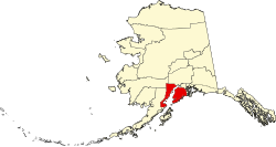
The only road access is Lowell Point Road, an extension of Seward's Railway Avenue which begins beyond the Seward townsite boundaries, a short distance southwest of the Alaska SeaLife Center and the southern terminus of the Seward Highway. The road is a rough gravel road running along a thin strip of flat land between the mountains and Resurrection Bay, and provides access to the CDP, and beyond to Caines Head State Recreation Area and Fort McGilvray.

Lowell Point does not have a formal harbor, as the well-developed Seward Harbor is a short distance away, but small boats can make beach landings.

Demographics

Historical population
CensusPop.Note
1890 12
2000 92
2010 80−13.0%
2020 79−1.2%
U.S. Decennial Census [5]

Lowell Point first appeared on the 1890 U.S. Census as the homestead of the Captain Franklin G. Lowell family, consisting of 12 residents, 10 Whites, 1 Native & 1 Creole (mixed Native & Russian). [6] It did not report again until 2000, when it first appeared as Lowell Point and made a census-designated place (CDP).

As of the census [7] of 2000, there were 92 people, 39 households, and 20 families residing in the CDP. The population density was 7.8 inhabitants per square mile (3.0/km2). There were 72 housing units at an average density of 6.1 per square mile (2.4/km2). The racial makeup of the CDP was 92.39% White, 1.09% Black or African American, 4.35% Native American and 2.17% Asian. 2.17% of the population were Hispanic or Latino of any race.

There were 39 households, out of which 20.5% had children under the age of 18 living with them, 43.6% were married couples living together, and 48.7% were non-families. 43.6% of all households were made up of individuals, and 2.6% had someone living alone who was 65 years of age or older. The average household size was 2.00 and the average family size was 2.75.

In the CDP, the population was spread out, with 15.2% under the age of 18, 7.6% from 18 to 24, 44.6% from 25 to 44, 27.2% from 45 to 64, and 5.4% who were 65 years of age or older. The median age was 36 years. For every 100 females, there were 187.5 males. For every 100 females age 18 and over, there were 212.0 males.

The median income for a household in the CDP was $32,000, and the median income for a family was $137,566. Males had a median income of $53,750 versus $54,000 for females. The per capita income for the CDP was $45,790. There were 31.3% of families and 28.4% of the population living below the poverty line, including no under eighteens and none of those over 64.

Related Research Articles

<span class="mw-page-title-main">Kenai Peninsula Borough, Alaska</span> Borough in Alaska, United States

Kenai Peninsula Borough is a borough of the U.S. state of Alaska. As of the 2020 census, the population was 58,799, up from 55,400 in 2010. The borough seat is Soldotna, the largest city is Kenai, and the most populated community is the census-designated place of Kalifornsky.

<span class="mw-page-title-main">Anchor Point, Alaska</span> Census-designated place in Alaska, United States

Anchor Point is an unincorporated community and census-designated place (CDP) in Kenai Peninsula Borough, in the U.S. state of Alaska. As of the 2010 census the population was 1,930, up from 1,845 in 2000. The community is located along the Sterling Highway, part of Alaska State Route 1. Anchor Point is the westernmost point in the North American highway system.

<span class="mw-page-title-main">Bear Creek, Alaska</span> Census-designated place in Alaska, United States

Bear Creek is a census-designated place (CDP) in Kenai Peninsula Borough, Alaska, United States. At the 2020 census the population was 2,129 up from 1,956 in 2010. Bear Creek is a few miles north of Seward near the stream of the same name and its source, Bear Lake.

<span class="mw-page-title-main">Cohoe, Alaska</span> Census-designated place in Alaska, United States

Cohoe (Dena'ina: Qughuhnaz’ut) is a census-designated place (CDP) in Kenai Peninsula Borough, Alaska, United States. At the 2010 census the population was 1,364, up from 1,168 in 2000.

<span class="mw-page-title-main">Cooper Landing, Alaska</span> Census-designated place in Alaska, United States

Cooper Landing is a census-designated place (CDP) in Kenai Peninsula Borough, Alaska, United States, about 100 miles (160 km) south of Anchorage, at the outlet of Kenai Lake into the Kenai River. The town was first settled in the 19th century by gold and mineral prospectors, and has become a popular summer tourist destination thanks to its scenic location and proximity to the salmon fishery of the Kenai River and Russian River. As of the 2010 census, the population in Cooper Landing was 289, down from 369 in 2000.

<span class="mw-page-title-main">Crown Point, Alaska</span> Census-designated place in Alaska, United States

Crown Point is a census-designated place (CDP) in Kenai Peninsula Borough, Alaska, United States. The population was 74 at the 2010 census. Land access to this area is by either the Alaska Railroad or the Seward Highway.

<span class="mw-page-title-main">Funny River, Alaska</span> Census-designated place in Alaska, United States

Funny River is a census-designated place (CDP) in Kenai Peninsula Borough, Alaska, United States. At the 2010 census the population was 877, up from 636 in 2000.

<span class="mw-page-title-main">Hope, Alaska</span> Census-designated place in Alaska, United States

Hope is a census-designated place (CDP) in Kenai Peninsula Borough in the U.S. state of Alaska. It is eighty-seven miles south from Anchorage. As of the 2010 census the population was 192, up from 137 in 2000.

<span class="mw-page-title-main">Kalifornsky, Alaska</span> Census-designated place in Alaska, United States

Kalifornsky is a census-designated place (CDP) in Kenai Peninsula Borough, Alaska, United States. The population was 8,487 at the 2020 census, up from 7,850 in 2010. It is the most populated locality in the borough.

<span class="mw-page-title-main">Kasilof, Alaska</span> Census-designated place in Alaska, United States

Kasilof is a census-designated place (CDP) in Kenai Peninsula Borough, Alaska, United States. At the 2020 census the population was 525, down from 549 in 2010.

<span class="mw-page-title-main">Moose Pass, Alaska</span> Census-designated place in Alaska, United States

Moose Pass is a census-designated place (CDP) in Kenai Peninsula Borough, Alaska, United States. The population was 219 at the 2010 census, up from 206 in 2000.

<span class="mw-page-title-main">Nikiski, Alaska</span> Census-designated place in Alaska, United States

Nikiski is a census-designated place (CDP) in Kenai Peninsula Borough, Alaska, United States. The population was 4,456 at the 2020 census, down from 4,493 in 2010.

<span class="mw-page-title-main">Primrose, Alaska</span> Census-designated place in Alaska, United States

Primrose is a census-designated place (CDP) in Kenai Peninsula Borough, Alaska, United States. The population was 78 at the 2010 census, down from 93 at the 2000 census. Primrose is one of a number of small communities located north of Seward along the Seward Highway.

Ridgeway is a census-designated place (CDP) in Kenai Peninsula Borough, Alaska, United States. At the 2020 census the population was 2,136, up from 2,022 in 2010.

Salamatof is a census-designated place (CDP) in Kenai Peninsula Borough, Alaska, United States. The population was 1,078 at the 2020 census, up from 980 in 2010. Salamatof is the location for the former Wildwood Air Force Station, which operated from 1965 to 1972. Today, it is the Wildwood Correctional Complex.

<span class="mw-page-title-main">Seward, Alaska</span> City in Alaska, United States

Seward is an incorporated home rule city in Alaska, United States. Located on Resurrection Bay, a fjord of the Gulf of Alaska on the Kenai Peninsula, Seward is situated on Alaska's southern coast, approximately 120 miles (190 km) by road from Alaska's largest city, Anchorage.

<span class="mw-page-title-main">Sterling, Alaska</span> Census-designated place in Alaska, United States

Sterling is a census-designated place (CDP) in Kenai Peninsula Borough, Alaska, United States. At the 2020 census the population was 5,918, up from 5,617 in 2010. Sterling is the tenth-most populated CDP in Alaska.

<span class="mw-page-title-main">Sunrise, Alaska</span> Archaeological site in Alaska, United States

Sunrise is a census-designated place (CDP) in Kenai Peninsula Borough, Alaska, United States. The population was 18 at the 2010 census, unchanged from 2000.

<span class="mw-page-title-main">Point MacKenzie, Alaska</span> CDP in Alaska, United States

Point MacKenzie is a census-designated place (CDP) in Matanuska-Susitna Borough, Alaska, United States. It is part of the Anchorage, Alaska Metropolitan Statistical Area. At the 2020 census the population was 1,852, up from 529 in 2010.

<span class="mw-page-title-main">Stevens Village, Alaska</span> CDP in Alaska, United States

Stevens Village is a census-designated place (CDP) in Yukon-Koyukuk Census Area, Alaska, United States. The population was 78 at the 2010 census, down from 87 in 2000.

References

  1. "2020 U.S. Gazetteer Files". United States Census Bureau. Retrieved October 29, 2021.
  2. "Lowell Point AK ZIP Code". zipdatamaps.com. 2023. Retrieved June 16, 2023.
  3. 1 2 "Geographic Identifiers: 2010 Demographic Profile Data (G001): Lowell Point CDP, Alaska". U.S. Census Bureau, American Factfinder. Retrieved January 18, 2019.[ dead link ]
  4. "US Gazetteer files: 2010, 2000, and 1990". United States Census Bureau. February 12, 2011. Retrieved April 23, 2011.
  5. "U.S. Decennial Census". Census.gov. Retrieved June 6, 2013.
  6. "Report on Population and Resources of Alaska at the Eleventh Census: 1890" (PDF). United States Census Bureau. Government Printing Office.
  7. "U.S. Census website". United States Census Bureau . Retrieved January 31, 2008.