Nikiski, Alaska

Last updated

Nikiski, Alaska
Downtown Nikiski.jpg
AKMap-doton-Nikiski.PNG
Location of Nikiski, Alaska
Coordinates: 60°42′28″N151°15′46″W / 60.70778°N 151.26278°W / 60.70778; -151.26278
CountryUnited States
State Alaska
Borough Kenai Peninsula
Government
  Borough mayor Peter Micciche
   State senator Jesse Bjorkman (R)
   State rep. Ben Carpenter (R)
Area
[1]
  Total75.93 sq mi (196.65 km2)
  Land69.48 sq mi (179.94 km2)
  Water6.45 sq mi (16.71 km2)
Elevation
128 ft (39 m)
Population
 (2020)
  Total4,456
  Density64.14/sq mi (24.76/km2)
Time zone UTC-9 (Alaska (AKST))
  Summer (DST) UTC-8 (AKDT)
ZIP code
99635
Area code 907
FIPS code 02-54050
GNIS feature ID1416651

Nikiski is a census-designated place (CDP) in Kenai Peninsula Borough, Alaska, United States. The population was 4,456 at the 2020 census, [2] down from 4,493 in 2010. [3]

Contents

Geography

Nikiski is located at 60°42′28″N151°15′46″W / 60.70778°N 151.26278°W / 60.70778; -151.26278 (60.707891, -151.262646) [4] on the west side of the Kenai Peninsula. It lies along the shore of Cook Inlet between Salamatof to the south and the Swanson River to the northeast. It is bordered across the Swanson River by the Point Possession CDP.

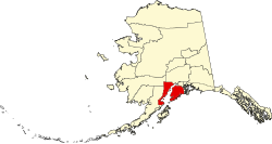
According to the United States Census Bureau, the Nikiski CDP has a total area of 75.9 square miles (196.7 km2), of which 69.4 square miles (179.8 km2) are land and 6.5 square miles (16.8 km2), or 8.57%, are water. [3] The CDP is in a low-lying region covered by several lakes, including Stormy Lake, Suneva Lake, Daniels Lake, Timberlost Lake, Island Lake, Foreland Lake, Bernice Lake, and Cabin Lake.

The main road access is via the Kenai Spur Highway, which leads south 11 miles (18 km) to the city of Kenai and north to Captain Cook State Recreation Area. A second road, the Nikiski Emergency Escape Route, also leads south to the City of Kenai.

Demographics

Historical population
CensusPop.Note
1880 74
1980 1,109
1990 2,743147.3%
2000 4,32757.7%
2010 4,4933.8%
2020 4,456−0.8%
U.S. Decennial Census [5]

Nikiski first appeared on the 1880 U.S. Census as the unincorporated Tinneh villages of "Kultuk" (AKA Nikishka No. 3) and "Titukilsk and Nikishka". Kultuk had a population of 17, and Titukilsk and Nikishka had a population of 57, [6] all of whom were Tinneh Natives. [7] There apparently were no census reports from 1880 until 1980, when the area was organized as "Nikishka" and made a census-designated place (CDP). The name was altered to "Nikiski" in 1990 and has reported as such on each successive census.

As of the census [8] of 2000, there were 4,327 people, 1,514 households, and 1,130 families residing in the CDP. The population density was 62.2 inhabitants per square mile (24.0/km2). There were 1,766 housing units at an average density of 25.4 per square mile (9.8/km2). The racial makeup of the CDP was 87.2% White, 0.1% Black or African American, 7.6% Native American, 0.7% Asian, 0.5% Pacific Islander, 0.8% from other races, and 3.1% from two or more races. 1.3% of the population were Hispanic or Latino of any race.

There were 1,514 households, out of which 41.7% had children under the age of 18 living with them, 60.9% were married couples living together, 7.9% had a female householder with no husband present, and 25.3% were non-families. 20.8% of all households were made up of individuals, and 3.8% had someone living alone who was 65 years of age or older. The average household size was 2.86 and the average family size was 3.31.

In the CDP, the population was spread out, with 33.5% under the age of 18, 6.3% from 18 to 24, 29.8% from 25 to 44, 24.5% from 45 to 64, and 5.9% who were 65 years of age or older. The median age was 34 years. For every 100 females, there were 109.0 males. For every 100 females age 18 and over, there were 111.3 males.

The median income for a household in the CDP was $51,176, and the median income for a family was $55,969. Males had a median income of $50,673 versus $26,779 for females. The per capita income for the CDP was $20,128. About 9.3% of families and 11.4% of the population were below the poverty line, including 13.0% of those under age 18 and 7.5% of those age 65 or over.

History

A motel from the area's boom days, now abandoned Lighthouse Inn Nikiski.jpg
A motel from the area's boom days, now abandoned

Nikiski was once home to an Agrium fertilizer plant, which was once the Kenai Peninsula Borough's largest employer. [9] The facility closed in 2008 due to natural gas shortages, but the company continues to explore reopening it. [9]

Notable people

See also

Related Research Articles

<span class="mw-page-title-main">Kenai Peninsula Borough, Alaska</span> Borough in Alaska, United States

Kenai Peninsula Borough is a borough of the U.S. state of Alaska. As of the 2020 census, the population was 58,799, up from 55,400 in 2010. The borough seat is Soldotna, the largest city is Kenai, and the most populated community is the census-designated place of Kalifornsky.

<span class="mw-page-title-main">Anchor Point, Alaska</span> Census-designated place in Alaska, United States

Anchor Point is an unincorporated community and census-designated place (CDP) in Kenai Peninsula Borough, in the U.S. state of Alaska. As of the 2010 census the population was 1,930, up from 1,845 in 2000. The community is located along the Sterling Highway, part of Alaska State Route 1. Anchor Point is the westernmost point in the North American highway system.

<span class="mw-page-title-main">Bear Creek, Alaska</span> Census-designated place in Alaska, United States

Bear Creek is a census-designated place (CDP) in Kenai Peninsula Borough, Alaska, United States. At the 2020 census the population was 2,129 up from 1,956 in 2010. Bear Creek is a few miles north of Seward near the stream of the same name and its source, Bear Lake.

<span class="mw-page-title-main">Beluga, Alaska</span> Census-designated place in Alaska, United States

Beluga is a census-designated place (CDP) in Kenai Peninsula Borough, Alaska, United States. The population was 20 at the 2010 census, down from 32 in 2000.

<span class="mw-page-title-main">Clam Gulch, Alaska</span> Census-designated place in Alaska, United States

Clam Gulch is a census-designated place (CDP) in Kenai Peninsula Borough, Alaska, United States. At the 2020 census, the population was 207.

<span class="mw-page-title-main">Cohoe, Alaska</span> Census-designated place in Alaska, United States

Cohoe (Dena'ina: Qughuhnaz’ut) is a census-designated place (CDP) in Kenai Peninsula Borough, Alaska, United States. At the 2010 census the population was 1,364, up from 1,168 in 2000.

<span class="mw-page-title-main">Cooper Landing, Alaska</span> Census-designated place in Alaska, United States

Cooper Landing is a census-designated place (CDP) in Kenai Peninsula Borough, Alaska, United States, about 100 miles (160 km) south of Anchorage, at the outlet of Kenai Lake into the Kenai River. The town was first settled in the 19th century by gold and mineral prospectors, and has become a popular summer tourist destination thanks to its scenic location and proximity to the salmon fishery of the Kenai River and Russian River. As of the 2010 census, the population in Cooper Landing was 289, down from 369 in 2000.

<span class="mw-page-title-main">Crown Point, Alaska</span> Census-designated place in Alaska, United States

Crown Point is a census-designated place (CDP) in Kenai Peninsula Borough, Alaska, United States. The population was 74 at the 2010 census. Land access to this area is by either the Alaska Railroad or the Seward Highway.

<span class="mw-page-title-main">Funny River, Alaska</span> Census-designated place in Alaska, United States

Funny River is a census-designated place (CDP) in Kenai Peninsula Borough, Alaska, United States. At the 2010 census the population was 877, up from 636 in 2000.

Happy Valley is a census-designated place (CDP) in Kenai Peninsula Borough, Alaska, United States. At the 2010 census the population was 593, up from 489 in 2000.

<span class="mw-page-title-main">Kalifornsky, Alaska</span> Census-designated place in Alaska, United States

Kalifornsky is a census-designated place (CDP) in Kenai Peninsula Borough, Alaska, United States. The population was 8,487 at the 2020 census, up from 7,850 in 2010. It is the most populated locality in the borough.

<span class="mw-page-title-main">Kasilof, Alaska</span> Census-designated place in Alaska, United States

Kasilof is a census-designated place (CDP) in Kenai Peninsula Borough, Alaska, United States. At the 2020 census the population was 525, down from 549 in 2010.

<span class="mw-page-title-main">Moose Pass, Alaska</span> Census-designated place in Alaska, United States

Moose Pass is a census-designated place (CDP) in Kenai Peninsula Borough, Alaska, United States. The population was 219 at the 2010 census, up from 206 in 2000.

<span class="mw-page-title-main">Nanwalek, Alaska</span> Census-designated place in Alaska, United States

Nanwalek, formerly Alexandrovsk and later English Bay, is a census-designated place (CDP) in the Kenai Peninsula Borough, Alaska, United States, that contains a traditional Alutiiq village. The population was 254 at the 2010 census, up from 177 in 2000. There is one school located in the community, attended by 76 students.

<span class="mw-page-title-main">Primrose, Alaska</span> Census-designated place in Alaska, United States

Primrose is a census-designated place (CDP) in Kenai Peninsula Borough, Alaska, United States. The population was 78 at the 2010 census, down from 93 at the 2000 census. Primrose is one of a number of small communities located north of Seward along the Seward Highway.

Ridgeway is a census-designated place (CDP) in Kenai Peninsula Borough, Alaska, United States. At the 2020 census the population was 2,136, up from 2,022 in 2010.

Salamatof is a census-designated place (CDP) in Kenai Peninsula Borough, Alaska, United States. The population was 1,078 at the 2020 census, up from 980 in 2010. Salamatof is the location for the former Wildwood Air Force Station, which operated from 1965 to 1972. Today, it is the Wildwood Correctional Complex.

Seldovia Village is a census-designated place (CDP) in Kenai Peninsula Borough, Alaska, United States. At the 2010 census the population was 165, up from 144 in 2000. Seldovia Village is not to be confused with the adjacent city of Seldovia.

<span class="mw-page-title-main">Sterling, Alaska</span> Census-designated place in Alaska, United States

Sterling is a census-designated place (CDP) in Kenai Peninsula Borough, Alaska, United States. At the 2020 census the population was 5,918, up from 5,617 in 2010. Sterling is the tenth-most populated CDP in Alaska.

<span class="mw-page-title-main">Tyonek, Alaska</span> Census-designated place in Alaska, United States

Tyonek or Present / New Tyonek is a census-designated place (CDP) in Kenai Peninsula Borough in the U.S. state of Alaska. As of the 2020 census the population was 152, down from 171 in 2010. In 1973, the community formed the Tyonek Native Corporation (TNC) under the Alaska Native Claims Settlement Act and is federally recognized.

References

  1. "2020 U.S. Gazetteer Files". United States Census Bureau. Retrieved October 29, 2021.
  2. "2020 Census Data - Cities and Census Designated Places" (Web). State of Alaska, Department of Labor and Workforce Development. Retrieved October 31, 2021.
  3. 1 2 "Geographic Identifiers: 2010 Demographic Profile Data (G001): Nikiski CDP, Alaska". U.S. Census Bureau, American Factfinder. Retrieved January 22, 2019.[ dead link ]
  4. "US Gazetteer files: 2010, 2000, and 1990". United States Census Bureau. February 12, 2011. Retrieved April 23, 2011.
  5. "U.S. Decennial Census". Census.gov. Retrieved June 6, 2013.
  6. "Statistics of the Population of Alaska" (PDF). United States Census Bureau. 1880.
  7. "Geological Survey Professional Paper". U.S. Government Printing Office. January 13, 2019. Retrieved January 13, 2019 via Google Books.
  8. "U.S. Census website". United States Census Bureau . Retrieved January 31, 2008.
  9. 1 2 "Agrium explores reopening its Nikiski plant". Homer News. October 30, 2013. Retrieved March 30, 2017.