Kalifornsky, Alaska

Last updated

Kalifornsky, Alaska
Unhghenesditnu
AKMap-doton-Kalifornsky.PNG
Location of Kalifornsky, Alaska
Coordinates: 60°28′24″N151°12′5″W / 60.47333°N 151.20139°W / 60.47333; -151.20139
CountryUnited States
State Alaska
Borough Kenai Peninsula
Government
  Borough mayor Peter Micciche
   State senators Jesse Bjorkman (R)
Gary Stevens (R)
   State reps. Ben Carpenter (R)
Justin Ruffridge (R)
Sarah Vance (R)
Area
[1]
  Total69.74 sq mi (180.63 km2)
  Land68.72 sq mi (177.99 km2)
  Water1.02 sq mi (2.64 km2)
Elevation
23 ft (7 m)
Population
 (2020)
  Total8,487
  Density123.5/sq mi (47.68/km2)
Time zone UTC-9 (AKST)
  Summer (DST) UTC-8 (AKDT)
ZIP Codes
99610 (Kasilof)
99611 (Kenai)
99669 (Soldotna)
Area code 907
FIPS code 02-37250
GNIS feature ID1413260

Kalifornsky (Tanaina : Unhghenesditnu) is a census-designated place (CDP) in Kenai Peninsula Borough, Alaska, United States. The population was 8,487 at the 2020 census, [2] up from 7,850 in 2010. [3] It is the most populated locality in the borough.

Contents

Location

Kalifornsky is located at 60°28′24″N151°12′5″W / 60.47333°N 151.20139°W / 60.47333; -151.20139 (60.473421, -151.201427). [4] It is bordered to the north by the city of Kenai and to the east by the city of Soldotna, the borough seat. The Kenai River forms part of the northeast border of the CDP, across which is the CDP of Ridgeway. It is bordered to the south by the CDPs of Cohoe and Kasilof.

According to the United States Census Bureau, the CDP has a total area of 69.8 square miles (180.7 km2), of which 68.9 square miles (178.4 km2) are land and 0.89 square miles (2.3 km2), or 1.27%, are water. [3]

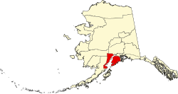
Kalifornsky is on the eastern shore of Cook Inlet on the Kenai Peninsula. It lies off the Sterling Highway along Kalifornsky Beach Road, 4 to 17 miles (6 to 27 km) south of the center of Kenai [5] and 4 to 16 miles (6 to 26 km) west of the center of Soldotna.

Climate

Kalifornsky CDP has relatively mild winter temperatures, ranging from 14 to 27 °F (−10 to −3 °C). Summer temperatures are relatively cool, ranging from 45 to 65 °F (7 to 18 °C). Average annual precipitation is 24 inches (610 mm). [5]

History and culture

The Dena'ina name for Kalifornsky is Unhghenesditnu, meaning 'farthest creek over'. [6]

The place name "Kalifonsky" (omitting the letter "r") was noted in 1916 by the United States Coast and Geodetic Survey, with its etymology attributed to an Indian word kali meaning "fishermen". [5]

However, this place name appears to have been due to a mistaken transcription [7] of the village name "Kalifornsky", which took its name from the surname of the village's founder, a Dena'ina Indian named Qadanalchen (meaning "acts quickly" in the Outer Inlet dialect of the Dena'ina language). Qadanalchen had worked at the Russian American colony of Fort Ross in California from about 1812 to about 1821. On his return to Alaska, Qadanalchen took the name "Kalifornsky", [8] the Russian equivalent of "Californian". [9]

Qadanalchen's great-great-grandson, the self-taught Dena'ina writer and ethnographer Peter Kalifornsky (1911–1993), was born in Kalifornsky village, [10] which lay about 10 miles (16 km) south of Kenai and 4 miles (6 km) north of the mouth of the Kasilof River.

Demographics

Historical population
CensusPop.Note
1980 92
1990 285209.8%
2000 5,8461,951.2%
2010 7,85034.3%
2020 8,4878.1%
U.S. Decennial Census [11]

Kalifornsky first appeared without an "r" the 1980 U.S. Census as Kalifonsky, a census-designated place (CDP). The name was corrected to "Kalifornsky" with the 2000 U.S. Census.

As of the census [12] of 2000, there were 5,846 people, 2,117 households, and 1,596 families residing in the CDP. The population density was 84.5 inhabitants per square mile (32.6/km2). There were 2,479 housing units at an average density of 35.8 per square mile (13.8/km2). The racial makeup of the CDP was 89.8% White, 0.2% Black or African American, 4.6% Native American, 0.7% Asian, 0.1% Pacific Islander, 0.6% from other races, and 4.1% from two or more races. 2.0% of the population were Hispanic or Latino of any race.

There were 2,117 households, out of which 42.0% had children under the age of 18 living with them, 62.3% were married couples living together, 8.0% had a female householder with no husband present, and 24.6% were non-families. 19.4% of all households were made up of individuals, and 2.5% had someone living alone who was 65 years of age or older. The average household size was 2.74 and the average family size was 3.13.

In the CDP, the population was spread out, with 31.3% under the age of 18, 6.1% from 18 to 24, 31.5% from 25 to 44, 25.6% from 45 to 64, and 5.4% who were 65 years of age or older. The median age was 35 years. For every 100 females, there were 107.5 males. For every 100 females age 18 and over, there were 107.1 males.

The median income for a household in the CDP was $54,864, and the median income for a family was $58,750. Males had a median income of $50,583 versus $30,493 for females. The per capita income for the CDP was $23,898. About 6.6% of families and 7.9% of the population were below the poverty line, including 9.2% of those under age 18 and none of those age 65 or over.

Economy and transportation

The area's economy is diverse. Industries and services providing employment include oil and gas processing, timber, commercial and sport fishing, government, retail businesses, and tourism. [5]

Kalifornsky Beach Road is frequently trafficked by Kenai River sports fishermen. The nearby Sterling Highway, a component of Alaska Route 1, provides access to the state road system. The nearby city of Kenai has an airport and boating facilities. [5]

Related Research Articles

<span class="mw-page-title-main">Kenai Peninsula Borough, Alaska</span> Borough in Alaska, United States

Kenai Peninsula Borough is a borough of the U.S. state of Alaska. As of the 2020 census, the population was 58,799, up from 55,400 in 2010. The borough seat is Soldotna, the largest city is Kenai, and the most populated community is the census-designated place of Kalifornsky.

<span class="mw-page-title-main">Anchor Point, Alaska</span> Census-designated place in Alaska, United States

Anchor Point is an unincorporated community and census-designated place (CDP) in Kenai Peninsula Borough, in the U.S. state of Alaska. As of the 2010 census the population was 1,930, up from 1,845 in 2000. The community is located along the Sterling Highway, part of Alaska State Route 1. Anchor Point is the westernmost point in the North American highway system.

<span class="mw-page-title-main">Beluga, Alaska</span> Census-designated place in Alaska, United States

Beluga is a census-designated place (CDP) in Kenai Peninsula Borough, Alaska, United States. The population was 20 at the 2010 census, down from 32 in 2000.

<span class="mw-page-title-main">Clam Gulch, Alaska</span> Census-designated place in Alaska, United States

Clam Gulch is a census-designated place (CDP) in Kenai Peninsula Borough, Alaska, United States. At the 2020 census, the population was 207.

<span class="mw-page-title-main">Cohoe, Alaska</span> Census-designated place in Alaska, United States

Cohoe (Dena'ina: Qughuhnaz’ut) is a census-designated place (CDP) in Kenai Peninsula Borough, Alaska, United States. At the 2010 census the population was 1,364, up from 1,168 in 2000.

<span class="mw-page-title-main">Cooper Landing, Alaska</span> Census-designated place in Alaska, United States

Cooper Landing is a census-designated place (CDP) in Kenai Peninsula Borough, Alaska, United States, about 100 miles (160 km) south of Anchorage, at the outlet of Kenai Lake into the Kenai River. The town was first settled in the 19th century by gold and mineral prospectors, and has become a popular summer tourist destination thanks to its scenic location and proximity to the salmon fishery of the Kenai River and Russian River. As of the 2010 census, the population in Cooper Landing was 289, down from 369 in 2000.

<span class="mw-page-title-main">Funny River, Alaska</span> Census-designated place in Alaska, United States

Funny River is a census-designated place (CDP) in Kenai Peninsula Borough, Alaska, United States. At the 2010 census the population was 877, up from 636 in 2000.

Happy Valley is a census-designated place (CDP) in Kenai Peninsula Borough, Alaska, United States. At the 2010 census the population was 593, up from 489 in 2000.

<span class="mw-page-title-main">Hope, Alaska</span> Census-designated place in Alaska, United States

Hope is a census-designated place (CDP) in Kenai Peninsula Borough in the U.S. state of Alaska. It is eighty-seven miles south from Anchorage. As of the 2010 census the population was 192, up from 137 in 2000.

<span class="mw-page-title-main">Kasilof, Alaska</span> Census-designated place in Alaska, United States

Kasilof is a census-designated place (CDP) in Kenai Peninsula Borough, Alaska, United States. At the 2020 census the population was 525, down from 549 in 2010.

<span class="mw-page-title-main">Kenai, Alaska</span> City in Alaska, United States

Kenai is a city in the Kenai Peninsula Borough in the U.S. state of Alaska. By road, it is 158 miles southwest of Anchorage. The population was 7,424 as of the 2020 census, up from 7,100 in 2010, the fifteenth-most populated city in the state.

<span class="mw-page-title-main">Nanwalek, Alaska</span> Census-designated place in Alaska, United States

Nanwalek, formerly Alexandrovsk and later English Bay, is a census-designated place (CDP) in the Kenai Peninsula Borough, Alaska, United States, that contains a traditional Alutiiq village. The population was 254 at the 2010 census, up from 177 in 2000. There is one school located in the community, attended by 76 students.

<span class="mw-page-title-main">Nikiski, Alaska</span> Census-designated place in Alaska, United States

Nikiski is a census-designated place (CDP) in Kenai Peninsula Borough, Alaska, United States. The population was 4,456 at the 2020 census, down from 4,493 in 2010.

<span class="mw-page-title-main">Ninilchik, Alaska</span> Census-designated place in Alaska, United States

Ninilchik is a census-designated place (CDP) in Kenai Peninsula Borough, Alaska, United States. At the 2010 census the population was 883, up from 772 in 2000.

Ridgeway is a census-designated place (CDP) in Kenai Peninsula Borough, Alaska, United States. At the 2020 census the population was 2,136, up from 2,022 in 2010.

Salamatof is a census-designated place (CDP) in Kenai Peninsula Borough, Alaska, United States. The population was 1,078 at the 2020 census, up from 980 in 2010. Salamatof is the location for the former Wildwood Air Force Station, which operated from 1965 to 1972. Today, it is the Wildwood Correctional Complex.

<span class="mw-page-title-main">Seward, Alaska</span> City in Alaska, United States

Seward is an incorporated home rule city in Alaska, United States. Located on Resurrection Bay, a fjord of the Gulf of Alaska on the Kenai Peninsula, Seward is situated on Alaska's southern coast, approximately 120 miles (190 km) by road from Alaska's largest city, Anchorage.

<span class="mw-page-title-main">Soldotna, Alaska</span> City in Alaska, United States

Soldotna is a city in the Kenai Peninsula Borough in the U.S. state of Alaska. At the 2020 census, the population was 4,342, up from 4,163 in 2010. It is the seat of the Kenai Peninsula Borough.

<span class="mw-page-title-main">Sterling, Alaska</span> Census-designated place in Alaska, United States

Sterling is a census-designated place (CDP) in Kenai Peninsula Borough, Alaska, United States. At the 2020 census the population was 5,918, up from 5,617 in 2010. Sterling is the tenth-most populated CDP in Alaska.

Alan S. Boraas is a professor of anthropology at Kenai Peninsula College in Alaska. He is known for his research into the culture, history, and archaeology of the peoples of the Cook Inlet area of Alaska, and in particular has worked closely with the Dena'ina people of the Kenai Peninsula. He is an adopted honorary member of the Kenaitze Indian Tribe, and is helping the tribe develop a program to teach the Dena'ina language.

References

  1. "2020 U.S. Gazetteer Files". United States Census Bureau. Retrieved October 29, 2021.
  2. "2020 Census Data - Cities and Census Designated Places" (Web). State of Alaska, Department of Labor and Workforce Development. Retrieved October 31, 2021.
  3. 1 2 "Geographic Identifiers: 2010 Demographic Profile Data (G001): Kalifornsky CDP, Alaska". U.S. Census Bureau, American Factfinder. Retrieved January 17, 2019.[ dead link ]
  4. "US Gazetteer files: 2010, 2000, and 1990". United States Census Bureau. February 12, 2011. Retrieved April 23, 2011.
  5. 1 2 3 4 5 Community Information Summaries: "Kalifornsky." Alaska Community Database Online, Alaska Department of Commerce, Community, and Economic Development. Retrieved on February 24, 2007.
  6. "Major Native Place Names in Southcentral Alaska" (PDF). uafanlc.alaska.edu. 1985. Retrieved December 30, 2023.
  7. Kizzia, Tom (December 19, 1991), "The Invisible People: In Kalifornsky Village Dena'ina Find a Measure of Past and Peace", Anchorage Daily News , pp. A1
  8. Kizzia, Tom (December 16, 1991), "The Invisible People The Good Land: Competing Myths Shroud Arrival of Russian Traders", Anchorage Daily News , pp. A1
  9. Little, Jon (June 28, 2002), "Diggin' history — Kenaitze youths help archaeology students", Anchorage Daily News , pp. A1
  10. Kalifornsky, Peter (1991), James Kari; Alan Boraas (eds.), A Dena'ina Legacy — K'tl'egh'i Sukdu: The Collected Writings of Peter Kalifornsky, Fairbanks, AK: Alaska Native Language Center, University of Alaska Fairbanks, p. 357, ISBN   1-55500-043-6
  11. "U.S. Decennial Census". Census.gov. Retrieved June 6, 2013.
  12. "U.S. Census website". United States Census Bureau . Retrieved January 31, 2008.