Fritz Creek Community center and general store
In 1954, two acres of private land were designated by a local family for a Fritz Creek Civic and Social Center, intended to be an alternative to the rowdy bar scene in nearby Homer. A large stockade-style log building was built to house the center. Community events such as square dances were held in the building for years. The center was damaged by the 1964 Alaska earthquake and required major repairs to the foundation. Over time the building became less of a community center and was largely rented out for events.
In 1982 the property was sold and the building was converted into a general store and gas station, with a post office being added in 1983. Hot food and a small dining area were added later and the store returned to being something of a gathering spot for the surrounding community. Eventually a liqour store was added as well. In 2019, the store was told by the Alaska Department of Environmental Conservation that Stormy, a cat that had lived in the store for years, was in violation of state law and would need to be removed. Stormy was rehomed with a local resident. [4] The building changed hands several more times before being badly damaged in a fire in July 2023. The cause of the fire is not known. [5] [6] It was reopened under new management in April of 2025 [7]
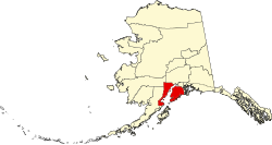
Demographics
Historical population| Census | Pop. | Note | %± |
|---|
| 1970 | 27 | | — |
|---|
| 1980 | 302 | | 1,018.5% |
|---|
| 1990 | 1,426 | | 372.2% |
|---|
| 2000 | 1,603 | | 12.4% |
|---|
| 2010 | 1,932 | | 20.5% |
|---|
| 2020 | 2,248 | | 16.4% |
|---|
|
Fritz Creek first appeared on the 1970 U.S. Census as an unincorporated village. In 1980 it was made a census-designated place (CDP).
As of the census [10] of 2000, there were 1,603 people, 661 households, and 413 families residing in the CDP. The population density was 29.5 inhabitants per square mile (11.4/km2). There were 854 housing units at an average density of 15.7 per square mile (6.1/km2). The racial makeup of the CDP was 93.0% White, 0.2% Black or African American, 2.4% Native American, 0.6% Asian, 0.9% from other races, and 3.1% from two or more races. 2.3% of the population were Hispanic or Latino of any race.
There were 661 households, out of which 36.0% had children under the age of 18 living with them, 52.3% were married couples living together, 7.0% had a female householder with no husband present, and 37.4% were non-families. 29.7% of all households were made up of individuals, and 3.0% had someone living alone who was 65 years of age or older. The average household size was 2.43 and the average family size was 3.06.
In the CDP, the population was spread out, with 29.8% under the age of 18, 4.4% from 18 to 24, 30.4% from 25 to 44, 29.8% from 45 to 64, and 5.6% who were 65 years of age or older. The median age was 38 years. For every 100 females, there were 103.7 males. For every 100 females age 18 and over, there were 109.1 males.
The median income for a household in the CDP was $41,400, and the median income for a family was $49,881. Males had a median income of $42,083 versus $31,250 for females. The per capita income for the CDP was $18,937. About 3.6% of families and 9.6% of the population were below the poverty line, including 11.4% of those under age 18 and 3.4% of those age 65 or over.
This page is based on this
Wikipedia article Text is available under the
CC BY-SA 4.0 license; additional terms may apply.
Images, videos and audio are available under their respective licenses.