Lydbury North

Last updated • 3 min readFrom Wikipedia, The Free Encyclopedia

Lydbury North
St. Michael's and All Angels church, Lydbury North - geograph.org.uk - 654967.jpg
St Michael's and All Angels, the parish church of Lydbury North
Shropshire UK location map.svg
Red pog.svg
Lydbury North
Location within Shropshire
Population695 (2011)
OS grid reference SO352859
Civil parish
  • Lydbury North
Unitary authority
Ceremonial county
Region
Country England
Sovereign state United Kingdom
Post town LYDBURY NORTH
Postcode district SY7
Dialling code 01588
Police West Mercia
Fire Shropshire
Ambulance West Midlands
UK Parliament
List of places
UK
England
Shropshire
52°28′05″N2°57′22″W / 52.468°N 2.956°W / 52.468; -2.956
Lydbury North and the Kemp valley as viewed from Oakeley Mynd Lydbury North from Oakeley Mynd 2011.jpg
Lydbury North and the Kemp valley as viewed from Oakeley Mynd

Lydbury North ( /lɪdbr/ LID-bree) is a village and a geographically large civil parish in south Shropshire, England. The population of the parish at the 2011 census was 695. [1] The parish is locally called Lydbury, and there is no settlement called Lydbury South.

Contents

It lies in the southwest corner of the county, near to the towns of Clun and Bishop's Castle. The B4385 road runs through the village, as does the Jack Mytton Way. To the west is the village and parish of Colebatch. There is a part-time post office, community shop, school and church. Also there is a public house called the Powis Arms. [2] The parish church, St Michael and All Angels, contains a small Catholic chapel.[ citation needed ]

The village is at grid reference SO352859 and lies between 155m and 165m above sea level. Whilst the land to the south is flat, to the north it rises steeply.

Settlements

Priors Holt, Priors Holt Hill and Churchmoor are at the northeastern extremities of the parish. Other settlements include Acton, Choulton, Eyton, Plowden and Walcot. [3]

Etymology

According to the Institute for Name Studies the name is Old English in derivation and means 'Fortification on the *Hlyde (= noisy stream)', perhaps an early name for the River Kemp. [4]

Walcot Hall

Walcot Hall Walcot House - geograph.org.uk - 1242316.jpg
Walcot Hall

Walcot Hall is a Georgian country house to the south of the village. An original Elizabethan manor house was remodelled in 1764 by Sir William Chambers for Clive of India, who had bought the estate from Charles Walcot. It is constructed in two storeys of red brick with a slate roof to an irregular U-shaped floor plan

Walcot Pool, a large body of water which is part of the estate, was created by French prisoners of war during the Napoleonic War. [5]

From 1929 to the Second World War the estate was a bird sanctuary for the Stevens brothers, Ronald and Noel, sons of Ernest Stevens founder and owner of the 'Judge' hollowware company of Stourbridge. One brother was an authority on the raptors and the other on water fowl. In an article in Country Life (June 1936) their two collections were deemed to be of 'world class'. Notable among the royalty who passed through the doors was Emperor Haile Selassie in 1936 who, at that time in exile, lived in Bath, Somerset. Shropshire Archives have a photograph (ref: PH/W/2/17) of the Stevens brothers meeting him and his daughter at Craven Arms railway station. The British army took over the estate for the duration of the Second World War and the collection was dispersed. The brothers returned after the war and rebuilt the collection. During the Stevens occupation the cluttered original entrance hall was remodelled with much open space gained and a sweeping wooden staircase now illuminated by large roof lights, for the brothers to entertain their numerous guests in grand style. The collection of birds went to Bristol Zoological Gardens in Clifton in 1956 when the Stevens brothers put the property on the market.

Since 1957 it has been owned by the Parish family and used for weddings, corporate hospitality and accommodation. [6]

See also

Related Research Articles

<span class="mw-page-title-main">Bishop's Castle</span> Town in Shropshire, England

Bishop's Castle is a market town in the south west of Shropshire, England. According to the 2011 Census it had a population of 1,893.

<span class="mw-page-title-main">Powis Castle</span> Grade I listed castle in Powys, Wales

Powis Castle is a medieval castle, fortress and grand country house near Welshpool, in Powys, Wales. The seat of the Herbert family, earls of Powis, the castle is known for its formal gardens and for its interiors, the former having been described as "the most important", and the latter "the most magnificent", in the country. The castle and gardens are under the care of the National Trust. Powis Castle is a Grade I listed building, while its gardens have their own Grade I listing on the Cadw/ICOMOS Register of Parks and Gardens of Special Historic Interest in Wales.

<span class="mw-page-title-main">Craven Arms</span> Town in Shropshire, England

Craven Arms is a market town and civil parish in Shropshire, England. It is sited on the A49 road and the Welsh Marches railway line, which link it north and south to the larger towns of Shrewsbury and Ludlow respectively. The town is enclosed to the north by the Shropshire Hills Area of Outstanding Natural Beauty and to the south is the fortified manor house of Stokesay Castle.

<span class="mw-page-title-main">Withington, Shropshire</span> Human settlement in England

Withington is a village and parish in Shropshire, England.

<span class="mw-page-title-main">Bentworth</span> Village in Hampshire, England

Bentworth is a village and civil parish in the East Hampshire district of Hampshire, England. The nearest town is Alton, which lies about 3 miles (5 km) east of the village. It sits within the East Hampshire Hangers, an area of rolling valleys and high downland. The parish covers an area of 3,763 acres (15.23 km2) and at its highest point is the prominent King's Hill, 716 feet (218 m) above sea level. According to the 2011 census, Bentworth had a population of 553.

<span class="mw-page-title-main">Chirbury</span> Human settlement in England

Chirbury is a village and former civil parish, now in the parish of Chirbury with Brompton, in the Shropshire district, in west Shropshire, England. It is situated in the Vale of Montgomery, close to the Wales–England border, which is to its north, west and south. The A490 and B4386 routes cross at Chirbury.

<span class="mw-page-title-main">Cheswardine</span> Village and civil parish in Shropshire, England

Cheswardine is a rural village and civil parish in north east Shropshire, England. The village lies close to the border with Staffordshire and is about 8 miles north of Newport and 5 miles south east of Market Drayton. At the 2001 Census, the parish, had a population of 991 people, increasing to 1,076 at the 2011 Census.

<span class="mw-page-title-main">Matlaske</span> Human settlement in England

Matlaske is a village and a civil parish in the English county of Norfolk. The village is 21.6 miles (34.8 km) North-north-west of Norwich, 9.3 miles (15.0 km) south-west of Cromer and 136 miles (219 km) north-north-east of London. The nearest railway station is at Sheringham for the Bittern Line which runs between Sheringham, Cromer and Norwich. The nearest airport is Norwich International Airport. The parish of Matlask in the 2001 census, a population of 124, increasing to 139 at the 2011 Census. For the purposes of local government, the parish falls within the district of North Norfolk.

<span class="mw-page-title-main">Edward Herbert, 2nd Earl of Powis</span> British peer and Tory politician

Edward Herbert, 2nd Earl of Powis, KG, styled Viscount Clive between 1804 and 1839, was a British peer and Tory politician. He was the grandson of Clive of India.

Walcot may refer to:

<span class="mw-page-title-main">Walcot, Shropshire</span> Human settlement in England

Walcot is a small village in the borough of Telford and Wrekin and ceremonial county of Shropshire, England.

<span class="mw-page-title-main">Edward Clive, 1st Earl of Powis</span> British politician

Edward Clive, 1st Earl of Powis,, known as the Lord Clive between 1774 and 1804, was a British politician who sat in the House of Commons from 1774 to 1794 when he was raised to the peerage as Baron Clive.

<span class="mw-page-title-main">Edgton</span> Human settlement in England

Edgton is a small village and civil parish in Shropshire, England. It is also an ecclesiastical parish and a chapelry. It lies in a rather remote and very rural area, south of the River Onny. The nearest market towns are Bishop's Castle, Craven Arms, Clun and Church Stretton, while the larger village of Lydbury North lies a few miles to the west. It is located 4 miles west of Craven Arms and is positioned on the former stagecoach route from London to Bishop's Castle.

<span class="mw-page-title-main">Munslow</span> Human settlement in England

Munslow is a small village and civil parish in Shropshire, England. It is situated on the B4368, 7 miles (11 km) northeast of the small town of Craven Arms, in the Corvedale, at around 140 metres (460 ft) above sea level.

<span class="mw-page-title-main">Joseph Bromfield</span> English tradesman come architect

Joseph Bromfield (1744–1824) was a notable English plasterer and architect working in the West Midlands and in Central and Northern Wales in the late Georgian period. He was Mayor of Shrewsbury in 1809.

<span class="mw-page-title-main">Henrietta Clive, Countess of Powis</span> British writer, mineral collector and botanist

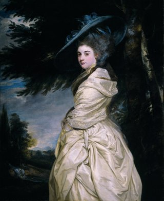
Henrietta Antonia Clive, Countess of Powis, was a British writer, mineral collector, and botanist. Her time in India, while her husband was Governor of Madras, was inspirational to her for all three of these pursuits.

<span class="mw-page-title-main">Pitchford Hall</span> Grade I listed building in Shropshire, United Kingdom

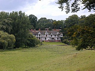
Pitchford Hall is a Grade I listed Tudor country house in the village of Pitchford, Shropshire, 6 miles south east of Shrewsbury.

<span class="mw-page-title-main">River Kemp</span> River in Shropshire, England

The River Kemp is a tributary of the River Clun which flows through Shropshire, England.

Lydbury North is a civil parish in Shropshire, England. It contains 57 listed buildings that are recorded in the National Heritage List for England. Of these, one is listed at Grade I, the highest of the three grades, three are at Grade II*, the middle grade, and the others are at Grade II, the lowest grade. The parish contains the villages of Lydbury North and Brockton, and smaller settlements including Plowden, but is otherwise rural. Most of the listed buildings are houses and cottages, farmhouses and farm buildings, a high proportion of which are timber framed or have timber frame cores, and some contain cruck trusses. The other listed buildings include a church, a tomb in the churchyard, country houses and associated structures, a public house, a former railway station and stationmaster's house, a water mill, and seven milestones.

References

  1. "Civil Parish population 2011" . Retrieved 20 November 2015.
  2. "Powis Arms information" . Retrieved 19 December 2014.
  3. "Election Maps". Ordnance Survey. Retrieved 22 October 2020.
  4. Institute for Name Studies, University of Nottingham. "A Key to English Place-Names" . Retrieved 15 July 2009.
  5. "Walcot Hall" . Retrieved 15 July 2009.
  6. "Walcot Hall" . Retrieved 26 April 2013. Official Website