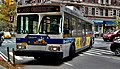
M7 (New York City bus)

Last updated

m7
Columbus / Amsterdam /
Sixth / Seventh / Lenox Avenues Line
NYC Transit Authority Orion V 241.jpg
An M7 bus at 23rd Street and Broadway, along which the route ran prior to 2009
Overview
System MTA New York City Bus
Operator New York City Transit Authority
Garage Mother Clara Hale Depot
Vehicle New Flyer Xcelsior XDE40
Began service1892 (train)
1936 (streetcar)
1962 (bus)
2009-2010 (current alignment)
Route
Locale Manhattan, New York, U.S.
Start 14th Street  / 6th Avenue
Via Sixth Avenue (northbound)
Seventh Avenue (southbound)
Amsterdam Avenue (northbound)
Columbus Avenue (southbound)
Lenox Avenue
End Harlem  147th Street
Length7.6 miles (12.2 km) [1] (southbound)
Other routes M11 9th (Columbus)/10th (Amsterdam) Avs
M102 3rd/Lexington/Lenox Avs
Service
Operates24 hours
Annual patronage2,291,676 (2022) [2]
TransfersYes (within 2 hours)
Timetable M7
  M5  {{{system_nav}}}  M8  

The Columbus Avenue Line is a public transit line in Manhattan, New York City, running mostly along Columbus Avenue, 116th Street, and Lenox Avenue from Lower Manhattan to Harlem. Originally a streetcar line, it is now the M7 bus route, operated by the New York City Transit Authority, a division of the Metropolitan Transportation Authority.

Route description

The M7 route begins at the intersection of Sixth Avenue and 14th Street. Northbound it shares Sixth Avenue with the M55 between 14th Street and 44th Street, as well as the M5 above 31st Street. Southbound it shares Seventh Avenue with the M20. The M7 turns west at 59th Street and northwest on Broadway to reach the one-way pair of Amsterdam Avenue (northbound) and Columbus Avenue (southbound). These two streets are shared with the M11. The M7 turns east at 106th Street, north on Manhattan Avenue, east on 116th Street, and north on Lenox Avenue to a loop at the 145th Street subway station. [3] This is the exact path followed by the former streetcar north of 109th Street.

Prior to 2009, southbound M7 service ran along Broadway and terminated at Union Square along 14th Street. This was changed due to pedestrianization of Broadway at Times Square, Duffy Square, and Herald Square, which closed the street to traffic. The southbound M7 now turns left at 14th Street and terminates at Sixth Avenue and 14th Street.

History

Gold Bond of the Columbus and Ninth Avenue Railroad Company, issued 24. August 1893 Columbus and Ninth Avenue RR 1893.jpg
Gold Bond of the Columbus and Ninth Avenue Railroad Company, issued 24. August 1893

The Ninth Avenue Railroad's Ninth Avenue Line used the southernmost part of Columbus Avenue, but cut over along Broadway to use Amsterdam Avenue to Harlem. On December 30, 1892, the Columbus and Ninth Avenue Railroad acquired a franchise from the city to build along Columbus Avenue from Broadway to 110th Street, with a branch west on 106th Street to Amsterdam Avenue. [4] It was soon authorized to build in 109th Street and Manhattan Avenue to 116th Street. The company was consolidated into the Metropolitan Street Railway on November 7, 1895.

Columbus Avenue cars were operated by the Metropolitan along their Broadway Line from lower Manhattan to Midtown, and then along the 53rd Street Crosstown Line (later the 59th Street Crosstown Line) west to 9th Avenue/Columbus Avenue. Cable cars were used from the line's opening on December 6, 1894 until May 1901. After the Metropolitan system was split in 1913, and the Third Avenue Railway acquired the 59th Street Crosstown, 53rd Street was again used.

Buses were substituted for streetcars by the New York City Omnibus Corporation on March 25, 1936. In 1956 it was renamed Fifth Avenue Coach Lines, and the Manhattan and Bronx Surface Transit Operating Authority replaced it in 1962. When Columbus and Amsterdam Avenues became one-way streets, northbound buses were moved to Amsterdam Avenue.

Pedestrianization of Broadway in Times Square and Herald Square in 2009 led to southbound buses using 7th Avenue instead of Broadway from 59th Street to 14th Street. Consequently, the 14th Street terminus was shifted to 6th Avenue.

On November 28, 2018, the route's southern terminal was moved to 18th Street and Sixth Avenue. Southbound buses began to run on 16th Street to reach the terminal. [5] As of 2020, the M7 has been restored to 14th Street and Sixth Avenue.

Related Research Articles

<span class="mw-page-title-main">M23 (New York City bus)</span> Bus route in Manhattan, New York

The 23rd Street Crosstown is a surface transit line on 23rd Street in Manhattan, New York City. It currently hosts the M23 SBS bus route of the Metropolitan Transportation Authority (MTA)'s Regional Bus Operations. The M23 runs between Chelsea Piers, along the West Side Highway near 22nd Street, via 23rd Street, to Avenue C and 20th Street in Stuyvesant Town–Peter Cooper Village.

<span class="mw-page-title-main">Third and Lexington Avenues Line</span> Bus routes in Manhattan, New York

The Third and Lexington Avenues Line, also known as the Third Avenue Line, is a public transit line in Manhattan, New York City, running from Lower Manhattan to Fort George in Washington Heights. Originally a streetcar line, it now consists of the M98, M101, M102, and M103 bus routes, operated by the New York City Transit Authority. The M98 bus route operates on Third Avenue between East 65th Street and East 127th Street, although it previously continued to 32nd Street. The M101, M102 and M103 bus routes run southbound on Lexington Avenue north of East 24th Street.

The Sixth Avenue Line was a public transit line in Manhattan, New York City, running mostly along Sixth Avenue from Lower Manhattan to Central Park. Originally a streetcar line and later a bus route, it has been absorbed into the M5 bus route, which replaced the Broadway Line, as its northbound direction.

<span class="mw-page-title-main">M10 and M20 buses</span> Bus routes in Manhattan, New York

The Eighth Avenue Line is a public transit line in Manhattan, New York City, running mostly along Eighth Avenue from Lower Manhattan to Harlem. Originally a streetcar line, it is now the M10 bus route and the M20 bus route, operated by the New York City Transit Authority. The M10 bus now only runs north of 57th Street, and the M20 runs south of 66th Street. The whole line was a single route, the M10, until 2000 when the M20 was created.

<span class="mw-page-title-main">M11 (New York City bus)</span> Bus route in Manhattan, New York

The Ninth and Tenth Avenues Line or Ninth Avenue Line is a surface transit line in the New York City borough of Manhattan, running mostly along Ninth Avenue and Amsterdam Avenue from Lower Manhattan to Manhattanville. Originally a streetcar line operated by the Manhattan and Bronx Surface Transit Operating Authority, it is now the M11 bus route operated by the New York City Transit Authority.

<span class="mw-page-title-main">M5 and M55 buses</span> Bus routes in Manhattan, New York

The M5 and M55 bus routes constitute a public transit corridor in Manhattan, New York City, running along the Fifth / Sixth Avenues / Riverside Drive Line as well as the southern portion of the Broadway Line after the discontinuation of the M6. The routes primarily run along Broadway, Fifth and Sixth Avenues, and Riverside Drive from South Ferry, Lower Manhattan to Washington Heights. The M5 covers the northern portion of the route north of 31st Street, while the M55 operates along the southern portion of the route south of 44th Street. The two routes overlap in Midtown Manhattan. The portion along Broadway south of East 8th Street was originally a streetcar line.

<span class="mw-page-title-main">M14 (New York City bus)</span> Bus routes in Manhattan, New York

The 14th Street Crosstown Line is a public transit line in Manhattan, New York City, running primarily along 14th Street from Chelsea or the West Village to the Lower East Side. Originally a streetcar line, it is now the M14 bus route, operated by the New York City Transit Authority. The line's two variants, the M14A SBS and M14D SBS, use Avenue A and Avenue D respectively from 14th Street south into the Lower East Side.

<span class="mw-page-title-main">B61 and B62 buses</span> Bus routes in Brooklyn, New York

The Crosstown Line is a public transit line in Brooklyn, New York City, running along Van Brunt Street and Manhattan Avenue between Red Hook and Long Island City, Queens. Originally a streetcar line, it is now the B61 and the B62 bus routes. The northern section, the B62, is operated by MTA New York City Bus' Grand Avenue Depot in Maspeth, Queens, and the southern section is the B61, operated by MTA New York City Bus' Jackie Gleason Depot in Sunset Park. The entire route was a single line, the B61, until January 3, 2010; the B62 was previously a separate, parallel route between Downtown Brooklyn and Greenpoint, now part of the B43 route. The streetcar line, B61 and the original B62 previously operated from the now-closed Crosstown Depot in Greenpoint.

<span class="mw-page-title-main">New York Railways Company</span> American public transport operator

The New York Railways Company operated street railways in Manhattan, New York City, between 1911 and 1925. The company went into receivership in 1919 and control was passed to the New York Railways Corporation in 1925 after which all of its remaining lines were replaced with bus routes.

<span class="mw-page-title-main">M104 (New York City bus)</span> Bus route in Manhattan, New York

The Broadway Line is a surface transit line in Manhattan, New York City, running mainly along 42nd Street and Broadway from Murray Hill to Harlem. Formerly a streetcar line operated by the Third Avenue Railway, it is now the M104 bus route operated by the New York City Transit Authority, a subsidiary of the Metropolitan Transportation Authority. This bus route no longer runs along the entire route of the former streetcar.

The 53rd Street Crosstown Line was a surface transit line in Manhattan, New York City, United States, running along 53rd Street in Midtown, between Sixth Avenue and Ninth Avenue. It served as a connection between north-south lines during the times that they were not affiliated with the 59th Street Crosstown Line. The street is no longer used by buses, which now use 59th Street to make the crosstown connection.

<span class="mw-page-title-main">Lenox Avenue Line (surface)</span>

The Lenox Avenue Line is a surface transit line on Lenox Avenue in Harlem, Manhattan, New York City, United States. The line was once operated separately, but later became the northern end of the Broadway and Columbus Avenue Line and Broadway and Lexington Avenue Line, now the M7 and M102 bus routes.

<span class="mw-page-title-main">M1, M2, M3, and M4 buses</span> Bus routes in Manhattan, New York

The M1, M2, M3, and M4 are four local bus routes that operate the Fifth and Madison Avenues Lines – along the one-way pair of Madison and Fifth Avenues in the Manhattan borough of New York City. Though the routes also run along other major avenues, the majority of their route is along Madison and Fifth Avenues between Greenwich Village and Harlem.

<span class="mw-page-title-main">New York Railways Corporation</span>

The New York Railways Corporation was a railway company that operated street railways in Manhattan, New York City, United States between 1925 and 1936. During 1935/1936 it converted its remaining lines to bus routes which were operated by the New York City Omnibus Corporation, and now operated by the Manhattan and Bronx Surface Transit Operating Authority. The organization was the successor to the New York Railways Company which was in receivership.

<span class="mw-page-title-main">M12 (New York City bus)</span> Bus route on Manhattans West Side

The M12 bus route constitutes a public transit line in Manhattan, New York City. The M12 operates between Columbus Circle and Abingdon Square, serving Manhattan's West Side. It uses 11th and 12th Avenues between 14th and 57th Streets. It was introduced in 2014 to provide better service to the far west side.

<span class="mw-page-title-main">Hylan Boulevard express buses</span> Bus routes in Staten Island and Manhattan, New York

The SIM1, SIM1C, SIM7,SIM10, and SIM11 bus routes constitute a public transit line in Staten Island and Manhattan, New York. The routes all operate on Richmond Avenue and Hylan Boulevard on Staten Island, but go to three separate terminals in Manhattan. The SIM1 goes to 6th Avenue & Houston Street, the SIM7 goes to 6th Avenue & 14th Street, the SIM1C and SIM10 go to Central Park South & 6th Avenue, and the SIM11 goes to 57th Street & 3rd Avenue. The SIM1, SIM7, SIM10, and SIM11 operate during the rush hour only. The SIM1C operates 24 hours per day, but does not run in the peak direction during rush hours.

The B99, Bx99, and M99 bus routes formed a temporary night bus service in the New York City boroughs of Manhattan, Brooklyn, and the Bronx. The three bus routes were created to replace overnight subway service during the height of COVID-19 pandemic, while the subway system was closed to the public between 1:00 AM and 5:00 AM. All three routes overlapped in Manhattan allowing customers to easily transfer between services.

<span class="mw-page-title-main">M34 and M34A buses</span> Bus routes in Manhattan, New York

The 34th Street Crosstown Line is a surface transit line on 34th Street in Manhattan, New York City, United States. It currently hosts the M34/M34A SBS routes of MTA's Regional Bus Operations. The M34 runs from 12th Avenue to FDR Drive via 34th Street, while the M34A runs from Port Authority Bus Terminal to Waterside Plaza.

<span class="mw-page-title-main">M31 and M57 buses</span> Bus routes in Manhattan, New York

The M31 and M57 bus routes constitute the 57th Street Crosstown Line, a public transit line in Manhattan, New York City, running primarily along 57th Street. The M31 runs between 11th Avenue and 54th Street in Hell's Kitchen to 1st Avenue and 92nd Street in Yorkville. The M57 runs from 72nd Street and Amsterdam Avenue in the Upper West Side to Sutton Place and 57th Street in Sutton Place.

References

  1. Google (May 8, 2017). "M7" (Map). Google Maps . Google. Retrieved May 8, 2017.
  2. "Subway and bus ridership for 2022". mta.info. August 3, 2023. Retrieved March 29, 2024.
  3. MTA Regional Bus Operations. "M7 bus schedule".
  4. "Sold by the Controller; the Franchise for the Extension of the Ninth Avenue Road". The New York Times . December 31, 1892. p. 9. Retrieved February 7, 2023.
  5. "M7 bus schedule" (PDF). mta.info. Metropolitan Transportation Authority. November 28, 2018. Archived (PDF) from the original on January 6, 2019. Retrieved January 6, 2018.