Machin, Ontario

Last updated

Machin
Township of Machin
Machin ON.JPG
Township office in Vermilion Bay
Canada Ontario location map 2.svg
Red pog.svg
Machin
Coordinates: 49°47′N93°10′W / 49.783°N 93.167°W / 49.783; -93.167
CountryCanada
Province Ontario
District Kenora
Incorporated1909
Government
  MayorGordon Griffiths
  Federal riding Kenora
  Prov. riding Kenora—Rainy River
Area
[1]
  Land290.14 km2 (112.02 sq mi)
Population
 (2021) [1]
  Total
1,012
  Density3.5/km2 (9/sq mi)
Time zone UTC-6 (CST)
  Summer (DST) UTC-5 (CDT)
Postal Code FSA
P0V
Area code 807
Website www.visitmachin.com OOjs UI icon edit-ltr-progressive.svg

Machin is a township in the Canadian province of Ontario, located in the Kenora District west of Dryden.

Contents

The township, named after Harold A.C. Machin, [2] consists of 2 non-contiguous areas on the north shore of Eagle Lake. The junction of Highway 17 and Highway 105 is located in Machin, just east of Vermilion Bay.

Communities

Vermilion Bay, Ontario Vermilion Bay ON.JPG
Vermilion Bay, Ontario

The main communities in Machin township are Eagle River ( 49°47′31″N93°11′41″W / 49.79194°N 93.19472°W / 49.79194; -93.19472 ), [3] Minnitaki ( 49°48′46″N93°5′41″W / 49.81278°N 93.09472°W / 49.81278; -93.09472 ), [4] and Vermilion Bay ( 49°51′23″N93°22′55″W / 49.85639°N 93.38194°W / 49.85639; -93.38194 ). [5]

Eagle River

The community of Eagle River has its origin as a Hudson's Bay Company fur-trading post on Eagle Lake, founded in 1869. It operated seasonally in the winter until 1882, when the post was moved to Wabigoon Lake. By that time, the Canadian Pacific Railway was built through the area and the settlement grew where the railroad crosses the namesake Eagle River. In the 1890s, Eagle River was an important coal and water supply station for the railroad, while shipping out wood and fur. [2]

Trade at Eagle River ceased in 1903. In 1928, a hydro-electric power station was built on the river (and another one in 1937). Around 1935/1936, the first fishing and hunting lodge was built on Eagle Lake. The community lost later its importance as a railroad hub, and in 1968 and 1969, railway docks were removed and its train station was demolished in 1973. [2]

Minnitaki

Minnitaki, Ontario Minnitaki ON.JPG
Minnitaki, Ontario

Minnitaki started as a railway point along the Canadian Pacific Railway, which was built in the early 1880s. Its indigenous name means "muddy waters" or "shaded waters", either referring to the murky waters of Beaver Creek that flows through the place or to the shadow cast on water by passing clouds. [2]

In 1896, the geographic townships of Eton, Sanford, and Aubrey were surveyed, after which the first homesteaders founded the settlement. [2]

Demographics

In the 2021 Census of Population conducted by Statistics Canada, Machin had a population of 1,012 living in 457 of its 632 total private dwellings, a change of 4.2% from its 2016 population of 971. With a land area of 290.14 km2 (112.02 sq mi), it had a population density of 3.5/km2 (9.0/sq mi) in 2021. [1]

Canada census – Machin community profile
2021 2016 2011
Population1,012 (+4.2% from 2016)971 (+3.9% from 2011)935 (-4.4% from 2006)
Land area290.14 km2 (112.02 sq mi)291.81 km2 (112.67 sq mi)289.84 km2 (111.91 sq mi)
Population density3.5/km2 (9.1/sq mi)3.3/km2 (8.5/sq mi)3.2/km2 (8.3/sq mi)
Median age53.6 (M: 53.6, F: 52.8)50.6 (M: 50.1, F: 50.9)47.0 (M: 48.5, F: 46.0)
Private dwellings632 (total)  457 (occupied)597 (total) 560 (total) 
Median household income$77,500$70,464
References: 2021 [6] 2016 [7] 2011 [8] earlier [9] [10]
Historical census populations – Machin, Ontario
YearPop.±%
1921 517    
1931 694+34.2%
1941 896+29.1%
1951 928+3.6%
1956 972+4.7%
1961 1,119+15.1%
YearPop.±%
1966 1,106−1.2%
1971 1,106+0.0%
1976 1,189+7.5%
1981 1,137−4.4%
1986 1,152+1.3%
1991 1,127−2.2%
YearPop.±%
1996 1,117−0.9%
2001 1,143+2.3%
2006 978−14.4%
2011 935−4.4%
2016 971+3.9%
2021 1,012+4.2%
Population counts are not adjusted for boundary changes.
Source: Statistics Canada [1] [11] [12]

See also

Related Research Articles

<span class="mw-page-title-main">Sables-Spanish Rivers</span> Township in Ontario, Canada

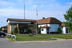
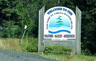
Sables-Spanish Rivers is a township in Ontario, Canada, on the north shore of Georgian Bay. It is located in the Sudbury District, approximately 70 kilometres (43 mi) west of Sudbury.

<span class="mw-page-title-main">Central Frontenac</span> Township in Ontario, Canada

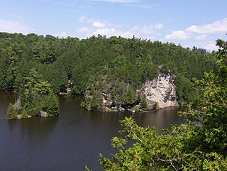
Central Frontenac is a township in eastern Ontario, Canada in the County of Frontenac.

<span class="mw-page-title-main">Black River-Matheson</span> Township in Ontario, Canada

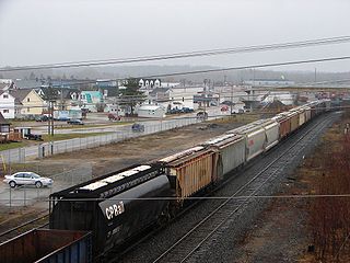
Black River-Matheson is a township in the Cochrane District of the Canadian province of Ontario. The municipality is astride the Black River, for which it is partly named. The Matheson railway station was serviced by the Northlander until 2012.

<span class="mw-page-title-main">Kenora District</span> District in Ontario, Canada

Kenora District is a district and census division in Northwestern Ontario, Canada. The district seat is the City of Kenora.

<span class="mw-page-title-main">Markstay-Warren</span> Municipality in Ontario, Canada

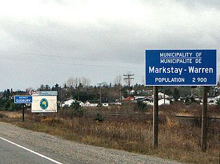
Markstay-Warren is a town in the Canadian province of Ontario, located in the Sudbury District. Highway 17, from the city limits of Greater Sudbury to the Sudbury District's border with Nipissing District, lies entirely within Markstay-Warren. The town had a population of 2,656 in the Canada 2016 Census.

<span class="mw-page-title-main">White River, Ontario</span> Township in Ontario, Canada

White River is a township located in Northeastern Ontario, Canada, at the western end of the District of Algoma. It sits along the namesake White River and the junction of Highway 17 of the Trans-Canada Highway, and Highway 631. It was originally a railway town on the Canadian Pacific Railway in 1885, and is still served by a passenger rail service to Sudbury, the Budd Car managed by Via Rail.

<span class="mw-page-title-main">Nipigon</span> Township in Ontario, Canada

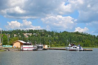
Nipigon is a township in Thunder Bay District, Northwestern Ontario, Canada, located along the west side of the Nipigon River and south of the small Helen Lake running between Lake Nipigon and Lake Superior. Lake Nipigon is located approximately 25 kilometres (16 mi) north of Nipigon. Located at latitude 49.0125° N, Nipigon is the northernmost community on the Great Lakes.

<span class="mw-page-title-main">Guelph/Eramosa</span> Township in Ontario, Canada

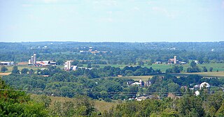
Guelph/Eramosa is a township located in Wellington County, in midwestern Ontario, Canada. It partly encircles the city of Guelph, surrounding it in a continuous arc from approximately northeast to south-southwest of the city. It is part of the Guelph census metropolitan area.

<span class="mw-page-title-main">Chapleau, Ontario</span> Township in Ontario, Canada

Chapleau is a township in Sudbury District, Ontario, Canada. It is home to one of the world's largest wildlife preserves. Chapleau has a population of 1,942 according to the 2021 Canadian census.

<span class="mw-page-title-main">Unorganized North Algoma District</span> Unorganized area in Ontario, Canada

Unorganized North Algoma District is an unorganized area in northeastern Ontario, Canada, comprising all areas in Algoma District, north of the Sault Ste. Marie to Elliot Lake corridor, which are not part of an incorporated municipality or a First Nation. It covers 43,618.95 km2 (16,841.37 sq mi) of land, and had a population of 6,050 in 2021. Many of these communities were/are stations on the Algoma Central Railway or were logging/mining towns.

<span class="mw-page-title-main">Ashfield–Colborne–Wawanosh</span> Township in Ontario, Canada

The Township of Ashfield–Colborne–Wawanosh is a municipality in Huron County, Ontario, Canada. It was formed as an amalgamation of the former Ashfield, Colborne and West Wawanosh townships in 2001, in an Ontario-wide local government restructuring imposed by the government of that time. The three former townships now comprise the wards of the amalgamated municipality.

<span class="mw-page-title-main">Dysart et al</span> United township in Ontario, Canada

The United Townships of Dysart, Dudley, Harcourt, Guilford, Harburn, Bruton, Havelock, Eyre and Clyde, commonly known as the Municipality of Dysart et al, is a municipality in Haliburton County in Central Ontario, Canada. The original townships were of the Canadian Land and Emigration Company.

<span class="mw-page-title-main">West Elgin, Ontario</span> Municipality in Ontario, Canada

West Elgin is a municipality in Elgin County, Ontario, Canada. The township was created on January 1, 1998, through the amalgamation of the former township of Aldborough with the village of West Lorne.

<span class="mw-page-title-main">Stirling-Rawdon</span> Township in Ontario, Canada

Stirling-Rawdon is a township in the Canadian province of Ontario, located in Hastings County. It was formed on January 1, 1998, through the amalgamation of Rawdon Township with the Village of Stirling. Stirling was named the 2012 Kraft Hockeyville winner, after gaining more than 3.9 million votes.

<span class="mw-page-title-main">Fauquier-Strickland</span> Township in Ontario, Canada

Fauquier-Strickland is a township municipality in Cochrane District in Northeastern Ontario, Canada. The three main communities in the township are Fauquier, Strickland, and Gregoires Mill. All are located along Ontario Highway 11 between the community of Departure Lake to the east and the municipality of Moonbeam to the west.

<span class="mw-page-title-main">South Algonquin</span> Township municipality in Ontario, Canada

South Algonquin is a township municipality in Nipissing District, Ontario, Canada. Located south of Algonquin Provincial Park, it is the sole populated portion of the district that lies south of the traditional dividing line between Northern Ontario and Southern Ontario and is closer connected to Renfrew County as opposed to the core portions of Nipissing District.

<span class="mw-page-title-main">Gauthier, Ontario</span> Township municipality in Ontario, Canada

Gauthier is a township municipality in Timiskaming District the Northeastern Ontario, Canada. The township had a population of 138 in the Canada 2016 Census. Its main population centre is Dobie, located just north of Ontario Highway 66, 18.5 kilometres (11.5 mi) east of Kirkland Lake.

<span class="mw-page-title-main">Vermilion Bay, Ontario</span> Place in Ontario, Canada

Vermilion Bay is an unincorporated community on Vermilion Bay on Eagle Lake in the township of Machin, Kenora District in northwestern Ontario, Canada. It is located on Ontario Highway 17 between the cities of Kenora to the west and Dryden to the east.

Greater Oxdrift is a local services board in Kenora District in northwestern Ontario, Canada. It provides services to the geographic townships of Aubrey, Britton, Brownbridge, Eton, Rugby, Van Horne, Wainwright, and Zealand and was created in 2009.

<span class="mw-page-title-main">Gordon/Barrie Island</span> Municipality in Ontario, Canada

The Municipality of Gordon/Barrie Island is a township in Manitoulin District in north central Ontario, Canada. It was formed on January 1, 2009, upon the amalgamation of the townships of Gordon and Barrie Island.

References

  1. 1 2 3 4 "Machin, Ontario (Code 3560021) Census Profile". 2021 census . Government of Canada - Statistics Canada . Retrieved 2025-01-02.
  2. 1 2 3 4 5 "The History of the Municipality of Machin". www.visitmachin.com. Municipality of Machin. Retrieved 2 January 2025.
  3. "Eagle River". Geographical Names Data Base . Natural Resources Canada . Retrieved 2 January 2025.
  4. "Minnitaki". Geographical Names Data Base . Natural Resources Canada . Retrieved 2 January 2025.
  5. "Vermilion Bay". Geographical Names Data Base . Natural Resources Canada . Retrieved 2 January 2025.
  6. "2021 Community Profiles". 2021 Canadian census . Statistics Canada. February 4, 2022. Retrieved 2023-10-19.
  7. "2016 Community Profiles". 2016 Canadian census . Statistics Canada. August 12, 2021. Retrieved 2019-06-06.
  8. "2011 Community Profiles". 2011 Canadian census . Statistics Canada. March 21, 2019. Retrieved 2012-04-03.
  9. "2006 Community Profiles". 2006 Canadian census . Statistics Canada. August 20, 2019.
  10. "2001 Community Profiles". 2001 Canadian census . Statistics Canada. July 18, 2021.
  11. "Machin, Ontario (Code 3560021) Census Profile". 2011 census . Government of Canada - Statistics Canada. 2012.
  12. "1971 Census of Canada - Population Census Subdivisions (Historical)". Catalogue 92-702 Vol I, part 1 (Bulletin 1.1-2). Statistics Canada: 76, 139. July 1973.