Mamberamo Raya Regency Kabupaten Mamberamo Raya | |
---|---|
Motto: Mecom Cirimo Ecipiri Punum Mate | |
Location in Indonesian Papua Location in Indonesia | |
Coordinates: 2°14′08″S137°46′56″E / 2.2356°S 137.7823°E | |
Country | Indonesia |
Province | Papua |
Capital | Burmeso |
Government | |
• Regent | Dorinus Dasinapa |
• Vice Regent | Yakobus Britay |
Area | |
• Total | 23,813.91 km2 (9,194.60 sq mi) |
Highest elevation | 2,200 m (7,200 ft) |
Population (mid 2023 estimate) [1] | |
• Total | 38,636 |
• Density | 1.6/km2 (4.2/sq mi) |
Time zone | UTC+9 (Indonesia Eastern Time) |
Area code | (+62) 969 |
Website | mamberamorayakab.go.id |
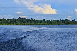
Mamberamo Raya Regency or Greater Mamberamo Regency is one of the regencies (kabupaten) in Papua Province, Indonesia. Tt was created on 15 March 2007 from parts of Sarmi Regency and Waropen Regency. The regency gets its name from the Mamberamo River. The largest regency by land in Papua province, It covers an area of 23,813.91 km2, but had a population of only 18,365 at the 2010 Census [2] which had almost doubled to 36,483 at the 2020 Census; [3] the official estimate as at mid 2023 was 38,636 (comprising 20,171 males and 18,465 females). [1] The administrative centre is at the town of Burmeso in Mamberamo Tengah (Central Mamberamo District).
Mamberamo Raya is bordered to the south by Central Papua Province (Puncak Papua Regency and Puncak Jaya Regency) and Highland Papua Province (Tolikara Regency and Central Mamberamo Regency). Mamberamo Raya is bordered by Sarmi Regency to the east and Waropen Regency to the west. The Yapen Islands Regency in the Cenderawasih Bay lies to the northwest.
The confluence of the Tariku River and Taritatu River is found south of the Gauttier Range. The highest elevation in this regency is near the summit of the Gauttier Mountain Range, at ~2,200 m above sea level; the actual summit of the Gauttier Mountains lies in Sarmi Regency.
Languages spoken in Mamberamo Raya Regency: [4]
At the 2010 Census the regency comprised eight districts (distrik), tabulated below with their areas and their populations at the 2010 Census [2] and the 2020 Census, [3] together with the official estimates as at mid 2022. [5] The table also includes the locations of the district administrative centres, the number of administrative villages (kampung) in each district, and its post code. A ninth district (Iwaso, with its district centre at Metaweja) has recently been created, but no figures for its area or 2010 population are available.
Kode Wilayah | District (distrik) | Area in km2 | Pop'n 2010 census | Pop'n 2020 census | Pop'n mid 2022 estimate | Admin centre | No. of villages | Post code |
---|---|---|---|---|---|---|---|---|
91.20.06 | Waropen Atas | 2,935 | 2,876 | 5,413 | 5,447 | Barapasi | 7 | 98681 |
91.20.07 | Benuki | 2,636 | 1,183 | 2,425 | 2,495 | Gesa Baru | 8 | 98683 |
91.20.08 | Sawai (a) | 3,183 | 2,346 | 3,883 | 3,989 | Poiwai | 6 | 98682 |
91.20.05 | Mamberamo Hilir (Lower Mamberamo) | 2,078 | 1,734 | 3,330 | 3,387 | Trimuris | 7 | 98691 |
91.20.01 | Mamberamo Tengah (b) (Central Mamberamo) | 2,491 | 3,158 | 8,037 | 8,740 | Kasonaweja | 11 | 98692 |
91.20.09 | Iwaso | (c) | (c) | 541 | 553 | Metaweja | (c) | 98692 |
91.20.04 | Mamberamo Tengah Timur (East Central Mamberamo) | 2,429 | 1,551 | 2,940 | 2,980 | Kustra | 7 | 98693 |
91.20.03 | Rufaer | 3,514 | 2,546 | 4,909 | 4,992 | Kai (Kay Seta) | 6 | 98695 |
91.20.02 | Mamberamo Hulu (Upper Mamberamo) | 4,548 | 2,971 | 5,002 | 5,033 | Dabra | 8 | 98694 |
Totals | 23,814 | 18,365 | 36,483 | 37,616 | Bermeso | 60 |
Note: (a) includes the offshore islands of Pulau Kumkum and Pulau Poiwai. (b) Mamberamo Tengah District listed here should not be confused with Mamberamo Tengah Regency (now part of the province of Highland Papua), which lies to the southeast of Mamberamo Raya Regency. (c) the area and 2010 Population of the new Iwaso District, and the number of villages in the district, are included in the figures for Mamberamo Tengah District, from which it was cut out.
Alor is the largest island in the Alor Archipelago and is one of the 92 officially listed outlying islands of Indonesia. It is located at the eastern end of the Lesser Sunda Islands chain that runs through southeastern Indonesia, which from the west include such islands as Bali, Lombok, Sumbawa, Komodo, and Flores.
Anambas Islands Regency is an island regency in the Riau Islands Province, Indonesia, located in the Natuna Sea. The regency consists of 255 islands, including five outer islands that are important for Indonesia's sovereignty boundaries, namely: Tokong Berlayar Island, Tokong Nanas Island, Mangkai Island, Damar Island, and Malangbiru Island. Anambas Islands Regency located 150 nautical miles northeast of Batam Island in the Natuna Sea between the Malaysian Peninsula to the west and the island of Borneo to the east. Geographically part of the Tudjuh Archipelago. This island regency covers a land area of approximately 661.47 square kilometres (255.39 sq mi) spread over an area of approximately 46,664 km² of water. The regency had a population of around 37,411 at the 2010 Census. and 47,402 at the 2020 Census; the official estimate as at mid 2023 was 50,140. The administrative centre is at Tarempa on Siantan Island.
The Lingga Regency is a group of 600 islands in Indonesia, located south of Singapore and along both sides of the equator, off the eastern coast of Riau Province on Sumatra island. They are due south of the populated Riau Archipelago, known for the industrial island of Batam and the tourist-frequented island of Bintan, although the Lingga Islands themselves are rarely visited due to the infrequent local transportation. The equator goes through the northern tip of Lingga Island, the main island in the archipelago.
Sikka is a regency within East Nusa Tenggara province, Indonesia, on the island of Flores. It is bordered to the west by Ende Regency and to the east by East Flores Regency. It covers an area of 1,675.36 km2 and had a population of 300,301 at the 2010 census and 321,953 at the 2020 Census; the official estimate as at mid 2023 was 337,011. The capital is the town of Maumere, which comprises the districts of Alok Barat, Alok and Alok Timur.
Ende is the seat capital of the Ende Regency, East Nusa Tenggara province of Indonesia. Ende is located on the southern coast of Flores Island. The town had a population of 87,269 residents at the 2020 census, divided administratively between four districts (kecamatan) of the regency – Ende Selatan, Ende Timur, Ende Tengah, and Ende Utara. Note that this does not include Ende District or Pulau Ende District. The official estimate as at mid 2023 was 87,723.
Bogor Regency is a landlocked regency (kabupaten) of West Java province in Indonesia, situated south of DKI Jakarta. Covering an area of 2,734.33 km2, it is considered a bedroom community for Jakarta, and was home to 5,427,068 people at the 2020 census. The official estimate as at mid 2023 was 5,520,836. The town of Cibinong serves as the regency seat.
Alor Regency is a regency in East Nusa Tenggara (NTT) province of Indonesia. Established in 1958, Alor Regency administers the Alor Archipelago with its seat (capital) in Kalabahi on Alor Island.
The Karimun Regency is located in the Riau Islands Province, Indonesia. Besides the central island of Great Karimun, the regency also includes the island of Kundur and over 240 lesser islands. The district covers a land area of 1,339.9 km2 and a sea area of 6,460 km2, and its population was 212,561 at the 2010 census and 253,457 at the 2020 census; the official estimate as at mid 2023 was 270,121.
East Sumba Regency is geographically the largest of the four regencies which divide the island of Sumba, within East Nusa Tenggara Province of Indonesia. It occupies 62% of the entire island, being much less densely populated than the western third. The town of Waingapu is the capital of East Sumba Regency. The population of East Sumba Regency was 227,732 at the 2010 Census and 244,820 at the 2020 Census; the official estimate as at mid 2022 was 255,498.
West Manggarai Regency is one of the eight regencies which comprise the island of Flores, located in the province of East Nusa Tenggara in Indonesia. The Regency was created on 25 February 2003 by the separation off of the western districts from Manggarai Regency. It covers a land area of 3,141.47 km2, and had a population of 221,703 at the 2010 census, rising to 251,689 at the 2015 Intermediate census and to 256,317 at the 2020 census. The official estimate as at mid 2023 was 278,184. The regency's capital is the town of Labuan Bajo.
Sarmi Regency is one of the regencies (kabupaten) in Papua Province of Indonesia. It was formed from the western districts which had until then been part of Jayapura Regency with effect from 12 November 2002. It covers an area of 18,034.0 km2, and had a population of 32,971 at the 2010 Census and 41,515 at the 2020 Census; the official estimate as at mid 2023 was 42,680. The regency's administrative centre is at the town of Sarmi.
Central Mamberamo Regency is one of the regencies (kabupaten) in the Indonesian province of Highland Papua. It covers an area of 3,743.64 km2, and had a population of 39,537 at the 2010 Census and 50,685 at the 2020 Census. The official estimate as at mid 2023 was 51,430 - comprising 27,302 males and 24,128 females. The administrative centre is at Kobakma.
East Flores Regency is a regency in East Nusa Tenggara province of Indonesia. Established in 1958, the regency has its seat (capital) in Larantuka on Flores Island. It covers a land area of 1,812.65 km2, and it had a population of 232,605 as of the 2010 census and 276,896 at the 2020 Census; the official estimate as of mid-2023 was 289,376. The regency encompasses the eastern tip of the island of Flores, together with all of the adjacent islands of Adonara and Solor to the east of Flores, with some much smaller offshore islands. On 4 October 1999, the island of Lembata at the eastern end of the Solor Archipelago was separated from the East Flores Regency to create its own Regency.
Kupang Regency is a regency in East Nusa Tenggara province of Indonesia. It occupies the far western end of Timor Island, together with the smaller island of Semau and other minor offshore islands. Other islands further to the southwest and west which were formerly part of Kupang Regency have been separated administratively - the Rote Islands Group on 10 April 2002, and the Savu Islands Group on 29 October 2008.
South Central Timor Regency is a regency in East Nusa Tenggara province of Indonesia, established in 1958. the regency has its seat (capital) in the town of Soe. It covers an area of 3,956.15 km2 and had a population of 440,470 at the 2010 Census and 455,410 at the 2020 Census; the official estimate as at mid 2023 was 473,948.
North Central Timor Regency is a regency in East Nusa Tenggara Province, Indonesia. It covers an area of 2,674.02 km2, and had a population of 229,803 at the 2010 Census and 259,829 at the 2020 Census; the official estimate as at mid 2023 was 269,628. Its regency seat is located at the town of Kefamenanu, which had a population of 47,628 in mid 2023. The regency borders Timor Leste's Oecusse enclave, one of few Indonesian regions that have a land border with other countries.
Lembata Regency is a regency in East Nusa Tenggara province of Indonesia. Established on 4 October 1999 from the most easterly part of East Flores Regency, the regency covers the island of Lembata, together with three small offshore islands together forming the eastern part of the Solor Archipelago, and has its administrative seat (capital) in Lewoleba. The population of the Regency was 117,829 at the 2010 decennial census and at the 2020 census was 135,930; the official estimate as at mid 2023 was 137,812.
Nagekeo Regency is a regency on the island of Flores in East Nusa Tenggara province of Indonesia, comprising the Nage people in the south and the Keo in the north. It covers an area of 1,377.04 km2 and had a population of 130,120 at the 2010 Census, and 159,732 at the 2020 Census; the official estimate as at mid 2023 was 166,968. The regency was established on 2 January 2007 by separation of the former eastern districts from Ngada Regency; it has its administrative seat (capital) in the town of Mbay on the north coast of Flores. It is bordered to the west by the residual Ngada Regency and to the east by Ende Regency, while to the north is the Flores Sea and to the south is the Savu Sea.
Katingan Regency is one of the thirteen regencies which comprise the Central Kalimantan Province on the island of Kalimantan (Borneo), Indonesia. It was created on 10 April 2002 from what were previously the eastern districts of East Kotawaringin Regency. The town of Kasongan is the capital of the Regency, which covers an area of 20,382.26 km2. The population of Katingan Regency was 146,439 at the 2010 Census and 162,222 at the 2020 Census; the official estimate as at mid 2023 was 177,106.
Sukamara Regency is one of the thirteen regencies which comprise the Central Kalimantan Province on the island of Kalimantan (Borneo), Indonesia. It was created on 10 April 2002 from the former southwest part of West Kotawaringin Regency. The town of Padang contains the administrative centre of Sukamara Regency, and had a population of 6,555 in mid 2023. The Regency covers an area of 3,827 km2, and had a population of 44,952 at the 2010 Census and 63,464 at the 2020 Census; the official estimate as at mid 2023 was 63,039.