
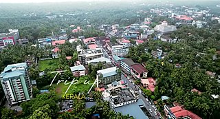
Kozhikode, also known in English as Calicut, is a city along the Malabar Coast in the state of Kerala in India. It has a corporation limit population of 609,224 and a metropolitan population of more than 2 million, making it the second largest metropolitan area in Kerala and the 19th largest in India. Kozhikode is classified as a Tier 2 city by the Government of India.
Vatakara, also spelled Vadakara, IPA: [ʋɐɖɐgɐɾɐ], French: Bargaret, is a Municipality in the state of Kerala, India. Vatakara is located between Kannur and Kozhikode. The municipality of Vatakara covers an area of 23.33 km2 (9.01 sq mi) and is bordered by Mahé to the north and Payyoli to the south. It is the headquarters of Vatakara taluk, which consists of 22 panchayats. During the reign of the Kolathiris and Zamorins, Vatakara was known as Kadathanadu. During the British Raj, it was part of the North Malabar region of Malabar District in the state of Madras. The historic Lokanarkavu temple, made famous by the Vadakkan Pattukal, is situated in Vatakara. A new tardigrade species collected from Vadakara coast has been named after Kerala State; Stygarctus keralensis.

Māmānkam or Māmāngam was a duodecennial medieval fair held on the bank, and on the dry river-bed, of Pērār at Tirunāvāya, southern India. The temple associated with the festival was Nava Mukunda Temple in Tirunavaya. It seems to have begun as a temple festival, analogous to the Kumbha Melas at Ujjaini, Prayaga, Haridwar and Kumbakonam.

Kozhikode, or Calicut district, is one of the 14 districts in the Indian state of Kerala, along its Southwestern Malabar Coast. The city of Kozhikode, also known as Calicut, is the district headquarters. The district is 67.15% urbanised.

Mankada is a hillside village in the Malappuram district of Kerala state. It is located 15 km (9.3 mi) from Malappuram and is part of the Malappuram parliament constituency. The municipal town of Perinthalmanna is just 10 km (6.2 mi) away. Also, the municipal towns of Manjeri and Malappuram are just 15 km (9.3 mi) away. Mankada Kadannamanna Kovilakam was the seat of ruling family of the erstwhile Kingdom of Valluvanad.

Vaniyamkulam is an old town and an important trading hub of Southern Malabar in Kerala state, India, particularly of livestock arriving from the neighbouring state of Tamil Nadu. The name derived from 'Vaniyan', connected with a trading community. It is part of the Palakkad District.

Valanchery is a major town and one of the 12 municipalities in Malappuram district, Kerala, India. It is one of the four municipalities in Tirur Taluk, besides Tirur, Kottakkal, and Tanur. It is situated about 40 kilometres (25 mi) southeast to Karipur International Airport and 25 kilometres (16 mi) southwards to the district headquarters, and forms a part of Malappuram metropolitan area. It is also one of the major commercial towns under the Malappuram urban agglomeration. Valanchery, which was a part of the erstwhile princely state of the Valluvanad in the early medieval period, had been under the direct control of the Zamorin of Calicut following the Tirunavaya war of 14th century CE. During British Raj, Valanchery was included in the Ponnani Taluk of erstwhile Malabar District. Vattapara accident zone is an accident zone near Valanchery. Valanchery is situated on National Highway 66.

Mananchira is a man-made freshwater pond situated in the centre of the city of Kozhikode (Calicut) in Kerala, southern India. The pond is 3.49 acres in area, is rectangular in shape and is fed by a natural spring.

Beaches in the Indian state of Kerala are spread along the 550-km Arabian Sea coastline. Kerala is an Indian state occupying the south-west corner of the subcontinent. The topography of the coastline is distinctive and changes abruptly as one proceeds from north to south. In the northern parts of Kerala, in places such as Bekal, Thalassery and Kannur, the headlands rise above the shore from the fringe of the beaches. The highlands are dotted with forts built by the colonial powers – the Portuguese, the Dutch and the British. The view of the surrounding area is mesmerizing. From Kozhikode, once the hub of the Malabar coast, the view changes to flat lands with rocky outcroppings jutting out. One feature is common all through – the coconut tree in large numbers. Dense groves of coconut trees line the coast and extend to the interiors.

Lakkidi or Lakkidi Perur is a small village in Ottapalam Taluk of Palakkad district, Kerala, India. It is located 23 km west of Palakkad on the Palakkad - Pattambi Road. The nearest town is Ottapalam, which is 10 km away. Lakkidi is situated 303 km from the state capital, Thiruvananthapuram. The pin code of Lakkidi Post Office is 679301 and the STD code is 0466.

Chadayamangalam is a village located in Kollam district of Kerala state, India. It is located along the Ithikkara river and the MC road that passes across the major urban locations of Kerala. It acts as centre for Chadayamangalam block panchayat, gram panchayat and assembly constituency. It hosts numerous government institutions including hospitals, schools and police station. Chadayamngalam is well noticed for newly constructed Jatayu Earth’s Center, which is a tourism centre in the town with the world’s largest bird sculpture..The place is also referred to as Jatayumangalam.
Nochad is a village in Kozhikode district in the state of Kerala, India.
Orkkatteri is a small town in Kozhikode district in the North Malabar region of state of Kerala, India. This is the center town for Eramala grama panchayath.

Eranad also known as Ernad refers to the erstwhile province in the midland area of Malabar, consisting of Malappuram and nearby regions such as Anakkayam, Manjeri, Kondotty, Nilambur, etc. Currently Eranad Taluk is a Taluk in Malappuram district. Eranad was ruled by a Samanthan Nair clan known as Eradis, similar to the Vellodis of neighbouring Valluvanad and Nedungadis of Nedunganad. The rulers of Eranad were known by the title Eralppad/Eradi. They also used the title Thirumulpad.
Madichel is a village in Vilavancode taluk, Kanniyakumari district, Tamil Nadu, India. The village is near Kuzhithurai, a historical seaport where merchants came from across the Arabian sea in ancient times.

Pizhala is an island village, one among the fourteen islands of Kadamakkudy archipelago, located near to the main land of the Ernakulam City. The island is surrounded by tributaries of River Periyar. Pizhala island is part of Kadamakkudy Village of Kanayannur Taluk in Ernakulam District in the State of Kerala, India.

Dharmashala is a small town and headquarters of the Anthoor Municipality in Kannur district of the North Malabar region in the Indian state of Kerala. It is located near National Highway 66 between Kannur and Taliparamba. It is located about 16 kilometres (9.9 mi) north of Kannur. Dharmashala is an important educational and industrial hub in the Kannur district and also an important tourism destination of Malabar region. Dharmashala is a major government officials settlement area in Kannur. A large number of migrant labourers from various other states are working in the industrial development area in Dharmashala. Students from various parts of country study at institutes such as NIFT. Nearby important institutions and attractions are the Kerala Armed Police (KAP) 4th Battalion Mangattuparamba, Government College of Engineering Kannur, Kannur University, KELTRON, Vismaya water theme park, Parassinikkadavu Shree Muthappan temple, Doordarshan kendra, Parassinikkadavu Snake Park, Industrial Development Plot, Central School, EK Nayanar memorial women and child hospital, Si-met college of nursing, M.V.R memorial Ayurveda Medical College, Institute of Co-operative Management (ICM), National Institute of Fashion Technology, Vellikkeel eco tourism park, Hi-Five sports indoor stadium, Kerala Clays and Ceramics Ltd. etc.
Malappuram is one of the 14 districts in the South Indian state of Kerala. The district has a unique and eventful history starting from pre-historic times. During the early medieval period, the district was the home to two of the four major kingdoms that ruled Kerala. Perumpadappu was the original hometown of the Kingdom of Cochin, which is also known as Perumbadappu Swaroopam, and Nediyiruppu was the original hometown of the Zamorin of Calicut, which is also known as Nediyiruppu Swaroopam. Besides, the original headquarters of the Palakkad Rajas were also at Athavanad in the district.
Mannoor is a village in Ittiva Grama Panchayath located towards the west of Kollam district of Kerala, India. It is located on the west of the Main Central Road. The closest towns are Anchal and Punalur. The village is also close to Kadakkal, an agricultural village known for its spice production and the Kadakkal Devi Temple. Thiruvananthapuram, formerly Trivandrum, is 65 kilometres (40 mi) from Mannoor and is the closest airport. Kollam, formerly Quilon, the district headquarters, is 46 kilometres (29 mi) away.

