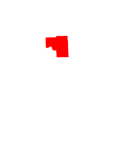
Marcell, Minnesota

Last updated

Marcell
Edge of the Wilderness - The Tender Tourist Trap in Marcell, Minnesota - NARA - 7718256.jpg
Flats of perennials greet visitors at the Tender Tourist Trap in Marcell, MN
USA Minnesota location map.svg
Red pog.svg
Marcell
Location of the community of Marcell
within Marcell Township, Itasca County
Usa edcp location map.svg
Red pog.svg
Marcell
Marcell (the United States)
Coordinates: 47°35′35″N93°41′27″W / 47.59306°N 93.69083°W / 47.59306; -93.69083
Country United States
State Minnesota
County Itasca
Township Marcell Township
Elevation
1,391 ft (424 m)
Population
  Total100
Time zone UTC-6 (Central (CST))
  Summer (DST) UTC-5 (CDT)
ZIP code
56657
Area code 218
GNIS feature ID657317 [1]

Marcell is an unincorporated community in Marcell Township, Itasca County, Minnesota, United States.

Contents

Minnesota State Highways 38 and 286 are two of the main routes in the community.

Marcell is located 28 miles north of Grand Rapids. The community is located within the Chippewa National Forest.

Nearby places include Bigfork, Talmoon, Bowstring, Deer River, and Effie.

Despite its unincorporated status, Marcell appears on most more detailed maps of Minnesota due to the presence of several locally important businesses and the lack of larger communities in the surrounding area. In addition, it has its own post office with the ZIP code 56657.

History

Marcell was founded under the name Turtle Lake in 1905. The name was changed to Marcell the following year due to a name conflict with other communities named Turtle Lake. The name Marcell is in honor of Andy Marcell, a conductor on the former Minneapolis and Rainy River Railway, who was involved in a railway accident in the area.

The site of the town center was originally at a store operated by John Lundeen on Big Turtle Lake, but was moved in 1910 to its present location near the railway.

Climate

Climate data for Marcell 5NE, Minnesota, 1991–2020 normals, 1981-2020 extremes: 1387ft (423m)
MonthJanFebMarAprMayJunJulAugSepOctNovDecYear
Record high °F (°C)46
(8)
54
(12)
64
(18)
82
(28)
91
(33)
92
(33)
93
(34)
96
(36)
91
(33)
80
(27)
67
(19)
50
(10)
96
(36)
Mean maximum °F (°C)36.6
(2.6)
42.8
(6.0)
55.0
(12.8)
71.7
(22.1)
81.4
(27.4)
85.1
(29.5)
86.1
(30.1)
86.5
(30.3)
81.0
(27.2)
71.8
(22.1)
52.6
(11.4)
38.8
(3.8)
87.0
(30.6)
Mean daily maximum °F (°C)15.7
(−9.1)
22.1
(−5.5)
35.6
(2.0)
49.3
(9.6)
62.9
(17.2)
71.9
(22.2)
76.8
(24.9)
74.8
(23.8)
66.0
(18.9)
50.9
(10.5)
33.9
(1.1)
21.2
(−6.0)
48.4
(9.1)
Daily mean °F (°C)5.5
(−14.7)
9.7
(−12.4)
23.8
(−4.6)
38.1
(3.4)
51.5
(10.8)
61.9
(16.6)
66.3
(19.1)
64.8
(18.2)
56.5
(13.6)
42.7
(5.9)
26.9
(−2.8)
13.2
(−10.4)
38.4
(3.6)
Mean daily minimum °F (°C)−4.7
(−20.4)
−2.6
(−19.2)
12.0
(−11.1)
26.9
(−2.8)
40.2
(4.6)
51.9
(11.1)
55.8
(13.2)
54.8
(12.7)
46.9
(8.3)
34.6
(1.4)
19.9
(−6.7)
5.1
(−14.9)
28.4
(−2.0)
Mean minimum °F (°C)−30.1
(−34.5)
−25.1
(−31.7)
−10.0
(−23.3)
12.9
(−10.6)
27.3
(−2.6)
37.9
(3.3)
45.9
(7.7)
44.2
(6.8)
31.7
(−0.2)
21.9
(−5.6)
0.3
(−17.6)
−24.3
(−31.3)
−31.6
(−35.3)
Record low °F (°C)−48
(−44)
−51
(−46)
−31
(−35)
−3
(−19)
19
(−7)
28
(−2)
40
(4)
35
(2)
26
(−3)
10
(−12)
−15
(−26)
−39
(−39)
−51
(−46)
Average precipitation inches (mm)0.91
(23)
0.77
(20)
1.32
(34)
2.20
(56)
3.15
(80)
4.21
(107)
5.90
(150)
3.46
(88)
3.71
(94)
2.66
(68)
1.57
(40)
1.26
(32)
31.12
(792)
Average snowfall inches (cm)14.10
(35.8)
10.00
(25.4)
7.70
(19.6)
5.20
(13.2)
0.20
(0.51)
0.00
(0.00)
0.00
(0.00)
0.00
(0.00)
0.00
(0.00)
1.20
(3.0)
12.90
(32.8)
12.80
(32.5)
64.1
(162.81)
Source 1: NOAA [2]
Source 2: XMACIS (temp records & 1981-2010 monthly max/mins) [3]

Related Research Articles

<span class="mw-page-title-main">Itasca County, Minnesota</span> County in Minnesota, United States

Itasca County is a county located in the Iron Range region of the U.S. state of Minnesota. As of the 2020 census, the population was 45,014. Its county seat is Grand Rapids. The county is named after Lake Itasca, which is in turn a shortened version of the Latin words veritas caput, meaning 'truth' and 'head', a reference to the source of the Mississippi River. Portions of the Bois Forte and Leech Lake Indian reservations are in the county.

Brimson is an unincorporated community in Ault Township, Saint Louis County, Minnesota, United States.

Bowstring is an unincorporated community in Bowstring Township, Itasca County, Minnesota, United States.

<span class="mw-page-title-main">Embarrass, Minnesota</span> Unincorporated community in Minnesota, United States

Embarrass is an unincorporated community in Embarrass Township, Saint Louis County, Minnesota, United States.

<span class="mw-page-title-main">Duquette, Minnesota</span> Unincorporated community in Minnesota, United States

Duquette is an unincorporated community in Pine County, Minnesota, United States; located along the Willow River.

<span class="mw-page-title-main">Minnesota State Highway 286</span> State highway in Minnesota, United States

Minnesota State Highway 286 (MN 286) is a 4.302-mile-long (6.923 km) highway in north-central Minnesota, which runs from its intersection with State Highway 6 in Talmoon and continues east to its eastern terminus at its intersection with State Highway 38 in Marcell.

Inger is an unincorporated community and census-designated place (CDP) in Itasca County, Minnesota, United States, along the Bowstring River of the Leech Lake Indian Reservation. As of the 2010 census, its population was 212.

Britt is an unincorporated area in Saint Louis County, Minnesota, United States.

Bengal was an unincorporated community on the boundary of Itasca County and Saint Louis County, Minnesota, United States, located about three hours north of Minneapolis. Bengal was also previously known as Powers.

Crane Lake is an unincorporated community in Crane Lake Township, Saint Louis County, Minnesota, United States; located within the Kabetogama State Forest.

Angora is an unincorporated community in Angora Township, Saint Louis County, Minnesota, United States.

Skibo is an unincorporated community in Bassett Township, Saint Louis County, Minnesota, United States.

Bear River is an unincorporated community in Itasca and Saint Louis counties in the U.S. state of Minnesota.

Talmoon is an unincorporated community in Itasca County, Minnesota, United States.

Spring Lake is an unincorporated community in Lake Jessie Township, Itasca County, Minnesota, United States; located within the Chippewa National Forest.

Max is an unincorporated community in Max Township, Itasca County, Minnesota, United States; located within the Chippewa National Forest and the Leech Lake Indian Reservation.

Mack is an unincorporated community in Itasca County, Minnesota, United States, located within the Chippewa National Forest. The community is located between Deer River and Talmoon, at the junction of State Highway 6 and Mac Road.

Alvwood is an unincorporated community in Alvwood Township, Itasca County, Minnesota, United States.

<span class="mw-page-title-main">Suomi, Minnesota</span> Unincorporated community in Minnesota, United States

Suomi is an unincorporated community in Itasca County, Minnesota, United States.

Jessie Lake is an unincorporated community in Lake Jessie Township, Itasca County, Minnesota, United States, located within the Chippewa National Forest. The community is located between Wirt and Talmoon; along Itasca County Road 4.

References

  1. "Marcell, Minnesota". Geographic Names Information System . United States Geological Survey, United States Department of the Interior.
  2. "Marcell 5NE, Minnesota 1991-2020 Monthly Normals" . Retrieved December 25, 2023.
  3. "xmACIS". National Oceanic and Atmospheric Administration. Retrieved December 25, 2023.

Further reading