Marlin, Washington

Last updated • 4 min readFrom Wikipedia, The Free Encyclopedia

Marlin, Washington
Grant County Washington Incorporated and Unincorporated areas Krupp Highlighted.svg
Location of Marlin (Krupp), Washington
Coordinates: 47°24′32″N118°59′18″W / 47.40889°N 118.98833°W / 47.40889; -118.98833
CountryUnited States
State Washington
County Grant
Founded1871
Incorporated January 7, 1911
Area
[1]
  Total0.58 sq mi (1.51 km2)
  Land0.58 sq mi (1.51 km2)
  Water0.00 sq mi (0.00 km2)
Elevation
[2]
1,326 ft (404 m)
Population
 (2020) [3]
  Total49
  Estimate 
(2023) [4]
47
  Density89.19/sq mi (34.42/km2)
Time zone UTC–8 (Pacific (PST))
  Summer (DST) UTC–7 (PDT)
ZIP Code
98832 [5]
Area code 509
FIPS code 53-43675
GNIS feature ID1534597 [2]

Marlin—officially the Town of Krupp—is a town in Grant County, Washington, United States. The population was 49 at the 2020 census, [3] the lowest of any incorporated municipality in Washington. Although legally incorporated as Krupp, the town is more commonly known as Marlin, which is the name of its post office. Elections are held there under the name of Marlin, Washington, and they are the same locale.

Contents

History

First settled in 1871 by Henry Marlin, the townsite was originally a cattle ranch that was later surrounded by wheat farms. [6] [7] The Great Northern Railway was built through the area in 1892 and placed a station, which was named Krupp—allegedly for a local German family. [7] Its plat was filed in 1902 by George Urquhart, a Scottish immigrant who bought land rights and cattle from Marlin. The area was then settled by families who emigrated from Iowa and incorporated as the town of Krupp on January 7, 1911, despite not meeting the population threshold of 300 residents needed for incorporation. [7]

A post office was established in 1918 under the name of "Marlin", following a request from local residents to avoid using Krupp amid anti-German sentiment during World War I. [8] The name was associated with Krupp, a well-known munitions plant in Germany. [9] From then on, the town was primarily known by the name of its post office, but officially remains Krupp; both names are also used on some signs. [9] [10]

In the summer of 1971 a three-day rock festival, "Sunrise '71," was scheduled to take place immediately south of town, but was shut down by county authorities. It was to be on the scale of Woodstock, with an estimated attendance of 50,000 people. [11]

Krupp/Marlin lost its lone school in 1970 and would eventually lack a filling station, grocery store, or restaurant. By 1983, it had 27 total homes and no formal municipal services. [12] It is the smallest incorporated place in Washington, with only 60 residents in 2000. [10] [13] The community was noted for its Hutterites, who resided in colonies in the surrounding farmland. [14]

Geography

Krupp is located along Crab Creek in eastern Grant County, approximately 25 miles (40 km) northeast of Moses Lake. It is on the north side of State Route 28. [7] [14] The city has 10 streets, centered around its main street, Urquhart Avenue, and is surrounded by gravel roads. [12]

According to the United States Census Bureau, the town has a total area of 0.58 square miles (1.50 km2), all of it land. [1]

Demographics

Historical population
CensusPop.Note
1920 106
1930 101−4.7%
1940 94−6.9%
1950 984.3%
1960 991.0%
1970 52−47.5%
1980 8359.6%
1990 53−36.1%
2000 6013.2%
2010 48−20.0%
2020 492.1%
2023 (est.)47 [4] −4.1%
U.S. Decennial Census [15]
2020 Census [3]

2010 census

As of the 2010 census, there were 48 people, 25 households, and 13 families residing in the town. The population density was 81.4 inhabitants per square mile (31.4/km2). There were 28 housing units at an average density of 47.5 per square mile (18.3/km2). The racial makeup of the town was 100.0% White. Hispanic or Latino of any race were 2.1% of the population.

There were 25 households, of which 16.0% had children under the age of 18 living with them, 40.0% were married couples living together, 4.0% had a female householder with no husband present, 8.0% had a male householder with no wife present, and 48.0% were non-families. 40.0% of all households were made up of individuals, and 20% had someone living alone who was 65 years of age or older. The average household size was 1.92 and the average family size was 2.62.

The median age in the town was 52 years. 12.5% of residents were under the age of 18; 6.4% were between the ages of 18 and 24; 18.8% were from 25 to 44; 29.2% were from 45 to 64; and 33.3% were 65 years of age or older. The gender makeup of the town was 58.3% male and 41.7% female.

2000 census

As of the 2000 census, there were 60 people, 24 households, and 15 families residing in the town. The population density was 100.5 people per square mile (38.6/km2). There were 30 housing units at an average density of 50.3 per square mile (19.3/km2). The racial makeup of the town was 83.33% White, 1.67% Asian, and 15.00% from two or more races. Hispanic or Latino of any race were 5.00% of the population.

There were 24 households, out of which 33.3% had children under the age of 18 living with them, 62.5% were married couples living together, and 37.5% were non-families. 29.2% of all households were made up of individuals, and 4.2% had someone living alone who was 65 years of age or older. The average household size was 2.50 and the average family size was 3.27.

In the town, the population was spread out, with 31.7% under the age of 18, 1.7% from 18 to 24, 23.3% from 25 to 44, 35.0% from 45 to 64, and 8.3% who were 65 years of age or older. The median age was 42 years. For every 100 females, there were 106.9 males. For every 100 females age 18 and over, there were 105.0 males.

The median income for a household in the town was $37,679, and the median income for a family was $37,857. Males had a median income of $36,250 versus $21,250 for females. The per capita income for the town was $9,149. There were no families and 2.7% of the population living below the poverty line, including no under eighteens and none of those over 64.

Related Research Articles

<span class="mw-page-title-main">Hardinsburg, Indiana</span> Town in Indiana, United States

Hardinsburg is a town in Posey Township, Washington County, in the U.S. state of Indiana. The population was 222 at the 2020 census.

Edinburg is a town in Penobscot County, Maine, United States. The population was 134 at the 2020 census. It is part of the Bangor Metropolitan Statistical Area. It is located between the towns of Argyle and Howland along Maine State Route 116 on the west bank of the Penobscot River.

Crawford is a town in Washington County, Maine, United States. The town was named after William H. Crawford, Secretary of the Treasury. The population was 93 at the 2020 census.

<span class="mw-page-title-main">Hartline, Washington</span> Town in Washington, United States

Hartline is a town in Grant County, Washington, United States. The population was 180 at the 2020 census. The high school for the Almira-Coulee/Hartline school district was located here, but moved to Coulee City, Washington in 2008. The name "Hartline" is an Americanized spelling of the German last name "Hartlein" and is an uncommon last name.

<span class="mw-page-title-main">Beaux Arts Village, Washington</span> Town in Washington, United States

Beaux Arts is a town located in the Eastside region of King County, Washington, United States. It is the smallest municipality in the county, with a population of 317 as of the 2020 census and a land area of 0.1 sq mi.

<span class="mw-page-title-main">Bonney Lake, Washington</span> City in Washington, United States

Bonney Lake is a city in Pierce County, Washington. The population was 22,487 at the time of the 2020 census.

<span class="mw-page-title-main">Hamilton, Washington</span> Town in Washington, United States

Hamilton is a town in Skagit County, Washington, United States. The population was 299 at the 2020 census. It is included in the Mount Vernon-Anacortes, Washington Metropolitan Statistical Area.

<span class="mw-page-title-main">Lyman, Washington</span> Town in Washington, United States

Lyman is a town in Skagit County, Washington, United States. The population was 423 at the 2020 census. It is included in the Mount Vernon-Anacortes, Washington Metropolitan Statistical Area.

<span class="mw-page-title-main">Stevenson, Washington</span> City in Washington, United States

Stevenson is a city in the Columbia River Gorge National Scenic Area along the Columbia River in Skamania County, Washington, United States. It is the county seat of Skamania County and home to the Skamania County Court House and Sheriff's Office. The population was 1,491 at the 2020 census.

<span class="mw-page-title-main">Waverly, Washington</span> Town in Washington, United States

Waverly is a town in Spokane County, Washington, United States. The population was 121 at the 2020 census.

<span class="mw-page-title-main">Marcus, Washington</span> Town in Washington, United States

Marcus is a town in Stevens County, Washington, United States. The population was 216 at the 2020 census.

<span class="mw-page-title-main">Albion, Washington</span> Town in Washington, United States

Albion is a town in Whitman County, Washington, United States. The population was 550 at the 2020 Census.

<span class="mw-page-title-main">Endicott, Washington</span> Town in Washington, United States

Endicott is a town in Whitman County, Washington, United States. The population was 312 at the 2020 census.

<span class="mw-page-title-main">Farmington, Washington</span> Town in Washington, United States

Farmington is a town in Whitman County, Washington, United States. The population was 131 at the 2020 census.

<span class="mw-page-title-main">Malden, Washington</span> Town in Washington, United States

Malden is a town in Whitman County, eastern Washington, United States. The population was 216 at the 2020 census. 80 percent of the buildings were destroyed by a wildfire on September 7, 2020.

<span class="mw-page-title-main">Oakesdale, Washington</span> Town in Washington, United States

Oakesdale is a town in Whitman County, Washington, United States. The population was 395 at the 2020 census.
<span class="mw-page-title-main">St. John, Washington</span> Town in Washington, United States

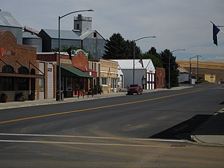
St. John is a town in Whitman County, Washington, United States. The population was 599 at the 2020 census. St. John is the birthplace of the twentieth governor of Washington, Mike Lowry.

<span class="mw-page-title-main">Grandview, Washington</span> City in Washington, United States

Grandview is a city in Yakima County, Washington, United States. It is about 38 miles west of Kennewick and 38 miles southeast of Yakima. The population was 10,907 at the 2020 census. Grandview's economy is agriculture based; with apples, cherries, concord and wine grapes, hops, asparagus, corn, wheat, dairy and other fruit and vegetable production supported by processing plants and cold storage facilities.
<span class="mw-page-title-main">Tieton, Washington</span> City in Washington, United States

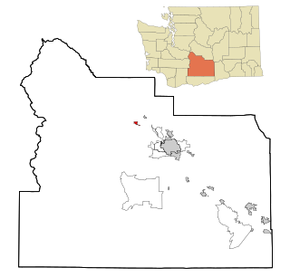
Tieton is a city in Yakima County, Washington, United States. The population was 1,389 at the 2020 census.

<span class="mw-page-title-main">Zillah, Washington</span> City in Washington, United States

Zillah is a city in Yakima County, Washington, United States, with a population of 3,179 as of the 2020 census.
References

  1. 1 2 "2023 U.S. Gazetteer Files". United States Census Bureau. Retrieved June 19, 2024.
  2. 1 2 U.S. Geological Survey Geographic Names Information System: Marlin, Washington
  3. 1 2 3 "Explore Census Data". United States Census Bureau . Retrieved January 4, 2024.
  4. 1 2 "City and Town Population Totals: 2020-2023". United States Census Bureau. June 19, 2024. Retrieved June 19, 2024.
  5. "Krupp (Marlin) WA ZIP Code". zipdatamaps.com. 2023. Retrieved June 16, 2023.
  6. Majors, Harry M. (1975). Exploring Washington. Van Winkle Publishing Co. p. 106. ISBN   978-0-918664-00-6.
  7. "Citizens Object to Town's Name". The Spokesman-Review . September 9, 1918. p. 5. Retrieved February 17, 2022 via Newspapers.com.
  8. 1 2 Wiley, John K. (June 22, 1986). "Krupp—or is it Marlin—has identity crisis". The Spokesman-Review. Associated Press. p. C4. Retrieved February 17, 2022 via Newspapers.com.
  9. 1 2 Modie, Neil (July 27, 2000). "This tiny town is fading fast". Seattle Post-Intelligencer . p. A1.
  10. Bryant, Hilda (June 16, 1971). "Town Keeps Its Cool In Sunrise 71 Heat". Seattle Post-Intelligencer. p. 20.
  11. 1 2 Bogan, Christopher (January 20, 1983). "Marlin: The streets are safe, folks are friendly and life is slow in the state's smallest town". The Spokesman-Review. p. 21. Retrieved February 17, 2022 via Newspapers.com.
  12. Gilmore, Susan (March 28, 2001). "The three in the little leagues". The Seattle Times . p. B1.
  13. 1 2 Seven, Richard (October 4, 1998). "A Road Less Taken". The Seattle Times. pp. 16–20.
  14. United States Census Bureau. "Census of Population and Housing" . Retrieved October 5, 2013.