
The Johore Strait is an international strait in Southeast Asia, between Singapore and Peninsular Malaysia.

Pulau Tekong, also known colloquially as Tekong, is the second-largest of Singapore's outlying islands, with an area of 24.43 km2. The island is still expanding due to land reclamation works on its southern and northwestern coasts which will eventually subsume many of its surrounding small islets, including the 89-hectare (220-acre) Pulau Tekong Kechil. Transport to the island is by SAF Changi Ferry Terminal.

Pulau Ubin, also simply known as Ubin, is an island situated in the north east of Singapore, to the west of Pulau Tekong. The Granite quarry used to be supported by a few thousand settlers on Pulau Ubin in the 1960s, but only about 38 villagers remains as of 2012. It is one of the last rural areas to be found in Singapore, with an abundance of natural flora and fauna. The island forms part of the Ubin–Khatib Important Bird Area (IBA), identified as such by BirdLife International because it supports significant numbers of visiting and resident birds, some of which are threatened. Today, the island is managed by the National Parks Board, compared to 12 agencies managing different areas of the island previously.

Pedra Branca is an outlying island and also the easternmost point of Singapore. The name means "white rock" in Portuguese, and refers to whitish guano deposited on the rock. The island consists of a small outcrop of granite rocks with an area of about 8,560 square metres (92,100 sq ft). During the low water spring tide it measures, at its longest, 137 metres (449 ft) and has an average width of 60 metres (200 ft). Pedra Branca is situated at 1°19′48″N104°24′27″E, where the Singapore Strait meets the South China Sea.
Pulau Semakau is located to the south of the main island of Singapore, off the Straits of Singapore. The Semakau Landfill is located on the eastern side of the island, and was created by the amalgamation of Pulau Sakeng, and "anchored" to Pulau Semakau. The Semakau Landfill is Singapore's first offshore landfill and now the only remaining landfill in Singapore.
The state of Johor in Malaysia is noted for its national parks and forest reserves which preserve virgin rainforests known for its biodiversity and endangered species of animals. Mangrove swamps and coral reefs are also protected within these parks.

The Malaysia–Singapore border is an international maritime border between the Southeast Asian countries of Malaysia, which lies to the north of the border, and Singapore to the south. The boundary is formed by straight lines between maritime geographical coordinates running along or near the deepest channel of the Straits of Johor.

Pulai River is a river in Johor, Malaysia. It runs from Mount Pulai in Kulai District until Tanjung Pelepas, draining into the Tebrau Straits. At its mouth lies the single largest seagrass bed in Malaysia which extents all the way to Pulau Merambong. Sungai Pulai is also a Mangrove Forest Reserve. The site is under intensive studies to help managing the vast mangrove ecosystem, with assistance from UTM, and UKM, in line with the Integrated Management Plan for the sustainable use of mangroves in Johore.
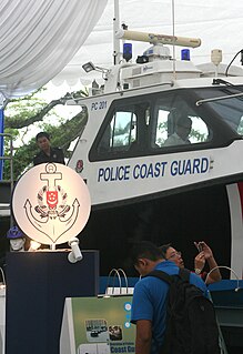
The Police Coast Guard is a division of the Singapore Police Force that combines the functions of marine police and coast guard in Singapore. Its duties include the law enforcement and search and rescue operations in collaboration with the Maritime and Port Authority of Singapore and the Immigration and Checkpoints Authority. It is headquartered at Brani Regional Base on Pulau Brani.

Pulau Sajahat, was a small island about 1.2 hectares located off the north-eastern coast of Singapore, near Pulau Tekong. The island, together with its smaller companion Pulau Sejahat Kechil, has been subsumed by Pulau Tekong with the land reclamation works on Pulau Tekong's southern and northwestern coasts.

Serangoon Harbour is a harbour in Singapore located between the mainland island of Singapore and Pulau Ubin.

The border between the Southeast Asian countries of Indonesia and Malaysia separates the two countries' territories on the island of Borneo and also includes maritime boundaries along the length of the Straits of Malacca, in the South China Sea and in the Celebes Sea.
Kukup Island is an island in Pontian District, Johor, Malaysia.

The Pedra Branca dispute was a territorial dispute between Singapore and Malaysia over several islets at the eastern entrance to the Singapore Strait, namely Pedra Branca, Middle Rocks and South Ledge. The dispute began in 1979 and was largely resolved by the International Court of Justice (ICJ) in 2008, which opined that Pedra Branca belonged to Singapore and Middle Rocks and South Ledge belonged to Malaysia.

The Middle Rocks are two uninhabited small rocks separated by 250 metres (820 ft) of open water at the eastern opening of the Strait of Singapore on the western edge of the South China Sea. The islands were disputed territory between Malaysia and Singapore until, on 23 May 2008, the International Court of Justice decided that sovereignty over Middle Rocks belonged to Malaysia by 15 votes to one.

Malaysia–Singapore relations refers to the bilateral foreign relations between the two countries Malaysia and Singapore, after the separation of Singapore from Malaysia in 1965. Singapore has a high commission in Kuala Lumpur and a consulate general in Johor Bahru, while Malaysia has a high commission in Singapore. Both countries are full members of the Commonwealth of Nations and ASEAN. Ties between the two countries remain intact despite several diplomatic issues that have arisen.

Johor, formerly known as Johore, is a state of Malaysia in the south of the Malay Peninsula. Johor has land borders with the Malaysian states of Pahang to the north and Malacca and Negeri Sembilan to the northwest. Johor shares maritime borders with Singapore to the south and Indonesia to both the west and east. Johor Bahru is the capital city and the economic centre of the state, Kota Iskandar is the seat of the state government, and Muar serves as the royal town of the state. The old state capital is Johor Lama. As of 2017, the state's population is 3,700,000. Johor has highly diverse tropical rainforests and an equatorial climate. The state's mountain ranges form part of the Titiwangsa Range, which is part of the larger Tenasserim Range connected to Thailand and Myanmar, with Mount Ophir being the highest point in Johor.

The Ubin–Khatib Important Bird Area, also known as the North-East Conservation Area , is an 8940 ha tract of largely undeveloped land in north-eastern Singapore on the border with the Malaysian state of Johor. It encompasses the island of Ubin and much of the islands of Tekong and Tekong Kechil, as well as a coastal strip of the main island, including the Lower Seletar Reservoir, with the intervening coastal waters, seagrass beds, mangroves and intertidal mudflats.
Pulau Seletar is an island situated in the Straits of Johor off the northern coast of Singapore. Located within Singapore waters, it has an area of 38.5 hectare. It lies within a bay into which several streams flow, including the waters of mainland Singapore's only hot spring.

