Quincy is a city in Norfolk County, Massachusetts, United States. It is the largest city in the county. Quincy is part of the Greater Boston area as one of Boston's immediate southern suburbs. Its population in 2020 was 101,636, making it the seventh-largest city in the state. Known as the "City of Presidents", Quincy is the birthplace of two U.S. presidents—John Adams and his son John Quincy Adams—as well as John Hancock, the first signer of the Declaration of Independence and the first and third governor of Massachusetts.
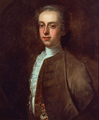
Thomas Hutchinson was an American merchant, politician, historian, and colonial administrator who repeatedly served as governor of the Province of Massachusetts Bay in the years leading up to the American Revolution. He has been described as "the most important figure on the loyalist side in pre-Revolutionary Massachusetts". Hutchinson was a successful merchant and politician who was active at high levels of the Massachusetts colonial government for many years, serving as lieutenant governor and then governor from 1758 to 1774. He was a politically polarizing figure who came to be identified by John Adams and Samuel Adams as a supporter of unpopular British taxes, despite his initial opposition to Parliamentary tax laws directed at the colonies. Hutchinson was blamed by British Prime Minister Lord North for being a significant contributor to the tensions that led to the outbreak of the American Revolutionary War.
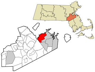
Milton is a town in Norfolk County, Massachusetts, United States and an affluent suburb of Boston. The population was 28,630 at the 2020 census.

Chestnut Hill is a wealthy New England village located six miles (10 km) west of downtown Boston, Massachusetts, United States. It is best known for being home to Boston College and a section of the Boston Marathon route. Like all Massachusetts villages, Chestnut Hill is not an incorporated municipal entity. It is located partially in Brookline in Norfolk County; partially in the city of Boston in Suffolk County, and partially in the city of Newton in Middlesex County. Chestnut Hill's borders are defined by the 02467 ZIP Code. The name refers to several small hills that overlook the 135-acre Chestnut Hill Reservoir rather than one particular hill.
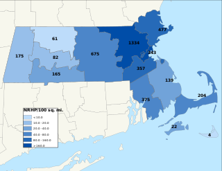
The National Register of Historic Places is a United States federal official list of places and sites considered worthy of preservation. In the state of Massachusetts, there are over 4,300 listings, representing about 5% of all NRHP listings nationwide and the second-most of any U.S. state, behind only New York. Listings appear in all 14 Massachusetts counties.

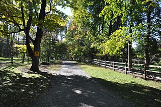
Governor Hutchinson's Field is a nature reserve located in Milton, Massachusetts. The field is owned by The Trustees of Reservations. The property is the only means of public access to another Trustees property, the otherwise inaccessible Pierce Reservation.

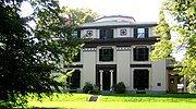
The Amos Adams House is a historic house in the Newton Corner village of Newton, Massachusetts. Built in 1888, it is a prominent local example of Queen Anne architecture. It was listed on the National Register of Historic Places on September 4, 1986.
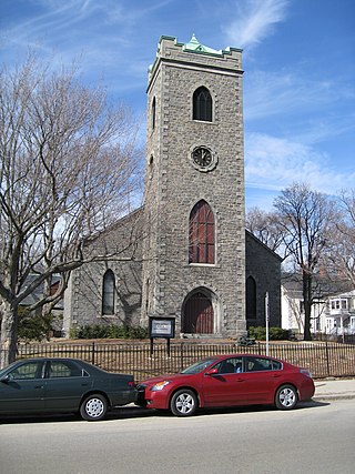
Monument Square Historic District is a predominantly residential historic district north of Monument Square in Jamaica Plain, a neighborhood of Boston, Massachusetts. The 43 acres (17 ha) district is bounded on the northwest by Pond Street, the northeast by Myrtle and Pond Streets, the southeast by Centre Street, and Holbrook and Eliot Streets to the west. This area, originally developed as country estates, was developed as a residential area in the late 19th and early 20th centuries, with its architecture reflecting a diversity of styles. Prominent non-residential buildings including the First Church of Jamaica Plain, Eliot Hall, and the Eliot School. Also included in the district is Jamaica Plain's Gothic Soldier's Monument, at the junction of South and Centre Streets.

The Sumner Hill Historic District encompasses a predominantly residential area of high-quality late 19th-century residences in the Jamaica Plain neighborhood of Boston, Massachusetts. It is roughly bounded by Seaverns Avenue, Everett Street, Carolina Avenue, and Newbern Street just east of the neighborhoods commercial Centre Street area. The district features Second Empire, Italianate, and Queen Anne style architecture, and was listed on the National Register of Historic Places in 1987.

The Dr. Amos Holbrook House is a historic house at 203 Adams Street in Milton, Massachusetts, across from Governor Hutchinson's Field. The two-story wood-frame house was built in 1800 by Dr. Amos Holbrook, a pioneer in the propagation of smallpox inoculations as a means of improving public health. The house has retained may interior finish details from the Federal period. It was expanded to the rear in 1872, at which time its front portico was added. The property also includes a c. 1810 barn.
Holbrook House or Holbrook Farm may refer to:
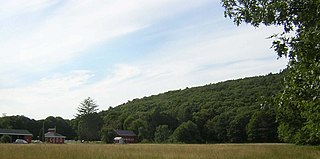
Brookwood Farm is a historic farm on Blue Hill River Road in Canton, Massachusetts. Some of its fields, but none of the buildings, are in Milton. It is owned by the Commonwealth of Massachusetts and managed by the Department of Conservation and Recreation.

The Brush Hill Historic District is a residential historic district along Brush Hill Road in Milton, Massachusetts. First developed in the 1660s, the district now encompasses a diversity of rural-suburban residential architecture from the late-17th to mid-29th centuries, encapsulating the development of the town's predominantly residential character. The district was listed on the National Register of Historic Places in 1998.

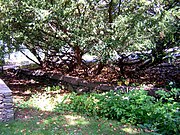
Gov. Thomas Hutchinson's Ha-ha is a historic ha-ha at 100–122 Randolph Avenue in Milton, Massachusetts, United States. Probably built about 1771, it is the only surviving structure of the once-extensive estate of Thomas Hutchinson, the last civilian colonial governor of the British Province of Massachusetts Bay, and one of the few examples of an early ha-ha in North America. It was added to the National Register of Historic Places in 1975, and is a contributing property to the Milton Hill Historic District.

The Railway Village Historic District is a historic district encompassing a densely populated, predominantly residential, area of eastern Milton, Massachusetts. The 30-acre (12 ha) district lies roughly between East Milton Square and the town line with neighboring Quincy. The area's significant growth occurred after the 1826 construction of the Granite Railway, which transported stone from the nearby granite quarries to the Neponset River. This resulted in the movement to the area of stone workers and related interests. The principal thoroughfare of the district is Adams Street; the district extends along Pierce Street, Granite Place, and Washington Street, and includes properties on intervening and connecting streets.

The Cottage Farm Historic District is a residential area in eastern Brookline, Massachusetts, United States, known for its association with industrialist Amos Adams Lawrence (1814–1886). Laid out in the 1850s and centered around the junction of Essex and Ivy Streets, it features high-quality housing on large lots, built between the 1850s and 1910s. The district was listed on the National Register of Historic Places in 1978.

The Longwood Historic District is roughly bounded by Chapel, St. Marys, Monmouth, and Kent Sts. in Brookline, Massachusetts. The area was developed in the mid-19th century by David Sears and Amos Adams Lawrence as a fashionable residential area, and retains a number of architecturally distinguished buildings, including the Longwood Towers complex at 20 Chapel Street, Christ's Church Longwood, and Church of Our Saviour, Brookline. The district was listed on the National Register of Historic Places on September 13, 1978.
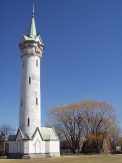
Fort Hill is a 0.4 square mile neighborhood and historic district of Roxbury, in Boston, Massachusetts. The approximate boundaries of Fort Hill are Malcolm X Boulevard on the north, Washington Street on the southeast, and Columbus Avenue on the southwest.

The Eustis Estate is a historic family estate on Canton Avenue in Milton, Massachusetts. Its centerpiece is the mansion house of William Ellery Channing Eustis, an eclectic Late Victorian stone building designed by preeminent architect William Ralph Emerson and constructed in 1878. The estate also includes several other houses associated with the Eustis family, and a gatehouse and stable historically associated with the main estate. The estate was listed on the National Register of Historic Places as a historic district in 2016. Most of the original estate is owned by Historic New England, and was opened to the public as a museum property in 2017.
The Wakefield Estate, formerly the Davenport Estate, is a historic country estate on Brush Hill Road in Milton, Massachusetts. The estate was owned and developed by the Davenport family for over 300 years before being taken over by its present ownership, a charitable trust. The estate is managed by the Wakefield Trust as part of its educational mission, and its grounds are open to the public by appointment, or on announced occasions. It was listed on the National Register of Historic Places in 2018.


