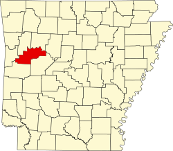
Morrison Bluff, Arkansas | |
---|---|
Coordinates: 35°22′58″N93°31′22″W / 35.38278°N 93.52278°W | |
Country | United States |
State | Arkansas |
County | Logan |
Area | |
• Total | 1.35 sq mi (3.51 km2) |
• Land | 1.34 sq mi (3.47 km2) |
• Water | 0.01 sq mi (0.04 km2) |
Elevation | 381 ft (116 m) |
Population (2020) | |
• Total | 78 |
• Density | 58.17/sq mi (22.46/km2) |
Time zone | UTC-6 (Central (CST)) |
• Summer (DST) | UTC-5 (CDT) |
FIPS code | 05-47030 |
GNIS feature ID | 2406197 [2] |
Morrison Bluff is a town in Logan County, Arkansas, United States. The population was 64 at the 2010 census [3] and an estimated 81 in 2017. [4]
Morrison Bluff is located in northern Logan County and is bordered to the north by an arm of Lake Dardanelle, an impoundment on the Arkansas River. State Highway 109 passes through the town, leading south 2 miles (3 km) to Scranton and north across the Arkansas River 5 miles (8 km) to U.S. Route 64 at a point 4 miles (6 km) west of Clarksville.
According to the United States Census Bureau, the town of Morrison Bluff has a total area of 1.3 square miles (3.4 km2), of which 0.02 square miles (0.04 km2), or 1.18%, are water. [5]
Census | Pop. | Note | %± |
---|---|---|---|
1970 | 49 | — | |
1980 | 69 | 40.8% | |
1990 | 84 | 21.7% | |
2000 | 74 | −11.9% | |
2010 | 64 | −13.5% | |
2020 | 78 | 21.9% | |
U.S. Decennial Census [6] |
As of the census [7] of 2000, there were 74 people, 29 households, and 18 families residing in the town. The population density was 26.0 people/km2 (67 people/sq mi). There were 32 housing units at an average density of 11.2 units/km2 (29 units/sq mi). The racial makeup of the town was 94.59% White, 4.05% Black or African American, and 1.35% from two or more races.
There were 29 households, out of which 27.6% had children under the age of 18 living with them, 51.7% were married couples living together, 6.9% had a female householder with no husband present, and 34.5% were non-families. 31.0% of all households were made up of individuals, and 13.8% had someone living alone who was 65 years of age or older. The average household size was 2.55 and the average family size was 3.11.
In the town, the population was spread out, with 24.3% under the age of 18, 10.8% from 18 to 24, 20.3% from 25 to 44, 28.4% from 45 to 64, and 16.2% who were 65 years of age or older. The median age was 39 years. For every 100 females, there were 100.0 males. For every 100 females age 18 and over, there were 100.0 males.
The median income for a household in the town was $78,750, and the median income for a family was $91,875. Males had a median income of $22,500 versus $16,875 for females. The per capita income for the town was $56,436, which is the highest per capita income in the state. There were no families and 4.7% of the population living below the poverty line, including no under eighteens and 22.2% of those over 64.
It is in the Scranton School District. [8] The district's comprehensive high school is Scranton High School.
Logan County is a county located in the U.S. state of Arkansas. As of the 2020 census, the population was 21,131. Its two county seats are Booneville and Paris.
Whelen Springs is a town in Clark County, Arkansas, United States. The population was 92 at the 2010 census. From 1930 through 1939 the town thrived, being a main hub of operations for the then powerful Ozan Lumber Company.
McDougal is a city in Clay County, Arkansas, United States. The population was 186 at the 2010 census.
St. Francis is a city in northeastern Clay County, Arkansas, United States, along the St. Francis River. The population was 250 at the 2010 census.
Emerson is a town in Columbia County, Arkansas, United States. The population was 368 at the 2010 census.
Guion is a town in Izard County, Arkansas, United States. The population had dropped from 86 at the 2010 census to 68 in 2020.
White Hall is a city in Washington Township, located in Jefferson County, Arkansas, United States. With a population of 5,526 in the 2010 census, it is included in the Pine Bluff Metropolitan Statistical Area and the greater Little Rock-North Little Rock-Pine Bluff Combined Statistical Area. White Hall is home to the Pine Bluff Arsenal.
Blue Mountain is a town in Logan County, Arkansas, United States. The population was 124 at the 2010 census.
Magazine is a city in Logan County, Arkansas, United States. The population was 847 at the 2010 census. The city is named for nearby Mount Magazine.
Ratcliff is a city in Logan County, Arkansas, United States. The population was 202 at the 2010 census.
Scranton is a city in Logan County, Arkansas, United States. The population was 224 at the 2010 census. It was named after Scranton, Pennsylvania.
Subiaco is a town in Logan County, Arkansas, United States. The population was 572 at the 2010 census.
Oden is a town in Montgomery County, Arkansas, United States. As of the 2020 census, its population was 180, down from 232 in 2010.
Bluff City is an unincorporated town in Nevada County, Arkansas, United States. The population was 158 at the 2000 census. It is part of the Hope Micropolitan Statistical Area.
Roque Bluffs is a town in Washington County, Maine, United States. The population was 296 at the 2020 census. The town is home to Roque Bluffs State Park.
Morse Bluff is a village in Saunders County, Nebraska, United States. The population was 117 at the 2020 census.
Scranton is a small city in Bowman County, North Dakota, United States. The population was 258 at the 2020 census.
Mitchell Heights is a town in Logan County, West Virginia, United States. The population was 315 at the 2020 census. The town was named for an early farm on which it was established.
West Logan is a town along the Guyandotte River in Logan County, West Virginia, United States. The population was 400 at the 2020 census. For unknown reasons, some sources report West Logan to lay west of the county seat at Logan, attributing to this fact the name.
Pine Bluffs is a town in eastern Laramie County, Wyoming, United States. It is located on the county's border with Nebraska. Pine Bluffs is part of the Cheyenne, Wyoming, Metropolitan Statistical Area. The population was 1,129 at the 2010 census. It was first known as Rock Ranch, but the name was changed by railroad officials for the pines on the nearby bluffs.