
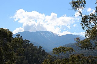
Skiing in Victoria, Australia takes place in the Australian Alps located in the State of Victoria during the southern hemisphere winter. Victoria is the State with the greatest number of ski resorts in Australia. The highest peak in Victoria is Mount Bogong at 1986m. The first ski tow was constructed near Mount Buffalo in 1938. Victoria has a number of well developed ski resorts including Mount Hotham, Falls Creek and Mount Buller. Cross country skiing is popular in such national parks as Mount Buffalo National Park and Alpine National Park.
Victoria is the smallest mainland state in Australia. As of 2008 it contained 2,850 separate protected areas with a total land area of 39,273 km2 (15,163 sq mi). Of these, 45 were national parks, totalling 28,023 km2 (10,820 sq mi).

The Baw Baw National Park is a national park located on the boundary between the Victorian Alps and Gippsland regions of Victoria, Australia. The 13,530-hectare (33,400-acre) national park is situated approximately 120 kilometres (75 mi) east of Melbourne and 50 kilometres (31 mi) north of the Latrobe Valley. The park contains the forest covered Baw-Baw Plateau and surrounds the Mount Baw Baw Alpine Resort.

The Wurundjeripeople are an Australian Aboriginal people of the Woiwurrung language group, in the Kulin nation. They are the Traditional Owners of the Birrarung Valley, covering much of the present location of Narrm (Melbourne). They continue to live in this area and throughout Australia. They were called the Yarra tribe by early European colonists.

Mansfield is a small town in the foothills of the Victorian Alps in the Australian state of Victoria. It is approximately 180 kilometres (110 mi) north-east of Melbourne by road. The population around Mansfield was 4,787 as at the 2016 census. The town itself has 3410 persons.

The Goulburn River, a major inland perennial river of the Goulburn Broken catchment, part of the Murray-Darling basin, is located in the alpine, Northern Country/North Central, and Southern Riverina regions of the Australian state of Victoria. The headwaters of the Goulburn River rise in the western end of the Victorian Alps, below the peak of Corn Hill before descending to flow into the Murray River near Echuca, making it the longest river in Victoria at 654 kilometres (406 mi). The river is impounded by the Eildon Dam to create Lake Eildon, the Eildon Pondage, the Goulburn Weir and Waranga Basin.
Mount Baw Baw is a mountain summit on the Baw-Baw Plateau of the Great Dividing Range, located in Victoria, Australia. The name is from the Woiwurrung language spoken by Eastern Kulin people. It is of uncertain meaning, but possibly signifies, echo, or ghost.
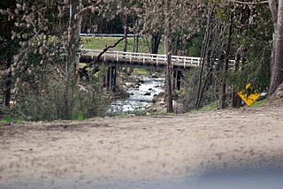
Eildon is a town in Victoria, Australia. It is located near Lake Eildon, on the Goulburn Valley Highway, in the Shire of Murrindindi local government area. At the 2016 census, Eildon had a population of 974.

The Taungurung people, also spelt Daung Wurrung, are an Aboriginal people who are one of the Kulin nations in present-day Victoria, Australia. They consist of nine clans whose traditional language is the Taungurung language.

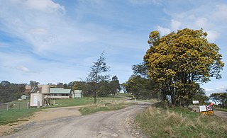
Jamieson is a small town in Victoria, Australia. It is located at the junction of the Goulburn River and Jamieson River, 193 kilometres (120 mi) north-east of Melbourne. The name is believed to have been derived from George Jamieson, a shepherd who grazed sheep in the area in the 1850s. At the time of the 2016 census, Jamieson had a population of 301.
Matlock is a rural locality in Victoria, Australia, located about 140 kilometres north-east of Melbourne, located within the Shires of Mansfield and Yarra Ranges local government areas. Matlock recorded a population of 7 at the 2021 census.
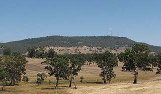
Mount Alexander is a mountain located approximately 125 km north-west of Melbourne, near the town of Harcourt. It rises 350 metres above the surrounding area to a level of 744 metres above sea level. Being a prominent local landmark, the mountain has its name associated with the surrounding district once known as the Mount Alexander goldfields, and presently defined as the Shire of Mount Alexander, centred on Castlemaine. Most of the mountain is included within the boundaries of the Mount Alexander Regional Park managed by Parks Victoria. The Djadjawurrung name for the mountain is Lanjanuc.
The Delatite River, an inland perennial river of the Goulburn Broken catchment, part of the Murray-Darling basin, is located in the lower South Eastern Highlands bioregion and Northern Country/North Central regions of the Australian state of Victoria. The headwaters of the Delatite River rise on the western slopes of the Victorian Alps and descend to flow into the Goulburn River within Lake Eildon.
Mount Buller is a mountain in the Victorian Alps of the Great Dividing Range, located in the Australian state of Victoria. It has an elevation of 1,805 metres (5,922 ft) AHD,

William Francis "Bill" Waters was Scouts Victoria's Headquarters Commissioner for Rover Scouts between 1930 and 1965.

Victoria is the southernmost mainland state of Australia. With an area of 227,594 km2 (87,875 sq mi), it is Australia's sixth largest state/territory, comparable in size to the island of Great Britain or the U.S. state of Utah. It is bound to the northwest by South Australia, directly north by New South Wales, and also shares a maritime border with Tasmania across the Bass Strait to the south. Most of Victoria's northern border lies along the Murray River. The eastern half of the state is dominated by the Australian Alps and the surrounding highlands of the Great Dividing Range, which also to a lesser extent extend far into the west of the state and ease off after The Grampians. By comparison the north and northwest of the state is extremely flat with little prominence.
The regions of Victoria vary according to the different ways that the Australian state of Victoria is divided into distinct geographic regions. The most commonly used regions are those created by the state government for the purposes of economic development.
Mount Selma is a mountain located to the north-east of Aberfeldy in Victoria, Australia. Its peak is 1463 metres above sea level. The headwaters of the Aberfeldy River rise on its southerly slopes.
Mount Useful is a mountain located to the west of Licola in Victoria, Australia. The summit lies within the Mount Useful Natural Features and Scenic Reserve which was established in 1979 and covers 354 hectares. The mountain has basalt cliffs with columnar jointing on the east and south-east sides.
Mt. Baw Baw Alpine Resort is a small Australian downhill ski resort located approximately 120 kilometres (75 mi) east of Melbourne and 50 kilometres (31 mi) north of the Latrobe Valley in Victoria. The Alpine Resort is an unincorporated area which is surrounded by the Baw Baw National Park and the Australian Alps Walking Track passes nearby. The summit of Mount Baw Baw (1567m) falls within the boundaries of the resort and is accessible by lift or walking trail. The resort is also a base for cross-country skiing on the Baw-Baw Plateau.

