The Alpine National Park is a national park located in the Central Highlands and Alpine regions of Victoria, Australia. The 646,000-hectare (1,600,000-acre) national park is located northeast of Melbourne. It is the largest National Park in Victoria, and covers much of the higher areas of the Great Dividing Range in Victoria, including Victoria's highest point, Mount Bogong at 1,986 metres (6,516 ft) and the associated subalpine woodland and grassland of the Bogong High Plains. The park's north-eastern boundary is along the border with New South Wales, where it abuts the Kosciuszko National Park. On 7 November 2008 the Alpine National Park was added to the Australian National Heritage List as one of eleven areas constituting the Australian Alps National Parks and Reserves.

Skiing in Victoria, Australia takes place in the Australian Alps located in the State of Victoria during the southern hemisphere winter. Victoria is the State with the greatest number of ski resorts in Australia. The highest peak in Victoria is Mount Bogong at 1986m. The first ski tow was constructed near Mount Buffalo in 1938. Victoria has a number of well developed ski resorts including Mount Hotham, Falls Creek and Mount Buller. Cross country skiing is popular in such national parks as Mount Buffalo National Park and Alpine National Park.

The Mount Buffalo National Park is a national park located in the alpine region of Victoria, Australia. The 31,000-hectare (77,000-acre) national park is located approximately 350 kilometres (220 mi) northeast of Melbourne in the Australian Alps. Within the national park is Mount Buffalo, a moderately high mountain plateau, with an elevation of 1,723 metres (5,653 ft) above sea level.

The Baw Baw National Park is a national park located on the boundary between the Victorian Alps and Gippsland regions of Victoria, Australia. The 13,530-hectare (33,400-acre) national park is situated approximately 120 kilometres (75 mi) east of Melbourne and 50 kilometres (31 mi) north of the Latrobe Valley. The park contains the forest covered Baw-Baw Plateau and surrounds the Mount Baw Baw Alpine Resort.
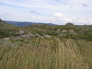
The Australian Alps montane grasslands is a montane grassland ecoregion of south-eastern Australia, restricted to the montane regions above 1300 metres .

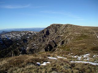
The Australian Alps is a mountain range in southeast Australia. It comprises an interim Australian bioregion, and is the highest mountain range in Australia. The range straddles the borders of eastern Victoria, southeastern New South Wales, and the Australian Capital Territory. It contains Australia's only peaks exceeding 2,000 m (6,600 ft) in elevation, and is the only bioregion on the Australian mainland in which deep snow falls annually. The range comprises an area of 1,232,981 ha.
Mount Baw Baw is a mountain on the Baw Baw Plateau and Great Dividing Range, located in Victoria, Australia. The name is from the Woiwurrung language spoken by Eastern Kulin people. It is of uncertain meaning, but possibly signifies, echo, or ghost.

Mount Bogong,, located in the Alpine National Park and part of the Victorian Alps of the Great Dividing Range, is the highest mountain in Victoria, Australia, at 1,986 metres (6,516 ft) above sea level.
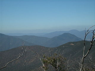
The Victorian Alps, also known locally as the High Country, is a large mountain system in the southeastern Australian state of Victoria. Occupying the majority of eastern Victoria, it is the southwestern half of the Australian Alps, the tallest portion of the Great Dividing Range. The Yarra and Dandenong Ranges, both sources of rivers and drinking waters for Melbourne, are branches of the Victorian Alps.

The Bogong High Plains, part of the Victorian Alps of the Great Dividing Range, are a section of plains located in the Alpine National Park in the Australian state of Victoria and are situated south of Mount Bogong.

Mount Feathertop is the second-highest mountain in the Australian state of Victoria and is part of the Australian Alps and is located within the Alpine National Park. It rises to 1,922 metres (6,306 ft) and is usually covered in snow from June to September. Unlike most mountains in the Australian Alps, Mount Feathertop has steep summit slopes instead of a rounded summit dome. Snow remaining in the summit gullies until late spring gives the appearance of feathers, hence the name.

Mount Stirling is a mountain in the Victorian Alps of the Great Dividing Range, located in the Hume region of Victoria, Australia. The mountain has an elevation of 1,747–1,749 metres (5,732–5,738 ft) above sea level.

Skiing in Australia takes place in the Australian Alps in the states of New South Wales, Victoria and the Australian Capital Territory as well as in the mountains of the island state Tasmania, during the southern hemisphere winter.

Mount Terrible is a mountain within the Great Dividing Range, located to the south-west of Kevington in Victoria, Australia. The mountain is located within the 100 hectares Mount Terrible Natural Features and Scenic Reserve.

Mount Gibbo is a mountain in the Australian Alps. It is 38 kilometres to the north-east of Benambra in Victoria, Australia and lies within the Mount Gibbo Natural Features and Scenic Reserve managed by Parks Victoria. The reserve, which covers 1493.1 hectares, was established in 1979. On the northern side of the mountain, Ordovician sediments are exposed on the steep slopes. Surrounding peaks include Mount Pinnibar to the north, Mount Hope to the south-east and Mount Sassafras to the west. Plant species found in the reserve include the rare Alpine Phebalium and the endangered Kosciuszko Grevillea. The area was extensively burned by a bushfire in 2003.
The Australian Alps National Parks and Reserves is a group of eleven protected areas consisting of national parks, nature reserves and one wilderness park located in the Australian Capital Territory, New South Wales and Victoria and which was listed as a "place" on the Australian National Heritage List on 7 November 2008 under the Environment Protection and Biodiversity Conservation Act 1999. The listing which covers an area of 16,531.80 square kilometres (6,382.96 sq mi), contains the vast majority of alpine and sub-alpine environments in Australia. The listing includes the following protected areas - Alpine, Baw Baw, Brindabella, Kosciuszko, Mount Buffalo, Namadgi and Snowy River national parks; the Avon Wilderness Park, and the Bimberi, Scabby Range and Tidbinbilla nature reserves.
The Eastern Victoria Great Divide bushfires, also known as the Great Divide Complex, were a series of bushfires that commenced in the Victorian Alps in Australia on 1 December 2006 due to lightning strikes, and continued for 69 days. They were the longest running bushfires in the state's history. Between 1.2 and 1.3 million hectares were burnt, most of it public land. Victorian fire personnel were assisted by others from all states and territories of Australia, as well as teams from New Zealand, the United States and Canada.

The Aberfeldy River is a perennial river of the West Gippsland catchment, located in the Alpine region of the Australian state of Victoria.
Mount Mueller is a mountain of the Great Dividing Range, located in Victoria, Australia. Mount Mueller has an elevation of 1,460 metres (4,790 ft) AHD .
Mt. Baw Baw Alpine Resort is an Australian ski resort located approximately 120 kilometres (75 mi) east of Melbourne and 50 kilometres (31 mi) north of the Latrobe Valley in Victoria. The Alpine Resort is an unincorporated area which borders the Baw Baw National Park and the Australian Alps Walking Track. The summit of Mount Baw Baw (1567m) falls within the boundaries of the resort and is accessible by lift or walking trail.
