The Blue Mountains are a mountainous region and a mountain range located in New South Wales, Australia. The region is considered to be part of the western outskirts of the Greater Sydney area. The region borders on Sydney's main metropolitan area, its foothills starting about 50 kilometres (31 mi) west of centre of the state capital, close to Penrith just at the foot of the Blue Mountains. The public's understanding of the extent of the Blue Mountains is varied, as it forms only part of an extensive mountainous area associated with the Great Dividing Range. As defined in 1970, the Blue Mountains region is bounded by the Nepean and Hawkesbury rivers in the east, the Coxs River and Lake Burragorang to the west and south, and the Wolgan and Colo rivers to the north. Geologically, it is situated in the central parts of the Sydney Basin.

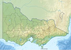
The Grampians National Park commonly referred to as the Grampians, is a national park located in the Grampians region of Victoria, Australia. The Jardwadjali name for the mountain range itself is Gariwerd.

The Blue Mountains National Park is a protected national park that is located in the Blue Mountains region of New South Wales, in eastern Australia. The 267,954-hectare (662,130-acre) national park is situated approximately 80 kilometres (50 mi) west of Sydney, and the park boundary is quite irregular as it is broken up by roads, urban areas and inholdings. Despite the name mountains, the area is an uplifted plateau, dissected by a number of larger rivers. The highest point in the park is Mount Werong at 1,215 metres (3,986 ft) above sea level; while the low point is on the Nepean River at 20 metres (66 ft) above sea level as it leaves the park.

Mount Kosciuszko, previously spelled Mount Kosciusko, is mainland Australia's tallest mountain, at 2,228 metres (7,310 ft) above sea level. It is located on the Main Range of the Snowy Mountains in Kosciuszko National Park, part of the Australian Alps National Parks and Reserves, in New South Wales, Australia, and is located west of Crackenback and close to Jindabyne, near the border with Victoria.

The Shire of Northern Grampians is a local government area in the Wimmera region of Victoria, Australia, located in the western part of the state. It covers an area of 5,730 square kilometres (2,210 sq mi) and in June 2018 had a population of 11,431, having fallen from 12,087 in 2008. It includes the towns of Stawell, St Arnaud, Great Western, Marnoo, Glenorchy, Stuart Mill, Navarre and the tourist town of Halls Gap. It was formed in 1995 from the amalgamation of the City of Stawell, Town of St Arnaud, Shire of Stawell, Shire of Kara Kara and parts of the Shire of Wimmera, Shire of Dunmunkle and Shire of Donald.

Stawell, is an Australian town in the Wimmera region of Victoria 237 kilometres (147 mi) west-north-west of the state capital, Melbourne. Located within the Shire of Northern Grampians local government area, it is a seat of local government for the shire and its main administrative centre. At the 2021 census, Stawell had a population of 6,220.

Mount Baw Baw is a mountain summit on the Baw-Baw Plateau of the Great Dividing Range, located in Victoria, Australia. The name is from the Woiwurrung language spoken by Eastern Kulin people. It is of uncertain meaning, but possibly signifies, echo, or ghost.

The Victorian government's Wimmera Southern Mallee subregion is part of the Grampians region in western Victoria. It includes most of what is considered the Wimmera, and part of the southern Mallee region. The subregion is based on the social catchment of Horsham, its main settlement.

Mount Victoria is a small township in the Blue Mountains of New South Wales, Australia. Mount Victoria is geographically the western most village and suburb of Greater Sydney on the great western highway in the City of Blue Mountains, located about 120 kilometres (75 mi) west-northwest by road from the Sydney central business district and at an altitude of about 1,052 metres (3,451 ft) AHD . The settlement had a population of 823 people at the 2011 Census.
Lake Mountain is a 1,433-metre-high (4,701 ft) mountain peak on a plateau that hosts a cross-country ski resort that is known by the same name. It is located in Victoria, Australia, approximately 120 kilometres (75 mi) north-east of Melbourne. The 1,483-metre-high (4,865 ft) Mount Bullfight, which is within the Mount Bullfight Nature Conservation Reserve, is the highest peak that can be reached by a cross-country ski trail from Lake Mountain. Access to Lake Mountain's summit is restricted to a snow shoe track in winter. The Lake Mountain Alpine Resort, located near Lake Mountain, is the most popular ski resort in Australia when measured in terms of total visitor numbers, including sightseers, due to its proximity to Melbourne.

Ballarat railway station is located on the Serviceton line in Victoria, Australia. It serves the city of Ballarat, and opened on 11 April 1862 as Ballarat West. It was renamed Ballarat in 1865.
The Serviceton railway line is part of the Melbourne–Adelaide rail corridor. It serves the west of Victoria, linking the state capital of Melbourne to the cities of Ballarat and Ararat. It once extended to the disputed South Australian border as part of the Melbourne–Adelaide railway. The former broad-gauge track was replaced in 1995 by the 1435 mm Western standard gauge line.

Mount Magnificent Conservation Park is a protected area in the Australian state of South Australia located in the Mount Lofty Ranges about 58 kilometres south of the state capital of Adelaide. It is located within the gazetted locality of Mount Magnificent.

Bell is a small rural and residential village in the Blue Mountains region of New South Wales, Australia. It is the north-westernmost village in the City of Blue Mountains, located approximately 125 kilometres (78 mi) west of Sydney central business district by road or 137 kilometres (85 mi) by rail, approximately 20 kilometres (12 mi) east of Lithgow and 10 kilometres (6.2 mi) north of Mount Victoria. It is a locality on the junction of the Bells Line of Road, Chifley Road and the Darling Causeway, with an elevation of approximately 1,100 metres (3,600 ft) AHD .

Mount York, a mountain in the western region of the Explorer Range, part of the Blue Mountains Range that is a spur off the Great Dividing Range, is located approximately 150 kilometres (93 mi) west of Sydney, just outside Mount Victoria in New South Wales, Australia. Mount York has an elevation of 1,061 metres (3,481 ft) AHD and is a projection of the Blue Mountains dissected plateau, creating a promontory of the western escarpment with a minor rise at its summit.

Pomonal is a town in western Victoria, Australia within the Rural City of Ararat local government area, 245 kilometres (152 mi) north west of the state capital, Melbourne. At the 2021 census, Pomonal had a population of 356.
The Jardwadjali (Yartwatjali), also known as the Jaadwa, are an Aboriginal Australian people of the state of Victoria, whose traditional lands occupy the lands in the upper Wimmera River watershed east to Gariwerd (Grampians) and west to Lake Bringalbert.
The Djab Wurrung, also spelt Djabwurrung, Tjapwurrung, Tjap Wurrung, or Djapwarrung, people are Aboriginal Australians whose country is the volcanic plains of central Victoria from the Mount William Range of Gariwerd in the west to the Pyrenees range in the east encompassing the Wimmera River flowing north and the headwaters of the Hopkins River flowing south. The towns of Ararat, Stawell and Hamilton are within their territory. There were 41 Djab Wurrung clans who formed an alliance with the neighbouring Jardwadjali people through intermarriage, shared culture, trade and moiety system before colonisation. Their lands were conquered but never ceded.
Crowlands is a locality nestled on the Wimmera River and is located approximately 24 kilometres (15 mi) northeast of the town of Ararat, in the state of Victoria, Australia. It comprises a small village area of scattered houses and larger farms.