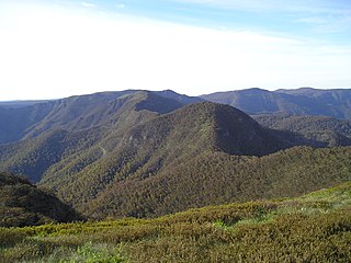
| Mount Typo | |
|---|---|
| Highest point | |
| Elevation | 982 m (3,222 ft) |
| Coordinates | 36°57.72′S146°30.18′E / 36.96200°S 146.50300°E |
| Geography | |
| Location | Victoria, Australia |
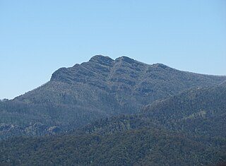
| Mount Typo | |
|---|---|
| Highest point | |
| Elevation | 982 m (3,222 ft) |
| Coordinates | 36°57.72′S146°30.18′E / 36.96200°S 146.50300°E |
| Geography | |
| Location | Victoria, Australia |

Mount Hotham is a mountain in the Victorian Alps of the Great Dividing Range, located in the Australian state of Victoria. The mountain is located approximately 357 kilometres (222 mi) north east of Melbourne, 746 kilometres (464 mi) from Sydney, and 997 kilometres (620 mi) from Adelaide by road. The nearest major road to the mountain is the Great Alpine Road. The mountain is named after Charles Hotham, Governor of Victoria from 1854 to 1855.

Mount Townsend, a mountain in the Main Range of the Great Dividing Range, is located in the Snowy Mountains region of New South Wales, Australia.

Mount Buffalo is a mountain plateau of the Australian Alps and is within the Mount Buffalo National Park in Victoria, Australia. It is located approximately 350 kilometres (220 mi) northeast of Melbourne. It is noted for its dramatic scenery.

Mount St Gwinear is a mountain in Victoria, Australia, located at the north-east end of the Baw Baw National Park in the Gippsland high country. It is popular with families looking for a cheap and accessible snow-play/tobogganing destination and cross-country skiers. The Baw Baw Plateau provides an abundance of easy touring terrain.Mount Baw Baw downhill ski village is approximately 9 km away across the Baw Baw plateau to the south-west and trails link the resorts.

Mount Napier in Victoria, Australia, is one of the youngest volcanoes in Australia. It erupted about 32,000 years ago. It was named by Major Thomas Mitchell after the three Napier brothers, who he had served alongside during the Peninsular War. Mitchell named it in August 1836, during his third expedition across south-eastern Australia. The local Aboriginal name for the mount is Tapoc. Mount Napier State Park is located 270 kilometres west of Melbourne and 17 km south of Hamilton.
Mount Hopeless is a mountain in Victoria, Australia. It is in a range on the eastern side of the Tambo River near Mount Bindi, Mount Tongio, and Mount Elizabeth.
Mount Buggery is a mountain located in the Alpine Shire within the Alpine National Park in the alpine region of Victoria, Australia. The mountain is located on the end of a ridgeline known as the Crosscut Saw between Mount Speculation and Mount Howitt, both located 4 kilometres (2.5 mi) to the south of Mount Buggery.

Mount Noorat is a dormant volcano, situated on Glenormiston Road north of the township of Noorat, and approximately six kilometres north of Terang, Victoria, Australia. The last eruption is estimated to have occurred between 5,000 and 20,000 years ago.

Mount Dom Dom is a mountain in Victoria, Australia 65 km from Melbourne.

The Horn is the most prominent peak on the Mount Buffalo plateau in Victoria, Australia. The Horn has an elevation of 1,723 metres (5,653 ft) AHD.
Mount Loch is a mountain in the Victorian Alps of the Great Dividing Range, located in the Australian state of Victoria. The summit of Mount Loch is at 1,887 metres (6,191 ft) AHD and it is the fourth highest mountain in the state.
Mount Cobbler is a mountain located in the Alpine National Park to the east of Mansfield in north-eastern Victoria, Australia. Its summit rises to 1,628 metres (5,341 ft) above sea level. The peak and surrounding Cobbler land system are composed of sedimentary rocks, dating to the Lower Carboniferous period, some 359 to 318 million years ago.

Mount Gibbo is a mountain in the Australian Alps. It is 38 kilometres to the north-east of Benambra in Victoria, Australia and lies within the Mount Gibbo Natural Features and Scenic Reserve managed by Parks Victoria. The reserve, which covers 1493.1 hectares, was established in 1979. On the northern side of the mountain, Ordovician sediments are exposed on the steep slopes. Surrounding peaks include Mount Pinnibar to the north, Mount Hope to the south-east and Mount Sassafras to the west. Plant species found in the reserve include the rare Alpine Phebalium and the endangered Kosciuszko Grevillea. The area was extensively burned by a bushfire in 2003.
Mount Bulla Bulla is a mountain in the of the Victorian Alps in the Great Dividing Range. It is located within the Alpine National Park, in the Australian state of Victoria. The name Bulla Bulla was the original indigenous name for Mt Buller.
Mount Useful is a mountain located to the west of Licola in Victoria, Australia. The summit lies within the Mount Useful Natural Features and Scenic Reserve which was established in 1979 and covers 354 hectares. The mountain has basalt cliffs with columnar jointing on the east and south-east sides.
Mount Beenak is a mountain in Victoria, Australia 65 km from Melbourne.
Mount Selwyn is a mountain that is part of the Victorian Alps of the Great Dividing Range, located in the Alpine National Park in the Australian state of Victoria. Mount Selwyn has an altitude of 1,411 metres (4,629 ft) AHD.
Mount Buggery is a mountain located in the Wangaratta Rural City local government area, near Abbeyard above the Buffalo River in the alpine region of Victoria, Australia.
Mount Despair is a mountain, part of the Cobbler Plateau, that is located in the Alpine Shire within the Alpine National Park in the alpine region of Victoria, Australia.
Mount Fainter South is a mountain in the Victorian Alps of the Great Dividing Range, located in the Australian state of Victoria. The summit is at 1,883 metres (6,178 ft) AHD and is located in the Alpine National Park.
| | This article about a location in Victoria, Australia is a stub. You can help Wikipedia by expanding it. |
| | This Australia mountain, mountain range, or peak related article is a stub. You can help Wikipedia by expanding it. |
