
The Oxley Wild Rivers National Park is a protected national park that is located in the Northern Tablelands region of New South Wales, Australia in the Port Macquarie-Hastings City Council and Walcha Shire councils. The 145,223-hectare (358,850-acre) park is situated 445 kilometres (277 mi) north of Sydney and is named in memory of the Australian explorer John Oxley, who passed through the area in 1818 and is one of the largest national parks in New South Wales.

The Coopracambra National Park is a national park located in the Gippsland region of Victoria, Australia. The 38,800-hectare (96,000-acre) national park is situated approximately 460 kilometres (290 mi) east of Melbourne and 250 kilometres (160 mi) south of Canberra, near the town of Cann River.

Fitzgerald River National Park is a national park in the Shires of Ravensthorpe and the Jerramungup in Western Australia, 419 kilometres (260 mi) southeast of Perth. The park is recognised on Australia's National Heritage List for its outstanding diversity of native plant species, including many plants which are unique to the local area.

The Monaro Highway is a highway in Victoria, New South Wales, and the Australian Capital Territory, in Australia.

The Victorian Alps, also known locally as the High Country, is a large mountain system in the southeastern Australian state of Victoria. Occupying the majority of eastern Victoria, it is the southwestern half of the Australian Alps, the tallest portion of the Great Dividing Range. The Yarra and Dandenong Ranges, both sources of rivers and drinking waters for Melbourne, are branches of the Victorian Alps.
East Gippsland is the eastern region of Gippsland, Victoria, Australia covering 31,740 square kilometres (14%) of Victoria. It has a population of 80,114.
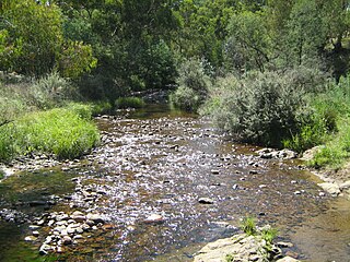
The Cann River is a perennial river located in the East Gippsland region of the Australian state of Victoria.
The Suggan Buggan River is a perennial river of the Snowy River catchment, located in the Alpine region of the Australian state of Victoria.

Victoria is the southernmost mainland state of Australia. With an area of 227,594 km2 (87,875 sq mi), it is Australia's sixth largest state/territory, comparable in size to the island of Great Britain or the U.S. state of Utah. It is bound to the northwest by South Australia, directly north by New South Wales, and also shares a maritime border with Tasmania across the Bass Strait to the south. Most of Victoria's northern border lies along the Murray River. The eastern half of the state is dominated by the Australian Alps and the surrounding highlands of the Great Dividing Range, which also to a lesser extent extend far into the west of the state and ease off after The Grampians. By comparison the north and northwest of the state is extremely flat with little prominence.
Genoa River is a perennial river located in the Monaro region of New South Wales and flows into the East Gippsland region of Victoria in Australia. It used to be known as Bondi Creek or Yard Creek. The river's name derives from the First People "jinoor" ("footpath").

Grevillea parvula , commonly known as Genoa grevillea, is a species of the plant genus Grevillea. It is native to the states of Victoria and New South Wales in Australia.
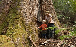
Mount Elizabeth is a mountain to the east of Tambo Crossing in East Gippsland, Victoria, Australia. It lies within the Mount Elizabeth Nature Conservation Reserve managed by Parks Victoria. The reserve, which covers 5,234 hectares, was established in 1984. The reserve is the only known location where the endangered plant species leafy nematolepis occurs. Other rare or vulnerable plant species found in the reserve include Tullach Ard grevillea, outcrop guinea-flower, Mount Elizabeth hovea, monkey mint-bush and leafless pink-bells. Fauna species of note include the lace monitor, yellow-tailed black cockatoo and gang-gang cockatoo.
The Cann River East Branch is a perennial river located in the East Gippsland region of the Australian state of Victoria.
The Errinundra River is a perennial river of the Bemm River catchment, located in the East Gippsland region of the Australian state of Victoria.
The Ada River is a perennial river of the Bemm River catchment, located in the East Gippsland region of the Australian state of Victoria.
The Goolengook River is a perennial river of the Bemm River catchment, located in the East Gippsland region of the Australian state of Victoria.
The Little Goolengook River is a perennial river of the Bemm River catchment, located in the East Gippsland region of the Australian state of Victoria.

The Arte River is a perennial river of the Bemm River catchment, located in the East Gippsland region of the Australian state of Victoria.
The Little Arte River is a perennial river of the Bemm River catchment, located in the East Gippsland region of the Australian state of Victoria.
The McKenzie River is a perennial river of the Bemm River catchment, located in the East Gippsland region of the Australian state of Victoria.
