Moylan Township, Marshall County, Minnesota

Last updated

Moylan Township, Minnesota
USA Minnesota location map.svg
Red pog.svg
Moylan Township, Minnesota
Location within the state of Minnesota
Usa edcp location map.svg
Red pog.svg
Moylan Township, Minnesota
Moylan Township, Minnesota (the United States)
Coordinates: 48°13′24″N95°47′14″W / 48.22333°N 95.78722°W / 48.22333; -95.78722
Country United States
State Minnesota
County Marshall
Area
  Total45.1 sq mi (116.9 km2)
  Land45.1 sq mi (116.9 km2)
  Water0.0 sq mi (0.0 km2)
Elevation
1,158 ft (353 m)
Population
 (2000)
  Total128
  Density2.8/sq mi (1.1/km2)
Time zone UTC-6 (Central (CST))
  Summer (DST) UTC-5 (CDT)
FIPS code 27-44692 [1]
GNIS feature ID0665060 [2]
A picture of the front of Moylan Township Hall VNov08 039.jpg
A picture of the front of Moylan Township Hall

Moylan Township is a township in Marshall County, Minnesota, United States. The population was 128 at the 2000 census.

Contents

Moylan Township was organized in 1902, and named for Patrick Moylan, an early settler. [3]

Geography

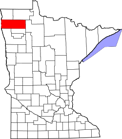
According to the United States Census Bureau, the township has a total area of 45.1 square miles (116.9 km2), of which 45.1 square miles (116.9 km2) is land and 0.02% is water.

Demographics

As of the census [1] of 2000, there were 128 people, 48 households, and 40 families residing in the township. The population density was 2.8 people per square mile (1.1/km2). There were 56 housing units at an average density of 1.2/sq mi (0.5/km2). The racial makeup of the township was 100.00% White.

There were 48 households, out of which 33.3% had children under the age of 18 living with them, 66.7% were married couples living together, 6.3% had a female householder with no husband present, and 14.6% were non-families. 14.6% of all households were made up of individuals, and 4.2% had someone living alone who was 65 years of age or older. The average household size was 2.67 and the average family size was 2.85.

In the township the population was spread out, with 27.3% under the age of 18, 5.5% from 18 to 24, 26.6% from 25 to 44, 25.0% from 45 to 64, and 15.6% who were 65 years of age or older. The median age was 38 years. For every 100 females, there were 120.7 males. For every 100 females age 18 and over, there were 121.4 males.

The median income for a household in the township was $25,833, and the median income for a family was $26,042. Males had a median income of $29,375 versus $17,500 for females. The per capita income for the township was $14,990. There were 22.6% of families and 32.7% of the population living below the poverty line, including 61.5% of under eighteens and 35.0% of those over 64.

Related Research Articles

Goose Prairie Township is a township in Clay County, Minnesota, United States. The population was 199 at the 2000 census.

Clover Township is a township in Clearwater County, Minnesota, United States. The population was 116 at the 2000 census.

Carson Township is a township in Cottonwood County, Minnesota, United States. The population was 283 at the 2020 census.

Bigfork Township is a township in Itasca County, Minnesota, United States. The population was 321 at the 2010 census.

Marsh Creek Township is a township in Mahnomen County, Minnesota, United States. The population was 128 at the 2000 census.

Comstock Township is a township in Marshall County, Minnesota. As of the 2000 census, the township population was 135.

Grand Plain Township is a township in Marshall County, Minnesota, United States. The population was 55 at the 2000 census.

McCrea Township is a township in Marshall County, Minnesota, United States. The population was 250 at the 2000 census.

Fairmont Township is a township in Martin County, Minnesota, United States. The population was 298 at the 2000 census.

Eastern Township is a township in Otter Tail County, Minnesota, United States. The population was 256 at the 2000 census.

Homestead Township is a township in Otter Tail County, Minnesota, United States. The population was 371 at the 2000 census.

Leaf Mountain Township is a township in Otter Tail County, Minnesota, United States. The population was 309 at the 2000 census.

Garfield Township is a township in Polk County, Minnesota, United States. It is part of the Grand Forks-ND-MN Metropolitan Statistical Area. The population was 391 at the 2000 census.

King Township is a township in Polk County, Minnesota, United States. It is part of the Grand Forks-ND-MN Metropolitan Statistical Area. The population was 195 at the 2000 census.

Brookfield Township is a township in Renville County, Minnesota, United States. The population was 163 at the 2000 census.

Kelso Township is a township in Sibley County, Minnesota, United States. The population was 357 at the 2000 census.

Lake George Township is a township in Stearns County, Minnesota, United States. The population was 335 at the 2010 census.

Huntersville Township is a township in Wadena County, Minnesota, United States. The population was 128 at the 2000 census. The unincorporated place also called Huntersville is located in this township, at the junction of County Roads 18 and 25. Most of Huntersville State Forest is located within this township as well.

Macsville Township is a township in Grant County, Minnesota, United States. The population was 128 at the 2000 census.

Everglade Township is a township in Stevens County, Minnesota, United States. The population was 128 at the 2000 census.

References

  1. 1 2 "American FactFinder". United States Census Bureau. Archived from the original on February 12, 2020. Retrieved January 31, 2008.
  2. "US Board on Geographic Names". United States Geological Survey. October 25, 2007. Retrieved January 31, 2008.
  3. Upham, Warren (1920). Minnesota Geographic Names: Their Origin and Historic Significance. Minnesota Historical Society. p.  329.