Bulawayo is the second largest city in Zimbabwe, and the largest city in the country's Matabeleland region. The city's population is disputed; the 2022 census listed it at 665,940, while the Bulawayo City Council claimed it to be about 1.2 million. Bulawayo covers an area of about 546 square kilometres in the western part of the country, along the Matsheumhlope River. Along with the capital Harare, Bulawayo is one of two cities in Zimbabwe that is also a province.

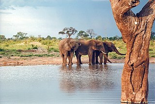
Hwange National Park is the largest natural reserve in Zimbabwe. It is around 14,600 sq km in area. It lies in the northwest of the country, just off the main road between Bulawayo and Victoria Falls. The nearest town is Dete. Histories of the region's pre-colonial days and its development as a game reserve and National Park are available online

The Matobo National Park forms the core of the Matobo or Matopos Hills, an area of granite kopjes and wooded valleys commencing some 35 kilometres (22 mi) south of Bulawayo, southern Zimbabwe. The hills were formed over 2 billion years ago with granite being forced to the surface; it has eroded to produce smooth "whaleback dwalas" and broken kopjes, strewn with boulders and interspersed with thickets of vegetation. Matopo/Matob was named by the Lozwi, who are the ancestors of Kalanga. A different tradition states that the first King, Mzilikazi Khumalo when told by the local residents that the great granite domes were called madombo he replied, possible half jest, "We will call them matobo" - an IsiNdebele play on 'Bald heads'.
Colleen Bawn is a town in Zimbabwe.

Lupane ( luːpɑːnɛ) District is located in the Matabeleland North Province of Zimbabwe, and it is also the Provincial Capital. The District is situated at an elevation of 976 m with a population of 198,600 inhabitants by 2019. Lupane Town is the main center of the district located 172 km from Bulawayo along the A8 Victoria Falls Road. The Government Provincial Administrative offices are located at the Town Centre. A new university near the Town has been established under the name Lupane State University, which caters for the region and beyond. The word Lupane is thought to be a Kalanga or Lozwi word.

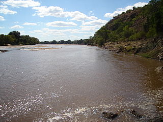
The Mzingwane River, formerly known Umzingwane River as or Umzingwani River is a major left-bank tributary of the Limpopo River in Zimbabwe. It rises near Fort Usher, Matobo District, south of Bulawayo and flows into the Limpopo River near Beitbridge, downstream of the mouth of the Shashe River and upstream of the mouth of the Bubye River.

The Shashe River is a major left-bank tributary of the Limpopo River in Zimbabwe. It rises northwest of Francistown, Botswana and flows into the Limpopo River where Botswana, Zimbabwe and South Africa meet. The confluence is at the site of the Greater Mapungubwe Transfrontier Conservation Area.

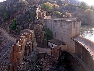
Manyuchi Dam forms a reservoir on the Mwenezi River in southern Zimbabwe. It is located in the Mwenezi District. The building of the dam was financed by the Mwenezi Development Corporation. The dam was built to irrigate oil palm estates.

The Mwenezi River, originally known as the Nuanetsi River, is a major tributary of the Limpopo River. The Mwenezi River starts up in south central Zimbabwe and flows south-east along what is known as the Mwenezi River Valley that bisects the district into two sectors. The river is found in both Zimbabwe and Mozambique. In Zimbabwe it has been known as the Nuanetsi or Nuanetzi River in the past, a name it retains in Mozambique.
Zimbabwe Electricity Supply Authority, (ZESA) whose official name is ZESA Holdings (Private) Limited, is a state-owned company whose task is to generate, transmit, and distribute electricity in Zimbabwe. It has organized this task by delegation to its subsidiaries, the energy generating company Zimbabwe Power Company (ZPC) and the Zimbabwe Electricity Transmission and Distribution Company (ZETDC). Other subsidiaries are the investment branch ZESA Enterprises (ZENT) and internet provider PowerTel Communications (Private) Limited. ZESA is the only electricity generator and supplier for the public grid. For many years the company has failed to produce enough energy to meet demands. ZESA produced an estimated 6.8 billion kWh in 2016, while demand was estimated at 7.118 billion kWh. ZESA represents Zimbabwe in the Southern African Power Pool.

The Insiza River is the principal tributary of the Mzingwane River in Zimbabwe.

The Thuli River, former name Tuli River, is a major tributary of the Shashe River in Zimbabwe. It rises near Matopo Mission, Matobo District, and flows into the Shashe River near Tuli village.

WAFLEX is a spreadsheet-based model. It can be used to analyse upstream-downstream interactions, dam management options and water allocation and development options.

Thuli–Makwe Dam is a reservoir on the Thuli River, west of Gwanda, Zimbabwe with a capacity of 8.3 million cubic metres.
Thuli–Moswa Dam is the name for a proposed reservoir on the Thuli River, south of Gwanda, Zimbabwe with a capacity of 419 million cubic metres.

Thuli–Manyange (Elliot) Dam is proposed a reservoir on the Thuli River, south of Gwanda, Zimbabwe with a capacity of 33 million cubic metres. It is designed to be co-operated with Thuli–Moswa Dam
Zhovhe Dam is a reservoir on the Mzingwane River, Zimbabwe with a capacity of 133 million cubic metres. It supplies water for commercial irrigation and the town of Beitbridge.

The Bubye River, also known as Bubi River, is a tributary of the Limpopo River in Beitbridge District and Gwanda District, Zimbabwe. It rises about 40 kilometres (25 mi) to the northeast of West Nicholson in Matabeleland South, from where it flows southeast before joining the Limpopo about 25 kilometres (16 mi) west of the border with Mozambique. Its course forms part of the border between Mberengwa and Mwenezi districts.

Sebakwe River or Zibagwe River is a river in Zimbabwe.
Ngondoma Irrigation Scheme is located in Zhombe, Kwekwe District in Zimbabwe's Agro-Ecological Region Three. The average annual rainfall for the location is 550 mm. The scheme area is 44.4 4 hectares. Of the 179 farmers in the scheme, 134 are women. It comprises members from various villages, including villagers from Chief Njelele side, Gokwe District on the other side of Ngondoma River.


