Midlands is a province of Zimbabwe. It has an area of 49,166 square kilometres (18,983 sq mi) and a population of 1,811,905 (2022). It is home to various peoples. Located at a central point in the country, it contains speakers of Shona, Ndebele, Tswana, Sotho and Chewa, as well as of various other languages. Gweru, the third-largest city in Zimbabwe, is the capital of the province.

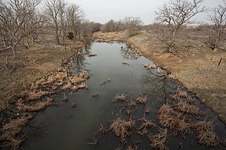
The Washita River is a river in the states of Texas and Oklahoma in the United States. The river is 295 miles (475 km) long and terminates at its confluence with the Red River, which is now part of Lake Texoma on the Texas–Oklahoma border.
Redcliff is a town situated in the Midlands Province of Zimbabwe, with a population of 41,526. It lies about 219 km (136 mi) north-east of Bulawayo.

The Usarp Mountains are a major mountain range in North Victoria Land, Antarctica. They are west of the Rennick Glacier and trend north to south for about 190 kilometres (118 mi). The mountains are bounded to the north by Pryor Glacier and the Wilson Hills. They are west of the Bowers Mountains.

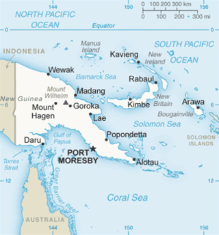
The Solomon Sea is a sea located within the Pacific Ocean. It lies between Papua New Guinea and Solomon Islands. Many major battles were fought there during World War II.

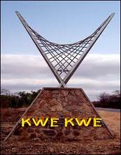
Kwekwe, formerly known as Que Que, is a city in the Midlands province in central Zimbabwe. The city has a population of 119,863 within the city limits, as of the 2022 census, making it the 7th-largest city in Zimbabwe and the second-most populous city in the Midlands, behind Gweru.

Nkayi is a district in Matabeleland North, Zimbabwe, about 100 km (62 mi) west of Kwekwe and 168 km (104 mi) northeast of Bulawayo in Nkayi communal land. It is believed that its name originates from the Tonga word "Uyinkayi" meaning "where are you going". The main language spoken is Ndebele.
Zhombe, originally known as Jombe, is a rural communal area in Kwekwe District, Midlands Province, Zimbabwe. It is an area of mixed Shona and Northern Ndebele People. It lies along the Mnyathi border line between Midlands and Mashonaland Provinces. There are a few commercial farms within its borders and a handful of resettlement areas. Most of it is within the Zhombe Constituency. Its administrative centre is the Zhombe Joel Growth Point, and it is under the Zibagwe Rural District Council.

Shinnan Glacier is a glacier which flows northwest to the coast just east of Shinnan Rocks and marks the division between Queen Maud Land and Enderby Land. Mapped from surveys and air photos by Japanese Antarctic Research Expedition (JARE), 1957–62, and named Shinnan Hyōga.

Kwekwe, originally known as Que Que, is a district in Zimbabwe. 197,062 people live in Kwekwe rural and 119,863 live in Kwekwe town.
Silobela is an agricultural Resettlement in Kwekwe District in the Midlands Province of Zimbabwe. It is located about 60 kilometres (37 mi) west of Kwekwe town, 80 kilometres (50 mi) north-west of Gweru town, and bordering Nkayi on the west.

Boonoo Boonoo River, a watercourse of the Clarence River catchment, is located in the Northern Tablelands district of New South Wales, Australia.

Sebakwe River or Zibagwe River is a river in Zimbabwe.
Chicago is a low density suburb located in the city of Kwekwe in Zimbabwe, just beside Kwekwe CBD in the southern parts.
The Kwekwe-Gokwe Highway or the R84-7 Highway is an all-weather bitumen macadam highway in Zimbabwe running from Kwekwe to Gokwe passing through Zhombe. As a trunk road it is officially designated as the P11 Highway.
Sebakwe Dam is a dam in the Midlands Province of Zimbabwe. It was built in 1957 and owned by the Zimbabwe government. It is across Sebakwe River in the Sanyati Catchment Area.
Globe and Phoenix Mine is a gold mine in Zimbabwe. It is just outside Kwekwe CBD.
The Gaika Mine, now known as the Gaika Gold Fields, is situated in what was Chicago Farm just about 2 kilometres (1.2 mi) south of Kwekwe CBD. The Gaika Mine was the earliest mine developed in 1894, then Globe and Phoenix in 1895-1900, the Eldorado in 1905, the Antelope in 1908, the Cam and Motor Mine in 1909, the Shamva Mine in 1909-1910, and numerous others during the period 1895-1911.
The A5 Highway is a national road in Zimbabwe. It joins the cities of Harare and Bulawayo, and is hence known as the Harare-Bulawayo Highway. It is one of the two routes that form the R2 Route, which connects Harare with the Plumtree Border with Botswana.
Prag Lalloo Naran was a Zimbabwean politician and businessman recognized as a "Nationalist for the struggle for Zimbabwe’s independence," and a "leading member of the (Zimbabwe) Asian Community".


