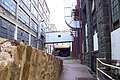
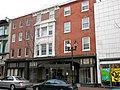
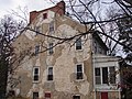
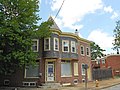
[ 4] Name on the Register [ 5] Image Date listed [ 6] Location Description 1 American Vulcanized Fibre Company-Wilmington Plant American Vulcanized Fibre Company-Wilmington Plant October 19, 2020 (# 100005688 700 Maryland Ave. 39°44′15″N 75°33′59″W / 39.7376°N 75.5664°W / 39.7376; -75.5664 (American Vulcanized Fibre Company-Wilmington Plant ) 2 Augustine Paper Mill Augustine Paper Mill August 3, 1978 (# 78000909 N. Brandywine Park Dr. 39°45′43″N 75°33′25″W / 39.7619°N 75.5569°W / 39.7619; -75.5569 (Augustine Paper Mill ) 3 Bancroft and Sons Cotton Mills Bancroft and Sons Cotton Mills December 20, 1984 (# 84000439 Rockford Rd. 39°46′06″N 75°33′47″W / 39.7683°N 75.5631°W / 39.7683; -75.5631 (Bancroft and Sons Cotton Mills ) 4 Baynard Boulevard Historic District Baynard Boulevard Historic District July 26, 1979 (# 79000631 Baynard Blvd. between 18th St. and Concord Ave. 39°45′29″N 75°32′39″W / 39.7581°N 75.5443°W / 39.7581; -75.5443 (Baynard Boulevard Historic District ) 5 Bellevue Range Rear Light Station Bellevue Range Rear Light Station April 26, 2006 (# 06000313 Christina River northern side, 0.3 mile west of Delaware River , 50 feet south of Cherry Island 39°43′13″N 75°31′04″W / 39.7203°N 75.5179°W / 39.7203; -75.5179 (Bellevue Range Rear Light Station ) 6 Brandywine Park Brandywine Park December 22, 1976 (# 76000574 Roughly bounded by Augustine, 18th, and Market Sts. and Lovering Ave. 39°45′27″N 75°33′13″W / 39.7574°N 75.5536°W / 39.7574; -75.5536 (Brandywine Park ) 7 Brandywine Village Historic District Brandywine Village Historic District February 24, 1971 (# 71000229 Roughly bounded by Brandywine Creek, Tatnall, 22nd, Gordon Sts., Vandever Ave., Mabel St., and the 14th St. bridge 39°45′04″N 75°32′29″W / 39.7511°N 75.5414°W / 39.7511; -75.5414 (Brandywine Village Historic District ) 8 Braunstein's Building Braunstein's Building December 19, 1985 (# 85003190 704-706 N. Market St. 39°44′34″N 75°32′57″W / 39.7428°N 75.5493°W / 39.7428; -75.5493 (Braunstein's Building ) 9 Dr. John A. Brown House Dr. John A. Brown House April 24, 1979 (# 79000632 4 7th Ave. 39°44′06″N 75°34′18″W / 39.735°N 75.5717°W / 39.735; -75.5717 (Dr. John A. Brown House ) 10 Florence and Isaac Budovitch House Florence and Isaac Budovitch House January 30, 2020 (# 100004954 4611 Bedford Blvd. 39°47′00″N 75°31′37″W / 39.7834°N 75.5270°W / 39.7834; -75.5270 (Florence and Isaac Budovitch House ) 11 Church Street Historic District Church Street Historic District June 12, 1987 (# 87000944 Bounded by Eighth, Locust, Seventh, and Church Sts. 39°44′21″N 75°32′26″W / 39.7392°N 75.5406°W / 39.7392; -75.5406 (Church Street Historic District ) 12 Compton Park Apartments Compton Park Apartments November 1, 2024 (# 100010936 610-650 N. Walnut Street 39°44′28″N 75°32′49″W / 39.7411°N 75.5469°W / 39.7411; -75.5469 (Compton Park Apartments ) 13 Continental Army Encampment Site Continental Army Encampment Site December 18, 1973 (# 73000547 Lovering Ave. near Broom St. 39°45′28″N 75°33′22″W / 39.7578°N 75.5561°W / 39.7578; -75.5561 (Continental Army Encampment Site ) 14 Cool Spring Park Historic District Cool Spring Park Historic District December 27, 1983 (# 83003513 Bounded by Park Pl., Jackson, Van Buren, and 10th Sts. 39°45′00″N 75°33′34″W / 39.75°N 75.5594°W / 39.75; -75.5594 (Cool Spring Park Historic District ) 15 Crosby and Hill Building Crosby and Hill Building January 30, 1985 (# 85000148 605 N. Market St. 39°44′32″N 75°33′01″W / 39.7422°N 75.5503°W / 39.7422; -75.5503 (Crosby and Hill Building ) 16 Delaware Academy of Medicine Delaware Academy of Medicine April 17, 2003 (# 03000240 1925 Lovering Ave. 39°45′44″N 75°33′42″W / 39.7622°N 75.5617°W / 39.7622; -75.5617 (Delaware Academy of Medicine ) 17 Delaware Avenue Historic District Delaware Avenue Historic District September 13, 1976 (# 76000576 Delaware Ave. from N. Harrison to N. Broom Sts. (both sides) 39°45′18″N 75°33′34″W / 39.755°N 75.5594°W / 39.755; -75.5594 (Delaware Avenue Historic District ) 18 Delaware Trust Building Delaware Trust Building April 18, 2003 (# 03000238 900–912 N. Market St. 39°44′41″N 75°32′52″W / 39.7448°N 75.5478°W / 39.7448; -75.5478 (Delaware Trust Building ) Residences@Rodney Square 19 Delmarva Power and Light Building Delmarva Power and Light Building January 30, 1985 (# 85000149 600 N. Market St. 39°44′31″N 75°33′00″W / 39.7419°N 75.5499°W / 39.7419; -75.5499 (Delmarva Power and Light Building ) Housed Delaware College of Art & Design , 1997-2024 20 Jacob Dingee House Jacob Dingee House October 16, 1970 (# 70000171 500 Block North Market Street (formerly 105 E. 7th St.) 39°44′30″N 75°33′03″W / 39.7416°N 75.5508°W / 39.7416; -75.5508 (Jacob Dingee House ) 21 Obidiah Dingee House Obidiah Dingee House October 21, 1970 (# 70000172 500 Block North Market Street (formerly 107 E. 7th St.) 39°44′30″N 75°33′03″W / 39.7416°N 75.5509°W / 39.7416; -75.5509 (Obidiah Dingee House ) 22 Downtown Wilmington Commercial Historic District Downtown Wilmington Commercial Historic District March 24, 2017 (# 100000790 Roughly bounded by W. 9th, N. King. W. 6th & Shipley Sts. 39°44′34″N 75°32′59″W / 39.7427°N 75.5498°W / 39.7427; -75.5498 (Downtown Wilmington Commercial Historic District ) 23 P. S. Dupont High School P. S. Dupont High School October 23, 1986 (# 86002917 701 W. 34th St., [ 7] 39°45′51″N 75°32′00″W / 39.764167°N 75.533333°W / 39.764167; -75.533333 (P. S. Dupont High School ) Now used as a middle school. 24 East Brandywine Historic District East Brandywine Historic District December 19, 1985 (# 85003220 Roughly bounded by Sixteenth St., Brandywine Creek, Twelfth St., and U.S. Route 13 39°44′55″N 75°32′31″W / 39.748611°N 75.541944°W / 39.748611; -75.541944 (East Brandywine Historic District ) 25 Eighth Street Park Historic District Eighth Street Park Historic District August 4, 1983 (# 83001334 Roughly bounded by 6th, 10th, Harrison, and Broom Sts. 39°44′56″N 75°33′47″W / 39.748889°N 75.563056°W / 39.748889; -75.563056 (Eighth Street Park Historic District ) 26 Zachariah Ferris House Zachariah Ferris House October 19, 1970 (# 70000173 500 Block North Market Street (formerly 414 W. 2nd St.) 39°44′30″N 75°33′03″W / 39.741603°N 75.550961°W / 39.741603; -75.550961 (Zachariah Ferris House ) 27 Foord & Massey Furniture Company Building Foord & Massey Furniture Company Building March 24, 2006 (# 06000145 701 N. Shipley St. 39°44′35″N 75°33′01″W / 39.743106°N 75.550368°W / 39.743106; -75.550368 (Foord & Massey Furniture Company Building ) 28 Fort Christina Fort Christina October 15, 1966 (# 66000260 E. 7th St. and the Christina River , Fort Christina State Park 39°44′14″N 75°32′18″W / 39.737222°N 75.538333°W / 39.737222; -75.538333 (Fort Christina ) 29 Friends Meetinghouse Friends Meetinghouse November 7, 1976 (# 76000577 4th and West Sts. 39°44′31″N 75°33′17″W / 39.741944°N 75.554722°W / 39.741944; -75.554722 (Friends Meetinghouse ) 30 Gibraltar Gibraltar September 14, 1998 (# 98001098 250 Pennsylvania Ave. 39°45′41″N 75°34′30″W / 39.761389°N 75.575000°W / 39.761389; -75.575000 (Gibraltar ) DeArmond, Ashmead & Bickley , architects of 1915 alteration. 31 Govatos'/McVey Building Govatos'/McVey Building January 30, 1985 (# 85000150 800 N. Market St. 39°44′36″N 75°32′56″W / 39.743368°N 75.548848°W / 39.743368; -75.548848 (Govatos'/McVey Building ) 32 Grace United Methodist Church Grace United Methodist Church November 12, 1983 (# 83001393 9th and West Sts. 39°44′47″N 75°33′06″W / 39.746366°N 75.551594°W / 39.746366; -75.551594 (Grace United Methodist Church ) 33 Charles Gray Printing Shop Charles Gray Printing Shop January 30, 1985 (# 85000151 11 E. 8th St. 39°44′36″N 75°32′55″W / 39.743252°N 75.548498°W / 39.743252; -75.548498 (Charles Gray Printing Shop ) Demolished. 34 Harlan and Hollingsworth Office Building Harlan and Hollingsworth Office Building April 26, 1979 (# 79000634 West St. 39°44′18″N 75°33′21″W / 39.738469°N 75.555964°W / 39.738469; -75.555964 (Harlan and Hollingsworth Office Building ) 35 Holy Trinity Church Holy Trinity Church October 15, 1966 (# 66000261 7th and Church Sts. 39°44′18″N 75°32′26″W / 39.738333°N 75.540556°W / 39.738333; -75.540556 (Holy Trinity Church ) 36 Howard High School Howard High School February 21, 1985 (# 85000309 13th and Poplar Sts. 39°44′48″N 75°32′30″W / 39.746667°N 75.541667°W / 39.746667; -75.541667 (Howard High School ) 37 Jackson-Wilson House Jackson-Wilson House April 10, 2017 (# 100000844 12 Red Oak Rd. 39°45′58″N 75°34′19″W / 39.766057°N 75.571941°W / 39.766057; -75.571941 (Jackson-Wilson House ) 38 Max Keil Building Max Keil Building January 30, 1985 (# 85000152 712 N. Market St. 39°44′35″N 75°32′57″W / 39.742928°N 75.549219°W / 39.742928; -75.549219 (Max Keil Building ) 39 Max Keil Building Max Keil Building January 30, 1985 (# 85000153 700 N. Market St. 39°44′34″N 75°32′58″W / 39.742650°N 75.549405°W / 39.742650; -75.549405 (Max Keil Building ) 40 Kingswood Methodist Episcopal Church Kingswood Methodist Episcopal Church February 9, 1989 (# 89000008 Fourteenth and Claymont Sts. 39°44′36″N 75°31′58″W / 39.743333°N 75.532778°W / 39.743333; -75.532778 (Kingswood Methodist Episcopal Church ) Replaced by new construction. 41 Logan House Logan House April 2, 1980 (# 80000935 1701 Delaware Ave. 39°45′30″N 75°33′45″W / 39.758304°N 75.562372°W / 39.758304; -75.562372 (Logan House ) 42 Charles B. Lore Elementary School Charles B. Lore Elementary School June 16, 1983 (# 83001337 Fourth St. and Woodlawn Ave. 39°45′01″N 75°34′36″W / 39.750278°N 75.576667°W / 39.750278; -75.576667 (Charles B. Lore Elementary School ) 43 Lower Market Street Historic District Lower Market Street Historic District May 15, 1980 (# 80000936 Market St. 39°44′21″N 75°33′07″W / 39.739167°N 75.551944°W / 39.739167; -75.551944 (Lower Market Street Historic District ) 44 Main Office of the New Castle Leather Company Main Office of the New Castle Leather Company December 19, 1985 (# 85003191 Eleventh and Poplar Sts. 39°44′41″N 75°32′36″W / 39.744813°N 75.543400°W / 39.744813; -75.543400 (Main Office of the New Castle Leather Company ) 45 Masonic Hall and Grand Theater Masonic Hall and Grand Theater December 11, 1972 (# 72000294 818 N. Market St. 39°44′38″N 75°32′55″W / 39.743852°N 75.548649°W / 39.743852; -75.548649 (Masonic Hall and Grand Theater ) 46 Louis McLane House Louis McLane House April 24, 1973 (# 73000549 606 Market St. 39°44′32″N 75°32′59″W / 39.742166°N 75.549836°W / 39.742166; -75.549836 (Louis McLane House ) Demolished in 2014. [ 8] 47 New Castle Leather Raw Stock Warehouse New Castle Leather Raw Stock Warehouse June 16, 1983 (# 83001401 14th and Poplar Sts. 39°44′49″N 75°32′28″W / 39.747047°N 75.541173°W / 39.747047; -75.541173 (New Castle Leather Raw Stock Warehouse ) 48 New Century Club New Century Club June 16, 1983 (# 83001336 1014 Delaware Ave. 39°45′06″N 75°33′22″W / 39.751667°N 75.556111°W / 39.751667; -75.556111 (New Century Club ) Delaware Children's Theatre 49 Old Asbury Methodist Church Old Asbury Methodist Church November 7, 1976 (# 76000578 Walnut and 3rd Sts. 39°44′18″N 75°32′56″W / 39.7384°N 75.5488°W / 39.7384; -75.5488 (Old Asbury Methodist Church ) 50 Old Customshouse Old Customshouse November 21, 1974 (# 74000604 516 N. King St. 39°44′29″N 75°32′57″W / 39.741318°N 75.549180°W / 39.741318; -75.549180 (Old Customshouse ) Wilmington University building 51 Old First Presbyterian Church of Wilmington Old First Presbyterian Church of Wilmington April 13, 1972 (# 72000295 West St. on Brandywine Park Dr. 39°45′03″N 75°32′51″W / 39.7508°N 75.5475°W / 39.7508; -75.5475 (Old First Presbyterian Church of Wilmington ) 52 Old Town Hall Old Town Hall December 31, 1974 (# 74000605 512 Market St. 39°44′30″N 75°33′00″W / 39.7416°N 75.5501°W / 39.7416; -75.5501 (Old Town Hall ) 53 Old Town Hall Commercial Historic District Old Town Hall Commercial Historic District January 30, 1985 (# 85000154 Roughly bounded by 5th, N. King, 6th, and Shipley Sts. 39°44′30″N 75°33′02″W / 39.7416°N 75.5506°W / 39.7416; -75.5506 (Old Town Hall Commercial Historic District ) 54 Philips-Thompson Buildings Philips-Thompson Buildings April 16, 1980 (# 80000937 200-206 E. 4th St. 39°44′22″N 75°32′59″W / 39.7394°N 75.5497°W / 39.7394; -75.5497 (Philips-Thompson Buildings ) Replaced by new construction. 55 Postles House Postles House November 12, 1982 (# 82001028 1007 N. Broom St. 39°45′09″N 75°33′43″W / 39.7524°N 75.5620°W / 39.7524; -75.5620 (Postles House ) 56 Public School No. 19 Public School No. 19 December 20, 1984 (# 84000453 801 S. Harrison St. 39°44′15″N 75°34′07″W / 39.7374°N 75.5686°W / 39.7374; -75.5686 (Public School No. 19 ) Susan McLaughlin Treatment Ctr. 57 Howard Pyle Studios Howard Pyle Studios March 8, 1978 (# 78000911 1305 and 1307 N. Franklin St. 39°45′17″N 75°33′28″W / 39.7547°N 75.5579°W / 39.7547; -75.5579 (Howard Pyle Studios ) 58 Quaker Hill Historic District Quaker Hill Historic District September 6, 1979 (# 79000635 Roughly bounded by Tatnall, Jefferson, 2nd and 7th Sts. 39°44′31″N 75°33′18″W / 39.7419°N 75.555°W / 39.7419; -75.555 (Quaker Hill Historic District ) 59 Reynold's Candy Company Building Reynold's Candy Company Building January 30, 1985 (# 85000155 703 N. Market St. 39°44′34″N 75°33′00″W / 39.7429°N 75.5499°W / 39.7429; -75.5499 (Reynold's Candy Company Building ) Cavanaugh's Restaurant 60 Riverview Cemetery Company of Wilmington, Delaware Riverview Cemetery Company of Wilmington, Delaware July 3, 2012 (# 12000378 3300 & 3117 N. Market St. 39°45′31″N 75°31′51″W / 39.7587°N 75.5308°W / 39.7587; -75.5308 (Riverview Cemetery Company of Wilmington, Delaware ) 61 Rockford Park Rockford Park September 20, 1978 (# 78000912 Roughly bounded by Red Oak and Rockford Rds., Church and Rising Sun Lanes, and the Brandywine River 39°46′00″N 75°34′18″W / 39.7667°N 75.5717°W / 39.7667; -75.5717 (Rockford Park ) 62 Rodney Court Rodney Court April 2, 1980 (# 80000938 1100 Pennsylvania Ave. 39°45′09″N 75°33′25″W / 39.7524°N 75.5570°W / 39.7524; -75.5570 (Rodney Court ) 63 Rodney Square Historic District Rodney Square Historic District August 10, 2011 (# 11000522 Buildings fronting Rodney Square at 10th, 11th, Market & King Sts. 39°44′45″N 75°32′49″W / 39.7458°N 75.5469°W / 39.7458; -75.5469 (Rodney Square Historic District ) 64 St. Anthony's Roman Catholic Church St. Anthony's Roman Catholic Church May 3, 1984 (# 84000851 W. 9th and N. DuPont Sts. 39°45′09″N 75°34′00″W / 39.7526°N 75.5667°W / 39.7526; -75.5667 (St. Anthony's Roman Catholic Church ) 65 St. Hedwig's Roman Catholic Church St. Hedwig's Roman Catholic Church November 12, 1982 (# 82001024 Linden and S. Harrison Sts. 39°44′25″N 75°33′57″W / 39.7403°N 75.5658°W / 39.7403; -75.5658 (St. Hedwig's Roman Catholic Church ) 66 St. Joseph's Catholic Church St. Joseph's Catholic Church January 14, 2004 (# 03001385 1012 N. French St. 39°44′43″N 75°32′43″W / 39.7452°N 75.5454°W / 39.7452; -75.5454 (St. Joseph's Catholic Church ) 67 St. Mary of the Immaculate Conception Church St. Mary of the Immaculate Conception Church December 12, 1976 (# 76000580 6th and Pine Sts. 39°44′21″N 75°32′38″W / 39.7391°N 75.5440°W / 39.7391; -75.5440 (St. Mary of the Immaculate Conception Church ) 68 St. Mary's School St. Mary's School January 5, 1983 (# 83001339 502 Pine St. 39°44′20″N 75°32′39″W / 39.7388°N 75.5442°W / 39.7388; -75.5442 (St. Mary's School ) Elementary Workshop Montessori School 69 St. Nicholas Ukrainian Catholic Church St. Nicholas Ukrainian Catholic Church January 25, 2021 (# 100006071 610 South Heald St. 39°43′40″N 75°32′42″W / 39.7277°N 75.5449°W / 39.7277; -75.5449 (St. Nicholas Ukrainian Catholic Church ) 70 Charles Schagrin Building Charles Schagrin Building January 30, 1985 (# 85000156 608 N. Market St. 39°44′32″N 75°32′59″W / 39.7422°N 75.5498°W / 39.7422; -75.5498 (Charles Schagrin Building ) Demolished in 2014. [ 8] 71 Frank E. Schoonover Studios Frank E. Schoonover Studios April 20, 1979 (# 79000636 1616 Rodney St. 39°45′26″N 75°33′30″W / 39.7571°N 75.5584°W / 39.7571; -75.5584 (Frank E. Schoonover Studios ) Four studios used by Frank Schoonover and other students of Howard Pyle 72 Scott A.M.E. Zion Church Upload image March 28, 2024 (# 100010113 629 E. 7th Street 39°44′23″N 75°32′33″W / 39.7397°N 75.5426°W / 39.7397; -75.5426 (Scott A.M.E. Zion Church ) 73 Shipley Run Historic District Shipley Run Historic District August 9, 1984 (# 84000854 Roughly bounded by Adams, 11th, Jefferson, and 7th Sts. 39°44′49″N 75°33′21″W / 39.7469°N 75.5558°W / 39.7469; -75.5558 (Shipley Run Historic District ) 74 Starr House Starr House March 24, 1971 (# 71000232 1310 King St. 39°44′53″N 75°32′41″W / 39.748141°N 75.544741°W / 39.748141; -75.544741 (Starr House ) 75 STATE OF PENNSYLVANIA (steamboat) STATE OF PENNSYLVANIA (steamboat) April 20, 1979 (# 79000637 Christina River 39°43′53″N 75°33′39″W / 39.731389°N 75.560833°W / 39.731389; -75.560833 (STATE OF PENNSYLVANIA (steamboat) Scrapped in 2005. 76 Torbert Street Livery Stables Torbert Street Livery Stables September 14, 1998 (# 98001095 305-307 Torbert St. 39°44′57″N 75°32′59″W / 39.749234°N 75.549773°W / 39.749234; -75.549773 (Torbert Street Livery Stables ) 77 Henry Townsend Building Henry Townsend Building January 30, 1985 (# 85000157 709 N. Market St. 39°44′35″N 75°32′59″W / 39.743068°N 75.549779°W / 39.743068; -75.549779 (Henry Townsend Building ) 78 Trinity Episcopal Church Trinity Episcopal Church August 16, 1984 (# 84000855 1108 N. Adams St. 39°45′01″N 75°33′17″W / 39.750309°N 75.554691°W / 39.750309; -75.554691 (Trinity Episcopal Church ) 79 U.S. Post Office, Courthouse, and Customhouse U.S. Post Office, Courthouse, and Customhouse June 14, 1979 (# 79000638 11th and Market Sts. 39°44′48″N 75°32′48″W / 39.746667°N 75.546667°W / 39.746667; -75.546667 (U.S. Post Office, Courthouse, and Customhouse ) Wilmington Trust Building 80 Water Witch Steam Fire Engine Company No. 5 Water Witch Steam Fire Engine Company No. 5 September 23, 2011 (# 11000697 1814 Gilpin Ave. 39°45′36″N 75°33′47″W / 39.759926°N 75.563189°W / 39.759926; -75.563189 (Water Witch Steam Fire Engine Company No. 5 ) 81 Wawaset Park Historic District Wawaset Park Historic District January 3, 1986 (# 86000008 Bounded by Pennsylvania Ave., Woodlawn Ave., Seventh St., and Greenhill Ave. 39°45′22″N 75°34′31″W / 39.756111°N 75.575278°W / 39.756111; -75.575278 (Wawaset Park Historic District ) 82 West 9th Street Commercial Historic District West 9th Street Commercial Historic District December 22, 2008 (# 08001204 111-320 W. 9th St., 901-909 N. Orange St., 825-901 N. Tatnall St. 39°44′44″N 75°33′02″W / 39.745556°N 75.550556°W / 39.745556; -75.550556 (West 9th Street Commercial Historic District ) 83 Wilmington Amtrak Station Wilmington Amtrak Station November 21, 1976 (# 76000581 Front and French Sts. 39°44′12″N 75°33′04″W / 39.736759°N 75.551093°W / 39.736759; -75.551093 (Wilmington Amtrak Station ) Frank Furness , architect (1908). 84 Wilmington Club Wilmington Club April 19, 2006 (# 06000282 1103 N. Market St. 39°44′49″N 75°32′51″W / 39.746944°N 75.5475°W / 39.746944; -75.5475 (Wilmington Club ) 85 Wilmington Rail Viaduct Wilmington Rail Viaduct November 10, 1999 (# 99001276 Amtrak 's northeast corridor through Wilmington 39°44′17″N 75°33′43″W / 39.738122°N 75.561850°W / 39.738122; -75.561850 (Wilmington Rail Viaduct ) 86 Wilmington Savings Fund Society Wilmington Savings Fund Society January 30, 1985 (# 85000158 838 N. Market St. 39°44′40″N 75°32′53″W / 39.744348°N 75.548036°W / 39.744348; -75.548036 (Wilmington Savings Fund Society ) 87 Wilmington YMCA Wilmington YMCA February 20, 2002 (# 02000035 501 W. 11th St. 39°44′55″N 75°33′05″W / 39.748569°N 75.551356°W / 39.748569; -75.551356 (Wilmington YMCA ) 88 Woodward Houses Woodward Houses April 20, 1979 (# 79000639 701-703 West St. 39°44′39″N 75°33′10″W / 39.74427°N 75.552904°W / 39.74427; -75.552904 (Woodward Houses ) 89 F. W. Woolworth Company Building F. W. Woolworth Company Building January 2, 1987 (# 86003755 839 N. Market St. 39°44′41″N 75°32′55″W / 39.744644°N 75.548589°W / 39.744644; -75.548589 (F. W. Woolworth Company Building ) Downtown Happy Harry's