Nauvoo, Alabama | |
---|---|
![]() Nauvoo Commercial Block, taken as part of the Historic American Buildings Survey | |
![]() Location of Nauvoo in Walker County and Winston County, Alabama. | |
Coordinates: 33°59′19″N87°29′16″W / 33.98861°N 87.48778°W | |
Country | United States |
State | Alabama |
Counties | Walker, Winston |
Area | |
• Total | 0.99 sq mi (2.57 km2) |
• Land | 0.99 sq mi (2.56 km2) |
• Water | 0.00 sq mi (0.01 km2) |
Elevation | 568 ft (173 m) |
Population (2020) | |
• Total | 185 |
• Density | 187.06/sq mi (72.20/km2) |
Time zone | UTC-6 (Central (CST)) |
• Summer (DST) | UTC-5 (CDT) |
ZIP code | 35578 |
Area code(s) | 205, 659 |
FIPS code | 01-53400 |
GNIS feature ID | 0160219 |
Nauvoo is a town on the northwestern edge of Walker County, Alabama, United States, that extends slightly north into southwestern Winston. As of the 2010 census, the population of the town is 221, down from 284 in 2000. Camp McDowell, the official camp and conference center of the Episcopal Diocese of Alabama, is located here.
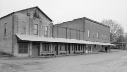
The town of Nauvoo was founded in 1888, during the construction of the Northern Alabama Railway, and was formerly a center of coal mining. [2] The town grew out of isolated agricultural settlements on the Walker County-Winston County line, which had been known unofficially as Blackwell's Crossing and Ingle Mills (or Ingle's Mill) after prominent local landowners. [3] Railroad construction drove the development of the town center on Joshua Blackwell's property, but he declined to have the new town be named officially in his honor. The local resident Tom Carroll suggested the name "Nauvoo," after Nauvoo, Illinois — a city founded by Mormon prophet Joseph Smith in 1839 and later the site of an Icarian colony settlement — reportedly "because he had admired the [Illinois] town... in his earlier travels through that state." [4] By 1891, the town was mentioned in the Winston Herald as "Nauvoo, a flourishing town with three stores and one steam gin doing good business." [5] Nauvoo incorporated in 1906. [6]
Nauvoo is located at 33°59′19″N87°29′16″W / 33.988571°N 87.487814°W . [7]
Census | Pop. | Note | %± |
---|---|---|---|
1910 | 392 | — | |
1920 | 489 | 24.7% | |
1930 | 648 | 32.5% | |
1940 | 533 | −17.7% | |
1950 | 416 | −22.0% | |
1960 | 318 | −23.6% | |
1970 | 265 | −16.7% | |
1980 | 259 | −2.3% | |
1990 | 240 | −7.3% | |
2000 | 284 | 18.3% | |
2010 | 221 | −22.2% | |
2020 | 185 | −16.3% | |
U.S. Decennial Census [8] 2013 Estimate [9] |
As of the census [10] of 2000, there were 284 people, 116 households, and 83 families residing in the town. The population density was 289.3 inhabitants per square mile (111.7/km2). There were 150 housing units at an average density of 152.8 per square mile (59.0/km2). The racial makeup of the town was 98.24% White, 1.06% from other races, and 0.70% from two or more races. 1.76% of the population were Hispanic or Latino of any race.
There were 116 households, out of which 30.2% had children under the age of 18 living with them, 60.3% were married couples living together, 9.5% had a female householder with no husband present, and 27.6% were non-families. 27.6% of all households were made up of individuals, and 13.8% had someone living alone who was 65 years of age or older. The average household size was 2.45 and the average family size was 2.93.
In the town, the population was spread out, with 24.6% under the age of 18, 7.4% from 18 to 24, 28.2% from 25 to 44, 22.9% from 45 to 64, and 16.9% who were 65 years of age or older. The median age was 36 years. For every 100 females, there were 89.3 males. For every 100 females age 18 and over, there were 81.4 males.
The median income for a household in the town was $22,274, and the median income for a family was $29,167. Males had a median income of $24,375 versus $16,875 for females. The per capita income for the town was $11,066. About 20.7% of families and 24.4% of the population were below the poverty line, including 35.1% of those under the age of eighteen and 22.2% of those 65 or over.
Winston County is a county of the U.S. state of Alabama. As of the 2020 census, the population was 23,540. Its county seat is Double Springs. Known as Hancock County before 1858, the county is named in honor of John A. Winston, the fifteenth Governor of Alabama.
Cullman County is a county located in the north central portion of the U.S. state of Alabama. As of the 2020 census, the population was 87,866. Its county seat and largest city is Cullman. Its name is in honor of Colonel John G. Cullmann.
Lawrence County is a county in the northern part of the U.S. state of Alabama. As of the 2020 census, the population was 33,073. The county seat is Moulton. The county was named after James Lawrence, a captain in the United States Navy from New Jersey.
Marion County is a county of the U.S. state of Alabama. As of the 2020 census the population was 29,341. The county seat is Hamilton. The county was created by an act of the Alabama Territorial General Assembly on February 13, 1818. The county seat was originally established in Pikeville in 1820, and moved to Hamilton in 1881. The county was named by planter and US Indian agent John Dabney Terrell, Sr., in recognition of General Francis Marion of South Carolina.
Sumter County is a county located in the west central portion of Alabama. At the 2020 census, the population was 12,345. Its county seat is Livingston. Its name is in honor of General Thomas Sumter of South Carolina. The University of West Alabama is in Livingston.
Talladega County is one of the sixty-seven counties located in the east central portion of the U.S. state of Alabama. As of the 2020 census, the population was 82,149. Its county seat is Talladega.
Walker County is a county located in the central portion of the U.S. state of Alabama. As of the 2020 census, the population was 65,342. Its county seat is Jasper. Its name is in honor of John Williams Walker, the first U.S. senator elected from Alabama.
Love County is a county on the southern border of the U.S. state of Oklahoma. As of the 2020 census, the population was 10,146. Its county seat is Marietta. The county was created at statehood in 1907 and named for Overton Love, a prominent Chickasaw farmer, entrepreneur and politician.
Hancock County is a county in the U.S. state of Illinois. According to the 2020 census, it has a population of 17,620. Its county seat is Carthage, and its largest city is Hamilton. The county is composed of rural towns with many farmers.
Dora is a city in Walker County, Alabama, United States. Coal mining took place in the area.
Eldridge is a town in Walker County, Alabama, United States. It was incorporated in 1972. At the 2010 census the population was 130, down from 184 in 2000.
Kansas is a town in Walker County, Alabama, United States. It incorporated in 1956. At the 2010 census the population was 226, down from 260 in 2000.
Oakman is a town in Walker County, Alabama, United States. At the 2020 census the population was 771, down from 789 in 2010. Initially named Day Gap, it was renamed Oakman and incorporated in 1895.
Parrish is a town in Walker County, Alabama, United States. It was incorporated in October 1922. At the 2010 census the population was 982, down from 1,268 in 2000.
Sipsey is a town in Walker County, Alabama, United States. In the 2010 census, the population was 437, down from the previous 552 in the year 2000.
Arley is a town in Winston County, Alabama, United States. It incorporated on December 18, 1965. At the 2020 census the population was 330, down from 357 in 2010.
Double Springs is a town in Winston County, Alabama, United States. The city is the county seat of Winston County. The county seat was initially located at Houston, but by referendum in 1883, Double Springs prevailed and it was removed to there. It was incorporated on May 17, 1943. At the 2010 census the population was 1,083, up from 1,003 in 2000.
Natural Bridge is a town at the southwest edge of Winston County, Alabama, United States, located near the intersection of U.S. Route 278, Alabama Highway 13, and Alabama State Route 5. It initially incorporated on September 3, 1914. In the 1930s, due to a dwindling population, its charter became dormant. On July 24, 1997, it reincorporated.
Danbury is a city located in Danbury Township, Stokes County, North Carolina, United States. As of the 2020 census, the city had a total population of 142. It is the county seat of Stokes County. Danbury is located on North Carolina Highway 8/89 approximately 20 miles (32 km) north of Winston-Salem and is the "Gateway to Hanging Rock". The Stokes County Government Center, Arts Council, school board, county jail, a public library, a post office, and other public services are found within the town limits. LifeBrite Community Hospital of Stokes is located about a half mile northwest of the town. North Stokes High School, a big part of town, is located 7.4 miles to the northwest.
Marietta is a town in Cass County, Texas, United States, incorporated in 1963. The population was 134 at the 2010 census, up from 112 at the 2000 census; in 2020, its population was 115.