Noma, Florida

Last updated

Noma, Florida
Holmes County Florida Incorporated and Unincorporated areas Noma Highlighted.svg
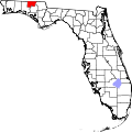
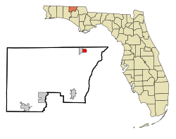
Location in Holmes County and the state of Florida
Usa edcp location map.svg
Red pog.svg
Noma, Florida
Location in the United States
Coordinates: 30°58′54″N85°37′10″W / 30.98167°N 85.61944°W / 30.98167; -85.61944
Country Flag of the United States.svg United States
State Flag of Florida.svg Florida
County   Holmes
Settled 1882 [1]
Incorporated July 1904 [1] [2]
Reincorporated 1977 [2] [3]
Government
  Type Mayor-Council
   Mayor [2] Literman Joseph
   Vice Mayor Coy Mixon
   Councilmembers Josephine Curry,
Betty Forthman, and
Daniel Arrant
   Town Clerk Ben Tew
Area
[4]
  Total
1.09 sq mi (2.83 km2)
  Land1.07 sq mi (2.76 km2)
  Water0.03 sq mi (0.07 km2)
Elevation
180 ft (55 m)
Population
 (2020)
  Total
208
  Density194.94/sq mi (75.25/km2)
Time zone UTC-6 (Central (CST))
  Summer (DST) UTC-5 (CDT)
ZIP code
32452
Area code 850
FIPS code 12-48900 [5]
GNIS feature ID0287758 [6]

Noma is a town in Holmes County, Florida, United States. The Town of Noma is part of the Florida Panhandle in North Florida. The population was 208 at the 2020 census.

Contents

Geography

The approximate coordinates for the Town of Noma is located at 30°58′54″N85°37′10″W / 30.981659°N 85.619364°W / 30.981659; -85.619364 . [7] It borders southern Alabama.

According to the United States Census Bureau, the town has a total area of 1.1 square miles (2.8 km2), all land.

Climate

The climate in this area is characterized by hot, humid summers and generally mild winters. According to the Köppen climate classification, the Town of Noma has a humid subtropical climate zone (Cfa).

Demographics

Historical population
CensusPop.Note
1980 113
1990 20783.2%
2000 2132.9%
2010 211−0.9%
2020 208−1.4%
U.S. Decennial Census [8]

2010 and 2020 census

Noma racial composition
(Hispanics excluded from racial categories)
(NH = Non-Hispanic)
RacePop 2010 [9] Pop 2020 [10] % 2010% 2020
White (NH)16414777.73%70.67%
Black or African American (NH)454321.33%20.67%
Native American or Alaska Native (NH)000.00%0.00%
Asian (NH)000.00%0.00%
Pacific Islander or Native Hawaiian (NH)010.00%0.48%
Some other race (NH)010.00%0.48%
Two or more races/Multiracial (NH)280.95%3.85%
Hispanic or Latino (any race)080.00%3.85%
Total211208

As of the 2020 United States census, there were 208 people, 104 households, and 68 families residing in the town. [11]

As of the 2010 United States census, there were 211 people, 111 households, and 82 families residing in the town. [12]

2000 census

As of the census [5] of 2000, there were 213 people, 91 households, and 54 families residing in the town. The population density was 194.7 inhabitants per square mile (75.2/km2). There were 104 housing units at an average density of 95.1 per square mile (36.7/km2). The racial makeup of the town was 77.93% White, 19.25% African American, 0.94% Pacific Islander, 0.47% from other races, and 1.41% from two or more races. Hispanic or Latino of any race were 1.41% of the population.

In 2000, there were 91 households, out of which 28.6% had children under the age of 18 living with them, 38.5% were married couples living together, 14.3% had a female householder with no husband present, and 39.6% were non-families. 36.3% of all households were made up of individuals, and 20.9% had someone living alone who was 65 years of age or older. The average household size was 2.34 and the average family size was 3.07.

In 2000, in the town, the population was spread out, with 23.5% under the age of 18, 8.0% from 18 to 24, 31.0% from 25 to 44, 22.1% from 45 to 64, and 15.5% who were 65 years of age or older. The median age was 39 years. For every 100 females, there were 95.4 males. For every 100 females age 18 and over, there were 83.1 males.

In 2000, the median income for a household in the town was $26,250, and the median income for a family was $40,625. Males had a median income of $20,000 versus $21,250 for females. The per capita income for the town was $10,958. About 14.3% of families and 18.3% of the population were below the poverty line, including 17.5% of those under the age of eighteen and 33.3% of those 65 or over.

References

  1. 1 2 "Discover Noma, FL". unexploredflorida.com.
  2. 1 2 3 "MUNICIPAL DIRECTORY: Town of Noma". www.floridaleagueofcities.com.
  3. "FLORIDA CITIES BY INCORPORATION YEAR WITH INCORPORATION & DISSOLUTION INFO" (PDF). www.flcities.com.
  4. "2020 U.S. Gazetteer Files". United States Census Bureau. Retrieved October 31, 2021.
  5. 1 2 "U.S. Census website". United States Census Bureau . Retrieved January 31, 2008.
  6. "US Board on Geographic Names". United States Geological Survey. October 25, 2007. Retrieved January 31, 2008.
  7. "US Gazetteer files: 2010, 2000, and 1990". United States Census Bureau. February 12, 2011. Retrieved April 23, 2011.
  8. "Census of Population and Housing". Census.gov. Retrieved June 4, 2015.
  9. "P2 HISPANIC OR LATINO, AND NOT HISPANIC OR LATINO BY RACE - 2010: DEC Redistricting Data (PL 94-171) - Noma town, Florida". United States Census Bureau .
  10. "P2 HISPANIC OR LATINO, AND NOT HISPANIC OR LATINO BY RACE - 2020: DEC Redistricting Data (PL 94-171) - Noma town, Florida". United States Census Bureau .
  11. "S1101 HOUSEHOLDS AND FAMILIES - 2020: Noma town, Florida". United States Census Bureau .
  12. "S1101 HOUSEHOLDS AND FAMILIES - 2010: Noma town, Florida". United States Census Bureau .