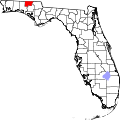
Esto, Florida

Last updated
Esto, Florida
Holmes County Florida Incorporated and Unincorporated areas Esto Highlighted.svg
Location in Holmes County and the state of Florida
Usa edcp location map.svg
Red pog.svg
Esto, Florida
Location in the United States
Coordinates: 30°58′52″N85°38′49″W / 30.98111°N 85.64694°W / 30.98111; -85.64694 Coordinates: 30°58′52″N85°38′49″W / 30.98111°N 85.64694°W / 30.98111; -85.64694
Country Flag of the United States.svg  United States
State Flag of Florida.svg  Florida
County   Holmes
Area
[1]
  Total2.36 sq mi (6.13 km2)
  Land2.18 sq mi (5.64 km2)
  Water0.19 sq mi (0.48 km2)
Elevation
233 ft (71 m)
Population
 (2020)
  Total341
  Density156.49/sq mi (60.41/km2)
Time zone UTC-6 (Central (CST))
  Summer (DST) UTC-5 (CDT)
ZIP code
32425 [2]
Area code 850
FIPS code 12-21250 [3]
GNIS feature ID0282263 [4]
Website estoflorida.com

Esto is a town in Holmes County, Florida, United States. The population was 364 at the 2010 census. [5]

Contents

Geography

Esto is located in northeastern Holmes County at 30°58′52″N85°38′49″W / 30.98111°N 85.64694°W / 30.98111; -85.64694 (30.981052, –85.646857). [6] It is bordered to the north by the state of Alabama and to the east by the town of Noma, Florida. Florida State Road 79 is the main road through town, leading south 13 miles (21 km) to Bonifay, the Holmes County seat, and north (as Alabama State Route 167) 9 miles (14 km) to Hartford, Alabama. Florida State Road 2 follows the southern border of Esto, and leads east 8 miles (13 km) to Graceville and west 20 miles (32 km) to State Road 81. Dothan, Alabama, 25 miles (40 km) to the northeast, is the closest city with more than 50,000 people.

According to the United States Census Bureau, the town of Esto has a total area of 2.4 square miles (6.1 km2), of which 2.2 square miles (5.6 km2) are land and 0.2 square miles (0.5 km2), or 7.89%, are water. [5]

Demographics

Historical population
CensusPop.Note
1910 340
1920 269−20.9%
1930 190−29.4%
1940 21312.1%
1950 2171.9%
1960 148−31.8%
1970 21041.9%
1980 30444.8%
1990 253−16.8%
2000 35640.7%
2010 3642.2%
2020 341−6.3%
U.S. Decennial Census [7]

As of the census [3] of 2000, there were 356 people, 144 households, and 95 families residing in the town. The population density was 161.6 inhabitants per square mile (62.4/km2). There were 167 housing units at an average density of 75.8 per square mile (29.3/km2). The racial makeup of the town was 92.13% White, 2.25% African American, 3.93% Native American, 0.56% from other races, and 1.12% from two or more races. Hispanic or Latino of any race were 2.81% of the population.

There were 144 households, out of which 30.6% had children under the age of 18 living with them, 50.7% were married couples living together, 9.0% had a female householder with no husband present, and 34.0% were non-families. 31.3% of all households were made up of individuals, and 17.4% had someone living alone who was 65 years of age or older. The average household size was 2.47 and the average family size was 3.09.

In the town, the population was spread out, with 28.1% under the age of 18, 7.6% from 18 to 24, 23.3% from 25 to 44, 26.4% from 45 to 64, and 14.6% who were 65 years of age or older. The median age was 37 years. For every 100 females, there were 110.7 males. For every 100 females age 18 and over, there were 100.0 males.

The median income for a household in the town was $31,667, and the median income for a family was $36,563. Males had a median income of $30,313 versus $15,625 for females. The per capita income for the town was $12,961. About 15.7% of families and 12.5% of the population were below the poverty line, including 16.8% of those under age 18 and none of those age 65 or over.

Related Research Articles

<span class="mw-page-title-main">Holmes County, Florida</span> County in Florida, United States

Holmes County is a county located in the northwestern part of the U.S. state of Florida, in the Panhandle. As of the 2020 census, the population was 19,653. Its county seat is Bonifay.

<span class="mw-page-title-main">Geneva County, Alabama</span> County in Alabama, United States

Geneva County is a county located in the southeastern part of the U.S. state of Alabama. As of the 2020 census, the population was 26,659. Its county seat is Geneva. The county was named after its county seat, which in turn was named after Geneva, New York which was named after Geneva, Switzerland, by Walter H. Yonge, an early town resident and Swiss native. Geneva County is a dry county in certain areas. Beer and wine are sold in Geneva, Samson, and Slocomb, but it isn't sold in any capacity in Hartford.

<span class="mw-page-title-main">New Brockton, Alabama</span> Town in Alabama, United States

New Brockton is a town in Coffee County, Alabama, United States. At the 2020 census, the population was 1,428. The community was named for Huey E. Brock, a settler who came to the region in 1871.

<span class="mw-page-title-main">Midland City, Alabama</span> Town in Alabama, United States

Midland City is a town in Dale County, Alabama, United States. At the 2010 U.S. Census the population was 2,344. It incorporated in 1890. It is part of the Ozark Micropolitan Statistical Area.

<span class="mw-page-title-main">Lakeview, Alabama</span> Town in Alabama, United States

Lakeview is a town in DeKalb County, Alabama, United States. At the 2020 census, the population was 161. Lakeview is located atop Sand Mountain.

<span class="mw-page-title-main">Sylvania, Alabama</span> Town in Alabama, United States

Sylvania is a town in DeKalb County, Alabama, United States. It incorporated in October 1967. At the 2010 census the population was 1,837, up from 1,186 in 2000. Sylvania is located atop Sand Mountain. Sylvania has its own Post Office, established in 1996 and located at 9596 Blue Pond Blvd. W.

<span class="mw-page-title-main">Valley Head, Alabama</span> Town in Alabama, United States

Valley Head is a town in DeKalb County, Alabama, United States. Although the town incorporated in 1921, it was also listed as being incorporated on the 1890 U.S. Census. At the 2020 census, the population was 577.

<span class="mw-page-title-main">Cottonwood, Alabama</span> Town in Alabama, United States

Cottonwood is a town in Houston County, Alabama, United States. One source said the town incorporated in 1901, although the 1910 U.S. Census stated 1903. It is part of the Dothan, Alabama Metropolitan Statistical Area. At the 2010 census the population was 1,289, up from 1,170 in 2000.

<span class="mw-page-title-main">Gordon, Alabama</span> Town in Alabama, United States

Gordon is a town in Houston County, Alabama, United States. It was incorporated in February 1872. It is part of the Dothan, Alabama Metropolitan Statistical Area. At the 2010 census the population was 332, down from 408 in 2000.

<span class="mw-page-title-main">Bonifay, Florida</span> City in Florida, United States

Bonifay is a city in Holmes County, Florida, United States. As of the 2020 census, the population was 2,759. It is the county seat of Holmes County.

<span class="mw-page-title-main">Noma, Florida</span> Town in the state of Florida, United States

Noma is a town in Holmes County, Florida, United States. The population was 211 at the 2010 census.

<span class="mw-page-title-main">Ponce de Leon, Florida</span> Town in the state of Florida, United States

Ponce de Leon is a town in Holmes County, Florida, United States. The population was 598 at the 2010 census, up from 457 at the 2000 census. From 2000 to 2010, the Ponce de Leon town population growth percentage was 30.9%.

<span class="mw-page-title-main">Westville, Florida</span> Town in the state of Florida, United States

Westville is a town in Holmes County, Florida, United States. As of the 2010 census, the town had a population of 289, up from 221 at the 2000 census. From 2000 to 2010, the Westville town population growth percentage was 30.8%.

<span class="mw-page-title-main">Bascom, Florida</span> Town in Florida, United States

Bascom is a town in Jackson County, Florida, United States, located 5 miles (8 km) south of the Alabama border. The population was 121 at the 2010 census.

<span class="mw-page-title-main">Campbellton, Florida</span> Town in Florida, United States

Campbellton is a town in Jackson County, Florida, United States. The population was 230 at the 2010 census.

<span class="mw-page-title-main">Cottondale, Florida</span> Town in Florida, United States

Cottondale is a town in Jackson County, Florida, United States. The population was 933 at the 2010 census, up from 869 at the 2000 census.

<span class="mw-page-title-main">Graceville, Florida</span> City in Florida, United States

Graceville is a city in Jackson County, Florida, United States. It is near the Alabama state line. The population was 2,278 at the 2010 census. A large portion of Graceville's rural acreage is located in Holmes County, Florida, United States.

<span class="mw-page-title-main">Grand Ridge, Florida</span> Town in Florida, United States

Grand Ridge is a town in Jackson County, Florida, United States. The population was 892 at the 2010 census, up from 792 at the 2000 census.

<span class="mw-page-title-main">Malone, Florida</span> Town in the state of Florida, United States

Malone is a town in Jackson County, Florida, United States. The population was 2,088 at the 2010 census.

<span class="mw-page-title-main">Stanton, Iowa</span> City in Iowa, United States

Stanton is a city in Montgomery County, Iowa, United States. The population was 678 at the time of the 2020 census.

References

  1. "2020 U.S. Gazetteer Files". United States Census Bureau. Retrieved October 31, 2021.
  2. "Esto FL ZIP Code". zipdatamaps.com. 2023. Retrieved February 17, 2023.
  3. 1 2 "U.S. Census website". United States Census Bureau . Retrieved 2008-01-31.
  4. "US Board on Geographic Names". United States Geological Survey. 2007-10-25. Retrieved 2008-01-31.
  5. 1 2 "Geographic Identifiers: 2010 Demographic Profile Data (G001): Esto town, Alabama". American Factfinder. U.S. Census Bureau. Retrieved May 8, 2017.[ dead link ]
  6. "US Gazetteer files: 2010, 2000, and 1990". United States Census Bureau. 2011-02-12. Retrieved 2011-04-23.
  7. "Census of Population and Housing". Census.gov. Retrieved June 4, 2015.