Westville, Florida

Last updated

Westville, Florida
Holmes County Florida Incorporated and Unincorporated areas Westville Highlighted.svg
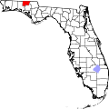
Location in Holmes County and the state of Florida
Usa edcp location map.svg
Red pog.svg
Westville, Florida
Location in the United States
Coordinates: 30°46′4″N85°51′8″W / 30.76778°N 85.85222°W / 30.76778; -85.85222
Country Flag of the United States.svg  United States
State Flag of Florida.svg  Florida
County   Holmes
Incorporated 1970 [1]
Government
  Type Mayor-Council
   Mayor [2] Stephen Herrington III
   Councilmembers Susan Bergeron,
Brittney Simmons,
Jason Stafford,
Paul Sasnett, and
Samanatha Webster
   Town Clerk Tammy Bowers
Area
[3]
  Total7.48 sq mi (19.37 km2)
  Land7.22 sq mi (18.69 km2)
  Water0.26 sq mi (0.68 km2)
Elevation
69 ft (21 m)
Population
 (2020)
  Total261
  Density36.17/sq mi (13.96/km2)
Time zone UTC-6 (Central (CST))
  Summer (DST) UTC-5 (CDT)
ZIP code
32464
Area code 850
FIPS code 12-76975 [4]
GNIS feature ID0293152 [5]

Westville is a town in Holmes County, Florida, United States. Westville is part of the Florida Panhandle in North Florida. As of the 2020 census, the town had a population of 261, down from 289 at the 2010 census. From 2010 to 2020, Westville's population growth percentage was -9.7%.

Contents

Geography

Westville is located in southern Holmes County at 30°46′4″N85°51′8″W / 30.76778°N 85.85222°W / 30.76778; -85.85222 (30.767681, –85.852302), [6] on the west side of the Choctawhatchee River. To the east across the river is the town of Caryville in Washington County.

U.S. Route 90 passes through Westville, leading east through Caryville 11 miles (18 km) to Bonifay, the Holmes County seat, and west 18 miles (29 km) to DeFuniak Springs. Interstate 10 passes through the southern part of the town limits, but the closest access is from Exit 104 in Caryville.

According to the United States Census Bureau, Westville has a total area of 7.5 square miles (19.4 km2), of which 7.2 square miles (18.7 km2) are land and 0.3 square miles (0.7 km2), or 3.53%, are water.

Climate

The climate in this area is characterized by hot, humid summers and generally mild winters. According to the Köppen climate classification, the Town of Westville has a humid subtropical climate zone (Cfa).

Demographics

Historical population
CensusPop.Note
1980 343
1990 257−25.1%
2000 221−14.0%
2010 28930.8%
2020 261−9.7%
U.S. Decennial Census [7]

2010 and 2020 census

Westville racial composition
(Hispanics excluded from racial categories)
(NH = Non-Hispanic)
RacePop 2010 [8] Pop 2020 [9] % 2010% 2020
White (NH)27424794.81%94.64%
Black or African American (NH)100.35%0.00%
Native American or Alaska Native (NH)000.00%0.00%
Asian (NH)010.00%0.38%
Pacific Islander or Native Hawaiian (NH)000.00%0.00%
Some other race (NH)000.00%0.00%
Two or more races/Multiracial (NH)993.11%3.45%
Hispanic or Latino (any race)541.73%1.53%
Total289261100.00%100.00%

As of the 2020 United States census, there were 261 people, 137 households, and 97 families residing in the town. [10]

For the period 2011-2015, the estimated median annual income for a household in the town was $34,375, and the median income for a family was $38,750. [11]

As of the 2010 United States census, there were 289 people, 103 households, and 91 families residing in the town. [12]

Of the 110 households in 2010, 37.3% had children under the age of 18 living with them, 55.5% were headed by married couples living together, 11.8% had a female householder with no husband present, and 26.4% were non-families. 20.0% of all households were made up of individuals, and 11.8% were someone living alone who was 65 years of age or older. The average household size was 2.63, and the average family size was 3.04. There were 137 housing units, of which 80.3% were occupied. [13]

In 2010, 26.0% of the town's population were under the age of 18, 8.6% were from age 18 to 24, 25.9% were from 25 to 44, 23.5% were from 45 to 64, and 15.9% were 65 years of age or older. The median age was 38.1 years. For every 100 females, there were 92.7 males. For every 100 females age 18 and over, there were 103.8 males. [13]

2000 census

As of the census of 2000, there were 221 people, 94 households, and 64 families residing in the town. The population density was 30.4 people per square mile (11.7/km2). There were 107 housing units at an average density of 14.7/sq mi (5.7/km2). The racial makeup of the town was 98.64% White, 0.45% Asian, and 0.90% from two or more races. Hispanic or Latino of any race were 2.26% of the population.

In 2000, there were 94 households out of which 30.9% had children under the age of 18 living with them, 50.0% were married couples living together, 13.8% had a female householder with no husband present, and 31.9% were non-families. 29.8% of all households were made up of individuals and 14.9% had someone living alone who was 65 years of age or older. The average household size was 2.35 and the average family size was 2.91.

In 2000, in the town, the population was spread out with 24.0% under the age of 18, 10.4% from 18 to 24, 27.1% from 25 to 44, 23.5% from 45 to 64, and 14.9% who were 65 years of age or older. The median age was 35 years. For every 100 females there were 82.6 males. For every 100 females age 18 and over, there were 78.7 males.

In 2000, the median income for a household in the town was $27,000, and the median income for a family was $34,375. Males had a median income of $25,625 versus $20,500 for females. The per capita income for the town was $11,415. About 9.2% of families and 13.9% of the population were below the poverty line, including 9.5% of those under the age of eighteen and 22.2% of those sixty five or over.

Notable people

Related Research Articles

<span class="mw-page-title-main">LaCrosse, Florida</span> Town in the state of Florida, United States

LaCrosse is a town in Alachua County, Florida, 15 miles (24 km) north of Gainesville. The LaCrosse is part of the Gainesville metropolitan area. As of the 2020 US census, the town population was 316, down from 360 in 2000 US Census.

<span class="mw-page-title-main">Cottondale, Florida</span> City in Florida, United States

Cottondale is a city in Jackson County, Florida, United States. It is part of the Florida Panhandle and North Florida. The population was 848 at the 2020 census, down from 933 at the 2010 census.

<span class="mw-page-title-main">Astatula, Florida</span> Town in the state of Florida, United States

Astatula is a town in Lake County, Florida, United States. The population was 1,889 at the 2020 census. It is part of the Orlando–Kissimmee–Sanford Metropolitan Statistical Area.

<span class="mw-page-title-main">Montverde, Florida</span> Town in Florida, United States

Montverde is a town in Lake County, Florida, United States. The population was 1,655 at the 2020 census. It is part of the Orlando–Kissimmee–Sanford Metropolitan Statistical Area.

<span class="mw-page-title-main">Inglis, Florida</span> Town in Florida, United States

Inglis is a town in Levy County, Florida, United States. It is on U.S. Highway 19 near the Cross Florida Greenway. As of the 2020 census, the town had a population of 1,476.

<span class="mw-page-title-main">Belleair Bluffs, Florida</span> City in Florida, United States

Belleair Bluffs is a city in Pinellas County, Florida, United States. It is part of the Tampa–St. Petersburg–Clearwater Metropolitan Statistical Area, more commonly known as the Tampa Bay Area. The population was 2,311 at the 2020 census.

<span class="mw-page-title-main">Caryville, Florida</span> Town in the state of Florida, United States

Caryville is a town in Washington County, Florida, United States located along the Choctawhatchee River. The Caryville is part of the Florida Panhandle in North Florida. The population was 301 at the 2020 census.

<span class="mw-page-title-main">Westville, Indiana</span> Town in Indiana, United States

Westville is a town in New Durham Township, LaPorte County, Indiana, United States. The population, as of the 2020 census is 5257. It is included in the Michigan City, Indiana-La Porte, Indiana Metropolitan Statistical Area. Westville is located in Northwest Indiana, also known as The Region.

<span class="mw-page-title-main">Ingalls, Indiana</span> Town in Indiana, United States

Ingalls is a town in Green Township, Madison County, Indiana, United States. It is part of the Indianapolis–Carmel–Anderson metropolitan statistical area. The population was 2,223 at the 2020 census.

<span class="mw-page-title-main">Ingalls, Kansas</span> City in Gray County, Kansas

Ingalls is a city in Gray County, Kansas, United States. As of the 2020 census, the population of the city was 252. It is located along Highway 50.

<span class="mw-page-title-main">Walnut Grove, Minnesota</span> City in Minnesota, United States

Walnut Grove is a city in Redwood County, Minnesota, United States. The population was 871 at the 2010 census. Another name formerly associated with the area is Walnut Station.

<span class="mw-page-title-main">Mansfield, Missouri</span> Town in Wright County

Mansfield is a city in Wright County, Missouri, United States. The population was 1,296 at the 2010 census.

Westville is a town in Franklin County, New York, United States. As of the 2010 census, the town had a population of 1,819. Westville is on the northern border of the county, northwest of Malone.

<span class="mw-page-title-main">De Smet, South Dakota</span> Town in South Dakota, United States

De Smet is a city in and the county seat of Kingsbury County, South Dakota, United States. The population was 1,056 at the 2020 census.

<span class="mw-page-title-main">Caryville, Tennessee</span> Town in Tennessee, United States

Caryville is a town in Campbell County, Tennessee, United States. The population was 2,297 at the 2010 census.

<span class="mw-page-title-main">Rock Creek, Wisconsin</span> Town in Wisconsin, United States

Rock Creek is a town in Dunn County, Wisconsin, United States. The population was 793 at the 2000 census. The unincorporated communities of Caryville and Rock Falls are located within the town. Located near Eau Claire the town has seen a great deal of recent suburban development in the corridor between the Chippewa River and Wis. 85.

Rome is a census-designated place (CDP) in the town of Sullivan in Jefferson County, Wisconsin, United States, along the Bark River. The population was 752 at the 2020 census.

<span class="mw-page-title-main">Pepin (town), Wisconsin</span> Town in Wisconsin, United States

Pepin is a town in Pepin County, Wisconsin, United States. The population was 580 at the 2000 census. The unincorporated communities of Barry Corner, Devils Corner, Hawkins Corner, and Lakeport are located in the town. The unincorporated community of Lund is also partially located within the town.

<span class="mw-page-title-main">Pepin, Wisconsin</span> Village in Wisconsin, United States

Pepin is a village in Pepin County, Wisconsin, United States. The population was 837 at the 2010 census. The village is located within the Town of Pepin.

<span class="mw-page-title-main">Fort Fairfield (CDP), Maine</span> Census-designated place in Maine, United States

Fort Fairfield is a census-designated place (CDP) comprising the main village within the town of Fort Fairfield in Aroostook County, Maine, United States. The population of the CDP was 1,825 at the 2010 census, out of a population of 3,496 for the entire town.

References

  1. "FLORIDA CITIES BY INCORPORATION YEAR WITH INCORPORATION & DISSOLUTION INFO" (PDF). www.flcities.com.
  2. "MUNICIPAL DIRECTORY: Town of Westville". Florida League of Cities.
  3. "2020 U.S. Gazetteer Files". United States Census Bureau. Retrieved December 2, 2021.
  4. "U.S. Census website". United States Census Bureau . Retrieved January 31, 2008.
  5. "US Board on Geographic Names". United States Geological Survey. October 25, 2007. Retrieved January 31, 2008.
  6. "US Gazetteer files: 2010, 2000, and 1990". United States Census Bureau. February 12, 2011. Retrieved April 23, 2011.
  7. "Census of Population and Housing". Census.gov. Retrieved June 4, 2015.
  8. "P2 HISPANIC OR LATINO, AND NOT HISPANIC OR LATINO BY RACE - 2010: DEC Redistricting Data (PL 94-171) - Westville town, Florida". United States Census Bureau .
  9. "P2 HISPANIC OR LATINO, AND NOT HISPANIC OR LATINO BY RACE - 2020: DEC Redistricting Data (PL 94-171) - Westville town, Florida". United States Census Bureau .
  10. "S1101 HOUSEHOLDS AND FAMILIES - 2020: Westville town, Florida". United States Census Bureau .
  11. "Selected Economic Characteristics: 2011-2015 American Community Survey 5-Year Estimates (DP03): Westville town, Florida". American Factfinder. U.S. Census Bureau. Archived from the original on February 13, 2020. Retrieved May 15, 2017.
  12. "S1101 HOUSEHOLDS AND FAMILIES - 2010: Westville town, Florida". United States Census Bureau .
  13. 1 2 "Profile of General Population and Housing Characteristics: 2010 Census Summary File 1 (DP-1): Westville town, Florida". American Factfinder. U.S. Census Bureau. Archived from the original on February 13, 2020. Retrieved May 15, 2017.
  14. 1 2 3 4 Westville, Florida information for Laura Ingalls Wilder