O'Donnell, Texas | |
---|---|
Coordinates: 32°57′49″N101°49′58″W / 32.96361°N 101.83278°W | |
Country | United States |
State | Texas |
Counties | Lynn, Dawson |
Region | Llano Estacado |
Established | 1910 |
Area | |
• Total | 0.86 sq mi (2.23 km2) |
• Land | 0.86 sq mi (2.23 km2) |
• Water | 0.00 sq mi (0.00 km2) |
Elevation | 3,045 ft (928 m) |
Population (2010) | |
• Total | 831 |
• Estimate (2019) [3] | 837 |
• Density | 973.26/sq mi (375.68/km2) |
Time zone | UTC-6 (CST) |
ZIP code | 79351 |
Area code | 806 |
FIPS code | 48-53436 |
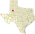
O'Donnell is a West Texas city that lies primarily in Lynn County, with a small portion extending south into Dawson County, Texas, United States. [4] Its population was 831 at the 2010 census, [5] down from 1,011 at the 2000 census. The Lynn county portion of O'Donnell is part of the Lubbock Metropolitan area.
O'Donnell was settled in 1910 [6] and named for Tom J. O'Donnell, a railroad promoter. O'Donnell was a railroad-created town, founded in anticipation that the Pecos and Northern Texas Railway would lay tracks through the area. [7]
A branch of the Pecos and Northern Texas Railway was constructed from Slaton to Lamesa in 1910. [8] The rails were abandoned and removed in 1999. In 2016, a controversy arose when the school was reported for having the ten commandments on its wall; when forced to take it down, the students came together and wrote Bible verses on sticky notes and posted them on the wall.[ citation needed ]
O'Donnell is on the High Plains of the Llano Estacado at 32°57′49″N101°49′58″W / 32.96361°N 101.83278°W (32.9637085 –101.8326542). [9] U.S. Highway 87 passes just northwest of the city limits, leading southwest 17 miles (27 km) to Lamesa and north 45 miles (72 km) to Lubbock.
According to the United States Census Bureau, O'Donnell has an area of 0.85 square miles (2.2 km2), all land. [5]
Census | Pop. | Note | %± |
---|---|---|---|
1930 | 1,026 | — | |
1940 | 1,147 | 11.8% | |
1950 | 1,473 | 28.4% | |
1960 | 1,356 | −7.9% | |
1970 | 1,148 | −15.3% | |
1980 | 1,200 | 4.5% | |
1990 | 1,102 | −8.2% | |
2000 | 1,011 | −8.3% | |
2010 | 831 | −17.8% | |
2019 (est.) | 837 | [3] | 0.7% |
U.S. Decennial Census [10] |
Race | Number | Percentage |
---|---|---|
White (NH) | 218 | 30.97% |
Black or African American (NH) | 5 | 0.71% |
Mixed/Multi-Racial (NH) | 7 | 0.99% |
Hispanic or Latino | 474 | 67.33% |
Total | 704 |
As of the 2020 United States census, there were 704 people, 353 households, and 252 families residing in the city.
As of the 2010 United States Census, O'Donnell had 831 people, a 17.8% reduction from the 2000 US Census. [14] The population resided in 315 households, of which 237 were identified as family households. The racial makeup of the city was 73.4% White, 1.2% African American, 0.6% Native American, 0.4% Asian, 20.3% from other races, and 4.1% from two or more races. Hispanics or Latinos of any race were 62.8% of the population. [14]
In the city, the age distribution was 31.2% under 18, 52.0% from 18 to 64, and 16.8% who were 65 or older. The median age was 38.5 years. [14]
The median income for a household in the city was $26,103, and for a family was $30,833. Males had a median income of $26,193 versus $15,917 for females. The per capita income for the city was $12,924. About 24.4% of families and 24.8% of the population were below the poverty line, including 31.1% of those under age 18 and 15.0% of those age 65 or over.
O'Donnell is served by the O'Donnell Independent School District and is home to the O'Donnell High School Eagles.
Lynn County is a county in the U.S. state of Texas. As of the 2020 census, its population was 5,596. Its county seat is Tahoka. The county was created in 1876 and organized in 1903.
Lubbock County is a county located in the U.S. state of Texas. The 2020 census placed the population at 310,639. Its county seat and largest city is Lubbock. The county was created in 1876 and organized in 1891. It is named for Thomas Saltus Lubbock, a Confederate colonel and Texas Ranger.
Hockley County is a county located in the U.S. state of Texas. As of the 2020 census, its population was 21,537. Its county seat is Levelland. The county was created in 1876, but not organized until 1921. It is named for George Washington Hockley, a secretary of war of the Republic of Texas.
Garza County is a county located in the U.S. state of Texas. As of the 2020 census, its population was 5,816, of which most of the population were residing in its county seat, and only incorporated municipality, Post. The county was created in 1876 and later organized in 1907. Garza is named for a pioneer Bexar County family, as it was once a part of that county.
Dawson County is a county in the U.S. state of Texas. As of the 2020 census, its population was 12,456. The county seat is Lamesa. The county was created in 1876 and later organized in 1905. It is named for Nicholas Mosby Dawson, a soldier of the Texas Revolution. Dawson County comprises the Lamesa, TX Micropolitan Statistical Area (μSA), and it is, by population, the smallest Micropolitan Statistical Area in the United States.
Crosby County is a county located in the U.S. state of Texas. As of the 2020 census, its population was 5,133. The county seat is Crosbyton. The county was founded in 1876 and later organized in 1886. Both the county and its seat are named for Stephen Crosby, a land commissioner in Texas.
Ralls is a city in Crosby County, Texas, United States. It was named after John Robinson Ralls, who, with the help of W.E. McLaughlin, laid out the townsite in July 1911. As of the 2010 census, it had a population of 1,944, down from 2,252 at the 2000 census. Ralls is surrounded by productive farmlands that primarily produce cotton and grains, with lesser amounts of soybean, sunflower seed, and vegetables.
Lamesa is a city in and the county seat of Dawson County, Texas, United States. The population was 8,674 at the 2020 census, down from 9,952 at the 2000 census. Located south of Lubbock on the Llano Estacado, Lamesa was founded in 1903. Most of its economy is based on cotton farming. The Preston E. Smith prison unit, named for the former governor of Texas, is located just outside Lamesa.
Post is a city in and the county seat of Garza County, Texas, United States. Its population was 5,376 at the 2010 census.
Hale Center is a city in Hale County, Texas. The population was 2,062 at the 2020 census, down from 2,252 in 2010.
Petersburg is a city in Hale County, Texas, United States. As of the 2020 census, it had a population of 1,014.
Plainview is a city in and the county seat of Hale County, Texas, United States. As of the 2020 census, its population was 20,187.
Anton is a city in Hockley County, Texas, United States. The population was 907 at the 2020 census.
Buffalo Springs is a village in Lubbock County, Texas, United States. The population was 453 at the 2010 census. It is part of the Lubbock Metropolitan Statistical Area.
New Deal is a U.S. town in Lubbock County, Texas. The population was 794 at the 2010 census. It is part of the Lubbock Metropolitan Statistical Area and the Llano Estacado region.
Shallowater is a city in Lubbock County, Texas, United States. Shallowater is on U.S. Route 84 and the Burlington Northern Santa Fe line, 12 miles (19 km) northwest of Lubbock. Its population was 2,484 at the 2010 census. It is part of the Lubbock metropolitan statistical area.
Slaton is a city in Lubbock County, Texas, United States. Founded by German immigrants, Slaton was the westernmost German settlement in Texas. The population was 6,121 at the 2010 census. Slaton is part of the Lubbock Metropolitan Statistical Area.
Wilson is a small rural city in the northeastern quadrant of Lynn County, Texas, United States. As of the 2020 census, the population was 434.
Bovina is a city in Parmer County, Texas, United States. The population was 1,868 at the 2010 census.
Abernathy is a city in Hale and Lubbock counties in the U.S. state of Texas. The population was 2,805 at the 2010 census.