Ojo Caliente Spring

Last updated
Ojo Caliente Spring
OjoCalienteSpring1967.jpg
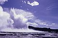
Ojo Caliente Spring, 1967
LocationLower Geyser Basin, Yellowstone National Park, Wyoming
Coordinates 44°33′47″N110°50′20″W / 44.5629852°N 110.8388101°W / 44.5629852; -110.8388101 [1]
Elevation7,182 feet (2,189 m) [2]
Temperature94 °C (201 °F) [1]

Ojo Caliente Spring is a hot spring in Lower Geyser Basin, of Yellowstone National Park. It is in the River Group which includes Azure Spring, [3] and is located a few yards off the Fountain Flats Freight Road on the northern bank of the Firehole River.

In Spanish Ojo Caliente means "hot eye". It is a superheated, alkaline spring which, on its northern end, boils constantly to a height of 12 to 20 inches (30 to 51 cm). [4]

Related Research Articles

Yellowstone National Park First national park in the world, located in the US states of Wyoming, Montana and Idaho

Yellowstone National Park is an American national park located in the western United States, with parts in Wyoming, Montana and Idaho. It was established by the U.S. Congress and signed into law by President Ulysses S. Grant on March 1, 1872. Yellowstone was the first national park in the U.S. and is also widely held to be the first national park in the world. The park is known for its wildlife and its many geothermal features, especially Old Faithful geyser, one of its most popular. While it represents many types of biomes, the subalpine forest is the most abundant. It is part of the South Central Rockies forests ecoregion.

Geothermal areas of Yellowstone geyser basins and other geothermal features in Yellowstone National Park

The geothermal areas of Yellowstone include several geyser basins in Yellowstone National Park as well as other geothermal features such as hot springs, mud pots, and fumaroles. The number of thermal features in Yellowstone is estimated at 10,000. A study that was completed in 2011 found that a total of 1,283 geysers have erupted in Yellowstone, 465 of which are active during an average year. These are distributed among nine geyser basins, with a few geysers found in smaller thermal areas throughout the Park. The number of geysers in each geyser basin are as follows: Upper Geyser Basin (410), Midway Geyser Basin (59), Lower Geyser Basin (283), Norris Geyser Basin (193), West Thumb Geyser Basin (84), Gibbon Geyser Basin (24), Lone Star Geyser Basin (21), Shoshone Geyser Basin (107), Heart Lake Geyser Basin (69), other areas (33). Although famous large geysers like Old Faithful are part of the total, most of Yellowstone's geysers are small, erupting to only a foot or two. The hydrothermal system that supplies the geysers with hot water sits within an ancient active caldera. Many of the thermal features in Yellowstone build up sinter, geyserite, or travertine deposits around and within them.

Yellowstone Lake lake in Teton County, Wyoming, USA

Yellowstone Lake is the largest body of water in Yellowstone National Park. The lake is 7,732 feet (2,357 m) above sea level and covers 136 square miles (350 km2) with 110 miles (180 km) of shoreline. While the average depth of the lake is 139 ft (42 m), its greatest depth is at least 394 ft (120 m). Yellowstone Lake is the largest freshwater lake above 7,000 ft (2,100 m) in North America.

Grand Canyon of the Yellowstone canyon on the Yellowstone River

The Grand Canyon of the Yellowstone is the first large canyon on the Yellowstone River downstream from Yellowstone Falls in Yellowstone National Park in Wyoming. The canyon is approximately 24 miles (39 km) long, between 800 and 1,200 ft deep and from .25 to .75 mi wide.

Grand Prismatic Spring largest hot spring in the United States

The Grand Prismatic Spring in Yellowstone National Park is the largest hot spring in the United States, and the third largest in the world, after Frying Pan Lake in New Zealand and Boiling Lake in Dominica. It is located in the Midway Geyser Basin.

Firehole River river in the United States of America

The Firehole River is located in northwestern Wyoming, and is one of the two major tributaries of the Madison River. It flows north approximately 21 miles (34 km) from its source in Madison Lake on the Continental Divide to join the Gibbon River at Madison Junction in Yellowstone National Park. It is part of the Missouri River system.

Narcissus Geyser is a geyser in the Lower Geyser Basin of Yellowstone National Park in the United States. Narcissus Geyser is part of the Pink Cone Group. Other geysers in this group are Bead Geyser, Box Spring, Dilemma Geyser, Labial Geyser, Labial's Satellite Geyser, Pink Geyser, and Pink Cone Geyser.

Giant Geyser geyser in Yellowstone National Park

Giant Geyser is a cone-type geyser in the Upper Geyser Basin of Yellowstone National Park in the United States. Giant Geyser is the namesake for the Giant Group of geysers, which, on its platform, includes Bijou Geyser, Catfish Geyser, Mastiff Geyser, the "Platform Vents," and Turtle Geyser. Giant Geyser's Platform, a raised stone structure incorporating all these geysers. Giant is notable for its spectacular, but sporadic eruptions, as well as for its very large cone of geyserite, which stands about 12 feet tall.

Colters Hell United States historic place

Colter's Hell is an area of fumaroles and hot springs on the Shoshone River near Cody in the U.S. state of Wyoming. The thermal area covers about a square mile at the mouth of the Shoshone's canyon. Its thermal activity has declined ever since its description by mountain man John Colter, who parted from the Lewis & Clark Expedition prior to its conclusion and passed through the region in the winter of 1807–1808. Colter's account of the features on what was then called the Stinkingwater River has subsequently been confused with the much more extensive and powerful geysers in Yellowstone National Park, which Colter may not have actually visited.

Cook–Folsom–Peterson Expedition research expedition

The Cook–Folsom–Peterson Expedition of 1869 was the first organized expedition to explore the region that became Yellowstone National Park. The privately financed expedition was carried out by David E. Folsom, Charles W. Cook and William Peterson of Diamond City, Montana, a gold camp in the Confederate Gulch area of the Big Belt Mountains east of Helena, Montana. The journals kept by Cook and Folsom, as well as their personal accounts to friends were of significant inspirational value to spur the organization of the Washburn-Langford-Doane Expedition which visited Yellowstone in 1870.

Washburn–Langford–Doane Expedition research expedition

The Washburn Expedition of 1870 explored the region of northwestern Wyoming that two years later became Yellowstone National Park. Led by Henry Washburn and Nathaniel P. Langford, and with a U.S. Army escort headed by Lt. Gustavus C. Doane, the expedition followed the general course of the Cook–Folsom–Peterson Expedition made the previous year.

Grand Loop Road Historic District United States historic place

The Grand Loop Road Historic District encompasses the primary road system in Yellowstone National Park. Much of the 140-mile (230 km) system was originally planned by Captain Hiram M. Chittenden of the US Army Corps of Engineers in the early days of the park, when it was under military administration. The Grand Loop Road provides access to the major features of the park, including the Upper, Midway and Lower geyser basins, Mammoth Hot Springs, Tower Fall, the Grand Canyon of the Yellowstone and Yellowstone Lake.

Outline of Yellowstone National Park Wikimedia list article

The following articles relate to the history, geography, geology, flora, fauna, structures and recreation in Yellowstone National Park.

Hayden Geological Survey of 1871 1871 federal geological exploration of US territories

The Hayden Geological Survey of 1871 explored the region of northwestern Wyoming that later became Yellowstone National Park in 1872. It was led by geologist Ferdinand Vandeveer Hayden. The 1871 survey was not Hayden's first, but it was the first federally funded, geological survey to explore and further document features in the region soon to become Yellowstone National Park and played a prominent role in convincing the U.S. Congress to pass the legislation creating the park. In 1894, Nathaniel P. Langford, the first park superintendent and a member of the Washburn-Langford-Doane Expedition which explored the park in 1870, wrote this about the Hayden expedition:

We trace the creation of the park from the Folsom-Cook expedition of 1869 to the Washburn expedition of 1870, and thence to the Hayden expedition of 1871, Not to one of these expeditions more than to another do we owe the legislation which set apart this "pleasuring-ground for the benefit and enjoyment of the people"

Frank Jay Haynes American photographer

Frank Jay Haynes, known as F. Jay or the Professor to almost all who knew him, was a professional photographer, publisher, and entrepreneur from Minnesota who played a major role in documenting through photographs the settlement and early history of the great Northwest. He became both the official photographer of the Northern Pacific Railway and of Yellowstone National Park as well as operating early transportation concessions in the park. His photographs were widely published in articles, journals, books and turned into stereographs, and postcards in the late 19th and early 20th century.

Shoshone Lake lake in Teton County, Wyoming, USA

Shoshone Lake is a U.S. backcountry lake with the area of 8,050 acres elevated at 7,795 feet (2,376 m) in the southwest section of Yellowstone National Park, Wyoming. It lies at the headwaters of the Lewis River a tributary of the Snake River. The U.S. Fish and Wildlife Service believes that Shoshone Lake is the largest backcountry lake in the lower 48 states that cannot be reached by a road.

Plateaus of Yellowstone National Park

There are nine named plateaus in Yellowstone National Park. These plateaus are part of the much larger Yellowstone Plateau and dominate areas in the park south and west of the Gallatin and Absaroka mountain ranges. Four of the plateaus are from rhyolite lava flows that occurred between 110,000 and 70,000 years ago.

Nez Perce in Yellowstone Park

The Nez Perce in Yellowstone Park was the flight of the Nez Perce Indians through Yellowstone National Park between August 20 and Sept 7, during the Nez Perce War in 1877. As the U.S. army pursued the Nez Perce through the park, a number of hostile and sometimes deadly encounters between park visitors and the Indians occurred. Eventually, the army's pursuit forced the Nez Perce off the Yellowstone plateau and into forces arrayed to capture or destroy them when they emerged from the mountains of Yellowstone onto the valley of Clark's Fork of the Yellowstone River.

References

  1. 1 2 "Ojo Caliente Spring". Yellowstone Geothermal Features Database. Montana State University.
  2. "Ojo Caliente Spring". Geographic Names Information System . United States Geological Survey.
  3. "River Group". Archived from the original on 2010-11-29. Retrieved 2010-11-14.
  4. "Geysers – Lower Geyser Basin". YellowstoneNationalPark.com.

44°33′47″N110°50′20″W / 44.562933°N 110.838783°W / 44.562933; -110.838783