Olar, South Carolina

Last updated

Olar, South Carolina
Town Hall in Olar, SC, US.jpg
SCMap-doton-Olar.PNG
Location of Olar, South Carolina
Coordinates: 33°10′49″N81°11′3″W / 33.18028°N 81.18417°W / 33.18028; -81.18417
Country United States
State South Carolina
County Bamberg
Area
[1]
  Total0.79 sq mi (2.03 km2)
  Land0.79 sq mi (2.03 km2)
  Water0.00 sq mi (0.00 km2)
Elevation
[2]
203 ft (62 m)
Population
 (2020) [3]
  Total215
  Density273.89/sq mi (105.70/km2)
Time zone UTC-5 (Eastern (EST))
  Summer (DST) UTC-4 (EDT)
ZIP code
29843
Area code(s) 803, 839
FIPS code 45-52585 [4]
GNIS feature ID1249948 [2]
Buildings in Olar Olar SC.jpg
Buildings in Olar

Olar is a town in Bamberg County, South Carolina, United States. The population was 257 at the 2010 census. [5]

Contents

History

The Mizpah Methodist Church was listed on the National Register of Historic Places in 2000. [6]

Geography

Olar is located in western Bamberg County at 33°10′49″N81°11′3″W / 33.18028°N 81.18417°W / 33.18028; -81.18417 (33.180266, -81.184248). [7] U.S. Route 321 passes through the town, leading north 10 miles (16 km) to Denmark and south 16 miles (26 km) to Fairfax. South Carolina Highway 64 crosses US 321 in the center of town, leading southeast 12 miles (19 km) to Ehrhardt and northwest 12 miles (19 km) to Barnwell.

Sign welcoming visitors to Olar OlarWelcomeSign.JPG
Sign welcoming visitors to Olar

According to the United States Census Bureau, Olar has a total area of 0.77 square miles (2.0 km2), all of it land. [5]

Demographics

Historical population
CensusPop.Note
1900 196
1910 35078.6%
1920 50042.9%
1930 5408.0%
1940 528−2.2%
1950 414−21.6%
1960 46712.8%
1970 423−9.4%
1980 381−9.9%
1990 3912.6%
2000 237−39.4%
2010 2578.4%
2020 215−16.3%
U.S. Decennial Census [8] [3]

The census [4] of 2000, there were 237 people, 111 households, and 71 families residing in the town. The population density was 301.1 inhabitants per square mile (116.3/km2). There were 152 housing units at an average density of 193.1 per square mile (74.6/km2). The racial makeup of the town was 52.74% White, 46.41% African American, 0.42% Native American and 0.42% Asian. Hispanic or Latino of any race were 0.42% of the population.

There were 111 households, out of which 12.6% had children under the age of 18 living with them, 51.4% were married couples living together, 9.9% had a female householder with no husband present, and 36.0% were non-families. 34.2% of all households were made up of individuals, and 17.1% had someone living alone who was 65 years of age or older. The average household size was 2.14 and the average family size was 2.70.

In the town, the population was spread out, with 12.2% under the age of 18, 9.3% from 18 to 24, 24.1% from 25 to 44, 28.3% from 45 to 64, and 26.2% who were 65 years of age or older. The median age was 49 years. For every 100 females, there were 79.5 males. For every 100 females age 18 and over, there were 80.9 males.

The median income for a household in the town was $31,250, and the median income for a family was $41,964. Males had a median income of $41,250 versus $11,771 for females. The per capita income for the town was $17,113. About 7.7% of families and 10.3% of the population were below the poverty line, including none of those under the age of eighteen and 9.5% of those 65 or over.

Notable people

Related Research Articles

<span class="mw-page-title-main">Bamberg County, South Carolina</span> County in South Carolina, United States

Bamberg County is a county located in the southwestern portion of U.S. state of South Carolina. As of the 2020 census, the population was 13,311, making the rural county the fourth-least populous of any in South Carolina. Its county seat is Bamberg.

<span class="mw-page-title-main">Allendale County, South Carolina</span> County in South Carolina, United States

Allendale County is a county located in the U.S. state of South Carolina. As of the 2020 census, the population was 8,039, making it the least populous county in South Carolina. Its county seat is Allendale.

<span class="mw-page-title-main">Jackson, South Carolina</span> Town in South Carolina, United States of America

Jackson is a town in Aiken County, South Carolina, United States. The population was 1,700 at the 2010 census. It is part of the Augusta, Georgia metropolitan area.

<span class="mw-page-title-main">New Ellenton, South Carolina</span> City in South Carolina

New Ellenton is a city in Aiken County, South Carolina, United States. The population was 2,210 at the 2020 census. It is part of the Augusta, Georgia metropolitan area.

<span class="mw-page-title-main">Perry, South Carolina</span> Town in South Carolina, United States of America

Perry is a town in Aiken County, South Carolina, United States. The population was 233 at the 2010 census. It is part of the Augusta, Georgia metropolitan area.

Ulmer is a town in Allendale County, South Carolina, United States. The population was 88 at the 2010 census.

<span class="mw-page-title-main">Bamberg, South Carolina</span> City in South Carolina, United States

Bamberg is a city in and the county seat of Bamberg County, South Carolina, United States. The population was 3,607 at the 2010 census.

<span class="mw-page-title-main">Denmark, South Carolina</span> City in South Carolina, United States

Denmark is a city in Bamberg County, South Carolina, United States. The population at the 2010 census is 3,538.

<span class="mw-page-title-main">Ehrhardt, South Carolina</span> Town in South Carolina, United States

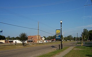
Ehrhardt is a town in Bamberg County, South Carolina, United States. As of the 2010 census, the town population was 545.

<span class="mw-page-title-main">Govan, South Carolina</span> Town in South Carolina, United States

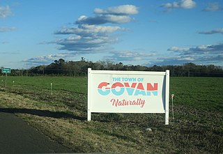
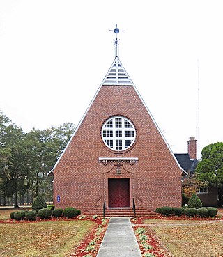
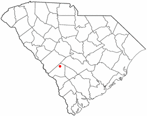
Govan is a town in Bamberg County, South Carolina, United States. The population was 65 at the 2010 census.

<span class="mw-page-title-main">Blackville, South Carolina</span> Town in South Carolina, United States

Blackville is a small town in Barnwell County, South Carolina, United States. The population was 2,406 at the 2010 census.

<span class="mw-page-title-main">Elko, South Carolina</span> Town in South Carolina, United States

Elko is a town in Barnwell County, South Carolina, United States. According to the 2010 census the population was 193.

<span class="mw-page-title-main">Hilda, South Carolina</span> Town in South Carolina, United States

Hilda is a town in Barnwell County, South Carolina, United States. The population was 447 at the 2010 census..

<span class="mw-page-title-main">Kline, South Carolina</span> Town in South Carolina, United States

Kline is a town in Barnwell County, South Carolina, United States. The population was 197 at the 2010 census.

<span class="mw-page-title-main">Snelling, South Carolina</span> Town in South Carolina, United States

Snelling is a town in Barnwell County, South Carolina, United States. The population was 274 at the 2010 census.

<span class="mw-page-title-main">Johnston, South Carolina</span> Town in South Carolina, United States

Johnston is a town in Edgefield County, South Carolina, United States. The population was 2,362 at the 2010 census. It is part of the Augusta, Georgia, metropolitan area. The town's official welcome sign states that it is "Peach Capital of the World".

<span class="mw-page-title-main">Trenton, South Carolina</span> Town in South Carolina, United States

Trenton is a town in Edgefield County, South Carolina, United States. The population was 196 at the 2010 census, down from 226 in 2000.

<span class="mw-page-title-main">Troy, South Carolina</span> Town in South Carolina, United States

Troy is a town in Greenwood County, South Carolina, United States. The population was 93 at the 2010 census.

<span class="mw-page-title-main">Red Bank, South Carolina</span> Census-designated place in South Carolina, United States

Red Bank is an unincorporated community and census-designated place (CDP) in Lexington County, South Carolina, United States. The population was 9,617 at the 2010 census, up from 8,811 at the 2000 census. It is part of the Columbia, South Carolina Metropolitan Statistical Area.

<span class="mw-page-title-main">South Congaree, South Carolina</span> Town in South Carolina, United States

South Congaree is a town in Lexington County, South Carolina, United States. The population was 2,306 at the 2010 census. It is part of the Columbia, South Carolina Metropolitan Statistical Area.

References

  1. "ArcGIS REST Services Directory". United States Census Bureau. Retrieved October 15, 2022.
  2. 1 2 U.S. Geological Survey Geographic Names Information System: Olar, South Carolina
  3. 1 2 "Census Population API". United States Census Bureau. Retrieved October 15, 2022.
  4. 1 2 "U.S. Census website". United States Census Bureau . Retrieved January 31, 2008.
  5. 1 2 "Geographic Identifiers: 2010 Demographic Profile Data (G001): Olar town, South Carolina". U.S. Census Bureau, American Factfinder. Archived from the original on February 12, 2020. Retrieved April 3, 2014.
  6. "National Register Information System". National Register of Historic Places . National Park Service. July 9, 2010.
  7. "US Gazetteer files: 2010, 2000, and 1990". United States Census Bureau. February 12, 2011. Retrieved April 23, 2011.
  8. "Census of Population and Housing". Census.gov. Retrieved June 4, 2015.