Old Greenwich, Connecticut

Last updated

Old Greenwich, Connecticut
Village of Old Greenwich
Fairfield County Connecticut incorporated and unincorporated areas Old Greenwich highlighted.svg
Country Flag of the United States.svg  United States
U.S. state Flag of Connecticut.svg  Connecticut
County Fairfield
Region Western CT
Town Greenwich
Area
  Total3.48 sq mi (9.01 km2)
  Land2.00 sq mi (5.17 km2)
  Water1.48 sq mi (3.84 km2)
Population
 (2010)
  Total6,611
  Density1,900/sq mi (730/km2)
Time zone UTC-5:00 (Eastern)
  Summer (DST) UTC-4:00 (Eastern)
Area code(s) 203/475
FIPS code 09-56900
GNIS feature ID2631571

Old Greenwich is an affluent coastal village in Fairfield County, Connecticut, United States. [1] [2] As of the 2010 census it had a population of 6,611. [3]

Contents

The town of Greenwich is one political and taxing body, but consists of several distinct sections or neighborhoods, such as Byram, Cos Cob, Glenville, Mianus, Old Greenwich, Riverside and Greenwich (sometimes referred to as central, or downtown, Greenwich). Of these neighborhoods, three (Cos Cob, Old Greenwich, and Riverside) have separate postal names and ZIP codes.

History

One of the founding settlers of Old Greenwich was Elizabeth Fones, [4] niece and daughter-in-law of John Winthrop, founder and Governor of the Massachusetts Bay Colony. What is now called Greenwich Point was known for much of its early history as "Elizabeth Neck" in recognition of Elizabeth (Fones) Feake Hallet and her 1640 purchase of the Point and much of the area now known as Old Greenwich. [5]

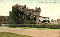
The Old Greenwich Railroad Station, originally called the "Sound Beach Railroad Station", built in 1894 and added to the National Register of Historic Places in 1989, serves commuters in the neighborhood. The town's largest beach is on a long, thin peninsula at the southwest end of the neighborhood. The town's local beach is called Tod's Point after a former resident. The beach is now public property, which belongs to the town of Greenwich. Residents can purchase a seasonal beach pass. Non-residents can purchase a one-day pass for $7 per person and $35 per vehicle. During "off season", Innis Arden, a local golf club, is a popular sledding destination for kids in Old Greenwich and neighboring Stamford.

Old Greenwich was known as "Sound Beach" in the 19th century for its proximity to Long Island Sound, and the main road through the small downtown business section is Sound Beach Avenue.

Old Greenwich had an industrial presence in the 1950s and 1960s when Electrolux had a vacuum manufacturing facility on Forest Avenue, opposite "ECCman Center" (now Greenwich Civic Center). Condé Nast operated a printing facility in Old Greenwich from 1924 to 1964 which published many different magazines, including Vogue, Vanity Fair and House & Garden. [6] [7]

The town of Greenwich has one political body (RTM – Representative Town Meeting). It has several distinct sections each with its own mailing address and ZIP code, such as Byram, Cos Cob, Glenville, Mianus, and Riverside and Greenwich proper (downtown Greenwich). The original "well to do" population lived mainly in "The Back Country" (north of the Merritt Parkway) or in the exclusive Belle Haven area on the waterfront. The town was founded there in 1641.

Geography

According to the U.S. Census Bureau, Old Greenwich has a total area of 3.48 mi2 (9.01 km2), of which 2.00 mi2 (5.17 km2) is land and 1.48 mi2 (3.84 km2), or 42.5%, is water. [8]

Notable people

See also

Related Research Articles

<span class="mw-page-title-main">Fairfield County, Connecticut</span> County in Connecticut, United States

Fairfield County is a county in the southwestern corner of the U.S. state of Connecticut. It is the most populous county in the state and was also its fastest-growing from 2010 to 2020. As of the 2020 census, the county's population was 957,419, representing 26.6% of Connecticut's overall population. The closest to the center of the New York metropolitan area, the county contains four of the state's top 7 largest cities—Bridgeport (1st), Stamford (2nd), Norwalk (6th), and Danbury (7th)—whose combined population of 433,368 is nearly half the county's total population.

<span class="mw-page-title-main">Greenwich, Connecticut</span> Town in Connecticut, United States

Greenwich is a town in southwestern Fairfield County, Connecticut, United States. At the 2020 census, the town had a total population of 63,518. The largest town on Connecticut's Gold Coast, Greenwich is home to many hedge funds and other financial services firms. Greenwich is a principal community of the Bridgeport–Stamford–Norwalk–Danbury metropolitan statistical area, which comprises all of Fairfield County. The town is part of the Western Connecticut Planning Region.

Mianus, formerly Mayamus and Upper Landing, is a neighborhood in the town of Greenwich in the U.S. state of Connecticut. Unlike other Greenwich neighborhoods such as Cos Cob or Old Greenwich, Mianus does not have its own ZIP code or post office. Mianus lies partly in the Cos Cob ZIP code, partly in the Riverside ZIP code area, and partly in the Old Greenwich ZIP code area. It lies at an elevation of 23 feet and is home to an elementary school. Mianus was also home to the Mianus Motor Works, a marine-engine manufacturer.

<span class="mw-page-title-main">Cos Cob, Connecticut</span> Census-designated place in Connecticut, United States

Cos Cob is a neighborhood and census-designated place in the town of Greenwich, Connecticut. It is located on the Connecticut shoreline in southern Fairfield County. It had a population of 6,770 at the 2010 census.

<span class="mw-page-title-main">Interstate 95 in Connecticut</span> Highway in Connecticut

Interstate 95 (I-95) is the main north–south Interstate Highway on the East Coast of the United States, running in a general east–west compass direction for 111.57 miles (179.55 km) in Connecticut, from the New York state line to the Rhode Island state line. I-95 from Greenwich to East Lyme is part of the Connecticut Turnpike, during which it passes through the major cities of Stamford, Bridgeport, and New Haven. After leaving the turnpike in East Lyme, I-95 is known as the Jewish War Veterans Memorial Highway and passes through New London, Groton, and Mystic, before exiting the state through North Stonington at the Rhode Island border.

<span class="mw-page-title-main">Byram, Connecticut</span> Census-designated place in Connecticut, United States

Byram is a neighborhood/section and census-designated place (CDP) in the town of Greenwich in Fairfield County, Connecticut, United States. It had a population of 4,146 at the 2010 census, and a census-estimated population of 4,216 in 2018. An endcap of Connecticut's Gold Coast, Byram is the southernmost point in the town of Greenwich and the U.S. state of Connecticut. It is separated from Port Chester, Westchester County, New York, by the Byram River. Byram was once known as East Port Chester.

<span class="mw-page-title-main">History of Greenwich, Connecticut</span>

The history of Greenwich, Connecticut.

<span class="mw-page-title-main">Greenwich Public Schools</span>

Greenwich Public Schools is a school district located in Fairfield County, in Greenwich, Connecticut. The district has boundaries that are coterminous with those of the town. Approximately 8,840 students, grades K–12, attend the Greenwich Public Schools.

<span class="mw-page-title-main">Riverside, Connecticut</span> Census-designated place in Connecticut, United States

Riverside is a neighborhood/section in the town of Greenwich in Fairfield County, Connecticut, United States. As of the 2020 census, it had a population of 8,843.

<span class="mw-page-title-main">Glenville, Connecticut</span> Census-designated place in Connecticut, United States

Glenville is a neighborhood and census-designated place in the town of Greenwich in Fairfield County, Connecticut, United States. As of the 2010 census, it had a population of 2,327. It is located in the western part of Greenwich at the falls of the Byram River, which provided waterpower when this was a mill village. The area is home to Glenville Elementary school, Western Civic Center and a volunteer fire station, the Glenville Fire Department.

<span class="mw-page-title-main">Riverside Yacht Club</span>

The Riverside Yacht Club is a private, recreational yacht club located in the Riverside neighborhood of Greenwich, Connecticut, with access to Long Island Sound. It is the second oldest yacht club in Connecticut.

<span class="mw-page-title-main">Cos Cob Power Station</span> United States historic place

Cos Cob Power Station was a historic power station near the Metro-North Railroad tracks, the Mianus River and Sound Shore Drive in the Cos Cob area of Greenwich, Connecticut.

<span class="mw-page-title-main">Mianus River Railroad Bridge</span> United States historic place

The Mianus River Railroad Bridge, also known as the Cos Cob Bridge, is a bascule drawbridge built in 1904 over the Mianus River, in Greenwich, Connecticut. It was listed on the National Register of Historic Places in 1987. The bridge carries the Northeast Corridor, the busiest rail line in the United States, both in terms of ridership and service frequency. It is operated by the Metro-North Railroad, successor to Conrail, Penn Central, and the New York, New Haven and Hartford Railroad, which erected it, and is owned by the Connecticut Department of Transportation.

<span class="mw-page-title-main">Pemberwick, Connecticut</span> Census-designated place in Connecticut, United States

Pemberwick is a neighborhood/section and census-designated place in Greenwich in Fairfield County, Connecticut, United States. As of the 2010 census it had a population of 3,680.

The Mianus River Bridge is a span that carries Interstate 95 over the Mianus River, between Cos Cob and Riverside, Connecticut. It is the second bridge on the site. The original bridge collapsed in 1983, killing three motorists. The replacement span is officially named the Michael L. Morano Bridge, after a state senator Michael L. Morano who represented Greenwich.

<span class="mw-page-title-main">Greenwich (CDP), Connecticut</span> Census-designated place in Connecticut, United States

Greenwich is a census-designated place (CDP) in Fairfield County, Connecticut, United States. It is one of several CDPs within the town of Greenwich and corresponds to the historic municipal center of the town and surrounding residential and commercial areas. As of the 2010 census, the population of the Greenwich CDP was 12,942, out of 61,171 in the entire town.

<span class="mw-page-title-main">Greenwich Library</span>

Greenwich Library is the main library in the Greenwich library system of Greenwich, Connecticut, United States. The Greenwich Library system consists of the Main Library and its Byram Shubert and Cos Cob branches.

<span class="mw-page-title-main">River Road-Mead Avenue Historic District</span> Historic district in Connecticut, United States

The River Road-Mead Avenue Historic District encompasses a well-preserved late-19th century upper-class residential area in the Cos Cob area of Greenwich, Connecticut. Extending along River Road between Mead Avenue and Robertson Lane, and along Mead Avenue most of the way to East Putnam Avenue, the district includes fourteen fine houses, most of which were built between 1870 and 1907. The district was listed on the National Register of Historic Places in 1979.

<span class="mw-page-title-main">Gold Coast (Connecticut)</span> Affluent part of southwestern Connecticut, US

The Gold Coast, also known as Lower Fairfield County or Southwestern Connecticut not limited to the Connecticut panhandle, is an affluent part of Western Connecticut that includes the entire southern portion of Fairfield County as defined by the U.S. Census Bureau, Super-Public Use Microdata Area (Super-PUMA) Region 09600. The area is about 50 miles northeast of New York City, and is home to many wealthy Manhattan business executives. Parts of the region are served by the Western Connecticut Council of Governments.

References

  1. Warren, Katie. "People aren't buying the iconic, sprawling mansions in one of America's richest cities, a haven for Wall Street types an hour from NYC. I spent a day there — here's what it was like". Business Insider. Retrieved June 30, 2020.
  2. U.S. Geological Survey Geographic Names Information System: Old Greenwich, Connecticut
  3. "Race, Hispanic or Latino, Age, and Housing Occupancy: 2010 Census Redistricting Data (Public Law 94-171) Summary File (QT-PL), Old Greenwich CDP, Connecticut". United States Census Bureau . Retrieved August 11, 2011.
  4. Mead, Spencer P. Ye Historie of Ye Town of Greenwich (New York: Knickerbocker Press, 1911), pp 4-9
  5. "Friendsofgreenwichpoint.org - Greenwich Point History". Archived from the original on November 17, 2012. Retrieved November 21, 2012.
  6. Merchant, Robert. "Effort afoot to restore Condé Nast pillars in Old Greenwich". Greenwich Time. Hearts CT Media. Retrieved January 22, 2022.
  7. "Condé Nast Publications, Inc. History". Funding Universe. Retrieved January 22, 2022.
  8. "US Gazetteer files: 2019". United States Census Bureau . Retrieved July 19, 2020.

41°01′22″N73°33′53″W / 41.02278°N 73.56472°W / 41.02278; -73.56472