Orient, South Dakota

Last updated

Orient, South Dakota
Town
Faulk County South Dakota Incorporated and Unincorporated areas Orient Highlighted.svg
Location in Faulk County and the state of South Dakota
Coordinates: 44°54′06″N99°05′20″W / 44.90167°N 99.08889°W / 44.90167; -99.08889
CountryUnited States
State South Dakota
County Faulk
Founded1887 [1]
Area
[2]
  Total0.30 sq mi (0.78 km2)
  Land0.29 sq mi (0.76 km2)
  Water0.01 sq mi (0.02 km2)
Elevation
[3]
1,608 ft (490 m)
Population
 (2020) [4]
  Total51
  Density173.47/sq mi (67.05/km2)
Time zone UTC-6 (Central (CST))
  Summer (DST) UTC-5 (CDT)
Area code 605
FIPS code 46-47460 [5]
GNIS feature ID1267525 [3]

Orient is a town in Faulk County, South Dakota, United States. The population was 51 at the 2020 census. [6]

Contents

Orient got its start in 1887 when the Milwaukee Railroad was extended into the area. [7]

Geography

According to the United States Census Bureau, the town has a total area of 0.30 square miles (0.78 km2), of which 0.29 square miles (0.75 km2) is land and 0.01 square miles (0.03 km2) is water. [8]

Demographics

Historical population
CensusPop.Note
1930 302
1940 250−17.2%
1950 206−17.6%
1960 133−35.4%
1970 131−1.5%
1980 87−33.6%
1990 59−32.2%
2000 57−3.4%
2010 6310.5%
2020 51−19.0%
U.S. Decennial Census [9] [4]

2010 census

As of the census [10] of 2010, there were 63 people, 30 households, and 16 families residing in the town. The population density was 217.2 inhabitants per square mile (83.9/km2). There were 38 housing units at an average density of 131.0 per square mile (50.6/km2). The racial makeup of the town was 100.0% White.

There were 30 households, of which 23.3% had children under the age of 18 living with them, 50.0% were married couples living together, 3.3% had a female householder with no husband present, and 46.7% were non-families. 46.7% of all households were made up of individuals, and 20% had someone living alone who was 65 years of age or older. The average household size was 2.10 and the average family size was 3.06.

The median age in the town was 49.1 years. 22.2% of residents were under the age of 18; 6.4% were between the ages of 18 and 24; 9.6% were from 25 to 44; 42.9% were from 45 to 64; and 19% were 65 years of age or older. The gender makeup of the town was 57.1% male and 42.9% female.

2000 census

As of the census [5] of 2000, there were 57 people, 25 households, and 14 families residing in the town. The population density was 183.2 inhabitants per square mile (70.7/km2). There were 38 housing units at an average density of 122.1 per square mile (47.1/km2). The racial makeup of the town was 100.00% White.

There were 25 households, out of which 24.0% had children under the age of 18 living with them, 56.0% were married couples living together, and 44.0% were non-families. 44.0% of all households were made up of individuals, and 20.0% had someone living alone who was 65 years of age or older. The average household size was 2.28 and the average family size was 3.29.

In the town, the population was spread out, with 28.1% under the age of 18, 5.3% from 18 to 24, 28.1% from 25 to 44, 19.3% from 45 to 64, and 19.3% who were 65 years of age or older. The median age was 42 years. For every 100 females, there were 103.6 males. For every 100 females age 18 and over, there were 115.8 males.

The median income for a household in the town was $18,750, and the median income for a family was $37,750. Males had a median income of $0 versus $6,250 for females. The per capita income for the town was $12,849. There were 30.8% of families and 54.5% of the population living below the poverty line, including 100.0% of under eighteens and none of those over 64.

Related Research Articles

<span class="mw-page-title-main">Yale, South Dakota</span> Town in South Dakota, United States

Yale is an incorporated town in Beadle County, South Dakota, United States. The population was 112 at the 2020 census.

<span class="mw-page-title-main">Claremont, South Dakota</span> Town in South Dakota, United States

Claremont is a town in Brown County, South Dakota, United States. The population was 108 at the 2020 census.

<span class="mw-page-title-main">Stratford, South Dakota</span> Town in South Dakota, United States

Stratford is a town in southern Brown County, South Dakota, United States. The population was 57 at the 2020 census.

<span class="mw-page-title-main">Westport, South Dakota</span> Town in South Dakota, United States

Westport is a town in western Brown County, South Dakota, United States. The population was 88 at the 2020 census.

<span class="mw-page-title-main">Wagner, South Dakota</span> City in South Dakota, United States

Wagner is a city in Charles Mix County, South Dakota, United States. The population was 1,490 at the 2020 census. The city is served by Wagner Municipal Airport as well as YST Transit buses.
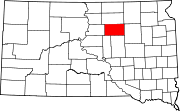
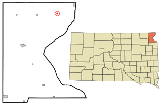
<span class="mw-page-title-main">Bradley, South Dakota</span> Town in South Dakota, United States

Bradley is a town in Clark County, South Dakota, United States. The population was 65 at the 2020 census.

<span class="mw-page-title-main">Hermosa, South Dakota</span> Town in South Dakota, United States

Hermosa is a town near the northern edge of Custer County, South Dakota, United States. The population was 382 at the 2020 census.

<span class="mw-page-title-main">Andover, South Dakota</span> Town in South Dakota, United States

Andover is a town in northwestern Day County, South Dakota, United States. The population was 66 at the 2020 census.

<span class="mw-page-title-main">Pierpont, South Dakota</span> Town in South Dakota, United States

Pierpont is a town in northwestern Day County, South Dakota, United States. The population was 129 at the 2020 census.

<span class="mw-page-title-main">Clear Lake, South Dakota</span> City in South Dakota, United States

Clear Lake is a city in and the county seat of Deuel County, South Dakota, United States. The population was 1,218 at the 2020 census.

<span class="mw-page-title-main">Onaka, South Dakota</span> Town in South Dakota, United States

Onaka is a town in Faulk County, South Dakota, United States. The population was 13 at the 2020 census.

<span class="mw-page-title-main">Revillo, South Dakota</span> Town in South Dakota, United States

Revillo is a town in southeastern Grant County, South Dakota, United States. The population was 99 at the 2020 census.

<span class="mw-page-title-main">Stockholm, South Dakota</span> Town in South Dakota, United States

Stockholm is a town in Grant County, South Dakota, United States. The population was 102 at the 2020 census.

<span class="mw-page-title-main">Hazel, South Dakota</span> Town in South Dakota, United States

Hazel is a town in Hamlin County, South Dakota, United States. It is part of the Watertown, South Dakota Micropolitan Statistical Area. The population was 102 at the 2020 census.

<span class="mw-page-title-main">Long Lake, South Dakota</span> Town in South Dakota, United States

Long Lake is a town in McPherson County, South Dakota, United States. The population was 27 at the 2020 census.

<span class="mw-page-title-main">Wetonka, South Dakota</span> Town in South Dakota, United States

Wetonka is a town in McPherson County, South Dakota, United States. The population was 16 at the 2020 census.

<span class="mw-page-title-main">Sherman, South Dakota</span> Town in South Dakota, United States

Sherman is a town in Minnehaha County, South Dakota, United States. The population was 81 at the 2020 census.

<span class="mw-page-title-main">Corona, South Dakota</span> Town in South Dakota, United States

Corona is a town in Roberts County, South Dakota, United States. The population was 69 at the 2020 census.

<span class="mw-page-title-main">Rosholt, South Dakota</span> Town in South Dakota, United States

Rosholt is a town in Roberts County, South Dakota, United States. The population was 379 at the 2020 census.

<span class="mw-page-title-main">Tulare, South Dakota</span> Town in South Dakota, United States

Tulare is a town in Spink County, South Dakota, United States. The population was 211 at the 2020 census.

References

  1. "SD Towns" (PDF). South Dakota State Historical Society . Retrieved February 14, 2010.
  2. "ArcGIS REST Services Directory". United States Census Bureau. Retrieved October 15, 2022.
  3. 1 2 U.S. Geological Survey Geographic Names Information System: Orient, South Dakota
  4. 1 2 "Census Population API". United States Census Bureau. Retrieved October 15, 2022.
  5. 1 2 "U.S. Census website". United States Census Bureau . Retrieved January 31, 2008.
  6. "U.S. Census Bureau: Orient town, South Dakota". www.census.gov. United States Census Bureau. Retrieved March 25, 2022.
  7. Federal Writers' Project (1940). South Dakota place-names, v.1-3. University of South Dakota. p. 52.
  8. "US Gazetteer files 2010". United States Census Bureau. Archived from the original on January 12, 2012. Retrieved June 21, 2012.
  9. "Census of Population and Housing". Census.gov. Retrieved June 4, 2015.
  10. "U.S. Census website". United States Census Bureau . Retrieved June 21, 2012.