Palisade, Nebraska | |
---|---|
Coordinates: 40°20′54″N101°06′27″W / 40.34833°N 101.10750°W | |
Country | United States |
State | Nebraska |
Counties | Hitchcock, Hayes |
Area | |
• Total | 0.35 sq mi (0.92 km2) |
• Land | 0.35 sq mi (0.92 km2) |
• Water | 0.00 sq mi (0.00 km2) |
Elevation | 2,763 ft (842 m) |
Population (2020) | |
• Total | 294 |
• Density | 828.17/sq mi (319.74/km2) |
Time zone | UTC-6 (Central (CST)) |
• Summer (DST) | UTC-5 (CDT) |
ZIP code | 69040 |
Area code | 308 |
FIPS code | 31-38130 [3] |
GNIS feature ID | 2399611 [2] |
Palisade is a village in Hayes and Hitchcock counties in the U.S. state of Nebraska. The population was 294 at the 2020 census.
Palisade was established at its current site in 1882, when the railroad was extended to that point. [4] It was named from the terrain around the town, which was thought to resemble a palisade. [5]
Most of the village is located in Hitchcock County; only a small portion extends into Hayes County.
According to the United States Census Bureau, the village has a total area of 0.36 square miles (0.93 km2), all land. [6]
Census | Pop. | Note | %± |
---|---|---|---|
1890 | 126 | — | |
1900 | 176 | 39.7% | |
1910 | 380 | 115.9% | |
1920 | 527 | 38.7% | |
1930 | 731 | 38.7% | |
1940 | 799 | 9.3% | |
1950 | 694 | −13.1% | |
1960 | 544 | −21.6% | |
1970 | 372 | −31.6% | |
1980 | 401 | 7.8% | |
1990 | 381 | −5.0% | |
2000 | 386 | 1.3% | |
2010 | 351 | −9.1% | |
2020 | 294 | −16.2% | |
U.S. Decennial Census [7] |
As of the census [8] of 2010, there were 351 people, 162 households, and 97 families residing in the village. The population density was 975.0 inhabitants per square mile (376.4/km2). There were 195 housing units at an average density of 541.7 per square mile (209.2/km2). The racial makeup of the village was 98.9% White and 1.1% Native American.
There were 162 households, of which 22.8% had children under the age of 18 living with them, 50.6% were married couples living together, 8.0% had a female householder with no husband present, 1.2% had a male householder with no wife present, and 40.1% were non-families. 37.7% of all households were made up of individuals, and 17.9% had someone living alone who was 65 years of age or older. The average household size was 2.17 and the average family size was 2.87.
The median age in the village was 47.3 years. 21.7% of residents were under the age of 18; 6.8% were between the ages of 18 and 24; 18.5% were from 25 to 44; 28.8% were from 45 to 64; and 24.2% were 65 years of age or older. The gender makeup of the village was 50.1% male and 49.9% female.
As of the census [3] of 2000, there were 386 people, 162 households, and 109 families residing in the village. The population density was 1,081.7 inhabitants per square mile (417.6/km2). There were 188 housing units at an average density of 526.8 per square mile (203.4/km2). The racial makeup of the village was 96.63% White, 0.26% African American, 0.52% Native American, and 2.59% from two or more races. Hispanic or Latino of any race were 0.78% of the population.
There were 162 households, out of which 26.5% had children under the age of 18 living with them, 56.2% were married couples living together, 9.9% had a female householder with no husband present, and 32.7% were non-families. 30.2% of all households were made up of individuals, and 21.0% had someone living alone who was 65 years of age or older. The average household size was 2.38 and the average family size was 2.98.
In the village, the population was spread out, with 27.7% under the age of 18, 6.0% from 18 to 24, 23.1% from 25 to 44, 20.5% from 45 to 64, and 22.8% who were 65 years of age or older. The median age was 40 years. For every 100 females, there were 87.4 males. For every 100 females age 18 and over, there were 82.4 males.
The median income for a household in the village was $25,417, and the median income for a family was $31,635. Males had a median income of $21,875 versus $18,750 for females. The per capita income for the village was $13,106. About 12.9% of families and 20.8% of the population were below the poverty line, including 38.0% of those under age 18 and 9.5% of those age 65 or over.
Every year in June, Palisade stages a weekend-long "Palisade Pioneer Days" celebration. The emphasis is on Palisade High School alumni; the event includes games, meals, and a parade. [9] [10]
Hitchcock County is a county in the U.S. state of Nebraska. As of the 2020 United States Census, the population was 2,616. Its county seat is Trenton.
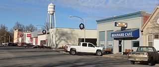
Brainard is a village in Butler County, Nebraska, United States. The population was 330 at the 2010 census.
Callaway is a village in Custer County, Nebraska, United States. The population was 539 at the 2010 census.
Waterloo is a village in Douglas County, Nebraska, United States. The population was 935 at the 2020 census.
Haigler is a village in southwestern Dundy County, Nebraska, United States. The population was 158 at the 2010 census.
Campbell is a village in Franklin County, Nebraska, United States. The population was 347 at the 2010 census.
Wolbach is a village in Greeley county, Nebraska, United States. The population was 283 at the time of the 2010 census.
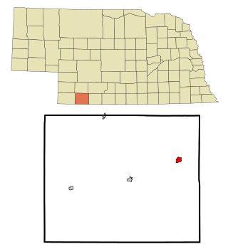
Culbertson is a village in Hitchcock County, Nebraska, United States. The population was 534 at the 2020 census.
Stratton is a village in Hitchcock County, Nebraska, United States. The population was 310 at the 2020 census.
Trenton is a village in Hitchcock County, Nebraska, United States. The population was 516 at the 2020 census. It is the county seat of Hitchcock County.
Chambers is a village in Holt County, Nebraska, United States. The population was 268 at the 2010 census.
Dannebrog is a village in Howard County, Nebraska, United States. It is part of the Grand Island, Nebraska Micropolitan Statistical Area. The population was 303 at the 2010 census.
Bushnell is a village in Kimball County, Nebraska, United States. The population was 124 at the 2010 census.
Meadow Grove is a village in Madison County, Nebraska, United States. It is part of the Norfolk, Nebraska Micropolitan Statistical Area. The population was 301 at the 2010 census.
Belgrade is a village in Nance County, Nebraska, United States. The population was 126 at the 2010 census.
Loomis is a village in Phelps County, Nebraska, United States. The population was 383 at the 2010 census.
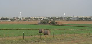
Lyman is a village in Scotts Bluff County, Nebraska, United States. It is part of the Scottsbluff, Nebraska Micropolitan Statistical Area. The population was 341 at the 2010 census.
Bruning is a village in Thayer County, Nebraska, United States. The population was 285 at the 2020 census.
Byron is a village in Thayer County, Nebraska, United States, and its south edge is the Nebraska-Kansas state border. The population was 85 at the 2020 census.
Guide Rock is a village in Webster County, Nebraska, United States. The population was 225 at the 2010 census.
Media related to Palisade, Nebraska at Wikimedia Commons