Paradise Hill, Oklahoma

Last updated
Paradise Hill, Oklahoma
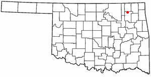
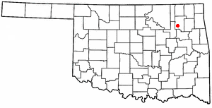
OKMap-doton-ParadiseHill.PNG
Location of Paradise Hill, Oklahoma
Coordinates: 35°37′26″N95°4′14″W / 35.62389°N 95.07056°W / 35.62389; -95.07056 Coordinates: 35°37′26″N95°4′14″W / 35.62389°N 95.07056°W / 35.62389; -95.07056
Country United States
State Oklahoma
County Sequoyah
Area
[1]
  Total0.56 sq mi (1.46 km2)
  Land0.56 sq mi (1.45 km2)
  Water0.00 sq mi (0.00 km2)
Elevation
846 ft (258 m)
Population
 (2020)
  Total73
  Density129.89/sq mi (50.19/km2)
Time zone UTC-6 (Central (CST))
  Summer (DST) UTC-5 (CDT)
FIPS code 40-57150 [2]
GNIS feature ID1096427 [3]

Paradise Hill is a town in the northwest corner of Sequoyah County, Oklahoma, United States. It is part of the Fort Smith, Arkansas-Oklahoma Metropolitan Statistical Area. The population was 85 at the 2010 census, a decline from the figure of 100 recorded in 2000. [4]

Contents

History

Paradise Hill is a relatively new town, having originated in 1954 on the shore of Tenkiller Ferry Lake. There were 47 permanent homes by 1962. The town had already incorporated and owned its own water system. It more than doubled its physical size by 1969 by annexing adjacent land. [4]

Geography

Paradise Hill is located at 35°37′26″N95°4′14″W / 35.62389°N 95.07056°W / 35.62389; -95.07056 (35.624009, -95.070563). [5]

According to the United States Census Bureau, the town has a total area of 0.5 square miles (1.3 km2), of which 0.5 square miles (1.3 km2) is land and 1.89% is water.

Demographics

Historical population
CensusPop.
1970 87
1980 15477.0%
1990 88−42.9%
2000 10013.6%
2010 85−15.0%
2020 73−14.1%
U.S. Decennial Census [6]

As of the census [2] of 2000, there were 100 people, 45 households, and 31 families residing in the town. The population density was 191.6 inhabitants per square mile (74.0/km2). There were 105 housing units at an average density of 201.2 per square mile (77.7/km2). The racial makeup of the town was 76.00% White, 6.00% Native American, 1.00% from other races, and 17.00% from two or more races. Hispanic or Latino of any race were 4.00% of the population.

There were 45 households, out of which 22.2% had children under the age of 18 living with them, 64.4% were married couples living together, 4.4% had a female householder with no husband present, and 31.1% were non-families. 28.9% of all households were made up of individuals, and 11.1% had someone living alone who was 65 years of age or older. The average household size was 2.22 and the average family size was 2.74.

In the town, the population was spread out, with 17.0% under the age of 18, 5.0% from 18 to 24, 22.0% from 25 to 44, 27.0% from 45 to 64, and 29.0% who were 65 years of age or older. The median age was 48 years. For every 100 females, there were 78.6 males. For every 100 females age 18 and over, there were 80.4 males.

The median income for a household in the town was $30,500, and the median income for a family was $38,125. Males had a median income of $43,333 versus $48,750 for females. The per capita income for the town was $22,835. There were 8.0% of families and 12.4% of the population living below the poverty line, including no under eighteens and 7.4% of those over 64.

Related Research Articles

<span class="mw-page-title-main">Evening Shade, Arkansas</span> City in Arkansas, United States

Evening Shade is a city in southwest Sharp County, Arkansas, United States. The population was 432 at the 2010 census.

<span class="mw-page-title-main">Jackman, Maine</span> Town in Maine, United States

Jackman is a town in Somerset County, Maine, United States. The population was 782 at the 2020 census.

Moscow is a town in Somerset County, Maine, United States. The population was 475 at the 2020 census.

<span class="mw-page-title-main">Watson, Missouri</span> Village in Missouri

Watson is a village in Nishnabotna Township, Atchison County, Missouri, United States. The population was 61 at the 2020 census. It is the westernmost settlement in the state of Missouri, about 120 miles northwest of Kansas City.

<span class="mw-page-title-main">Rockville, Missouri</span> City in Missouri, United States

Rockville is a city in Bates County, Missouri, and is part of the Kansas City metropolitan area within the United States. The population was 166 at the 2010 census.

<span class="mw-page-title-main">Lumber Bridge, North Carolina</span> Town in North Carolina, United States

Lumber Bridge is a town in Robeson County, North Carolina, United States. The population was 94 at the 2010 census.

<span class="mw-page-title-main">Renfrow, Oklahoma</span> Town in Oklahoma, United States

Renfrow is a town in Grant County, Oklahoma, United States. The population was 12 at the 2010 census, a decline of 33.3 percent from the figure of 16 at the 2000 census.

<span class="mw-page-title-main">Warwick, Oklahoma</span> Town in Oklahoma, United States

Warwick is a town in Lincoln County, Oklahoma, United States. The population was 148 at the 2010 census, down from 235 in 2000.

<span class="mw-page-title-main">Wellston, Oklahoma</span> Town in Oklahoma, United States

Wellston is a town in Lincoln County, Oklahoma, United States. The population was 788 at the 2010 census.

<span class="mw-page-title-main">Strang, Oklahoma</span> Town in Oklahoma, United States

Strang is a town in Mayes County, Oklahoma, United States. The population was 100 at the 2000 census.

<span class="mw-page-title-main">Millerton, Oklahoma</span> Town in Oklahoma, United States

Millerton is a town in McCurtain County, Oklahoma, United States. The population was 359 at the 2000 census.

<span class="mw-page-title-main">Hanna, Oklahoma</span> Town in Oklahoma, United States

Hanna is a town in southwestern McIntosh County, Oklahoma, United States. The population was 138 at the 2010 census, an increase of 3.8 percent from 133 in 2000. It was named for Hanna Bullett, the daughter of a prominent early resident.

<span class="mw-page-title-main">Council Hill, Oklahoma</span> Town in Oklahoma, United States

Council Hill is a town in Muskogee County, Oklahoma, United States. The population was 158 at the 2010 census, an increase of 28.5 percent over the figure of 129 recorded in 2000.

<span class="mw-page-title-main">Kiowa, Oklahoma</span> Town in Oklahoma, United States

Kiowa is a town in Pittsburg County, Oklahoma, United States. The population was 731 at the 2010 census.

Pittsburg is a town in Pittsburg County, Oklahoma, United States. The population was 280 at the 2000 census.

<span class="mw-page-title-main">Quinton, Oklahoma</span> Town in Oklahoma, United States

Quinton is a town in Pittsburg County, Oklahoma, United States. The population was 1,051 at the 2010 census. The town was named for Elizabeth Quinton, who lived to be 116 years old. Her family still resides in and around the town of Quinton.

<span class="mw-page-title-main">Foyil, Oklahoma</span> Town in Oklahoma, United States

Foyil is a town in Rogers County, Oklahoma, United States. It was named for Alfred Foyil, a local landowner and the first postmaster of the town. The population was 344 at the 2010 census, a 47.0 percent increase over the figure of 234 recorded in 2000.

<span class="mw-page-title-main">Jamestown, Oklahoma</span> Unincorporated community in Oklahoma, United States

Jamestown is an unincorporated community in Rogers County, Oklahoma, United States. The population was 10 at the 2000 census, at which time it was a town; the community disincorporated in 1998, but the change was not reported to the Census Bureau until 2006.
<span class="mw-page-title-main">Valley Park, Oklahoma</span> Town in Oklahoma, United States

Valley Park is a town in Rogers County, Oklahoma, United States. The population was 77 at the 2010 census, up 221 percent from the figure of 24 recorded in 2000.

<span class="mw-page-title-main">Fair Oaks, Oklahoma</span> Town in Oklahoma, United States

Fair Oaks is a town in Rogers and Wagoner counties in the U.S. state of Oklahoma. The population was 103 at the 2010 census, a 15.6 percent decline from the figure of 122 recorded in 2000. It is a suburb of Tulsa.

References

  1. "ArcGIS REST Services Directory". United States Census Bureau. Retrieved September 20, 2022.
  2. 1 2 "U.S. Census website". United States Census Bureau . Retrieved 2008-01-31.
  3. "US Board on Geographic Names". United States Geological Survey. 2007-10-25. Retrieved 2008-01-31.
  4. 1 2 Larry O'Dell, "Paradise Hill," Encyclopedia of Oklahoma History and Culture. Accessed March 18, 2015.
  5. "US Gazetteer files: 2010, 2000, and 1990". United States Census Bureau. 2011-02-12. Retrieved 2011-04-23.
  6. "Census of Population and Housing". Census.gov. Retrieved June 4, 2015.