
Hughes Bay is a bay lying between Cape Sterneck and Cape Murray along the west coast of the Antarctic Peninsula. It is 42 kilometres (26 mi) wide and lies south of Chavdar Peninsula and north of Pefaur (Ventimiglia) Peninsula, indenting the Danco Coast on the west side of Graham Land for 20 kilometres (12 mi).

Mount Zeppelin is an Antarctic mountain, 1,265 m, standing 3 miles (4.8 km) southeast of Eckener Point on Pefaur (Ventimiglia) Peninsula, Danco Coast on the west coast of Graham Land. It surmounts Poduene Glacier to the north. Mount Zeppelin was charted by the Belgian Antarctic Expedition under Gerlache, 1897–99. Named by the United Kingdom Antarctic Place-Names Committee (UK-APC) in 1960 for Count Ferdinand von Zeppelin (1838-1917), German aeronautical engineer who perfected the large-scale rigid airship, 1894–1917.
Bozhinov Glacier is the 5 km long and 2.5 km wide glacier on Danco Coast in Graham Land on the Antarctic Peninsula situated north of Krebs Glacier and south of Nobile Glacier. Flowing westwards to enter Gerlache Strait at Kapisturia Cove in Charlotte Bay.
Sigmen Glacier is a 2.2 km long and 2 km wide glacier draining the northwest slopes of Brugmann Mountains on Liège Island in the Palmer Archipelago, Antarctica. It is situated northeast of Zbelsurd Glacier and southwest of Shterna Glacier, draining the west-southwest slopes of Vazharov Peak and the northwest slopes of Mount Kozyak, and flows northwestwards to enter Palakariya Cove.

Ogoya Glacier is the 8 km long and 3 km wide glacier on Trinity Peninsula, Antarctic Peninsula. Situated west-northwest of Laclavère Plateau, northwest of Broad Valley and northeast of Sestrimo Glacier. Draining the northeast slopes of Morro del Paso Peak, the north side of Misty Pass and the northwest slopes of Dabnik Peak, and flowing northwards to enter Huon Bay in Bransfield Strait.
Poduene Glacier is the 3.3 km long and 2.4 km wide glacier on Pefaur (Ventimiglia) Peninsula, Danco Coast on the west side of Antarctic Peninsula, situated west of Agalina Glacier. It drains the north slopes of Mount Zeppelin, and flows northwestwards into Gerlache Strait east of Eckener Point.
Agalina Glacier is a 4.8 km (3.0 mi) long and 2.9 km (1.8 mi) wide glacier on Pefaur (Ventimiglia) Peninsula, Danco Coast on the west side of Antarctic Peninsula, situated east of Poduene Glacier and west of Krapets Glacier. It drains northwards, and flows into both Graham Passage and the west arm of Salvesen Cove.
Krapets Glacier is the 3.5 km long and 1.4 km wide glacier on Pefaur (Ventimiglia) Peninsula, Danco Coast on the west side of Antarctic Peninsula, situated east of Agalina Glacier and west of Zimzelen Glacier. It drains northwards, and flows into the east arm of Salvesen Cove.
Zimzelen Glacier is the 3.7 km long and 2.5 km wide glacier on Pefaur (Ventimiglia) Peninsula, Danco Coast on the west side of Antarctic Peninsula, situated east of Krapets Glacier and west of Blériot Glacier It drains northwards, and flowing into the east arm of Salvesen Cove.

Butamya Glacier is the 6.9 km long and 2.5 km wide glacier on Barison Peninsula, Graham Coast on the west side of Antarctic Peninsula, situated northwest of Talev Glacier and north-northeast of Chernomen Glacier. It drains northwards, and flows into Beascochea Bay.
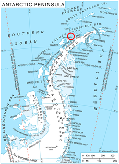
Murray Harbour is a small harbor lying east of Cape Murray on the north side of Murray Island, off the west coast of Pefaur (Ventimiglia) Peninsula on Danco Coast, Graham Land. The name was used by whalers in the area in 1922.
Eckener Point is a point marking both the northeast side of the entrance to Charlotte Bay and the west side of the entrance to Latinka Cove, and forming the western extremity of Pefaur (Ventimiglia) Peninsula on the west coast of Graham Land. It was first roughly charted by the Belgian Antarctic Expedition under Gerlache, 1897–99. It was named by the UK Antarctic Place-Names Committee in 1960 for Hugo Eckener, a German pioneer of airship aviation who was president of Aeroarctic, an international society for exploration of the Arctic with airships, 1929–37. He piloted the Graf Zeppelin for more than 600 flights including a major Arctic flight in 1931.
Valdivia Point is a point forming both the northwest side of the entrance to Salvesen Cove and the north extremity of Pefaur (Ventimiglia) Peninsula on Danco Coast, Graham Land in Antarctica. Charted and named Valdivia Insel, after the German ship Valdivia, by the Swedish Antarctic Expedition under Nordenskjold, 1901–04. Air photos taken by the Falkland Islands and Dependencies Aerial Survey Expedition (FIDASE) in 1956-57 show the feature to be joined to the mainland.
Cape Murray is a cape forming the western end of Murray Island just off the west coast of Pefaur (Ventimiglia) Peninsula in Graham Land, Antarctica, separating Hughes Bay to the northeast from Charlotte Bay to the south. First charted by the 1897-99 Belgian Antarctic Expedition under Lt. Adrien de Gerlache, and considered at the time as joined to the mainland. Named by Gerlache, presumably for Sir John Murray, British marine zoologist and oceanographer, an ardent advocate of Antarctic research.
Barison Peninsula is the mostly ice-covered peninsula projecting 19 km in northwest direction from Graham Coast in Graham Land, Antarctica. It is 12 km wide between Beascochea Bay to the northeast and Leroux Bay to the southwest. The area was possibly visited by the 1897–99 Belgian expedition under Adrien de Gerlache and the 1903–05 French expedition under Jean Charcot.

Magnier Peninsula is the mostly ice-covered peninsula projecting 18 km in northwest direction from Graham Coast in Graham Land, Antarctica. It is 17 km wide between Leroux Bay to the northeast and Bigo Bay to the southwest. Magnier Peaks rise in the northern part of the peninsula, while Lisiya Ridge occupy its base.
Binkos Point is the point on the northeast side of the entrance to Latinka Cove on the northwest coast of Pefaur (Ventimiglia) Peninsula, Danco Coast on the Antarctic Peninsula.
Latinka Cove is the 1.95 km wide cove indenting for 1.65 km the northwest coast of Pefaur (Ventimiglia) Peninsula, Danco Coast on the Antarctic Peninsula. It is entered east of Eckener Point and west of Binkos Point. The head of the cove is fed by Poduene Glacier.

Felipe Solo (Obligado) Peninsula is the heavily glaciated 13.5 km wide peninsula projecting 19.8 km in northwest direction from Danco Coast on the west side of Graham Land, Antarctica. It is bounded by Barilari Bay to the southwest and Bigo Bay to the northeast, ending in Cape Garcia to the northwest, and separated from Biscoe Islands to the northwest by Grandidier Channel.

Glogovo Passage is the 110 metre wide passage between Zverino Island on the west-southwest and Cave Island on the east-northeast in the Meade group off Archar Peninsula, the northwest extremity of Greenwich Island in the South Shetland Islands.

