Lincoln most commonly refers to:

Wisconsin is a state in the upper Midwestern United States. Wisconsin is the 25th-largest state by total area and the 20th-most populous. It is bordered by Minnesota to the west, Iowa to the southwest, Illinois to the south, Lake Michigan to the east, Michigan to the northeast, and Lake Superior to the north.

Waupaca County is a county in the U.S. state of Wisconsin. As of the 2020 census, the population was 51,812. The county seat is Waupaca. The county was created in 1851 and organized in 1853. It is named after the Waupaca River, a Menominee language name meaning 'white sand bottom', 'pale water', or 'tomorrow river'.

Racine County is a county in southeastern Wisconsin. As of the 2020 census, its population was 197,727, making it Wisconsin's fifth-most populous county. Its county seat is Racine. The county was founded in 1836, then a part of the Wisconsin Territory. Racine County comprises the Racine metropolitan statistical area. This area is part of the Milwaukee-Racine-Waukesha combined statistical area. According to the U.S. Census Bureau, the county has an area of 792 square miles (2,050 km2), of which 333 square miles (860 km2) is land and 460 square miles (1,200 km2) (58%) is water. The county's unemployment rate was 5.6% in June 2021.

Union County is a county located in the southern part of the U.S. state of Iowa. As of the 2020 census, the population was 12,138. The county seat is Creston. Organized at a time of tensions before the Civil War, the county was named in 1853 for the union that people wanted to preserve. The rural county's peak of population was in 1930. Its economy is based on agriculture and related industries.

Petersville is a census-designated place (CDP) in Matanuska-Susitna Borough, Alaska, United States. It is part of the Anchorage Metropolitan Area. The population was 27 at the 2020 census.

Trapper Creek is a census-designated place (CDP) in Matanuska-Susitna Borough, Alaska, United States. It is part of the Anchorage Metropolitan Area and is known as the southern gateway to Denali State Park. According to the 2020 census the population of Trapper Creek was 499.
Iola is a town in Waupaca County, Wisconsin, United States. The population was 818 at the 2000 census. The Village of Iola is located partially within the town. The ghost town of Petersville was also located in the town.

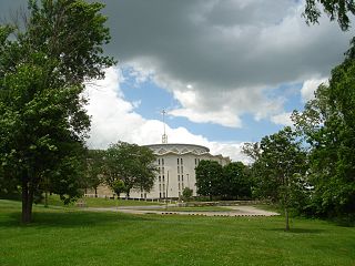
Sinsinawa is an unincorporated community in Grant County, Wisconsin, United States. The community is in the towns of Jamestown and Hazel Green, one mile north of the border with Illinois. The community is 7+1⁄2 miles (12.1 km) east of Dubuque, Iowa, and 6+1⁄2 miles (10.5 km) west of the village of Hazel Green, Wisconsin. The town is best known for being the mother house of the Sinsinawa Dominican Sisters.

Maryland Route 17 is a state highway in the U.S. state of Maryland. The state highway begins at the Virginia state line at the Potomac River in Brunswick, where the highway continues south as Virginia State Route 287. MD 17 runs 29.49 miles (47.46 km) north from the Brunswick Bridge to the Frederick–Washington county line near Wolfsville. The state highway serves as the main north–south highway of the Middletown Valley of western Frederick County. MD 17 connects Brunswick and Wolfsville with Rosemont, Burkittsville, Middletown, and Myersville. The state highway also connects those communities with the valley's main east–west highways, which include U.S. Route 340, US 40 Alternate, Interstate 70 (I-70), and US 40.
The following is a set–index article, providing a list of lists, for the cities, towns and villages within the jurisdictional United States. It is divided, alphabetically, according to the state, territory, or district name in which they are located.

Petersville is an unincorporated community in Clay Township, Bartholomew County, in the U.S. state of Indiana.

The Anchorage Metropolitan Statistical Area, as defined by the United States Census Bureau, is an area consisting of the Municipality of Anchorage and the Matanuska-Susitna Borough in the south central region of Alaska.
Petersville was an Australian food production company.

The following is an alphabetical list of articles related to the U.S. state of Wisconsin.
Petersville is an unincorporated community in Eliza Township, Mercer County, Illinois, United States. Petersville is 6.5 miles (10.5 km) north-northwest of Joy. The Mayor of Petersville is Michael Frazier.
Cloverdale, also known as Raw Hide, is an unincorporated community in Lauderdale County, Alabama, United States. Cloverdale is located on Alabama State Route 157, 11 miles (18 km) north-northwest of Florence. Cloverdale has a post office with ZIP code 35617, which opened on April 8, 1872.

Petersville is a civil parish in Queens County, New Brunswick, Canada.
Petersville is an unincorporated community in Frederick County, Maryland, United States. Petersville is located at the junction of Maryland routes 79 and 180, 1.3 miles (2.1 km) northeast of Rosemont.

Petersville is an unincorporated community in Clinton County, in the U.S. state of Iowa.


