
Brookline is a town in Norfolk County, Massachusetts, United States, and part of the Boston metropolitan area. Brookline borders six of Boston's neighborhoods: Brighton, Allston, Fenway–Kenmore, Mission Hill, Jamaica Plain, and West Roxbury. The city of Newton lies to the west of Brookline. Brookline was first settled in 1638 as a hamlet in Boston, known as Muddy River; it was incorporated as a separate town in 1705.

Chestnut Hill is a wealthy New England village located six miles (10 km) west of downtown Boston, Massachusetts, United States. It is best known for being home to Boston College and a section of the Boston Marathon route. Like all Massachusetts villages, Chestnut Hill is not an incorporated municipal entity. It is located partially in Brookline in Norfolk County; partially in the city of Boston in Suffolk County, and partially in the city of Newton in Middlesex County. Chestnut Hill's borders are defined by the 02467 ZIP Code. The name refers to several small hills that overlook the 135-acre Chestnut Hill Reservoir rather than one particular hill.

The Emerald Necklace consists of a 1,100-acre chain of parks linked by parkways and waterways in Boston and Brookline, Massachusetts. It was designed by landscape architect Frederick Law Olmsted, and gets its name from the way the planned chain appears to hang from the "neck" of the Boston peninsula. In 1989, the Emerald Necklace was designated as a Boston Landmark by the Boston Landmarks Commission.

Frederick Law Olmsted National Historic Site is a United States National Historic Site located in Brookline, Massachusetts, a suburb of Boston. Frederick Law Olmsted (1822–1903) is recognized as the founder of American landscape architecture and the nation's foremost parkmaker of the 19th century. In 1883, Olmsted moved his home to suburban Boston and established "Fairsted", the world's first full-scale professional office for the practice of landscape design. Over the course of the next century, his sons and successors expanded and perpetuated Olmsted's design ideals, philosophy, and influence.
The John Fitzgerald Kennedy National Historic Site is the birthplace and childhood home of John F. Kennedy, the 35th president of the United States. The house is at 83 Beals Street in the Coolidge Corner neighborhood of Brookline, Massachusetts. Kennedy is one of four U.S. presidents born in Norfolk County, Massachusetts. The property is now owned by the National Park Service; tours of the house are offered, and a film is presented.

Mission Hill is a 3⁄4 square mile, primarily residential neighborhood of Boston, bordered by Roxbury, Jamaica Plain and Fenway-Kenmore and the town of Brookline. The neighborhood has two main streets, namely Tremont Street and Huntington Ave. It is served by several stations on the MBTA's Green Line E branch, as well as Roxbury Crossing station on the Orange Line.

Larz Anderson Park is a wooded, landscaped, and waterscaped 64-acre (26 ha) parkland in Brookline, Massachusetts that is listed on the National Register of Historic Places. The southwest corner of the park is in Boston. The park contains playing fields, picnic areas, gardens, waterways, an ice skating rink, and two sites of special interest:

The following properties in Newton, Massachusetts are listed on the National Register of Historic Places. They are a subset of all properties in Middlesex County. There are over 180 places listed in Newton.

The Chestnut Hill Reservoir Historic District is a historic district encompassing the Chestnut Hill Reservoir and the surrounding water works facilities which were historically used to provide fresh water to Boston, Massachusetts, and surrounding towns. The district is nearly coextensive with the Chestnut Hill Reservation, a state park managed by the Massachusetts Department of Conservation and Recreation (DCR); those elements of the water works that are still required as an emergency backup are managed by the Massachusetts Water Resources Authority (MWRA). The reservoir is located between Beacon Street and Commonwealth Avenue in Boston's Chestnut Hill district, just east of the Boston College Main Campus Historic District.

Bellevue Standpipe is a historic water storage tank on Bellevue Hill at Washington Street and West Roxbury Parkway in the Stony Brook Reservation of Boston, Massachusetts. Built in 1914, it is one of three early 20th-century water tanks built as part of Greater Boston's public water supply. The structure was added to the National Register of Historic Places in 1990.

The Commonwealth Avenue Historic District of Newton, Massachusetts, encompasses roughly the eastern half of Commonwealth Avenue, extending from Waban Hill Road, near the city line with Boston, westward to Walnut Street. The roadway was laid out in 1894 and completed in 1895. Its design was influenced in part by the local residents, who were willing to give land for some of the route, and the design of Boston portions of the road, in which Frederick Law Olmsted was involved. Construction of the roadway was followed by the construction of fashionably large residences along its route, which took place mostly between the road's construction and about 1920. The district includes 188 residential properties, which are mainly built in the revival styles popular in the early 20th century. The district was added to the National Register of Historic Places in 1990.
Pill Hill, also known as "High Street Hill," is a neighborhood of Brookline, Massachusetts, United States, and part of Greater Boston.

Brookline Village is one of the major commercial and retail centers of the town of Brookline, Massachusetts. Located just north of Massachusetts Route 9 and west of the Muddy River, it is the historic center of the town and includes its major civic buildings, including town hall and the public library. The commercial spine of the village, extending along Washington Street from Route 9 to the library, is a historic district listed on the National Register of Historic Places as the Brookline Village Commercial District.

The Fisher Hill Reservoir and Gatehouse are historic elements of the public water supply for the Greater Boston area.

Hammond Pond Parkway is a historic parkway in Chestnut Hill, Massachusetts. The road, built in 1932, extends 2 miles (3.2 km) from Hobart Road in Newton to Horace James Circle in Brookline, where it joins the West Roxbury Parkway. It was designed by Charles Eliot and the Olmsted Brothers to provide a parkway setting that provided access from Brookline, Newton, and the western portions of Boston to the southern parks of the Emerald Necklace. The parkway was listed on the National Register of Historic Places in 2004.

The Hotel Adelaide is a historic apartment house at 13–21 High Street in the Pill Hill neighborhood of Brookline, Massachusetts, United States. Built in 1875, it is one of the earliest known examples of a duplex-style apartment house, in which the individual units occupy space on two floors, connected by a private staircase. The building and added to the National Register of Historic Places in 1985.

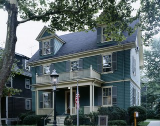
The Eliphalet Spurr House is a historic house located at 103 Walnut Street in Brookline, Massachusetts, United States.

West Roxbury Parkway is a historic parkway running from Washington Street in Boston, Massachusetts, where the Enneking Parkway runs south, to Horace James Circle in Chestnut Hill, where it meets the Hammond Pond Parkway. The parkway serves as a connector between Stony Brook Reservation and Hammond Pond Reservation. West Roxbury Parkway was built between 1919 and 1929 and added to the National Register of Historic Places in 2006. The parkway is distinctive in the roadway system developed by the Metropolitan District Commission beginning around the turn of the 20th century in that it was built in collaboration with the City of Boston, and is maintained by the city.

Hartwell and Richardson was a Boston, Massachusetts architectural firm established in 1881, by Henry Walker Hartwell (1833–1919) and William Cummings Richardson (1854–1935). The firm contributed significantly to the current building stock and architecture of the greater Boston area. Many of its buildings are listed on the National Register of Historic Places.

Kilham & Hopkins was an architectural firm in Boston, Massachusetts formed in 1899 or 1900 by its founding members, Walter Harrington Kilham and James Cleveland Hopkins. The firm later became Kilham, Hopkins & Greeley after William Roger Greeley joined the firm in 1916, and Kilham Hopkins Greeley and Brodie after Walter S. (Steve) Brodie joined the firm in 1945.


