
Sussex County is the northernmost county in the State of New Jersey. Its county seat is Newton. It is part of the New York metropolitan area and is part of New Jersey's Skylands Region. As of the 2020 U.S. census, the county's population was enumerated at 144,221, making it the 17th-most populous of the state's 21 counties, and representing a decrease of 5,044 (3.4%) from the 149,265 counted at the 2010 U.S. census, in turn an increase of 5,099 (3.5%) over the 144,166 persons at the 2000 census. Based on 2010 census data, Vernon Township was the county's largest in both population and area, with a population of 23,943 and covering an area of 70.59 square miles (182.8 km2).
Andover Township is a township in Sussex County, New Jersey, United States. As of the 2010 United States Census, the township's population was 6,319, reflecting an increase of 286 (+4.7%) from the 6,033 counted in the 2000 Census, which had in turn increased by 595 (+10.9%) from the 5,438 counted in the 1990 Census.

Fredon Township is a township in Sussex County, New Jersey, United States. As of the 2010 United States Census, the township's population was 3,437, reflecting an increase of 577 (+20.2%) from the 2,860 counted in the 2000 Census, which had in turn increased by 97 (+3.5%) from the 2,763 counted in the 1990 Census.

Green Township is a township in Sussex County, New Jersey, United States. As of the 2010 United States Census, the township's population was 3,601, reflecting an increase of 381 (+11.8%) from the 3,220 counted in the 2000 Census, which had in turn increased by 511 (+18.9%) from the 2,709 counted in the 1990 Census.

Lafayette Township is a township located in the Skylands Region of Sussex County, New Jersey, United States. As of the 2010 United States Census, the township's population was 2,538, reflecting an increase of 238 (+10.3%) from the 2,300 counted in the 2000 Census, which had in turn increased by 398 (+20.9%) from the 1,902 counted in the 1990 Census. The township is crossed by Route 15 and Route 94.

Montague Township is a township in Sussex County, New Jersey, United States, in the New York City Metropolitan Area. As of the 2010 United States Census, the township's population was 3,847, reflecting an increase of 435 (+12.7%) from the 3,412 counted in the 2000 Census, which had in turn increased by 580 (+20.5%) from the 2,832 counted in the 1990 Census. High Point, within Montague Township, is the highest elevation within New Jersey at an altitude of 1,803 feet (550 m) above sea level. Montague is also the northernmost municipality in the state of New Jersey.

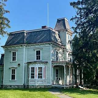
Newton, officially the Town of Newton, is an incorporated municipality located in Sussex County, New Jersey, United States. It is situated approximately 60 miles (97 km) by road northwest of New York City. As the location of the county's administrative offices and court system, Newton is the county seat of Sussex County. One of 15 municipalities in the state organized as a town, the municipal government operates under a council-manager structure provided by the Faulkner Act, or Optional Municipal Charter Law.

Sandyston Township is a small rural township in Sussex County, New Jersey. It is located in the northwestern part of the state near the Pennsylvania border. The township is surrounded by and part of many national and state parks. As of the 2010 United States census, the township's population was 1,998, reflecting an increase of 173 (+9.5%) from the 1,825 counted in the 2000 census, which had in turn increased by 93 (+5.4%) from the 1,732 counted in the 1990 census. Sandyston's growth in recent years has been attributed to the influx of people from more urban parts of the state and even New York City, located less than 75 miles (121 km) away.

Sparta is a township in Sussex County, New Jersey, United States. As of the 2020 United States Census, the population was 19,600, reflecting a decrease of 122 (−0.6%) from the 2010 United States Census, when the township's population was 19,722, which in turn reflected an increase of 1,642 (+9.1%) from the 18,080 counted in the 2000 Census.

Stillwater Township is a township located in Sussex County, New Jersey, United States. Located in the Kittatinny Valley, Stillwater is a rural farming community with a long history of dairy farming. As of the 2010 United States Census, the township's population was 4,099, reflecting a decrease of 168 (−3.9%) from the 4,267 counted in the 2000 Census, which had in turn increased by 14 (+0.3%) from the 4,253 counted in the 1990 Census.

Walpack Township is a township in Sussex County, New Jersey, United States. As of the 2020 United States Census, the township had a population of 7, reflecting a decline of 34 (−82.9%) from the 41 counted in the 2000 Census, which had in turn declined by 26 (−38.8%) from the 67 counted in the 1990 Census. Walpack Township was one of only four municipalities in New Jersey with a double-digit population as of the 2010 Census, and it placed third behind Tavistock and Pine Valley, both in Camden County.
Wantage Township is a township in Sussex County, New Jersey, United States. As of the 2010 United States Census, its population was 11,358, reflecting an increase of 971 (+9.3%) from the 10,387 counted in the 2000 Census, which had in turn increased by 900 (+9.5%) from the 9,487 counted in the 1990 Census.

Newton Cemetery is a cemetery in Newton, in Sussex County, New Jersey, United States. Founded in 1860, the 24.05 acres (9.73 ha) cemetery is in current use and is owned and operated by the Newton Cemetery Company.

Wallpack Center is an unincorporated community located within Walpack Township, Sussex County, New Jersey, United States. Wallpack Center is located in the Flat Brook Valley 6.7 miles (10.8 km) west of Branchville. Wallpack Center has a post office with ZIP code 07881. It is now part of the Delaware Water Gap National Recreation Area.
Quarryville is an unincorporated community located within Wantage Township in Sussex County, New Jersey, United States.
Warrington is an unincorporated community located within Knowlton Township in Warren County, New Jersey, United States.
Springdale is an unincorporated community in Andover Township, in Sussex County, New Jersey, United States.
Brighton is an unincorporated community located within Andover Township and Green Township in Sussex County, New Jersey, United States.
Whitehall is an unincorporated community located within Andover Township in Sussex County, New Jersey, United States.


