Beemerville, New Jersey

Last updated

Beemerville, New Jersey
Location map of Sussex County, New Jersey.svg
Red pog.svg
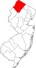
Beemerville, New Jersey
Location of Beemerville in Sussex County Inset: Location of county within the state of New Jersey
USA New Jersey location map.svg
Red pog.svg
Beemerville, New Jersey
Beemerville, New Jersey (New Jersey)
Usa edcp location map.svg
Red pog.svg
Beemerville, New Jersey
Beemerville, New Jersey (the United States)
Coordinates: 41°12′38″N74°41′30″W / 41.2106512°N 74.6915525°W / 41.2106512; -74.6915525
Country Flag of the United States.svg  United States
State Flag of New Jersey.svg  New Jersey
County Sussex
Township Wantage
Elevation
[1]
232 ft (71 m)
Time zone UTC−05:00 (Eastern (EST))
  Summer (DST) UTC−04:00 (Eastern (EDT))
Area code(s) 973 [2]
GNIS feature ID874637 [1]

Beemerville is an unincorporated community located within Wantage Township in Sussex County, in the U.S. state of New Jersey. [3]

Space Farms Zoo and Museum, established in 1927, is a combination of a natural environment for animals and historical museum located on County Route 519 in Beemerville. [4]

Related Research Articles

<span class="mw-page-title-main">Sussex County, New Jersey</span> County in New Jersey, United States

Sussex County is the northernmost county in the U.S. state of New Jersey. Its county seat is Newton. It is part of the New York metropolitan area and is part of New Jersey's Skylands Region. As of the 2020 census, the county was the state's 17th-most-populous county, with a population of 144,221, a decrease of 5,044 (−3.4%) from the 2010 census count of 149,265, which in turn reflected an increase of 5,099 (+3.5%) over the 144,166 persons at the 2000 census. Based on 2020 census data, Vernon Township was the county's largest in both population and area, with a population of 22,358 and covering an area of 70.59 square miles (182.8 km2).

<span class="mw-page-title-main">Branchville, New Jersey</span> Borough in Sussex County, New Jersey, United States

Branchville is a borough in Sussex County, in the U.S. state of New Jersey. As of the 2020 United States census, the borough's population was 791, a decrease of 50 (−5.9%) from the 2010 census count of 841, which in turn reflected a decline of 4 (−0.5%) from the 845 counted in the 2000 census. The borough is located in the northernmost region of Sussex County.

<span class="mw-page-title-main">Frankford Township, New Jersey</span> Township in Sussex County, New Jersey, United States

Frankford Township is a township in Sussex County, in the U.S. state of New Jersey. As of the 2020 United States census, the township's population was 5,302, a decrease of 263 (−4.7%) from the 2010 census count of 5,565, which in turn reflected an increase of 145 (+2.7%) from the 5,420 counted in the 2000 census.

<span class="mw-page-title-main">Hopatcong, New Jersey</span> Borough in Sussex County, New Jersey, United States

Hopatcong is a borough in Sussex County, in the U.S. state of New Jersey. As of the 2020 United States census, the borough's population was 14,362, a decrease of 785 (−5.2%) from the 2010 census count of 15,147, which in turn reflected a decline of 741 (−4.7%) from the 15,888 counted in the 2000 census.

<span class="mw-page-title-main">Lafayette Township, New Jersey</span> Township in Sussex County, New Jersey, United States

Lafayette Township is a township located in the Skylands Region of Sussex County, in the U.S. state of New Jersey. As of the 2020 United States census, the township's population was 2,358, a decrease of 180 (−7.1%) from the 2010 census count of 2,538, which in turn reflected an increase of 238 (+10.3%) from the 2,300 counted in the 2000 census. The township is crossed by Route 15 and Route 94.

<span class="mw-page-title-main">Montague Township, New Jersey</span> Township in Sussex County, New Jersey, United States

Montague Township is a township in Sussex County, in the U.S. state of New Jersey, in the New York City Metropolitan Area. As of the 2020 United States census, the township's population was 3,792, a decrease of 55 (−1.4%) from the 2010 census count of 3,847, which in turn reflected an increase of 435 (+12.7%) from the 3,412 counted in the 2000 census. High Point, within Montague Township, is the highest elevation within New Jersey at an altitude of 1,803 feet (550 m) above sea level. Montague is also the northernmost municipality in the state of New Jersey.

<span class="mw-page-title-main">Sandyston Township, New Jersey</span> Township in Sussex County, New Jersey, United States

Sandyston Township is a small rural township in Sussex County, in the U.S. state of New Jersey. It is located in the northwestern part of the state near the Pennsylvania border. The township is surrounded by and part of many national and state parks. As of the 2020 United States census, the township's population was 1,977, a decrease of 21 (−1.1%) from the 2010 census count of 1,998, which in turn reflected an increase of 173 (+9.5%) from the 1,825 counted in the 2000 census. Sandyston's growth in recent years has been attributed to the influx of people from more urban parts of the state and even New York City, located less than 75 miles (121 km) away.

<span class="mw-page-title-main">Sussex, New Jersey</span> Borough in Sussex County, New Jersey, United States

Sussex is a borough in Sussex County, in the U.S. state of New Jersey. As of the 2020 United States census, the borough's population was 2,024, a decrease of 106 (−5.0%) from the 2010 census count of 2,130, which in turn reflected a decline of 15 (−0.7%) from the 2,145 counted in the 2000 census.

<span class="mw-page-title-main">Wantage Township, New Jersey</span> Township in Sussex County, New Jersey, United States

Wantage Township is a township in Sussex County, in the U.S. state of New Jersey. As of the 2020 United States census, the township's population was 10,811, a decrease of 547 (−4.8%) from the 2010 census count of 11,358, which in turn reflected an increase of 971 (+9.3%) from the 10,387 counted in the 2000 census.

<span class="mw-page-title-main">Newport, Cumberland County, New Jersey</span> Populated place in Cumberland County, New Jersey, US

Newport is an unincorporated community and census-designated place (CDP) located within Downe Township in Cumberland County, in the U.S. state of New Jersey. The area is served as United States Postal Service ZIP Code 08345.

<span class="mw-page-title-main">Papakating Creek</span> Creek in Sussex County, New Jersey, U.S.

Papakating Creek is a 20.1-mile-long (32.3 km) tributary of the Wallkill River located in Frankford and Wantage townships in Sussex County, New Jersey in the United States. The creek rises in a small swamp located beneath the eastern face of Kittatinny Mountain in Frankford and its waters join the Wallkill to the east of Sussex borough.

High Point Regional High School is a comprehensive four-year public high school located in Wantage Township, in the U.S. state of New Jersey, which is the sole high school in its school district.

<span class="mw-page-title-main">County Route 519 (New Jersey)</span>

County Route 519 is a county highway in the U.S. state of New Jersey. The highway extends 88.54 miles (142.49 km) from Daniel Bray Highway in Delaware Township to the New York state line in Wantage Township. It is the state's longest county route.

<span class="mw-page-title-main">Richland, New Jersey</span> Populated place in Atlantic County, New Jersey, US

Richland is an unincorporated community and census-designated place (CDP) located within Buena Vista Township in Atlantic County, in the U.S. state of New Jersey. The area is served as United States Postal Service ZIP Code 08350.

Space Farms Zoo and Museum is a roadside zoo and historical museum located at 218 Route 519, in the Beemerville section of Wantage Township in Sussex County, New Jersey, in the United States. It is currently owned by New Jersey Assemblyman Parker Space.

<span class="mw-page-title-main">Jobstown, New Jersey</span> Populated place in Burlington County, New Jersey, US

Jobstown is an unincorporated community and census-designated place (CDP) located within Springfield Township in Burlington County, in the U.S. state of New Jersey. The area is served as United States Postal Service ZIP Code 08041.

<span class="mw-page-title-main">Jacksonville, New Jersey</span> Populated place in Burlington County, New Jersey, US

Jacksonville is an unincorporated community located within Springfield Township, in Burlington County, in the U.S. state of New Jersey. Located at a skewed intersection of County Routes 628 and 670, the area consists of farmland, houses, and the remains of the Animal Kingdom Zoo, a small zoo shuttered since 2012 due to deadly fires and numerous animal welfare violations.

Lusscroft Farm is a historically significant dairy farming and scientific research facility located in Wantage Township in Sussex County, New Jersey that was established in 1914. It was first operated by James Turner, a stockbroker from Montclair, to promote scientific research in the dairy farming industry. In 1931, Turner donated the facility and land to the State of New Jersey and from 1931 to 1970 it was operated as an Agricultural Research Station by Rutgers University—New Jersey's land grant university.

<span class="mw-page-title-main">Rutan Hill</span> Hill in New Jersey, United States

Rutan Hill is the local name for a hill on the United States Geological Survey Branchville 7.5-minute map. It is located about 2.46 miles (3.96 km) south-southwest of Colesville, New Jersey in Wantage Township, of Sussex County, New Jersey in the United States. Rutan Hill rises about 270 feet (82 m) above the adjacent creek valley to an elevation of just over 1,020 feet (310 m). This hill lies entirely within private, posted property. This nondescript hill is the surface expression of a diatreme that is the northern part of the Late Ordovician Beemerville Alkaline Complex.

<span class="mw-page-title-main">Parker Space</span> Member of the New Jersey General Assembly

Parker Space is an American Republican Party politician, and owner of Space Farms Zoo and Museum. Space has served in the New Jersey General Assembly since March 2013, where he represents the 24th Legislative District.

References

  1. 1 2 Beemerville, Geographic Names Information System. Accessed June 9, 2016.
  2. Area Code Lookup - NPA NXX for Wantage, NJ, Area-Codes.com. Accessed June 9, 2016.
  3. Locality Search, State of New Jersey. Accessed June 9, 2016.
  4. Space Farms Zoo and Museum, Eighty- Five Years of Family Tradition, Space Farms Zoo and Museum, April 5, 2012. Accessed June 9, 2016. "In the midst of the depression in 1927, Ralph and Elizabeth Space purchased a quarter-acre in the hamlet of Beemerville on which they built a small country store and started a wild animal collection."