Byram Center, New Jersey | |
|---|---|
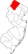
 Byram Center Location in Sussex County  Byram Center Location in New Jersey  Byram Center Location in the United States | |
| Coordinates: 40°56′24″N74°43′01″W / 40.93989°N 74.717073°W [1] [2] | |
| Country | |
| State | |
| County | Sussex |
| Township | Byram |
| Area | |
• Total | 2.88 sq mi (7.45 km2) |
| • Land | 2.86 sq mi (7.41 km2) |
| • Water | 0.012 sq mi (0.03 km2) 0.00% |
| Elevation | 850 ft (260 m) |
| Population | |
• Total | 2,232 |
| • Density | 779.9/sq mi (301.12/km2) |
| Time zone | UTC−05:00 (Eastern (EST)) |
| • Summer (DST) | UTC−04:00 (Eastern (EDT)) |
| Area codes | 862/973 |
| FIPS code | 34-09170 [1] [6] [7] |
| GNIS feature ID | 02583979 [1] [8] |
Byram Center is an unincorporated community and census-designated place (CDP) [9] located in Byram Township, in Sussex County, in the U.S. state of New Jersey. [10] [11] [12] As of the 2010 United States census, the CDP's population was 90. [13]