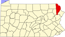
Pocono Springs, Pennsylvania | |
---|---|
Pocono Springs | |
Nickname: Pocono Springs Estates [1] | |
Country | United States |
State | Pennsylvania |
U.S. Congressional Districts | PA-10 PA-17 |
School Districts | Western Wayne (Region III) Wallenpaupack Area |
Counties | Wayne |
Magisterial Districts | 22-3-01 [2] |
Townships | Lehigh Sterling |
Named for | Pocono Mountains |
Area | |
• Total | 3.980 sq mi (10.309 km2) |
• Land | 3.804 [3] sq mi (9.853 km2) |
• Water | 0.176 [3] sq mi (0.456 km2) |
Elevation | 2,070 [4] ft (631 m) |
Population (2010) | |
• Total | 926 [5] |
• Density | 233/sq mi (89.8/km2) |
Time zone | UTC-5 (Eastern (EST)) |
• Summer (DST) | UTC-4 (Eastern Daylight (EDT)) |
ZIP code | |
Area code | 570 |
GNIS feature IDs | 1212903 [4] (Community) 2633409 [8] (CDP) |
FIPS codes | 42-127-42432 [9] -61774 [4] 42-089-15960 [10] -61774 [4] |
Major Roads | |
Waterways | Crystal Lake, [11] Lehigh River, Mill Creek, [12] Pocono Peak Lake |
Website | Pocono Springs |
Pocono Springs is a private community and census-designated place (CDP) in Lehigh and Sterling Townships in Wayne County, Pennsylvania, United States. The CDP's population was 926 at the time of the 2010 United States Census. [5]
According to the United States Census Bureau, Pocono Springs has a total area of 3.980 sq mi (10.31 km2), of which 3.804 sq mi (9.85 km2) is land and 0.176 sq mi (0.46 km2), or 4.42%, is water. [3]
As of the Census of 2010, there were 926 people, 383 households, and 269 families in Pocono Springs. The CDP's population density was 233 people per square mile (90 people/km2), and there were 866 housing units at an average density of 228/sq mi (87.9/km2). The racial makeup of the populace was 92.1% White, 3.5% African American, 0.0% Native American, 1.1% Asian, 0.1% Pacific Islander, 1.2% of other races, and 2.1% of two or more races. Hispanics and Latinos of all races made up 5.1% of the population. [3] [13]
70.2% of Pocono Springs' households were families, 56.1% were headed by a heterosexual married couple (Pennsylvania did not allow same-sex marriage until May 20, 2014, after the 2010 Census had been completed), and 27.9% included children under the age of 18. 7.8% of households were headed by a female householder with no husband present, 6.3% by a male householder with no wife present, and 29.8% consisted of non-families. 23.8% of all households were made up of individuals, and 7.9% consisted of a person 65 years of age or older living alone. The average household size was 2.42 and the average family size was 2.84. [13]
Pocono Springs' age distribution was 21.0% under the age of 18, 4.1% between the ages of 18 and 24, 22.6% between 25 and 44, 36.7% between 45 and 64, and 15.7% 65 years of age or older. The population's median age was 46.6 years. For every 100 females, there were 104 males. For every 100 females age 18 and over, there were 103 males in the same age range. [13]
According to American Community Survey (ACS) estimates, the median income for a household in Pocono Springs in 2013 was $66,250, and the median income for a family was $77,067. Males had a median income of $51,250, while females had a median income of $32,986. The per capita income for the CDP was $35,592. 8.6% of families and 14.5% of people were below the Census Bureau's poverty thresholds (different from the federally defined poverty guidelines), including 23.4% of those under age 18 and 8.1% of those age 65 or over. [14] [15]
According to self-reported ancestry figures recorded by the ACS, the five largest ancestral groups in Pocono Springs in 2013 were Germans (34.7%), Irish (20.0%), Poles (12.7%), Italians (12.0%), and English (6.3%). Those reporting American ancestry made up 5.5% of the population. [16]
Wayne is a county in the Commonwealth of Pennsylvania. It is part of Northeastern Pennsylvania. The county's population was 51,155 at the 2020 census. The county seat is the Borough of Honesdale. The county was formed from part of Northampton County on March 21, 1798, and was named for the Revolutionary War General Anthony Wayne.
Fairview is a census-designated place (CDP) in Alameda County, California, United States. It borders on the city of Hayward and the census-designated place of Castro Valley. The population was 11,341 at the 2020 census.
Waldon is a former census-designated place (CDP) in Contra Costa County, California, United States. The population was 5,133 at the 2000 census. It is served by Pleasant Hill/Contra Costa Centre station on the Bay Area Rapid Transit (BART) Yellow Line, and by Interstate 680. The area has been undergoing a series of transit-oriented development projects under the auspices of the Contra Costa Centre Transit Village public/private partnership.
East Whittier is an unincorporated community in Los Angeles County, California, United States. The population was 9,757 at the 2010 census, up from 9,538 at the 2000 census. For statistical purposes, the United States Census Bureau has defined this community as a census-designated place (CDP). The name was changed from East La Mirada in 2012, likely due to its precise location in relation to the city of Whittier. The previous delineation of East Whittier CDP occurred during the 1960 census, when the area recorded a population of 19,884.
Beaverdale is an unincorporated community and census-designated place (CDP) in Cambria County, Pennsylvania, United States. The population was 1,035 at the 2010 census. Prior to that time, the CDP was known as Beaverdale-Lloydell.
Belmont is an unincorporated community and census-designated place (CDP) in Cambria County, Pennsylvania, United States. The population was 2,784 at the 2010 census.
Salix is an unincorporated community and census-designated place (CDP) in Cambria County, Pennsylvania, United States. The population was 1,149 at the 2010 census. In previous censuses it was listed as Salix-Beauty Line Park.
Spring Hill is a census-designated place (CDP) in Cambria County, Pennsylvania, United States. The population was 839 at the 2010 census, down from 970 at the 2000 census.
Spring Mills is an unincorporated community and census-designated place (CDP) in Centre County, Pennsylvania, United States. It is part of the State College, Pennsylvania Metropolitan Statistical Area. The population was 268 at the 2010 census.
New Kingstown is a census-designated place (CDP) in Silver Spring Township, Cumberland County, Pennsylvania. The population was 495 at the 2010 census. It is part of the Harrisburg–Carlisle metropolitan statistical area.
Dixonville is an unincorporated community in Indiana County, Pennsylvania, United States. The area is recorded as the "Dicksonville" census-designated place (CDP), with a population of 467 at the 2010 census. The CDP lies mostly on the western edge of Green Township, though a small portion extends west into Rayne Township.
Moscow is a borough in Lackawanna County, Pennsylvania, United States. The population was 2,039 at the 2020 census. It is located 11 miles (18 km) southeast of Scranton and 24 miles (39 km) southwest of Honesdale.
Sand Hill is an unincorporated community and census-designated place (CDP) in Lebanon County, Pennsylvania, United States. The population was 2,496 at the 2010 census.
Mountainhome is a census-designated place (CDP) in Monroe County, Pennsylvania, United States. The population was 1,182 at the 2010 census.
Spring House is a census-designated place (CDP) in Montgomery County, Pennsylvania, United States. The population was 3,804 at the 2010 census.
Preston is a second-class township in Wayne County, Pennsylvania, United States. The township's population was 1,014 at the time of the 2010 United States Census.
Starrucca is a borough in Wayne County, Pennsylvania, United States. The borough's population was 173 at the time of the 2010 United States Census.
Boiling Springs is a census-designated place (CDP) in Spartanburg County, South Carolina, United States. The population was 8,219 at the 2010 census.
Gouldsboro is a village and census-designated place (CDP) in Lehigh Township in Wayne County, and Coolbaugh Township, in Monroe County, Pennsylvania, United States. The CDP's population was 750 at time of the 2020 United States Census.
White Mills is a village and census-designated place in Texas Township, Wayne County, Pennsylvania, United States. The CDP's population was 659 at time of the 2010 United States Census.