Polo Township | |
|---|---|
| Nickname: Gu | |
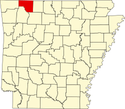
 Polo Township Location in Arkansas | |
| Coordinates: 36°26′36.67″N93°32′40.15″W / 36.4435194°N 93.5444861°W | |
| Country | |
| State | |
| County | Carroll |
| Area | |
• Total | 40.932 sq mi (106.01 km2) |
| • Land | 40.938 sq mi (106.03 km2) |
| • Water | 0.006 sq mi (0.016 km2) |
| Population (2010) | |
• Total | 1,224 |
| • Density | 29.9/sq mi (11.5/km2) |
| Time zone | UTC-6 (CST) |
| • Summer (DST) | UTC-5 (CDT) |
| Zip Code | 72616 (Berryville) |
| Area code | 870 |
Polo Township is one of twenty-one current townships in Carroll County, Arkansas, USA. [1] As of the 2010 census, its total population was 1,224.
Contents
Polo Township was established in 1874. [2]