The Cisuralian is the first series/epoch of the Permian. The Cisuralian was preceded by the Pennsylvanian and followed by the Guadalupian. The Cisuralian Epoch is named after the western slopes of the Ural Mountains in Russia and Kazakhstan and dates between 298.9 ± 0.15 – 272.3 ± 0.5 Ma.

Captorhinidae is an extinct family of tetrapods, typically considered primitive reptiles, known from the late Carboniferous to the Late Permian. They had a cosmopolitan distribution across Pangea.

The Beaufort Group is the third of the main subdivisions of the Karoo Supergroup in South Africa. It is composed of a lower Adelaide Subgroup and an upper Tarkastad Subgroup. It follows conformably after the Ecca Group and unconformably underlies the Stormberg Group. Based on stratigraphic position, lithostratigraphic and biostratigraphic correlations, palynological analyses, and other means of geological dating, the Beaufort Group rocks are considered to range between Middle Permian (Wordian) to Early Triassic (Anisian) in age.

The Pristerognathus Assemblage Zone is a tetrapod assemblage zone or biozone which correlates to the upper Abrahamskraal Formation and lowermost Teekloof Formation, Adelaide Subgroup of the Beaufort Group, a fossiliferous and geologically important geological Group of the Karoo Supergroup in South Africa. The thickest outcrops, reaching not more than 300 metres (980 ft), occur just east of Sutherland through to Beaufort West in the south and Victoria West in the north. Exposures are also found west of Colesberg and south of Graaff-Reinet. The Pristerognathus Assemblage Zone is the third biozone of the Beaufort Group.

The Ecca Group is the second of the main subdivisions of the Karoo Supergroup of geological strata in southern Africa. It mainly follows conformably after the Dwyka Group in some sections, but in some localities overlying unconformably over much older basement rocks. It underlies the Beaufort Group in all known outcrops and exposures. Based on stratigraphic position, lithostratigraphic correlation, palynological analyses, and other means of geological dating, the Ecca Group ranges between Early to earliest Middle Permian in age.
The Fremouw Formation is a Triassic-age rock formation in the Transantarctic Mountains of Antarctica. It contains the oldest known fossils of tetrapods from Antarctica, including synapsids, reptiles and amphibians. Fossilized trees have also been found. The formation's beds were deposited along the banks of rivers and on floodplains. During the Triassic, the area would have been a riparian forest at 70–75°S latitude.
The geology of Cheshire in England consists mainly of Triassic sandstones and mudstones. To the north west of Cheshire, these rocks are heavily faulted and the underlying Carboniferous Coal Measures are thrown up. Around the areas of Poynton and Macclesfield, the coal is close to the surface and was easily mined. Below the Coal Measures is the Millstone Grit, which appears towards the Derbyshire border on the flanks of the Peak District dome.

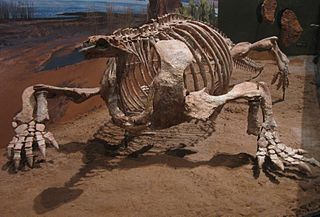
Cotylorhynchus is an extinct genus of herbivorous caseid synapsids that lived during the late Lower Permian (Kungurian) and possibly the early Middle Permian (Roadian) in what is now Texas and Oklahoma. The large number of specimens found make it the best-known caseid. Like all large herbivorous caseids, Cotylorhynchus had a short snout sloping forward and very large external nares. The head was very small compared to the size of the body. The latter was massive, barrel-shaped, and ended with a long tail. The limbs were short and robust. The hands and feet had short, broad fingers with powerful claws. The barrel-shaped body must have housed large intestines, suggesting that the animal had to feed on a large quantity of plants of low nutritional value. Caseids are generally considered to be terrestrial, though a semi-aquatic lifestyle has been proposed by some authors. The genus Cotylorhynchus is represented by three species, the largest of which could reach more than 6 m in length. However, a study published in 2022 suggests that the genus may be paraphyletic, with two of the three species possibly belonging to separate genera.

The geology of the Iberian Peninsula consists of the study of the rock formations on the Iberian Peninsula, connected to the rest of the European landmass by the Pyrenees. The peninsula contains rocks from every geological period from the Ediacaran to the Quaternary, and many types of rock are represented. World-class mineral deposits are also found there.

The geology of the Orkney islands in northern Scotland is dominated by the Devonian Old Red Sandstone (ORS). In the southwestern part of Mainland, this sequence can be seen to rest unconformably on a Moinian type metamorphic basement.

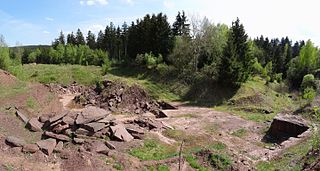
The Tambach Formation is an Early Permian-age geologic formation in central Germany. It consists of red to brown-colored sedimentary rocks such as conglomerate, sandstone, and mudstone, and is the oldest portion of the Upper Rotliegend within the Thuringian Forest Basin.

The Abo Formation is a geologic formation in New Mexico. It contains fossils characteristic of the Cisuralian epoch of the Permian period.

The Corona Formation is a geologic formation of the Carnian Alps at the border of Austria and Italy. It preserves fossils dated to the Gzhelian stage of the Late Carboniferous period.
The geology of Northumberland in northeast England includes a mix of sedimentary, intrusive and extrusive igneous rocks from the Palaeozoic and Cenozoic eras. Devonian age volcanic rocks and a granite pluton form the Cheviot massif. The geology of the rest of the county is characterised largely by a thick sequence of sedimentary rocks of Carboniferous age. These are intruded by both Permian and Palaeogene dykes and sills and the whole is overlain by unconsolidated sediments from the last ice age and the post-glacial period. The Whin Sill makes a significant impact on Northumberland's character and the former working of the Northumberland Coalfield significantly influenced the development of the county's economy. The county's geology contributes to a series of significant landscape features around which the Northumberland National Park was designated.

The Organ Rock Formation or Organ Rock Shale is a formation within the late Pennsylvanian to early Permian Cutler Group and is deposited across southeastern Utah, northwestern New Mexico, and northeastern Arizona. This formation notably outcrops around Canyonlands National Park, Natural Bridges National Monument, and Monument Valley of northeast Arizona, southern Utah. The age of the Organ Rock is constrained to the latter half of the Cisuralian epoch by age dates from overlying and underlying formations. Important early terrestrial vertebrate fossils have been recovered from this formation in northern Arizona, southern Utah, and northern New Mexico. These include the iconic Permian terrestrial fauna: Seymouria, Diadectes, Ophiacodon, and Dimetrodon. The fossil assemblage present suggests arid environmental conditions. This is corroborated with paleoclimate data indicative of global drying throughout the early Permian.

The Balfour Formation is a geological formation that is found in the Beaufort Group, a major geological group that forms part of the greater Karoo Supergroup in South Africa. The Balfour Formation is the uppermost formation of the Adelaide Subgroup which contains all the Late Permian - Early Triassic aged biozones of the Beaufort Group. Outcrops and exposures of the Balfour Formation are found from east of 24 degrees in the highest mountainous escarpments between Beaufort West and Fraserburg, but most notably in the Winterberg and Sneeuberg mountain ranges near Cradock, the Baviaanskloof river valley, Graaff-Reniet and Nieu Bethesda in the Eastern Cape, and in the southern Free State province.

The Middleton Formation is a geological formation that extends through the Northern Cape, Western Cape, and Eastern Cape provinces of South Africa. It overlies the lower Abrahamskraal Formation, and is the eastern correlate, East of 24ºE, of the Teekloof Formation. Outcrops and exposures of the Middleton Formation range from Graaff-Reinet in the Eastern Cape onwards. The Middleton Formation's type locality lies near the small hamlet, Middleton, approximately 25 km south of Cookhouse. Other exposures lie in hillsides along the Great Fish River in the Eastern Cape. The Middleton Formation forms part of the Adelaide Subgroup of the Beaufort Group, which itself forms part of the Karoo Supergroup.

The Teekloof Formation is a geological formation that forms part of the Beaufort Group, one of the five geological groups that comprises the Karoo Supergroup in South Africa. The Teekloof Formation is the uppermost formation of Adelaide Subgroup deposits West of 24ºE and contains Middle to Late Permian-aged deposits and four biozones of the Beaufort Group. It overlies the Abrahamskraal Formation. The Teekloof Formation does not underlie other units other than the younger Karoo dolerites and sills that relate to the emplacement of the Early Jurassic Drakensberg Group to the east. Outcrops and exposures of the Teekloof Formation range from Sutherland through the mountain escarpments between Fraserburg and Beaufort West. The northernmost localities of the Teekloof Formation are found by Loxton, Victoria West and Richmond.
Balearosaurus is an extinct genus of moradisaurine captorhinid from the Permian of Spain. The type species is B. bombardensis.

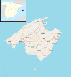
Tramuntanasaurus is an extinct genus of moradisaurine captorhinid that lived during the late Early Permian (Artinskian–Kungurian) or early Middle Permian in what is now the island of Mallorca of the Balearic Islands. The genus is only known by its type species, Tramuntanasaurus tiai, which was named in 2023 by Rafel Matamales-Andreu, Eudald Mujal, Àngel Galobart and Josep Fortuny, from an almost complete skeleton discovered in 2019.


