
Potisje (Serbian Cyrillic : Потисје) is the name of the Tisa river basin parts located in Serbia, in the autonomous province of Vojvodina. The river Tisa flows between the Banat and Bačka regions.
Potisje (Serbian Cyrillic : Потисје) is the name of the Tisa river basin parts located in Serbia, in the autonomous province of Vojvodina. The river Tisa flows between the Banat and Bačka regions.
Municipalities in Bačka:
Municipalities in Banat:


In the 1st century, ancient author Plinius used the name Pathissus to describe the surroundings of the river Tisa. Because of the similarity of this name with the modern Slavic name Potisje (meaning approximately "a land around the river Tisa" in Slavic), which is a typical Slavic name used for surroundings of rivers (like Podunavlje, Pomoravlje, etc.), the name mentioned by Plinius might indicate an early Slavic presence in the area. [1]
Between 1702 and 1751, the western part of Potisje (in the region of Bačka) belonged to the Tisa-Mureș (Potisje-Pomorišje) section of the Habsburg Military Frontier. The Potisje segment of the Frontier included towns near the river Tisa: Bečej, Ada, Senta and Kanjiža (in present-day Serbia), Szeged (in present-day Hungary), as well as other places in Bačka, including Subotica, Sombor and Sentomaš (Srbobran). After the abolishment of this part of the Frontier in 1751, many Serbs that lived in the region emigrated to Russia (notably to New Serbia and Slavo-Serbia). To prevent this emigration, the Habsburg authorities formed the autonomous District of Potisje with its seat in Bečej. The District of Potisje existed between 1751 and 1848. The three privileges were given to the district in 1759, 1774, and 1800. The first privilege of the District defined its autonomous status, while the second one allowed ethnic Hungarians to settle in the district. In the following period many Hungarians settled in Potisje and they replaced Serbs as the dominant ethnic group in parts of the region.
The municipalities with a Serb ethnic majority are: Žabalj (86%), Titel (85%), Novi Kneževac (59%), Kikinda (76%), Novi Bečej (69%), and Zrenjanin (74%).
The municipalities with a Hungarian ethnic majority are: Kanjiža (86%), Senta (81%), Ada (77%), and Čoka (52%).
The Bečej municipality is ethnically mixed with 49% Hungarians and 41% Serbs.


This is a list of cities in Serbia and Montenegro. For a list of municipalities, see Internal structure of Serbia and Montenegro; for a list of all places in Serbia, see List of places in Serbia; for lists of villages in Serbia and Montenegro, see List of villages in Serbia and Montenegro.

Bačka or Bácska is a geographical and historical area within the Pannonian Plain bordered by the river Danube to the west and south, and by the river Tisza to the east. It is divided between Serbia and Hungary. Most of the area is located within the Vojvodina region in Serbia and Novi Sad, the capital of Vojvodina, lies on the border between Bačka and Syrmia. The smaller northern part of the geographical area is located within Bács-Kiskun County in Hungary.

The North Banat District is one of seven administrative districts of the autonomous province of Vojvodina, Serbia. It lies in the geographical regions of Banat and Bačka. According to the 2022 census, the district has a population of 117,896 inhabitants. The administrative center of the district is the city of Kikinda.
The South Bačka District is one of seven administrative districts of the autonomous province of Vojvodina, Serbia. Geographically it lies in the southern part of Bačka and northern part of Syrmia. According to the 2022 census results, it has a population of 607,178 inhabitants. The administrative center of the district is the city of Novi Sad, which is also the capital and the largest city of the Autonomous Province of Vojvodina.

Vojvodina is a province in Republic of Serbia and one of the most ethnically diverse regions in Europe, home to 25 different ethnicities.
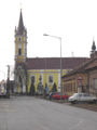
Novi Kneževac is a town and municipality located in the North Banat District of the autonomous province of Vojvodina, Serbia. The town has a population of 6,960, while the Novi Kneževac municipality has 11,269 inhabitants according to.

The Hungarian Regional Autonomy is the name of a proposed new administrative unit in the northern part of the Autonomous Province of Vojvodina in Serbia.

Hungarians in Serbia are a recognized national minority in Serbia. According to the 2022 census, the population of ethnic Hungarians in Serbia is 184,442, constituting 2.8% of the total population, which makes them the second-largest ethnic group in the country behind Serbs and the largest minority group. The vast majority of them live in the northern autonomous province of Vojvodina, where they number 182,321 and make up 10.5% of the province's population. Almost 99% of all Hungarians in Serbia live in the province of Vojvodina. Most Hungarians in Serbia are Roman Catholics, while smaller numbers of them are Protestant. Their cultural center is located in Subotica.

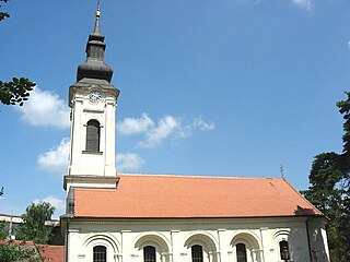
Čurug is a village located in the municipality of Žabalj, Serbia. It is situated in the Autonomous Province of Vojvodina. The village has a Serb ethnic majority and its population numbering 8,166 inhabitants. It is the biggest village in Serbia.

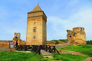
The Privileged District of Velika Kikinda was an administrative territorial entity of the Habsburg monarchy between 1774 and 1876. It was an autonomous area centered around the town of Velika Kikinda, and mainly inhabited by ethnic Serbs.
The District of Potisje was an administrative territorial entity of the Habsburg monarchy. It was formed in 1751 with the headquarters in Stari Bečej, and existed for almost one century.

Pomorišje is a historical geographical region on the banks of the river Mureș that in the past has had a sizable ethnic Serb population. The region is mostly divided between Romania and Hungary, with small part of it in northern Serbia. Today, a Serb minority is present in parts of the region that are part of Romania and Hungary.
The Hungarian Coalition was a political coalition composed of 3 ethnic Hungarian political parties in Serbia: the Alliance of Vojvodina Hungarians, the Democratic Party of Vojvodina Hungarians, and the Democratic Fellowship of Vojvodina Hungarians. The leader of the Hungarian Coalition was István Pásztor.
Below is a list of Slovak language exonyms for towns and villages in the Vojvodina region of Serbia.
Below is a list of Rusyn language exonyms for towns and villages in the Vojvodina region of Serbia.

Kanjiža formerly Stara Kanjiža is a town and municipality located in the North Banat District of the autonomous province of Vojvodina, Serbia. Kanjiža town has a population of 9,871, while the Kanjiža municipality has 25,343 inhabitants.

Belgrade Oblast was one of the oblasts of the Kingdom of Serbs, Croats and Slovenes from 1922 to 1929. Its administrative center was Belgrade.
This is a list of coats of arms of Serbia.
